|
Roanoke is the largest population center on the Parkway, a late nineteenth century railroad town that still reflects much of the natural and cultural history of the entire Blue Ridge region. Regional crossroads, whether they are small mountain communities or larger cities such as this, are as much a part of the Parkway experience as the drive itself. Even here on the edge of the Parkway’s largest city, there is ample opportunity to stretch your legs on short trails, or to have a more extensive hiking experience. At Stewarts Knob (Milepost 110.6), Roanoke Mountain (Milepost 120.3 at the top of the one way loop road), or at Buck Mountain (Milepost 123.2), trails of one mile or less offer the casual hiker the opportunity to get away from the road and traffic to experience the forested slopes of the Blue Ridge. In the winter when trees shed their leaves, some views of the Roanoke Valley or surrounding peaks are also worth the effort. The Chestnut Ridge Trail (Milepost 120.4) has various accesses along the spur road or from the Roanoke Mountain Picnic area and offers the more serious hiker over five miles of moderate trails with a few views of Roanoke Valley and the natural history it has to offer. There are few opportunities along the Parkway for horseback riding, but here in Roanoke, horse trails parallel the Parkway from Gum Springs overlook on the spur road (Milepost 120.4). There is no access for horses across the river. 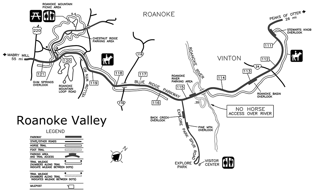
|
Last updated: May 23, 2016