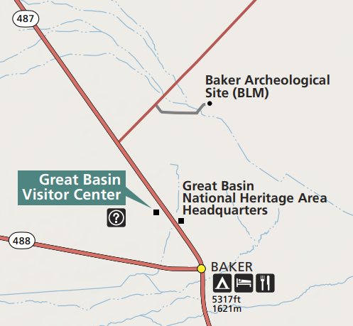
NPS The Baker Archaeological Site, also known as Baker Village, contains the remains of a Fremont Indian village occupied from approximately 1220 to 1295 CE. The Fremont lived in this well planned community of several small pit houses and granaries, surrounding a main big house, and practiced a form of agriculture. The site was excavated by Brigham Young University's Office of Public Archaeology, in cooperation with the BLM, from 1991 to 1994. Recovered artifacts are currently stored at BYU's Museum of People and Cultures in Provo, Utah. After the excavations, the site was backfilled (reburied with the dirt that was removed during excavation), a necessary step in protecting the cultural features that remain. As a result, the foundations of the village can no longer be seen on the surface. The walls visible today are modern walls, built in 2002. Artifacts found on the ground may be observed, but not removed, from the site. The site is currently administerd by the Bureau of Land Management. Brochures and an information kiosk are located at the parking area. A restroom, picnic tables, and a sun shelter are available for day use. No water is available. The Baker Archaeological Site is located on a cut-off road that runs between NV Hwy 487 at Baker, Nevada, and US Hwy 6/50. The cutoff is one-half mile north of the Great Basin Visitor Center. |
Last updated: August 15, 2021
