Last updated: March 10, 2022
Place
Dorchester Heights
NPS Photo
Quick Facts
Location:
Thomas Park, Telegraph Hill, South Boston
Significance:
Fortifications built here led to the Evacuation of the British from Boston.
Designation:
National Historic Site
Due to its role during the Siege of Boston, Dorchester Heights serves as a landmark in our nation’s revolutionary landscape. Also known as Telegraph Hill or Thomas Park, Dorchester Heights has become a gathering space for the local community as well.
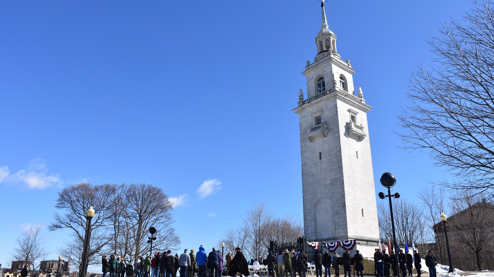
Today, towering high above the neighborhood of South Boston, stands a marble monument atop the highest hill in the area. The monument is known as Dorchester Heights, and it marks the last surviving hill of a collection of hills that once commanded Boston and Boston Harbor.1
People have long inhabited Dorchester Heights and the neighboring areas. Local Indigenous people lived on this land, particularly on the southern coast of Dorchester Neck, which was known as Mattapannock.2 The first Europeans settled on Dorchester Neck in 1630 with the landing of the English ship Mary and John. These settlers gave the land the name "Dorchester" after Dorchester, England.3 For the following century, Dorchester Neck served as farmland and grazing pastures for cattle.4
When the Siege of Boston began in April 1775, residents on Dorchester Neck became nervous of their proximity to Castle William, a British military stronghold on Castle Island just off the coast of the peninsula. In the summer and fall of 1775, these residents moved inland to distance themselves from the fort.5 A few months later, on February 13, 1776, the British military sent a small force to Dorchester Heights to explore how to fortify the site, but they recognized it would be difficult to do so with the frozen ground.6 British Lieutenant-General Archibald Robertson documented that the soldiers "took 6 Rebel prisoners, burnt 6 or 8 Empty uninhabited houses and barns, and return’d about ½ after 6 o’clock."7
Meanwhile, George Washington, Commander-in-Chief of the Continental Army, and his generals agreed to fortify Dorchester Heights in an attempt to finally dislodge the British from Boston. To fortify the Heights undetected, Washington planned a distraction. On the nights of March 2, 3, and 4, Washington ordered a large bombardment of Boston using additional artillery General Henry Knox recovered from Fort Ticonderoga. This attack diverted the attention of British forces to the west of town.
Finally, on the night of March 4, 1776, Washington directed General John Thomas and Colonel Richard Gridley, the chief engineer of the army, to fortify Dorchester Heights. Over 1,200 soldiers and volunteers and 300 oxcarts transported tools and materials to the site as stealthily as possible. The dawn of March 5, 1776 – the 6-year anniversary of the Boston Massacre – revealed to everyone what the Continental forces achieved overnight. A fortification with cannon towered over Boston, as well as the only shipping routes out of the Harbor. British General William Howe commented, "My God, these fellows have done more work in one night than I could make my army do in three months."8
General Howe planned an attack on Dorchester Heights in response to this aggressive act by the colonial forces, yet a storm prevented an immediate response. Having been surrounded by Washington’s army, Howe recognized he was at a military disadvantage and determined to remove his troops from the city. On March 17, 1776, the British forces evacuated Boston, along with over a thousand colonial Loyalists.
Shortly after the evacuation of the British, Chief Engineer and Colonel Richard Gridley reconstructed the fortification on Dorchester Heights into a star shape. This new structure would better defend against a future attack, which never came. Similarly, during the War of 1812, U.S. forces refortified the site, but British forces did not attack Boston. Over time, the fort degraded, leaving only remnants in the mid-1800s.
In the late 1840s, the growing community in South Boston called upon the city to improve city services for local residents, which included better access to water and more public spaces. The city selected Telegraph Hill as a site to build both a reservoir and a park.9 The city of Boston constructed Thomas Park on Dorchester Heights between 1852 and 1854. This 5.43-acre park became one of the first public parks in the city.10 Its original elliptical-shaped plan still stands today.
One hundred years after the fortification of Dorchester Heights and Evacuation Day, the community held a memorial to recognize this significant moment in the site’s history.11 Initially the community installed a granite Centennial Monument in 1877. However, in the 1890s local residents called for "a more substantial monument."12 This led to a design competition for a new monument. Boston architectural firm Peabody & Stearns won this contest and in 1901 constructed the 115-foot-tall marble commemorative tower.13 Dedicated on March 17, 1902, the Georgian Revival Style tower commemorates the fortification of Dorchester Heights during the Revolutionary War.
Throughout the 1900s, Dorchester Heights continued to be a feature of the local community, leading to efforts to protect and preserve this site. In 1951, the Secretary of the Interior and the Mayor of Boston announced the designation of Dorchester Heights as a National Historic Site. Twenty-seven years later, in 1978, Dorchester Heights National Historic Site joined Boston National Historical Park, with the transfer of ownership occurring in 1980. Today, the National Parks of Boston continues to steward Dorchester Heights.
To learn more about the history and legacy of this local and national site, explore the articles and digital content on the Dorchester Heights webpage.
Footnotes
- "Cultural Landscape Report: Dorchester Heights / Thomas Park, Boston National Historical Park," Danielle D. Desilets, RLA (Historic Landscape Architect, Kyle Zick Landscape Architecture, Inc.) and Cynthia Zaitzevsky, Historian, 2020, NPGallery, 26.
- "Cultural Landscape Report," 30.
- "Cultural Landscape Report," 31.
- "Cultural Landscape Report," 31.
- "Cultural Landscape Report," 31.
- "Cultural Landscape Report," 31.
- "Cultural Landscape Report," 31; Archibald Robertson, "Archibald Robertson: His Diaries And Sketches In America, 1762-1780" (New York: New York Public Library, 1971), 72, HathiTrust.
- David McCullough, 1776 (New York: Simon & Schuster, 2005), 93.
- "Nation Park Service Cultural Landscapes Inventory: Dorchester Heights National Historic Site," Boston NHP - Dorchester Heights, 2010 https://irma.nps.gov/DataStore/DownloadFile/449583, 33; "Cultural Landscape Report," 63-67.
- "Nation Park Service Cultural Landscapes Inventory," 3.
- "Nation Park Service Cultural Landscapes Inventory," 2.
- "Nation Park Service Cultural Landscapes Inventory," 2.
- "Nation Park Service Cultural Landscapes Inventory," 2.