Backcountry Conditions

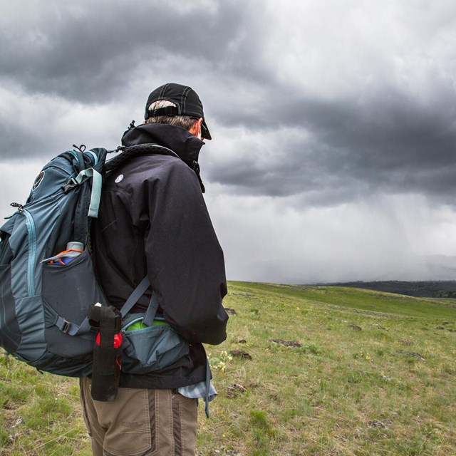
This page offers current backcountry conditions and is updated frequently. It is always good practice to check this page regularly leading up to your trip’s start date.

The map offers a quick snapshot of current trail status. Below the map are more detailed information regading the condition of the trail, further descriptions of trail closures,warnings, and known hazards. Please make sure to review both the backcountry conditions map, and the Area Conditions Detail Section of this page

Conditions reports offer specific details about a given trail on a given date. However, Yellowstone's backcountry is vast and some trail status reports may not be updated for several weeks, or even months for lesser used trails. For this reason, Backcountry Conditions reports only offer a snapshot of trail conditions and should be used in conjunction with other tools such as weather reports, prior backpacking experience in Yellowstone, and assessment of your own backpacking skill level.


Legend for Backcountry Conditions Map, depicting green lines, and polygons for open trails, orange lines and polygons for restrcited status, and red lines and polygons for closed status.
Trail status for stock (horse and llama) use will not be depicted on this map until trails open for stock use on July 1.
 

  General Information

Many of the park's trails are still snow covered. Check out the snowpack map (right side of linked page) to see estimated snow depths.

Most streams are likely still crossable, however as temperatures warm streams will soon begin to rise and  become too high and dangerous to cross. Streams which are crossable in the morning may rise to unsafe levels by afternoon. Don’t get caught on the wrong side of a stream. If you must cross – scout out the safest location, the best crossing may not be in the exact location where the trail meets the stream. Above all use caution and be safe around all streams. Yellowstone’s backcountry does not have many bridges, please evaluate planned travel routes for any potentially hazardous stream crossings. 

The fishing season is currently closed until Saturday May 25th.  Learn more about Fishing in the Park.
 

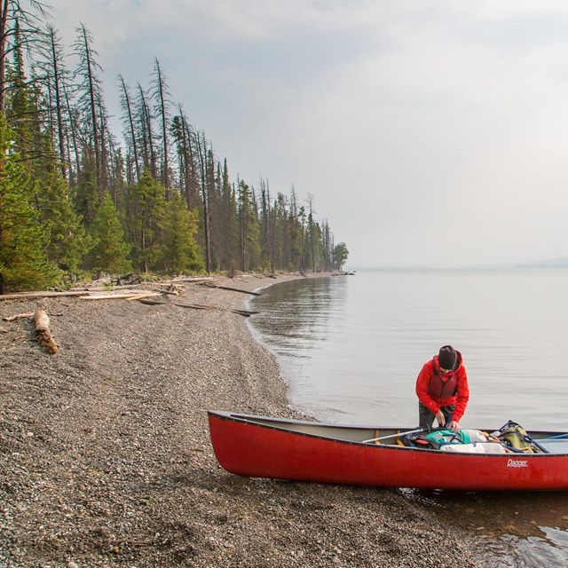
The boating season is currently closed until Saturday May 25th.  Learn more about Boating in Yellowstone.

All trails are currently CLOSED for stock use (horse and llama). Overnight stock use is closed until July 1. Trails for day riding may begin earlier, as conditions allowed. If trails are open to stock prior to July 1 this information will be included below in the Area Conditions Detail section. Get prepared for the season by reviewing Yellowstone's horse riding pages.

There are no current fire restrictions, however please note not all campsites allow for fires.  Check your backcountry permit to see if your permited campsite allows for fires, or view our backcountry trails and campsite map. In addition, please note that fires are only allowed in designated firepits. If the firepit is under snow visitors will need to dig out the firepit and downed wood.

With exception of qualified service animals, pets are not allowed in the backcountry.
 

Backcountry Office Hours

  • Currently there are no locations open for in-person permits. Starting May 15th, offices will begin to be staffed and permits will no longer be available over the phone.
  • Reservations can be made on Recreation.gov
  • For last minute trips (within 3 days of your start trip) contact the Central Backcountry Office at 307-344-2160. Please note the Central Backcountry Office is minimall staffed. Permits are only available to be issued Monday through Friday from 8:00 to 4:00pm. Permitting staff is not available on weekends or holidays. Please plan to contact us accordingly.
  • If you have a trip reserved please watch the Beyond Roads video and then give our office a call at 307-344-2160 within 5 days of your start date. At the time of your call we will go over the permit and issue you your permit to be printed from home or downloaded to your phone.  Please note the Central Backcountry Office is minimall staffed. Permits are only available to be issued Monday through Friday from 8:00 to 4:00pm. Permitting staff is not available on weekends or holidays. Please plan to contact us accordingly.

Backcountry Permits are available 8:00 am to 4:30pm. Offices close for lunch.
Location Opening Date
Mammoth Backcountry Office (located in Albright Visitor Center) 5/15
Tower Ranger Station 5/15
Canyon Backcountry Office CLOSED
Bridge Bay Ranger Station 5/23
Grant Backcountry Office 5/23
Old Faithful Backcountry Office CLOSED
Snake River Ranger Station (at the South Entrance) 5/23
Bechler Ranger Station 6/3
West Yellowstone Backcountry Office (located in West Yellowstone Visitor Information Center)  5/15


Area Condition Details

Trails are listed by region as shown on the map below. Scroll down or select a region name to view backcountry conditions for the area: 
Northwest               Northeast               Central               Southwest               Southeast

 
Map of backcountry condition report areas
 

Northwest

  • No off trail Travel within the Gallatin Bear Management Area
  • A Minimum group size of four people is recommended for hiking and camping withing the Gallatin Bear Management Area.
  • Wet, muddy and snowy conditions prevail throughout the area. (4/24/24)

  • Expect wet and muddy conditions at lower elevations and deep snow at higher elevations.(5/3/24)
  • Daly Creek Trail is mostly snow free for the first few miles. Campsite WF2 is still under snow. (5/3/24)
  • Sky Rim trail has some areas that are exposed along a ridge and are not advised to attempt while there is lingering ice and snow. (5/3/24)

  • Beaver Ponds Trail is mostly snow free and cleared of down trees. (5/3/24)
  • The barricade at the Mammoth Terraces is open. (4/29/24)
  • Sepulcher trail is likely mostly snow covered.(4/24/24)

  • Glen Creek Trail, Sportsman's Lake Trail, and Electric Peak are all mostly snowy. Not recommended.(4/26/24)

  • Bunsen Peak still has significant snow. Hiking is not recommended. 05/3/24)
  • Osprey Falls trail is CLOSED due to trail damage from the 2022 Flooding event. 

  •  Swan Lake is CLOSED, no entry and no boating allowed in order to protect nesting birds. (4/29/24)

  • Expect muddy trail conditions in the lower elevations, and snow as you increase in elevation. (4/24/24)

  • Access road to the Bighorn Pass Tralhead parking area at the Indian Creek Campground is closed until June 14th. Until then hikers wanting to access the Bighorn Pass Trail must park in the pullouts near the access road barricade. Do not block the barricade and access road. 
  • Bighorn Pass Trail has deep snow and cannot be crossed.(4/24/24)

  • Likely wet/ snowy (4/24/24)

  • The West side of Gneiss Creek is CLOSED until June 30th due to the Gneiss Creek Bear Management Area. 

  • Trail is mostly snow covered. Not recommended. (5/3/24) 


Northeast

Ticks are out.(4/29/24)

  • Rescue Creek Trailhead along the washed out North Entrance Road is inaccessible due to the bridge having washed out in the 2022 Floods. See map above. 
  • Rescue Creek Trail accessed from the Blacktail Trailhead is open, likely wet with residual patches of snow in the shade.(4/24/24)
  • Lava Creek Trail on the west side of the Gardner River and the Boiling River Trail are CLOSED due to a carcass. See map above(4/24/24)
  • Lava Creek Trail (from Lava Creek Picnic Area or Blacktail Trailhead) is likely wet, with minimal snow.  The trail can be hiked down to the Gardner river, but you will need to return the same way. The bridge over the Gardner River is out. (5/3/24)

  • Likely wet and muddy.(4/24/24)

  • Trail is mostly snow free. There may be some residual patches of snow near campsite 1A1 before the trail descends into the Black Canyon. (5/3/24)
  • The Yellowstone River Trail is closed west of campsite 1Y1 due to a trail washout. 
  • The Yellowstone River Trail is snow free. (5/3/24)
  • Cottonwood Creek (west of campsite 1R1) will start to rise as the weather warms. Hikers will need to scout for the best place to cross which is not necessarily where the trail meets the creek. (5/3/24)

  • Hellroaring Creek Trail has areas of patchy snow north of campsite 2H7. Expect to increasing snow heading north of campsite 2H9 towards the Northern Boundary of the Park.(5/3/24)
  • Hellroaring may still be crossible on foot, but as warm temperatures increase will likely become uncrossable. At that point visitors will need to head North along Hellroaring Creek to the foot bridge located south of campsite 2H8.
  • Upper Coyote Creek and Buffalo Plateau likely to be snow free in the lower elevations, with increasing snow in higher elevations. (5/3/24)
  • Campsite 2C1 is snow free. Campsite 2C2 has snow in the campsite. (5/2/24)
  • Snow cover increases going north of campsite 2C2. (5/3/24)
  • Hikers are seeing a lot of signs of bear activity along the Coyote Creek Trail and in the Hellroaring Creek area. Be Bear Aware. (4/29/24)
  • The full Bull Mountain Loop is not accessible during the early season The bridge across Horse Creek (north of the park on the Hellroaring Creek Trail) washed out in the 2022. Horse Creek is too deep and swift to cross until waters drop in mid-late July. 

  • Floating Island Lake is CLOSED. No Entry or Boating in order to protect nesting birds.(4/29/24)

  • Sections of the Lost Lake Trail are currently CLOSED. See Conditions Map above.(4/24/24)
  • The barricade at Petrified Tree is currently open.(4/24/24)

  • The West side of the Garnet Hill trail is CLOSED due to a carcass along the trail. See Backcountry Conditions map  above for location of closure.(4/29/24)
  • Due to road construction, the Garnett Hill trail should be accessed from Tower Junction, and then continue on to the wagon road.
  • The Garnett Hill Loop is Partially closed due to damage from the 2022 Flooding event. See Backcountry Conditions Map above.(4/24/24)

  • Inaccessible due to road closure. Road is scheduled to open May 10th.

  • Buffalo Fork trail is inaccessible due to the fact that Slough Creek is not crossable.(4/24/24)

  • The barricade at Slough Creek is Closed. Hikers will need to walk the mile and three quarter long road to the trailhead. (4/24/24)
  • Slough Creek likely has snow between the trailhead and first meadow. Expect a few areas of snow beyond the first meadow. (5/3/24)

  • Mostly snow covered.(4/24/24)
  • Pebble Creek is currently crossable.However, as temperatures rise will shortly become unfordable. At that time camspite 3P1 will be the only accessible campsite.(4/24/24)
  • Bliss Pass is inaccessible due to snow (4/24/24)

  • Snowy(4/24/24)

  • The Yellowstone River Picnic Area Trailhead is CLOSED for the 2024 season due to a road construction project.
  • Specimen Ridge trail has patchy snow west of Amethyst Mountain and areas of deep snow east of Amethyst. (5/3/24)
  • As spring run-off increases,  the Lamar River located on the east side of the trail will not be crossable.  At that point access to Specimen Ridge will only be through the Specimen Ridge Trailhead. Don't be caught on the wrong side of the river as it is a 14 mile backtrack to the trailhead (4/24/24)

  • Lower Lamar Trail is mostly snow free( 4/24/24)
  • Cache Creek which is about 3 miles from the Lamar River trailhead is currently crossable, as temperatures rise the river will soon become uncrossable. Be cautious of streams wwhich are crossable in the morning may rise to unsafe levels by afternoon. Don't get caught on the wrong side of the stream.(4/24/24)
  • The Pelican Valley Trailhead is closed until July 4th due to thePelican Valley Bear Management area. No through travel from Lamar River to Pelican Valley.
  • Miller and Frost Lake likely snowy and will become inaccessible when Cache Creek, and the Lamar River become uncrossable.(4/24/24)

  • Cache Creek is likley snow free in the lower elevations, and increasingly snowy with increasing elevation. Campsites 3C2, 3C3, and 3C4 are likely snow covered. (4/2/424).
  • Cache Creek is crossable currently, but will soon start to rise. Be cautious that streams which are crossable in the morning may rise to unsafe levels by afternoon. (4/24/24)
  • Thunderer trail is snow covered. (5/3/24)
  • Republic Pass completely snow covered. (5/3/24)


Central

Most trails in the Central Region are snow covered. (5/2/24)

  • Access to trailhead is closed until May 24th when the road from Tower to Canyon opens to travel.

  • Inaccessible due to Inspiration Point Access Road closure.  See Canyon Rim Trail section. (4/24/24)

  • Due to Norris Campground being closed for the 2024 season, there is a barricade which will prevent visitors from parking at the trailhead. Visitors will need to park in the large pullout on the main road to the south of the barricade and walk through the campground to the trailhead.

Trails are snow covered. 
Grebe Lake Trailhead parking area has not been plowed. (5/2/24)

  • The Brink of the Upper and Lower Falls are open. (5/1/24)
  • The following trails along the rim of the Grand Canyon of the Yellowstone are CLOSED to all travel: Inspiration Point Trail and access road, Red Rocks Trail. This closure includes travel by foot, snowshoe, ski, horseback, and any other human powered conveyance.(5/2/24)

  • Trails are mostly snow covered. (5/3/24)

  • Trail is mostly snow covered. 
  • Mary Mountain Trail is closed west of Mary Lake through June 15.
 

Southwest

  • Expect all trails in the area to be snow covered and or muddy (5/3/24)
  • Some trailheads in this region are inaccessible due to seasonal road closures. (5/3/24)
  • The Bechler Region is inaccessible.The Cave Falls Road and Grassy Lake Road west of Grassy Lake are not plowed and still have deep snow. These roads are typically not driveable until late May. (5/3/24)
  • The Grassy Lake Road east of Grassy Lake is closed to motorized travel until at least June 1.

  • Expect 1-3 feet of rotten snow from the southern Grand Prismatic Overlook trail junction with the Freight Road all the way in to Fairy Falls. Not recommended (4/24/24)
  • The Grand Prismatic Ovelook trail is CLOSED (5/1/24)

  • Snowy. Not Recommended (4/24/24)

  • Snowy (4/24/24)

  • Snow covered (4/24/24)
  • Lone Star Trailhead inaccesible due to seasonal road closure. Road opens May 10th.


Southeast

  • Most trails in this region are inaccessible due to seasonal road closure and are otherwise snow covered. (5/3/24)
  • Trails between the South Entrance and Lake Village are not accessible until May 10.

  • Storm Point Trail is snow covered. Not recommended for hiking (5/3/24)
  • Elephant Back Trail is snow covered. Not recommended for hiking. (5/3/24)
  • Natural Bridge Trail is inacessible until May 10 when the road between Lake and Grant opens. Status to be determined - Natural Bridge Trail is often closed due to bear activity in May and ealry June.

  • Avalanche Peak is snow covered. Hiking not recommended. (5/3/24)

  • Yellowstone Lake is ice covered. (5/3/24)
  • Boating season opens May 25 (as long as ice is off the lake)

  • Thorofare Trail is snow covered. Not recommended for hiking. (5/3/24)
  • Streams will be rising and become uncrossable as the weather warms. (5/3/24)
  • No off-trail travel is permitted along the east shore of Yellowstone Lake until July 14 or later. Refer to the above map for more information on the Clear Creek Bear Management Areas.

  • The Snake River at the South Entrance is typically not crossable until July 10. 

  • The Heart Lake area does not open until July 1 (Bear Management Area).


Submit Trail Conditions

Have you hiked the trails lately and want to submit trail conditions? Please email the Central Backcountry Office with the trails and date you hiked the trails and as much details as you can provide.


More Information

Last updated: May 3, 2024

Park footer

Contact Info

Mailing Address:

PO Box 168
Yellowstone National Park, WY 82190-0168

Phone:

307-344-7381

Contact Us