NPS Photo / Kent Miller Explore Acadia's Geology!It has taken hundreds of millions of years for Acadia’s geology to take the form we see today. The land and region has experienced the passing of enormous glaciers, erosion from rivers and streams, volcanic activity, and more. By sculpting the landscape itself, this process has shaped the way we experience and enjoy the park as a whole. 
NPS Photo / Will Greene U-Shaped ValleysMuch of Mount Desert Island’s profile features valleys that resemble U’s rather than sharper and steeper V-shapes typically formed by the erosion of streams and rivers. After volcanism and erosion carved out mountain valleys, massive glaciers chipped away at their rigid corners and edges. This left soft, rounded mountain tops and smooth U-shaped valleys. The most famous of Acadia’s landscape often reflect this noticeable feature. The Bubbles, for instance, sit just north of Jordan Pond. The gently sloping U-shapes can be observed on either side of the mountain pair and is visible to some degree between North and South Bubble themselves. 
NPS Photo / Eric Michelena Glacial StriationsAs glaciers moved across the landscape, sediment and rock of all sizes were trapped beneath the ice. This debris was pulled and dragged along the surfaces of the mountains. The smaller particles, such as sand, smoothed out the surfaces of the mountains and rock. The larger stones dug into the rock, leaving scratches that now line the sides and exteriors. These lines are called striations. These lines can also tell us which direction the glacier was moving and pulling those smaller stones 
NPS Photo / Eric Michelena Chatter MarksChatter marks are one type of striation we might see. This occurs when a larger stone is pressed down under the weight of the glacier and cuts into the bedrock below. Because of the rock’s shape, the pressure forms a crescent fracture in the bedrock. The angle of the gouges inform us of which way the rock was being pulled. The side of the crescent that is cut deeper indicates the direction the glacier dragged the stone into the surface. 
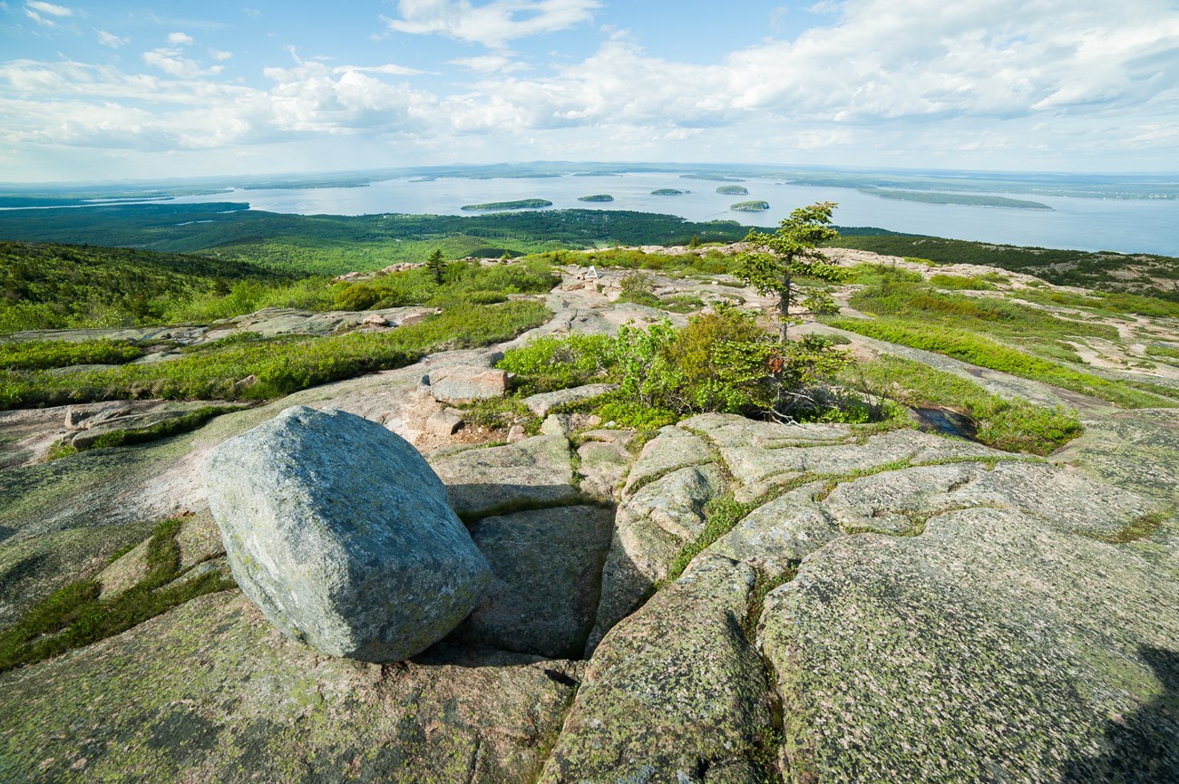
NPS Photo / Eric Michelena Glacial ErraticsWhile passing through the landscape, glaciers will trap debris or stones underneath and alongside its mass. Some of the rocks and large boulders will be picked up and carried along the way. These massive stones can be transported and later deposited in different areas along the glacier’s path. The most recognizable and photographed glacial erratic in Acadia is Bubble Rock, which sits near the edge atop South Bubble. 
NPS Photo / Will Greene CobblestonesAcadia’s cobblestone beaches are some of our most treasured gems for their striking beauty and charming rattling in the waves. The stones also tell the stories of countless rock formations that have traveled to the beach by means of glaciers and ocean currents. These rocks can be traced to areas all over the region, frequently starting as much larger glacial erratics. The stones are pounded by waves over years and years, through nor-easters and storms. They are smoothed out over the relentless shaping of the waters and collisions with other rocks. The rugged journey and significance behind each cobble makes their protection a priority, as more and more disappear from popular sites such as Seawall and Little Hunter’s Beach. With each missing piece of geological history, it becomes more important to leave no trace and allow the cobblestones to rattle where they are. 
NPS Photo / Victoria Stauffenberg Geological DikeGeological dikes form when a body of rock cracks or fractures. New magma or sediment will enter these openings and cool to form its own rock. This newly formed sheet looks very different than its surrounding neighbor. The fractured granite rock cooled more slowly, leaving larger crystals in its body. The basalt that penetrates the cut cooled more quickly, leaving behind smaller crystals. Visitors can investigate these differences in basalt dikes cut along the coast and throughout many of their mountain hikes. Schoodic Peninsula is home to some of the most spectacular geological dikes in the park.
More Ways to Experience Acadia's Geology |

Last updated: December 10, 2024