Last updated: June 21, 2021
Article
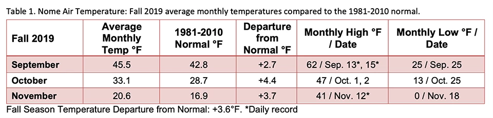
Fall 2019 Weather Summary for Arctic Parks

NPS/Ken Hill
Alaska has warmed over the past 50 years. Fall temperatures have increased the most in the central interior, west coast, and north slope regions of Alaska. The decline in sea ice over the past several years has been a factor in the recent statewide warming trend as sea ice concentration and temperature are strongly correlated in northern Alaska. Over the past 30 years, sea ice extent and volume have been decreasing and the sea-surface temperatures of the north Pacific Ocean over the past several years have been above normal, leading to record warm temperatures over northwest Alaska. Weather and climate are key drivers in ecosystem structure and function, and the high-latitude Arctic parklands are undergoing rapid change.

Analysis and graphic by Rick Thoman@AlaskaWx

Long-term National Weather Service stations near Arctic parks in Bettles, Kotzebue, and Nome are used as index sites to compare current climate conditions in the region to the climatological normal—the average weather conditions over a 30-year period. The current normal period is 1981-2010.
Bering Land Bridge National Preserve
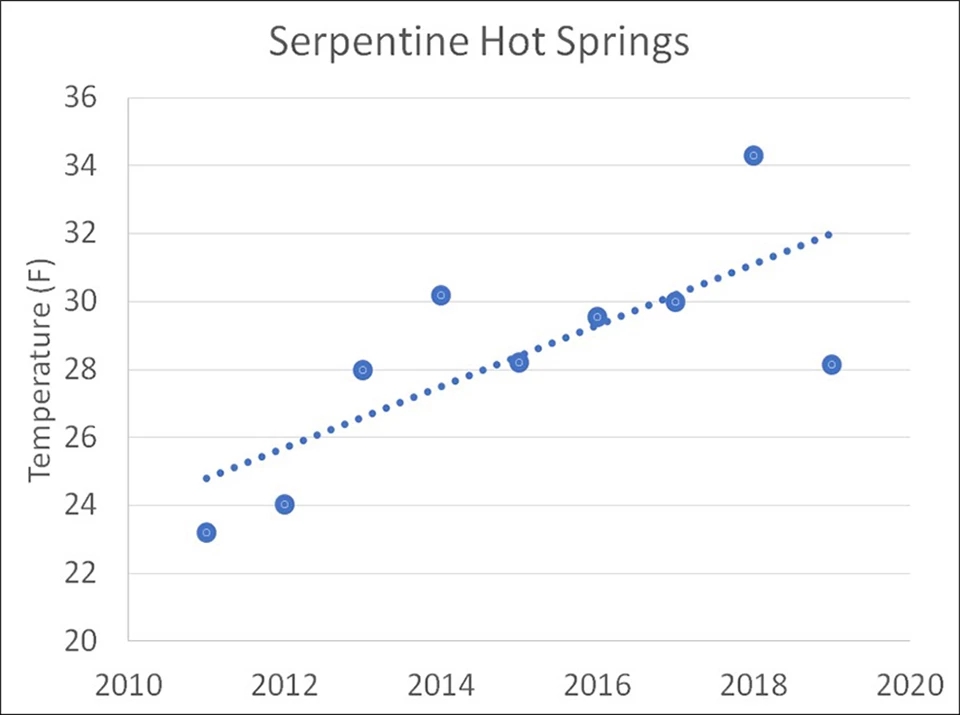
Fall season temperatures have increased since we started year-round measurements at Serpentine Hot Springs in 2011. The fall of 2018 was the warmest on record and 2019 was right at average for the 9-year record.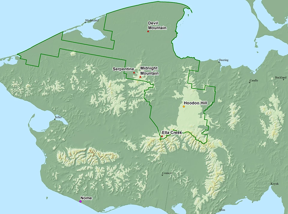
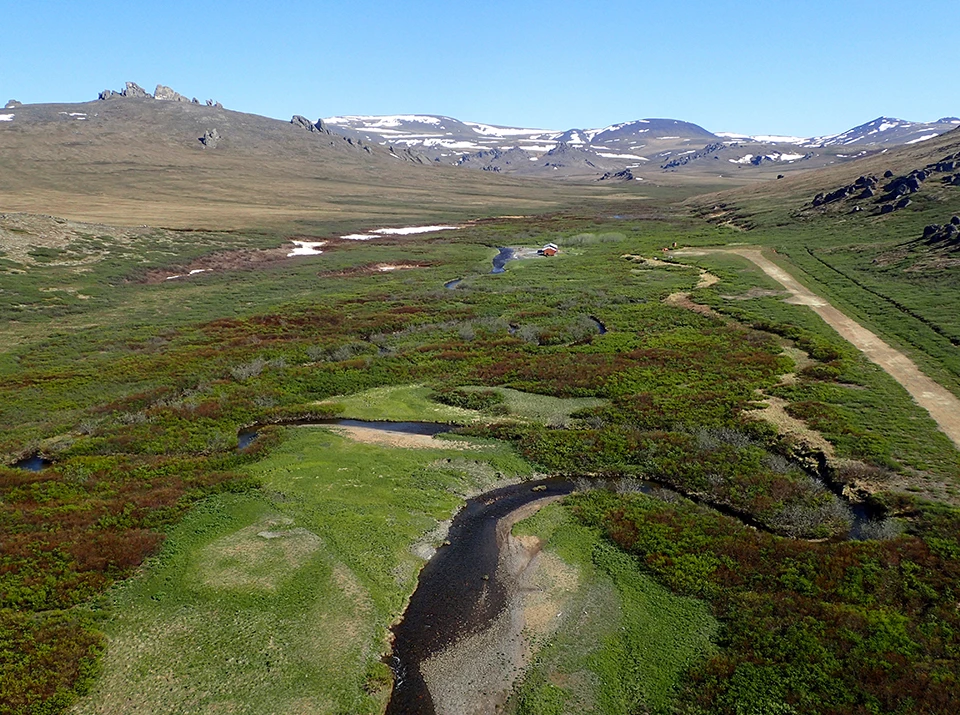
Left image
Serpentine Hot Springs
Credit: NPS/Ken Hill
Right image
Fall temperatures at Serpentine Hot Springs 2011-2019.
Gates of the Arctic National Park and Preserve
In Bettles, 2019 was the 3rd wettest and 7th warmest fall season (September-November) on record. The total snowfall November 26-27 was 25.0 inches, breaking the old 2-day record of 23.8 inches set in 1973. The event also broke the 3-day (28.4 inches) and 4-day (28.6 inches) snowfall records. Continuous snowfall records at Bettles date back to 1951.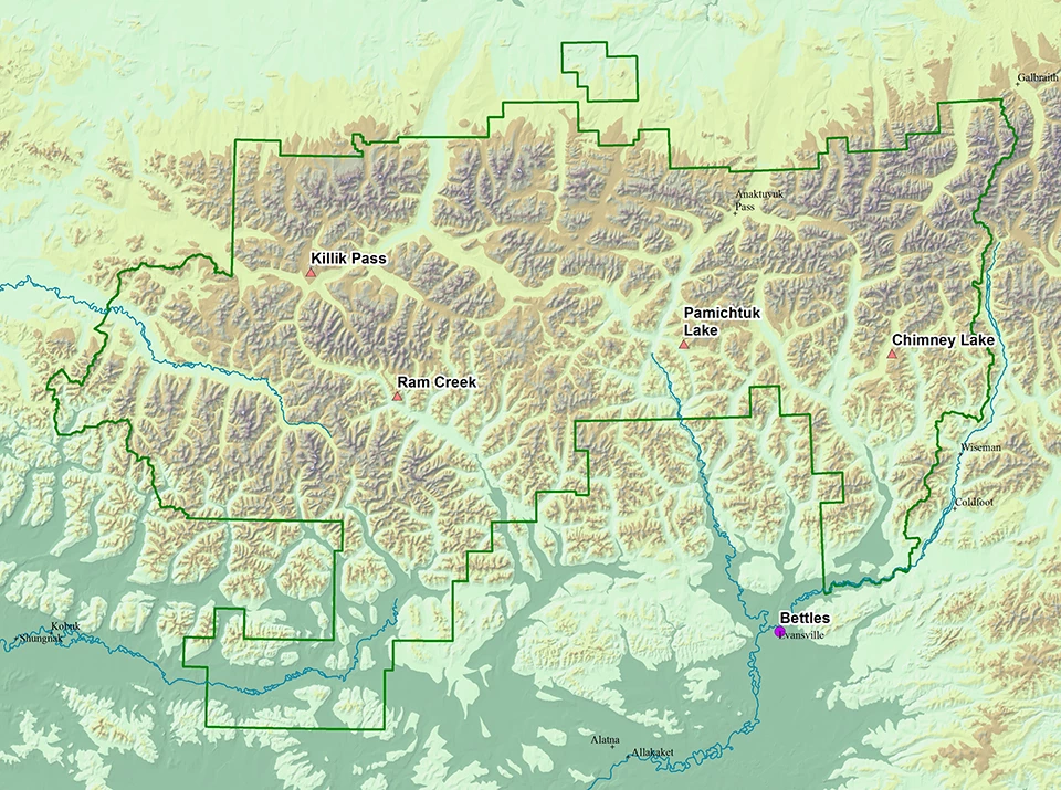

Western Arctic Parklands
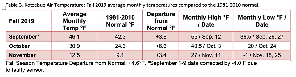
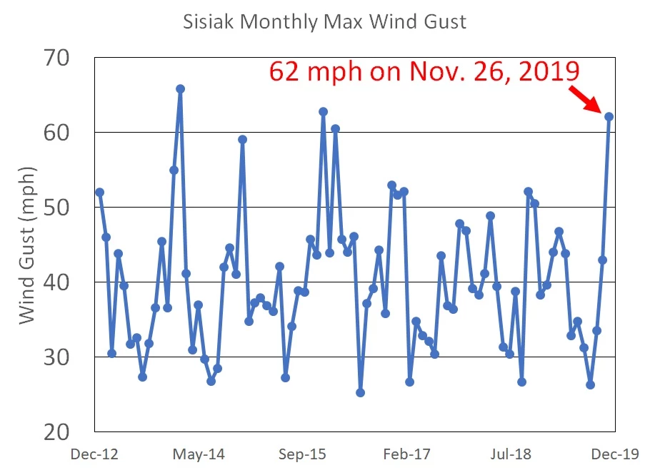
It was the 8th warmest and 11th wettest fall season (September-November) in Kotzebue since continuous records began in 1935. Chukchi Sea ice extent was the lowest of the satellite record (1979-) as of the end of the fall season. November marked the 27th consecutive month with above normal temperatures in Kotzebue, 30 miles southeast of Cape Krusenstern National Monument on the tip of the Baldwin Peninsula.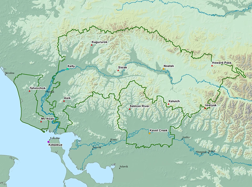

ACCAP Climate Specialist Rick Thoman
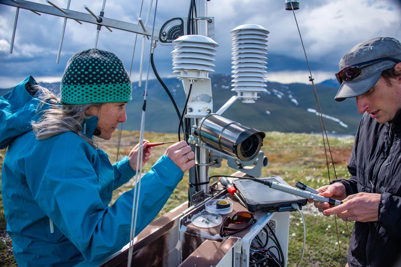
NPS/Seth Adams
Tags
- bering land bridge national preserve
- cape krusenstern national monument
- gates of the arctic national park & preserve
- kobuk valley national park
- noatak national preserve
- climate change science
- climate monitoring
- arctic science
- arctic network
- arcn
- weather stations
- alaska climate change
- alaska
- climate
- weather
- resource brief
- vital sign