Part of a series of articles titled Water Resources Monitoring in the Bighorn River at Kane, Wyoming, 2019.
Article
Water Flow in the Bighorn River at Kane, Wyoming

NPS
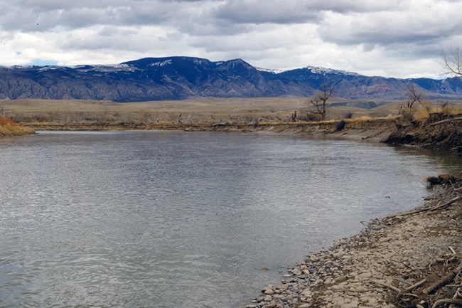
The U.S. Geological Survey operates two gaging stations on the Bighorn River; one station is located on the Bighorn River at Kane, Wyoming (USGS 06279500), and the other is on the Bighorn River near Fort Smith, Montana (USGS 06287800 Bighorn River near St. Xavier). The Bighorn River at Kane, Wyoming, has a mostly natural hydrograph with flows from several large tributaries. The upper reaches of the Bighorn River are regulated by operations of the Boysen Reservoir project near Shoshoni, Wyoming. Boysen Reservoir is formed by Boysen Dam, an earth-fill dam that was constructed between 1947 and 1952 at the mouth of Wind River Canyon. The dam and much of the associated Boysen Reservoir are located on the Wind River Reservation in Central Wyoming.
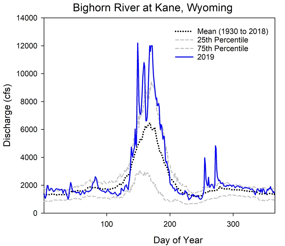
The hydrograph for the Bighorn River at Kane, Wyoming, is generally highest in the spring with the months of April through June coinciding with the melt-off of snow at higher elevations within the watershed. Average annual peak flows between 1930 and 2019 are 10,596 cfs occurring on June 11 (day 162 of the year). Peak flows in 2019 were higher (12,200 cfs) than the long-term average at this location. Minimum annual daily flows over this same period of record averaged 657 cfs. The minimum recorded flow in 2019 was 954 cfs and it occurred on August 18.
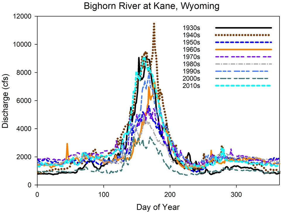
The extended flow record available for this location supports evaluations of recent or decadal change. Flows in the 2010s (2010 to 2019 averages) were like flows recorded in the 1930s, but on average considerably higher than those documented in the early 2000s (2000 to 2009). Although some flows within the most recent decade (2010 to 2019) were particularly low (2012, 2013), calendar year 2017 average daily flows were the highest in the 90-year time series.
USGS Bighorn River at Kane, Wyoming, Gage (USGS 06279500) Water Data

NPS

NPS
Last updated: September 16, 2022
