Part of a series of articles titled Buffalo National River Science Spotlights.
Previous: Algae and Nutrient Sourcing
Article

NPS/M. Perez
Buffalo National River has more than 500 known caves, and new caves are still being discovered. These underground passageways are formed by the carving and dissolving of limestone by moving water. This continuous flow of water is what has created the karst landscape we see here today.
The National Park Service works closely with partnering organizations like the Cave Research Foundation (CRF) to map caves, conduct biological surveys, and monitor the world beneath the surface of Buffalo National River.
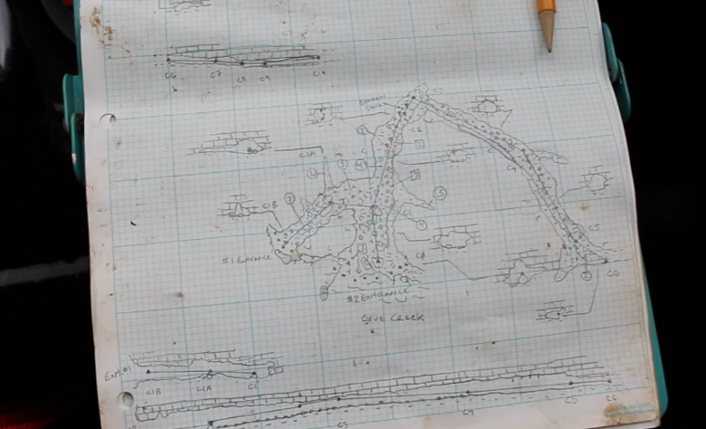
The process of mapping caves takes patience and a sense of curiosity and adventure. Volunteers use maps, GPS coordinates, and/or memory sketches (in some cases decades old) to guide them to their destination. Once the cave entrance is located, the mapping process begins. Typically requiring three volunteers, a line plot and sketch are slowly drawn as cavers work their way through the twisted passageways. The cave is divided into "stations" of variable distances. At each station, the vertical and horizontal depths are measured using a laser distance measurement tool that helps form a scaled map of the cave. These measurements provide a profile and plane view of the cave and inform scientists of what the cross sections of the cave look like. This representation can then be created into a digital map for the National Park Service to use.

NPS/M. Perez
Once a cave is mapped, it is routinely monitored to keep a record of biological and physical changes. This is essential in making well-informed decisions for the protection and management of these resources.
Most caves at Buffalo National River are closed to the public for the protection of several bat species, three of which are endangered, from a fungal disease known as White Nose Syndrome. Since 2006, this disease has claimed the lives of millions of bats and continues to quickly spread across the United States. Cave closures help to ensure the survival and health of cave life, and it takes time, effort, communication, and collaboration between partners and visitors to keep the underground resources of Buffalo National River unimpaired for future generations to enjoy.
Part of a series of articles titled Buffalo National River Science Spotlights.
Previous: Algae and Nutrient Sourcing
Last updated: July 8, 2021