Part of a series of articles titled Climate Change Response Strategy and Cultural Landscapes.
Article
Climate Change and Cultural Landscapes: Understand
Understand the Science
The NPS climate change response requires high-quality information shared among scientists, resource professionals, partner organizations, and Indigenous peoples. This collaborative approach strives towards achieving deeper knowledge and creative solutions around the realities of climate change and how it affects resources.

NPS
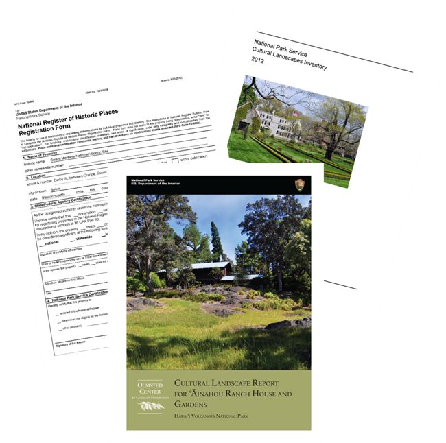
The NPS compiles a considerable amount of information about the landscape and how it has changed over time in the form of photos, aerials, historic maps, correspondence, contemporary descriptions, numerical data, and maps. This information contributes to an understanding of historical climate conditions, future projections, and potential effects on resources and operations.
The NPS is committed to gathering and using the best available information about climate change to inform decisions. Through documentation, analysis of existing conditions, data collection and modeling, historical research, and natural resource monitoring, the NPS Park Cultural Landscapes Program also contributes to the information that is available for ongoing cultural landscape management.
Tracking Change
As part of the process of landscape preservation, the NPS researches and documents landscape changes, identifies vulnerable cultural resources, recognizes sensitive natural systems, articulates historic character, and informs treatment and maintenance decisions. Each of these actions advances the understanding of climate change.
CLI condition updates and records of treatment also allow the NPS to monitor change.
Routine assessment and standard methodology help the NPS to monitor small- and large-scale changes in the landscape, revealing shifts in vegetation patterns and forest cover, rainfall and waterways, and topographical features
Landscape Case Studies and Examples
Big Hole National Battlefield

NPS / Upper Columbia Basin Network
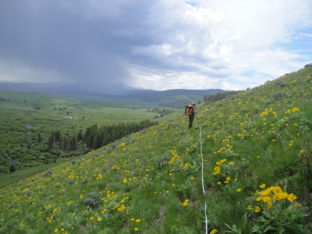
On August 9 and 10, 1877, a group of Nez Perce and US Army troops clashed on what later became known as Big Hole National Battlefield. The natural characteristics of the landscape, cultural traditions of the Nez Perce people, and historic events of the battle are closely related. The lodgepole pine forest that covered the hillside, dense willow thickets along the river bottom, camas meadow, and high bench to the south all influenced the choice of the site as a camp and played a part in the events of the battle. The natural systems and features were well documented in accounts and drawings of the battle.
While the natural systems of Big Hole Battlefield have changed over time, the current landscape appears similar to what battle participants would have seen in 1877. However, decades of farming near the site, development of roads and visitor facilities, and changing conditions have contributed to the introduction of invasive species in the landscape. In the 1910s and 1920s, a pine beetle blight began to decimate the forests around the Big Hole Valley. In the 1980s, the NPS and Forest Service cooperated to restore the historic character and composition of the hillside siege area, returning it to forest patterns that were present at the time of the battle.
The perimeter of the forest has also fluctuated through the decades. In recent years, prescribed burns have helped to suppress new growth of conifers on historically clear areas of the open hillside and reduce the number and density of willows in the bottomland.
Historic and ongoing documentation of the landscape's vegetation patterns help to monitor changes in the overall character of the landscape.
Saint-Gaudens National Historical Park
Seasonal changes in parks are important drivers in ecological processes. Understanding how the timing of the seasons impacts resources is necessary for planning when to treat invasive species, operate visitor facilities, and schedule climate-related events like flower festivals.
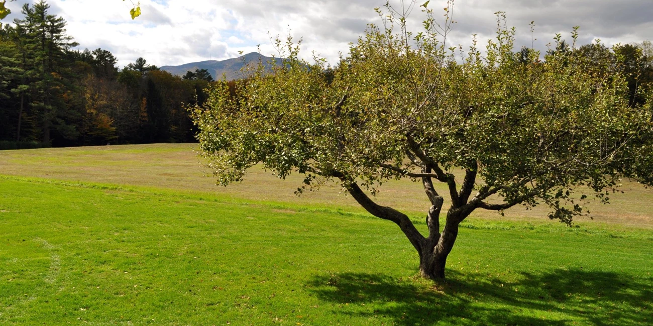
Researchers in the NPS and partnering institutions gather data in national parks across the country to model dates of first leaf and first bloom relative to a historical range of variability. For example, at Saint-Gaudens National Historical Park, monitoring apple tree blooming times can contribute to the information on the timing of seasonal change.
When sculptor Augustus Saint-Gaudens arrived in Cornish in the summer of 1885, the vegetation around the area was typical of a working agricultural landscape. In 1891, he purchased a farm (which would become known as Aspet) and began to alter the landscape, designing a series of classically-inspired gardens, outdoor rooms, geometric beds of annuals and perennials, and a system of hedges. These features of the designed landscape stood alongside characteristics that reflect the rural context, including patterns of forest and field and agricultural elements like apple trees.

NPS

NPS
Redwood National Park
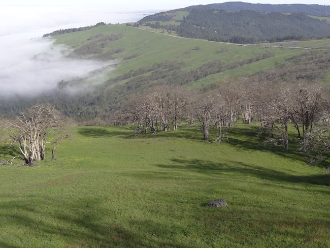
The Lyons Ranches Historic District, located in the Bald Hills of Redwood National Park in California, is characterized by upland prairies, oak woodlands, and conifer forest of the Redwood Creek watershed. The district includes a series of eight prairies and their features, surviving from the Lyons family sheep ranching era after 1868. Recent climate trends in temperature and precipitation threaten the cultural landscape. Fire danger is increased due to longer periods of drought, prairies have reduced in size and lost integrity in their edges due to Douglas fir encroachment and invasive species, flash flood conditions increase flood hazard, and buildings are vulnerable to high winds and storms.
The park has implemented a prairie management plan, including the use of prescribed burns, in addition to continued monitoring for other related impacts. This strategy is aimed at controlling the invasive California oat grass as well as the encroaching Douglas firs, which detract from this historic character.
Boston Harbor Islands National Recreation Area
At Boston Harbor Islands National Recreation Area, a phenological study of the periodic events in biological life cycles established a baseline of data for the leafing times of staghorn sumac. Staghorn sumac is a common native plant of the northeastern United States and Great Lakes lowlands. Long term monitoring may reveal a climate-related influence on a change to leafing times.
Last updated: June 24, 2024

