Last updated: January 8, 2025
Article
Controlled Submarine Mines in Boston Harbor

Boston Public Library
During the Civil War and the years that followed, warships became more advanced and rifled artillery proved to be stronger than the stone walls of Third System Fortifications. Although an initiative in the 1870s led to the construction of barbette batteries, large caliber-mortars, mines, and channel obstructions, most efforts to upgrade defenses failed until the following decade. In 1885, President Grover Cleveland convened a joint Navy-civilian board to reassess coastal defenses. Called the Endicott Board, their recommendations included floating batteries, submarine mines, and torpedo boats.
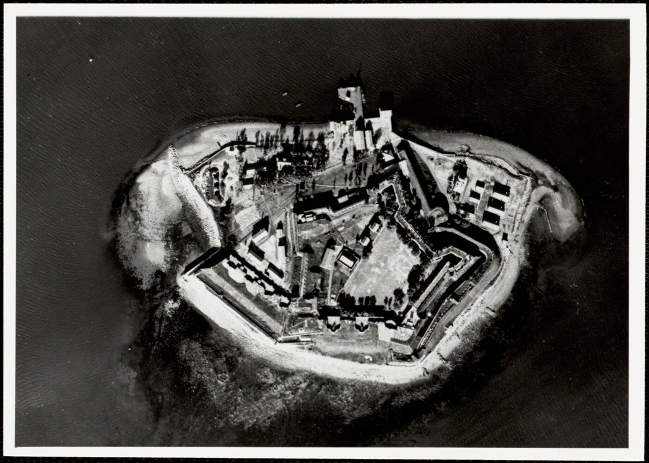
In the Boston Harbor, the Endicott Board’s recommendations resulted in the modernization of many existing fortifications in the harbor, as well as the creation of additional fortifications. The federal government acquired 88 acres on Peddocks Island in 1897 to build a fortification. First garrisoned in 1904, the fortification became known as Fort Andrews. Additional construction on Fort Warren on Georges Island began in 1888. This included the addition of two mining casemates, mine storage facilities, and bomb-proof structures for the denotation of submarine mines. Fort Strong, on Long Island, also received extensive renovations. Additional construction took place at Lovells and Deer Islands, as well as Hull and Winthrop. The military deactivated Fort Independence on Castle Island during this time.[1]
While the military first installed mine facilities in harbors around the country in the 1880s, they did not plant mines until the Spanish American War began in 1898. The military eventually planted underwater mines in 28 major US harbors.
In order to plant mines, all power and circuit connections first needed to be checked. Soldiers then laid the mines with a "flotilla," which consisted of a mine planter, a distribution boat, and somewhere between two and four yawls, or small crafts, used in this case to ferry ropes and cables. After 1904, the military had mine planters custom built with wide decks for assembled mines, and all the other materials needed to plant mines. Distribution boats held the distribution box as soldiers attached it to cables as the mines were being planted. All mines in a singular group connected to the distribution box. Once laid, the mines still needed to be checked and maintained regularly. [2]
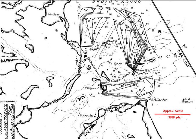
The mines had a watertight seal case that held the explosive inside, and a firing device with an electrical connection to shore. Ground mines sat on the seabed, and could be detonated by the control board, contact, or magnetic influence. Because they could be detonated by a control board operated by soldiers on nearby islands, these mines were considered "controlled mines."[3]

"Supplement to the Harbor Defense Project: Harbor Defenses of Boston," U.S. Army Engineers, 31 January, 1945.
In Boston, soldiers stationed on the Boston Harbor Islands operated underwater mine systems during World Wars I and II. The military also temporarily reactivated Fort Independence for storage. In July 1918, the defense system activated, suggesting one of the German U-boats might have entered the harbor, though nothing came of the situation. [4]
By World War II, the military had fortified nine islands in Boston Harbor. Soldiers on Deer Island, Georges Island, and Outer Brewster Island worked together to operate an underwater mine system. Great Brewster Island served as a control center for the mines that spanned between Hull, Great Brewster, and north of Deer Island. Each island managed a section of the mines. From December 1941 onward, soldiers stationed on Georges Island monitored new mines that had been planted between Point Allerton in Hull and Boston Light. Soldiers sent hourly reports out to Fort Dawes on Deer Island, which served as the harbor command center. The harbor defenses installed a new control apparatus for ground mines in 1943.[5]
The presence of controlled mines allowed for friendly relations in the harbor to continue during wartime. When operations suspended after World War II, the federal government sold many of the islands as surplus. Many of the Boston Harbor islands used during this period became part of Boston Harbor Islands State Park, later Boston Harbor Islands National and State Park.
Footnotes
[1] Olmsted Center for Landscape Preservation, Cultural Landscape Report: Boston Harbor Islands National & State Park, Volume 1: Historical Overview, (Boston: National Park Service, 2017), 92-100; "The Endicott Period Defenses," Gateway National Recreation Area, National Park Service, last modified February 26, 2015, accessed May 5, 2023; Gerald W. Butler, S.F.H., The Guns of Boston Harbor (1st book: Gerald W, Butler, 2001) 69-72.
[2] Mark Berhow, American Sea Coast Defenses: A Reference Guide, (CDSG Press, 2020), 335-361.
[3] Berhow, American Sea Coast Defenses: A Reference Guide, 335-361; Butler, The Guns of Boston Harbor, 225-230.
[4] Shurcliff & Merill, Landscape Architects, "History and Master Plan Georges Island and Fort Warren Boston," (Boston: Metropolitan District Commission; - Parks Division, 1960), 38-44; Berhow, American Sea Coast Defenses: A Reference Guide, 334- 335.
[5] Berhow, American Sea Coast Defenses: A Reference Guide, 335-361; Butler, The Guns of Boston Harbor, 191-225.
