Last updated: July 2, 2024
Article
Learning about Deep Bottom Stories

Library of Congress
Deep Bottom Park sits on the outside of a tight curve in a section of the James River sometimes called the Oxbows for its meandering course between Dutch Gap and Bermuda Hundred.
The James River has been flowing through this land for millennia, even going back into the last Ice Age, so the river has many, many more stories to tell. Contemplate, for example, how many Atlantic sturgeon, striped bass (rockfish), river herring (alewives and bluebacks) and shad (American and hickories) have made their springtime spawning runs through this curve in the river over, say, the past twenty thousand years. Consider other comings and goings through that period, such as migratory ducks, geese and swans arriving to forage the river’s wild rice marshes in wintertime or ospreys arriving in spring to nest, hatch and rear young and fish through the summer before returning to their “other summer” in Central America during our winter. Consider how many bald eagles, great blue herons, and river otters have called this section of the James home over those millennia, even before humans began to settle in villages along here.
Archaeologists tell us that nomadic American Indian hunters/foragers lived in this part of Virginia beginning some 12,000 years ago, though they didn’t begin to settle in villages and raise crops until after the last Ice Age began to end some 15,000 years ago. Sea level rose to create the current Chesapeake system, with its long tidal rivers, about 3,000 years ago. Archaeologists tell us that the Virginia tribes had settled into their territories by about 1200 A.D. Though Capt. John Smith did not show an Indian village on this site, it lies halfway between two unnamed villages that he does show within a mile or two upriver or downriver.
For the Powhatan people who lived in that area then, the Deep Bottom site offered a range of habitats from which to forage wild foods and plant crops for harvest. The high ground on the outside of this meander turn offered good soils for raising crops and provided a landing for canoes with lookout views both upstream and down. The runs of fish in the river provided both seasonal and year-round protein. The adjacent creeks, Roundabout and Four Mile, offered fresh water and marshes to forage for edible plants, including duck potato and wild rice, as well as waterfowl and furbearers to trap.
Captains. Christopher Newport and John Smith came through this area with a small crew on their first exploration up the James in late April of 1607. Various members of the Jamestown colony followed over time, especially during the founding of the Citie of Henricus, just upstream, in 1611.
Over the next century and a half, the American Indians and the English struggled through a bloody conflict, with the result along this part of the James that the land on both sides became tobacco plantations, with the river serving as the conduit for shipments to England. American Indian tribes were forced to sign treaties, and many were forcibly removed from their ancestral lands. Tensions with Great Britain grew in the latter eighteenth century, and during the Revolution there were skirmishes upriver, but the area around Deep Bottom stayed quiet until the Civil War.
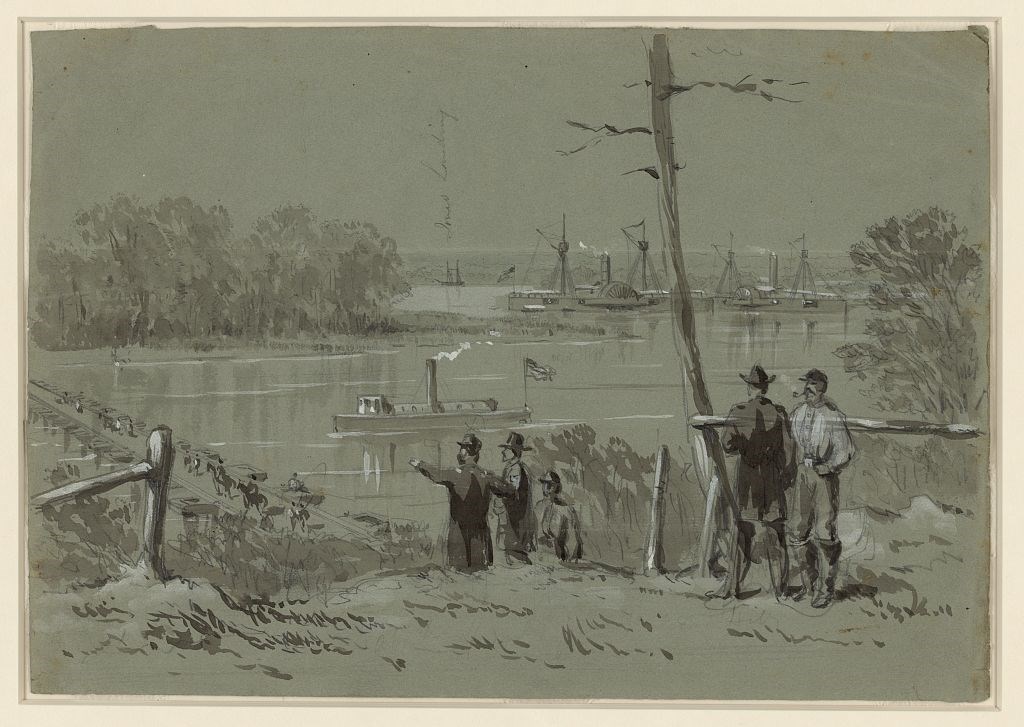
Today, Deep Bottom is a Henrico County Park, offering not only the launch ramps where Gen. Foster’s pontoon bridge came ashore, but also a landing for canoes and kayaks on Four Mile Creek. The canoe fleets of both the James River Association and the Chesapeake Bay Foundation use the two landings for school field trips.
The James River at Deep Bottom has more stories to tell than ever. It’s a splendid branch of the Chesapeake to explore by paddlecraft and powerboat alike. Go see for yourself.
