Part of a series of articles titled The Midden - Great Basin National Park: Vol. 19, No. 2, Winter 2019 .
Article
Lehman Caves Geology Reveals New Discoveries
This article was originally published in The Midden – Great Basin National Park: Vol. 19, No. 2, Winter 2019.

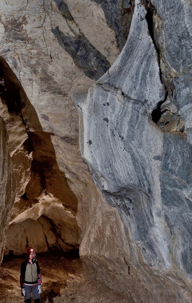
Photo by Dave Bunnell
We are learning a lot about Lehman Caves geology these days. While the Snake Range is a bit of a hot bed for geologists and university students to visit and study, the area immediately around the cave hasn’t received much attention. This may be, in part, because good topographic maps weren’t available until late in the 20th century for this part of the Range. Even into the 1970s and ‘80s, geologists and their students tended to map and study the areas with better base maps. By the time decent topo maps were released for the surface over Lehman Caves, attention had been drawn to the region’s fantastic Snake Range Décollement and areas of economic mineral resources.

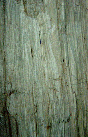
The Talus Room and the Royal Gorge of Lehman Caves are dramatically different from passages on the current tourist route. These areas have few secondary calcite (CaCO3 ) deposits (e.g., stalactites, stalagmites, flowstone, and shields). Instead of flowstone floors, the Talus Room is covered with a deep pile of talus. The walls and ceiling exhibit bedrock, which is nearly impossible to see in the tourist portions of the natural cave (you can observe bedrock in some parts of the tunnels and where blasting happened to install trails). An even greater contrast is experienced in the northwestern passages of Lehman, called the Gypsum Annex. Here, the walls, ceilings, and floors are covered with the mineral gypsum (CaSO4 . 2H2 O). So, why the differences?
Gypsum is highly soluble and, if formed in the cave before all the calcite “speleothems” (generic name of secondary mineral deposits in caves, such as flowstone, shields, and stalagmites), it would have been dissolved and removed when many of the beautiful calcite displays were deposited during the Pleistocene. This fact led me to hypothesize that there is a nearly impermeable layer of rock over the Gypsum Annex that prevented water from infiltrating from the surface. Given the difference in the Talus Room and Royal Gorge, I also suspected that those areas also had a mostly impermeable cover. Something other than marble must overlie much of the cave!

The thin red line in the northwest corner of the cave is the Gypsum Annex. X marks the site of a large quartzite outcrop.
The geology of Lehman Caves and its overlying surface is much more complex and certainly different than we have understood for decades. A complex mixture of highly fractured and faulted marble, shale, and quartzite make up the hill. The metamorphism of the limestone appears to have resulted from extensive faulting, probably associated with the Snake Range Décollement as the cave seems to have formed in a mylonitic (metamorphism along a fault zone) marble. Perhaps the discontinuous blocks of quartzite and shale are also fragments torn off and emplaced during that great, tectonic event. Detailed geologic mapping will continue as we try to better understand this area.
Citations
Moore, G.W. 1960. Summary report on the geology of Lehman Caves National Monument, Nevada: Great Basin National Park files, 8 p.
NPS. 2015. The formation of Lehman Caves: Available at https://www.nps.gov/grba/learn/ nature/the-formation-of-lehman-caves.htm. Accessed on October 28, 2019.
Rowley, P.D. et al. 2017. Geology and Geophysics of White Pine and Lincoln Counties, Nevada, and adjacent parts of Nevada and Utah: The geologic framework of regional groundwater flow systems. Nevada Bureau of Mines and Geology Report 56, Reno, Nevada, 146 p.
Last updated: February 15, 2024
