Last updated: January 12, 2024
Article
Monitoring Vital Signs in Times of Rapid Change
By Jeri Stoller, Scientist-in-Parks Communication Intern

Joshua tree (Michael Burchett, NPS); Monitoring desert spring (Logan Combs, NPS); Flooded road in Death Valley (California Highway Patrol)
Within the Mojave and Great Basin deserts of Nevada, Arizona, and California, lies a land of extremes and diversity. Joshua trees, fossil beds, dark night skies, and rich cultural history coexist. Understanding the health and condition of this land’s natural resources is essential for protecting this unique environment.
Environmental changes are occurring in the Mojave Desert at increasing rates over the last century. The average annual temperature in the southwestern US increased 1.6℉ between 1901 and 2016 [1], whereas annual precipitation decreased [2]. In addition to changes in average conditions, there have been more extreme climate events, such as more intense storms, floods, and droughts [3, 4].
The Mojave Desert today receives 20 percent less precipitation than it did in the early 20th century, with potentially widespread impacts on species and their environments. A recent study that re-surveyed historic bird transects found an average 43 percent decline in bird species diversity. Shortages of water in springs and other sources, rather than direct effects of higher temperatures, appear to be driving these declines, making this desert less habitable to many bird species [4].
Warming temperatures and severe droughts have contributed to an increase in the frequency of large wildfires in the western US since the early 1980s [5]. As temperatures increase and more water evaporates, vegetation becomes drier and more susceptible to wildfires. The lack of periodic, low-intensity fire and the spread of non-native plants into desert ecosystems have increased the amount of fuels (burnable vegetation) and the risk of severe wildfires. Estimates show that between 1984 and 2015, wildfires across the western US burned twice the area than would have burned if climate change were not a factor.
Long-term monitoring of key park resources provides information that can help park managers make decisions about how to respond to change and mitigate losses of critical plant and animal habitats.
Inventory and Monitoring Provide Status and Trend Information about Park Resources

The Mojave Desert Network (MOJN) is one of 32 inventory and monitoring networks collecting long-term data on key natural resources―like desert springs water quantity and quality, shrubland vegetation communities, and white pine forests. We call these key resources “vital signs” because they can be indicators of the health of park resources. MOJN scientists monitor selected vital signs in seven National Park Service units (Death Valley National Park, Great Basin National Park, Joshua Tree National Park, Lake Mead National Recreation Area, Manzanar National Historic Site, Mojave National Preserve, and Grand Canyon-Parashant National Monument) to report data on current condition and change over time to park managers. Learn more below about the vital signs we monitor and why they are important. We have not monitored long enough to detect trends yet, but we have documented current condition in sites we have visited.

NPS / Andrew Cattoir
Desert Springs
Desert springs are important water sources and hotspots of biodiversity. However, as temperatures increase, so does the possibility of losing these springs. We monitor 245 desert springs across five parks to help park managers understand how springs are changing in response to climate change and other threats, such as groundwater pumping, surface water diversion, recreation, livestock, and invasive species.
We collect a wide array of quantitative data for desert springs: presence of water, water quality (temperature, specific conductance, pH, dissolved oxygen), discharge, and surface water length. We also gather qualitative data, like disturbance, evidence of wildlife use, categories of spring vegetation, invasive plant species presence, and repeat photo points.

NPS / Jennifer Bailard
Recent data show that at desert springs, significant differences exist between water levels from wet and dry years. In Joshua Tree National Park, the number of dry springs and springs with only wet soil was much higher in 2017 than during the wetter period of 2005–2006 when spring inventories were done.
The dry year—2017—corresponds to the timing of an exceptional drought in California, from 2014 through 2017. See the repeat photo below of Sparrow Spring in Joshua Tree National Park, showing the dramatic contrast in water presence between the relatively wet year, 2006, and 2017, falling at the end of a severe drought.
Lack of water at desert springs negatively affects plants and animals. Shrubs and herbaceous plants that grow in and near springs depend on this water, and many of these species are highly adapted to these environments. Additionally, more than 75% of wildlife in the Mojave and Great Basin deserts depend on spring and stream vegetation to survive. These animals include aquatic species such as pupfish, resident terrestrial species such as bighorn sheep, and migratory species such as numerous types of birds.
As climate change intensifies, dry years will become more common and will be punctuated with very wet years, like 2023. Drying climate conditions can result in less water or even the loss of desert springs, which will have negative impacts on plants and animals. Continuing to monitor these springs can help managers make decisions on how to protect them.
Comparison of water presence at Sparrow Spring, Joshua Tree National Park, in 2006 and 2017

Left image
Sparrow Spring, Joshua Tree National Park, January 2006. This photo was taken during the initial desert springs inventory on January 15th, 2006. Surface water was present at the spring during the visit.
Credit: NPS Photo
Right image
Sparrow Spring, Joshua Tree National Park, February 2017. This photo was taken during a recent Joshua Tree desert springs monitoring field season on February 8th, 2017. No surface water was present during the visit.
Credit: NPS Photo

NPS / Jenette Jurado
Selected Large Springs
While the Desert Springs project involves rapid surveys at a large number of randomly-selected springs, the Selected Large Springs project focuses on more intensive monitoring of a small number of springs and wells. Park resource managers and MOJN staff chose springs that had high amounts of discharge and that were important water sources and habitat for wildlife. Some animals in these springs are endemic, meaning they have a very limited habitat range. For example, there are two species of aquatic springsnail that live only in one spring in Lake Mead National Recreation Area. The endangered Mohave tui chub is a fish that was originally found only in the Mojave River basin and now occurs in isolated ponds near the terminus of the river.
At these selected springs, the MOJN hydrology team monitors water quantity and chemistry along with biological indicators, like benthic macroinvertebrates. Benthic (meaning “bottom-dwelling”) macroinvertebrates are small aquatic animals that are visible to the naked eye. They include insects, arachnids, snails, crustaceans, and worms. They are reliable indicators of water quality because they spend all or most of their lives in water, are easy to collect, and differ in their tolerance to pollution and disturbance.
Spring Vegetation
In addition, the MOJN vegetation team conducts Spring Vegetation monitoring, a separate project to learn how the plant community composition and presence of invasive species are changing over time at these same selected large springs. These springs are expected to face increasing threats due to climate change, lower springflow and reduced aquatic habitat related to warmer temperatures, reduced snowpack, more severe droughts, and groundwater extraction for human water uses.

NPS / Jennifer Bailard
Streams and Lakes
In close collaboration with park staff, MOJN monitors nine perennial streams and six subalpine lakes in Great Basin National Park. Park staff collect all of the stream data, and work side-by-side with us to collect the lake data. Park managers used these data to determine whether a lake or stream was suitable for translocating the one native fish for the park, the Bonneville cutthroat trout, and establishing new populations. Along with providing habitat for aquatic organisms and water for terrestrial organisms, these lakes and streams contribute to local water supplies and are popular visitor destinations.
Climate change is a concern for streams and lakes because higher air temperatures result in more precipitation falling as rain than snow, thereby reducing snowpack. Longer and more severe drought can also reduce snowpack. This decreases the amount of snowmelt runoff feeding lakes and streams, lowering lake water levels and reducing stream flow. Higher air temperatures can also increase the water temperatures of lakes and streams, altering water chemistry and the biological functioning and health of aquatic plants and animals.
Monitoring streams and lakes involves analyzing current status and long-term trends in water quality, quantity, and chemistry; macroinvertebrate assemblages (streams only); and ice-free season length (lakes only).

NPS / Joseph Ladd
Forests
White Pine
In Great Basin National Park, we monitor limber pine and Great Basin bristlecone pine, both long-lived, high-elevation white pines. These pines grow in harsh environments and provide ecosystem services that make these environments a more suitable habitat for other species. For example, limber and bristlecone pines regulate snowmelt and streamflow, allow shade-tolerant species to grow under them, and provide habitat and food for animals.
White pines face several threats, including mountain pine beetles, warming climate, and the disease white pine blister rust, caused by a non-native pathogen. By 2020, we completed the first assessments of all our monitoring plots, and we found no evidence of white pine blister rust on pines in Great Basin National Park, an encouraging sign. However, insects are another concern.

USFS / Constance Millar
In some areas, such as the Rocky Mountains and the Cascades, drought has made white pines more susceptible to mountain pine beetles; warming temperatures have also made higher elevations, where white pines live, more hospitable for beetles. The usual defense mechanisms these pines have, such as producing pitch that helps to defend trees from beetle damage, were weakened by the severe drought. A recent study found bristlecone mortality at two sites in the Great Basin region, including Death Valley National Park, as a result of beetle attacks coinciding with increasing temperature and drought [6]. By monitoring white pines, we can inform park managers early about detection of bark beetle impacts, disease, or other changes.
In 2023, we found beetle-damaged limber pine in two monitoring plots in Great Basin National Park, but we have not yet documented beetle damage or mortality in the Great Basin bristlecone pines we monitor.

Quaking Aspen
Quaking aspen trees are the most widespread deciduous tree in North America. Aspen stands provide habitat for diverse species, but they face numerous threats, including the disease Sudden Aspen Decline (SAD). Researchers believe that droughts and hot temperatures increase aspen vulnerability to SAD. Droughts make aspen trees more susceptible not only to diseases but also to insects. Aspen are dependent on fire for creating opportunity to establish in new areas. We monitor aspen in Great Basin National Park and Parashant National Monument to understand how the populations may be changing and how these biologically rich plant communities are responding to the threats they face.

Photo by Sarah Barsch, Great Basin Institute.
Bats
Across six MOJN parks, we monitor 11 bat species during the winter hibernation season and 30 species in the summer season. This monitoring is essential to understanding how climate change and extended droughts are leading to loss of bat habitat and foraging sites. Wind energy development also poses a threat to bat species. In addition to monitoring bat species occurrence through acoustic monitoring, we also capture bats and assess them for white-nose syndrome, a disease caused by a non-native fungus that has killed millions of bats in other parts of the country. With predicted increases in droughts, researchers expect a decline in suitable habitats for bats, resulting in fewer bat species living in the western US [7]. The drying of desert springs reduces areas where bats can access water to drink and may restrict bat distributions across the Mojave Desert.
Check out this article—Bats are in Danger. Here's How We're Helping Them—to learn more about how a coordinated national response across national parks and other organizations is helping us better understand and protect bats.

NPS / Joseph Ladd
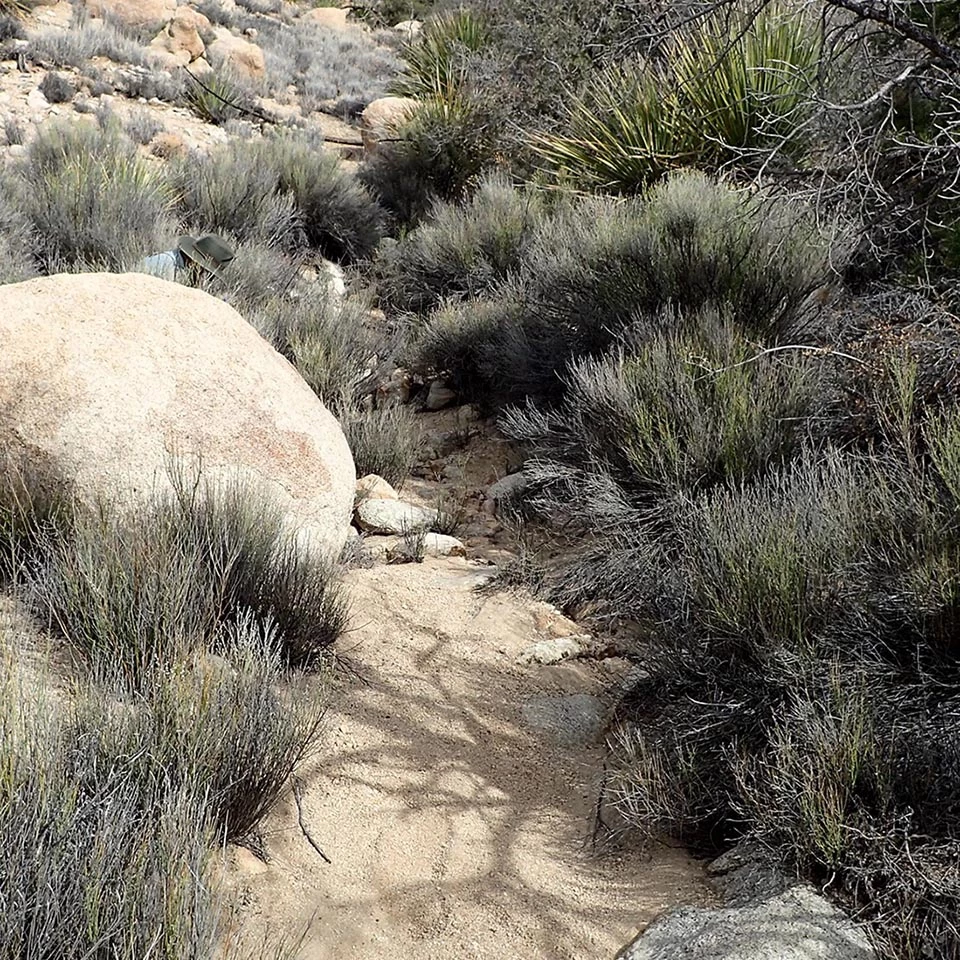
Upland Vegetation Communities
Upland vegetation communities are an important MOJN vital sign because they provide soil conservation, carbon storage, and wildlife habitat. We monitor one shrub community in each park to detect long-term change. Shrub communities collectively represent a large proportion of each park, and they capture several focal communities of interest such as Joshua tree, creosote bush, and sagebrush.
Vegetation communities in MOJN parks are vulnerable to a variety of threats. Increases in temperature and decreases in precipitation may lead many plant species to move up in elevation to cooler environments. This can lead to changes in species associations and community composition. Air quality, human water use, and altered disturbance regimes (such as fire, grazing, and development) also threaten these vegetation communities, as does the introduction of non-native species, which can compete with native plants and increase wildfire frequency.

NPS / Joseph Ladd
Joshua Trees
Joshua trees, a type of yucca, are a well-known symbol of the Mojave Desert and are part of the uplands vegetation vital sign. They are losing habitat because of increased temperatures, more severe droughts and fires, and invasive grasses [8].
One significant loss came in 2020 when the Dome Fire killed an estimated 1.3 million Joshua trees in Mojave National Preserve [9]. In 2023, the York Fire burned over 100,000 acres in and outside of the preserve, and assessment of impacts on Joshua trees is not yet complete. Even though the Joshua trees will likely never return to Mojave National Preserve with the same abundance as before these fires, by replanting Joshua trees and continuing to monitor them in Mojave Desert Network parks, managers can improve chances for these plants to survive changing climate and fire regimes, at least in some areas of their range. However, large areas of Joshua tree and pinyon/juniper habitats will likely convert to other types of vegetation, such as grasses (often non-native), shrubs, and other plants better adapted to wildfire.

NPS
Weather and Climate
Monitoring weather and climate is important for understanding changes we detect in other vital signs (such as changes in vegetation productivity, species composition, or desert spring condition), and for guiding us in the protection of sensitive habitats and endangered species. As noted in the introduction to this article, temperatures are increasing and amounts of precipitation decreasing. We access weather and climate data from existing meteorological stations in network parks.
The Desert Research Institute is one of our partner organizations that hosts weather and climate data from MOJN parks. Explore their data visualization tool where you can quickly and easily generate simple graphs and charts from a variety of near real-time data collected from weather stations in and near our network parks.

Photo by Jenelle Booker, Mosaics-in-Science Intern
How Does Monitoring Help Park Managers?
We continue to monitor vital signs to document and better understand changes that may be happening due to climate change, wildfire, and other threats. These monitoring data can help park managers make informed decisions to protect the parks. Below are a few examples of ways monitoring data can help park managers.
Early Detection of Declines or Disease Can Increase Effectiveness of Responses
Whether detecting white-nose fungus in bats or white pine blister rust in white pines, an early detection of disease or signs of decline can increase the likelihood that managers can effectively respond, and an early response may also reduce the cost of management actions.
Prioritizing Where to Take Management Actions
Some of the stressors impacting plants, animals, or ecosystems are large-scale, such as altered fire regimes and warming climate. Monitoring provides data on change through time, and can help managers identify resources that are more resilient to change and those that are more sensitive. For example, if a spring providing important habitat to birds and bats is being surrounded by non-native plant species that alter its hydrology, perhaps investing in restoration of that spring’s native vegetation will benefit multiple species. Some springs may be more vulnerable to warming temperatures and drought, while others maintain some level of moisture or water even during droughts. Understanding where the most resilient and most sensitive springs are may help managers prioritize actions to protect these water sources and reduce threats to water quality and quantity from non-native plants or animals, or recreation impacts.
Regional-scale Collaboration Enhances Conservation Efforts
A few monitoring projects (white pines, aspen, and bats) are conducted at multiple national parks (and sometimes other jurisdictions across the region or country) using identical or very similar methods. Collecting comparable data on the same species in various locations allows managers to problem-solve together and collaborate on solutions instead of working alone.
References
-
Vose, R.S., D.R. Easterling, K.E. Kunkel, A.N. LeGrande, and M.F. Wehner, 2017: Temperature changes in the United States. In: Climate Science Special Report: Fourth National Climate Assessment, Volume I [Wuebbles, D.J., D.W. Fahey, K.A. Hibbard, D.J. Dokken, B.C. Stewart, and T.K. Maycock (eds.)]. U.S. Global Change Research Program, Washington, DC, USA, pp. 185–206, doi: 10.7930/J0N29V45.
-
Easterling, D.R., K.E. Kunkel, J.R. Arnold, T. Knutson, A.N. LeGrande, L.R. Leung, R.S. Vose, D.E. Waliser, and M.F. Wehner, 2017: Precipitation change in the United States. In: Climate Science Special Report: Fourth National Climate Assessment, Volume I [Wuebbles, D.J., D.W. Fahey, K.A. Hibbard, D.J. Dokken, B.C. Stewart, and T.K. Maycock (eds.)]. U.S. Global Change Research Program, Washington, DC, USA, pp. 207–230, doi: 10.7930/J0H993CC.
-
Gonzalez, P., G.M. Garfin, D.D. Breshears, K.M. Brooks, H.E. Brown, E.H. Elias, A. Gunasekara, N. Huntly, J.K. Maldonado, N.J. Mantua, H.G. Margolis, S. McAfee, B.R. Middleton, and B.H. Udall, 2018. Southwest. In Impacts, Risks, and Adaptation in the United States: Fourth National Climate Assessment, Volume II [Reidmiller, D.R., C.W. Avery, D.R. Easterling, K.E. Kunkel, K.L.M. Lewis, T.K. Maycock, and B.C. Stewart (eds.)]. U.S. Global Change Research Program, Washington, DC, USA, pp. 1101–1184. doi: 10.7930/NCA4.2018.CH25
-
E. A. Riddell, K. J. Iknayan, L. Hargrove, S. Tremor, J. L. Patton, R. Ramirez, B. R. Wolf, and S. R. Beissinger. 2021. Exposure to climate change drives stability or collapse of desert mammal and bird communities. Science 371, 633-636 (2021). DOI: 10.1126/science.abd4605
-
Wehner, M.F., J.R. Arnold, T. Knutson, K.E. Kunkel, and A.N. LeGrande. 2017. Droughts, floods, and wildfires. In: Climate Science Special Report: Fourth National Climate Assessment, Volume I [Wuebbles, D.J., D.W. Fahey, K.A. Hibbard, D.J. Dokken, B.C. Stewart, and T.K. Maycock (eds.)]. U.S. Global Change Research Program, Washington, DC, USA, pp. 231–256 doi: 10.7930/J0CJ8BNN.
-
Bentz, B.J., C.I. Millar, J.C. Vandygriff, and E.M. Hansen. 2022. Great Basin bristlecone pine mortality: Causal factors and management implications, Forest Ecology and Management, Volume 509, 120099, ISSN 0378–1127, https://doi.org/10.1016/j.foreco.2022.120099.
-
Piccioli Cappelli, M., R.V. Blakey, D. Taylor, J. Flanders, T. Badeen, S. Butts, W. F. Frick, H. Rebelo. 2021. Limited refugia and high velocity range-shifts predicted for bat communities in drought-risk areas of the Northern Hemisphere, Global Ecology and Conservation, Volume 28, e01608, ISSN 2351–9894, https://doi.org/10.1016/j.gecco.2021.e01608.
-
Cameron W. Barrows, Michelle L. Murphy-Mariscal. 2012. Modeling impacts of climate change on Joshua trees at their southern boundary: How scale impacts predictions, Biological Conservation, Volume 152, Pages 29–36, ISSN 0006–3207, https://doi.org/10.1016/j.biocon.2012.03.028.
-
National Park Service. 2020. Dome Fire - Mojave National Preserve (U.S. National Park Service) (nps.gov). Accessed May 5, 2023.
More Information
Visit the Mojave Desert Network web page, or contact Allen Calvert, Program Manager, for more information.Article editors: Linda Mutch and Lise Grace.
Tags
- death valley national park
- grand canyon-parashant national monument
- great basin national park
- joshua tree national park
- lake mead national recreation area
- mojave national preserve
- mojave desert network
- climate change
- mojave national preserve
- death valley national park
- great basin national park
- lake mead national recreation area
- joshua tree national park
- parashant national monument
- grand canyon-parashant national monument
- manzanar national historic site
- bats
- integrated uplands vegetation
- aspen
- selected large springs
- desert springs
- streams and lakes
- spring vegetation
- invasive and exotic plants
- white pines
- weather and climate
- climate change effects
- inventory and monitoring
- monitoring