Last updated: November 1, 2021
Article
Vital Signs Monitoring at Courthouse Wash, Arches National Park, 2010–2019

Ecological Monitoring at Courthouse Wash
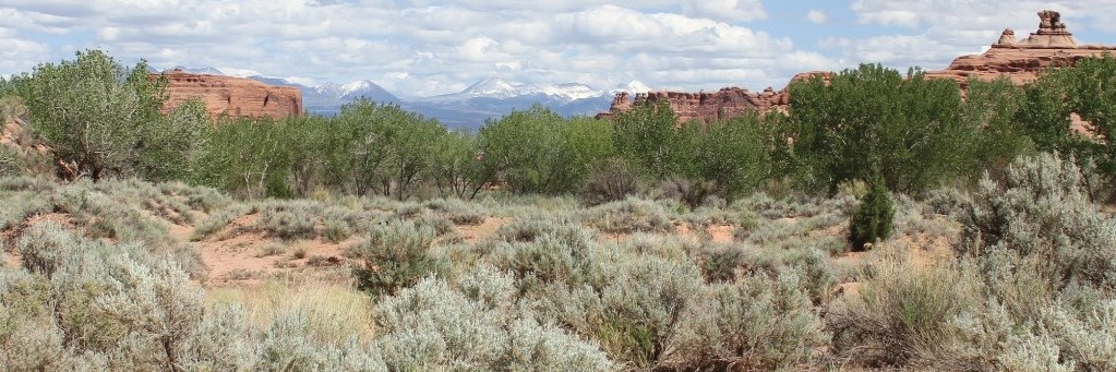
Where streams flow, riparian areas are oases of life. They are biologically diverse and perform important ecosystem services. In Arches NP, Courthouse Wash provides habitat for unique plant species, a corridor for wildlife movement, and rare surface water in an arid landscape. Linked to both aquatic and terrestrial systems, riparian ecosystems are potentially sensitive indicators of landscape-level change.
To evaluate the health of riparian systems, the Northern Colorado Plateau Network (NCPN) monitors hydrology (water quantity), geomorphology (channel shape), and vegetation of wadeable streams. Together, these indicators can tell us about “normal” conditions and also warn park managers of potential problems.
At a Glance
- The Courthouse Wash system is driven by natural processes rather than human effects. If its current protections are maintained, the primary stressors on the Courthouse Wash system are likely to be climate change and exotic-plant invasions.
- Increased drought stress has already been noted during dry years.
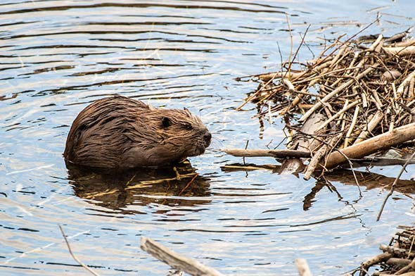
- Beaver activity may increase climate resiliency by creating deeper pools and shallower groundwater tables in some sections of the wash.

Hydrology
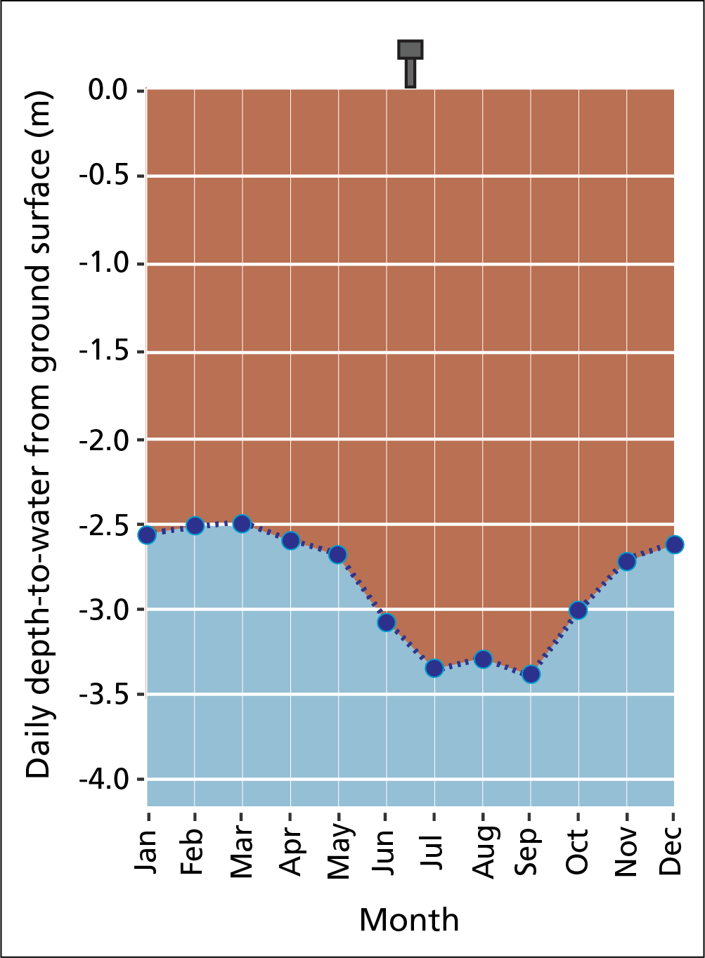
Measuring depth to groundwater tells us how much water is available in the system. We do this at monitoring wells installed at Reach 1. During the monitoring period (2010–2019), groundwater levels showed steep declines at the start of each growing season. From about January to July, the stream is a gaining reach, as groundwater drains toward the channel. But from about August to December, it becomes a losing reach, as channel water drains toward the riparian zone. Groundwater levels are consistently deeper than 2.5 meters below the ground surface in Reach 1, often reaching over 3 meters during summer and fall (see figure). Wetland vegetation cover was also lower at this reach than at any other. Monsoon storms may play a key role in keeping groundwater levels closer to the ground surface during the growing season.
Depth-to-water has trended downward since 2016, and climate-change models suggest monsoon recharge may be less common in the future. The growing season is expected to lengthen as air temperatures increase. When this happens, evaporation and water use by plants will also increase, likely resulting in a lower water table. This will increase drought stress during summer and fall. Drought stress on Fremont cottonwoods has already been noted on several occasions in Courthouse Wash.

Geomorphology
Flood events can deposit enough sediment to raise the channel bed. After this happens, the same amount of flow results in a (literally) higher flood stage. The 10 highest-stage flood events in the period of record all occurred after a significant flood event in September 2013 raised the channel elevation. After the flood events of 2013 and 2014, we measured significant channel deposition at reaches 1 (LCW) and 5 (UCW). The mean thalweg elevation (deepest part of the channel) increased 0.41 meters at Reach 5 between 2013 and 2015, and 0.24 meters at Reach 1 between 2013 and 2014. In Lower Courthouse Wash, the narrow confines of the canyon allow beavers to build dams. The dams create upstream pools that provide persistent surface water. The persistent pools also raise groundwater levels upstream and downstream of the dam. Beavers are likely to help maintain ecosystem resilience in Courthouse Wash by maintaining pockets of surface water and high groundwater tables during droughts. But at the same time, human effects can create unnatural erosion events. Field crews have noted gullying along social trails in Upper Courthouse Wash. The gullies funnel rain during intense storm events, increasing erosion. Encouraging visitors to hike in the wash, rather than on adjacent surfaces, could help reduce this problem.

Vegetation
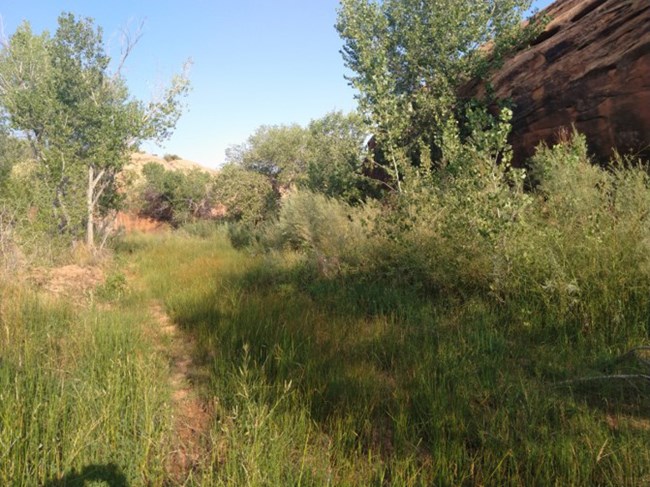
NCPN vegetation monitoring indicates that Courthouse Wash is a diverse, sustainable riparian area. We found seedlings and saplings in all monitoring reaches. This indicates good potential for regeneration of the primary overstory species, Fremont cottonwood (Populus fremontii), into the future. At most reaches, perennial cover was fairly consistent over time. Two species new to the park were vouchered during monitoring: ditch polypogon (Polypogon interruptus) and an exotic species, yard knotweed (Polygonum aviculare). Two species of special conservation concern were documented. Gumweed aster (Grindelia fastigiata), was recorded in four monitoring reaches, and lemon scurf-pea (Psoralideum lanceolatum), was recorded at one.
High exotic-plant cover increases the risk of fire in southwestern riparian systems. This is particularly true of species that contribute to fuel loading, such as tamarisk and annual brome grasses. Our data suggest that exotic-removal programs have helped keep tamarisk (Tamarix sp.) and Russian-olive (Elaeagnus angustifolia) at low cover at monitoring sites. But overall, total exotic cover (2–30%) was relatively high compared to total native cover (17–43%) at all reaches. Changes over time were especially evident in cheatgrass (Bromus tectorum) and Japanese chess (Bromus japonicus). To reduce wildfire risk, park staff may want to check backcountry campsites for high annual brome cover in wet years (even though campfires are not allowed at these sites).
Future Monitoring
NCPN vegetation and geomorphology monitoring have been suspended in Courthouse Wash since 2015, due to budget constraints. Baseline data from 2010 to 2015 can provide a valuable comparison for future monitoring efforts, when they are resumed. Retaking historic photos and overview photos of monitoring reaches would also help provide a record of change over time. In the meantime, maintaining the hydrologic record at Reach 1 should be a high priority to better understand the effects of climate on water availability in the system.
Information in this brief was summarized from R.H. Weissinger and D.L. Witwicki. 2020. Riparian Monitoring of Wadeable Streams at Courthouse Wash, Arches National Park: Summary Report, 2010–2019.
Tags
- arches national park
- ncpn
- northern colorado plateau network
- invasive plants
- invasive species
- invasive species management
- exotic & invasive species
- exotic plants
- exotic species
- monitoring
- non-native plants
- non-native species
- plants
- riparian communities
- riparian habitat
- riparian vegetation
- hydrology
- geomorphology
- utah
- wadeable stream monitoring
- inventory and monitoring
- climate change
- courthouse wash
