Last updated: October 14, 2021
Article
President's Park South Cultural Landscape

Library of Congress, Geography and Map Division
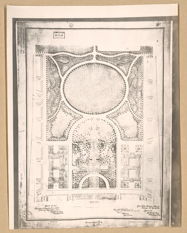
Pierre Charles L’Enfant first identified this location in 1791 as the site for a park associated with the White House. He envisioned a swath of green connecting the White House with the National Mall, and he dubbed this greensward “President’s Park.” This 82-acre tract was purchased by the federal government in 1792 and became an official part of what is now U.S. Reservation 1. However, the landscape to the south, the future Ellipse, remained relatively untouched.
By 1851, renowned landscape designer Andrew Jackson Downing was hired to prepare a new development plan for both the National Mall and President’s Park, with hopes of transforming these areas for public use. Downing’s plan called for the creation of a circular parade ground, the first progenitor of the present day Ellipse, as well as an associated network of paths and trees along the park border. Downing’s death delayed the realization of his vision, and the site's heavy use during the Civil War resulted in severe park damage. From 1861 to 1865, the Ellipse and Lafayette Park areas were used as a military barracks, parade grounds, and for animal grazing.
Earnest development of President’s Park South did not take place until the 1870s-1880s, when the site was reshaped into a public park through grading, tree plantings and circulation networks. The Ellipse was filled and sculpted to create a slope down to Constitution Ave. The landscape became further refined with the 1901 McMillan Plan, which set out a series of plans based on L’Enfant’s 1791 plan.
With the exception of the National Christmas Tree, the locations chosen for each of these features were restricted to areas outside of the central Ellipse, allowing this area to remain the same open lawn originally envisioned by Downing. As a landscape closely associated with the Presidents of the United States, Downing, and several other preeminent landscape architects and sculptors, President’s Park South is a unique resource with national significance.
With the exception of the National Christmas Tree, the locations chosen for each of these features were restricted to areas outside of the central Ellipse, allowing this area to remain the same open lawn originally envisioned by Downing. As a landscape closely associated with the Presidents of the United States, Downing, and several other preeminent landscape architects and sculptors, President’s Park South is a unique resource with national significance.

NPS
President’s Park South retains a high level of integrity to the period of significance. The open vista from the White House to the Washington Monument and the Jefferson Memorial remains intact, bordered on either side by trees marking the perimeter of the Ellipse. A collection of historic features still stand throughout the park landscape, including the Butt-Millet Memorial Fountain, the Bulfinch Gatehouses, the Ellipse Meridian Stone, the First Division Monument, the Zero Milestone, the Second Division Memorial, and the National Christmas Tree.

NPS
Quick Facts
- Cultural Landscape Type: Designed
- National Register Significance Level: National
- National Register Significance Criteria: A, B, C
- Period of Significance: 1791-1947


