Last updated: November 7, 2023
Article
Southeast Coast Network News October 2023
Data Management: New Wadeable Database in Production
A new database for wadeable stream habitat monitoring was put into production in September. The new database, which features a SQL back end for data storage and a web-based user interface, will streamline data reporting and publication.
Wendy Completes Detail at Central Support Office
Southeast Coast Network Data Manager Wendy Wright recently completed a 120-day detail with the Central Support Office Data Management Team. During the course of her detail, Wendy met with data managers, network program managers, regional program managers, ecologists and biologists from all 32 networks in individual network calls and Teams meetings. Wendy discussed data management and data publication status and support needs with each network for every protocol implemented in IMD. Over 700 individual data streams were documented across the Inventory and Monitoring Division. The networks were provided a written summary of the meetings and their networks "State of the Data." A wish list of data support requests from each network was collected and a group of SCA interns funded by the Central Support Office will start to work on those support requests in January.
New Shoreline Data Package
An open-data geo package containing all shoreline data collected by the Southeast Coast Network from 2017–2023 has been published. This geo package meets open data requirements outlined in the Open Government Data Act of 2018. The geo packages can be opened in open-source applications such as QGIS and don’t require ESRI products to view. They also contain embedded Federal Geographic Data Committee (FDGC) compliant metadata. The complete shoreline open data set will consist of one tabular data package with event and logistical data and one geo spatial data GeoPackage. Kudos to SECN Coastal Technician Abby Gonzalez for pushing through the geospatial open data requirements! This will be one of the first geospatial datasets published in IMD that meets open data requirements. It is available at DataStore - Southeast Coast Network Shoreline Change Monitoring GeoPackages 2018-2023 Shoreline Change Data (nps.gov)

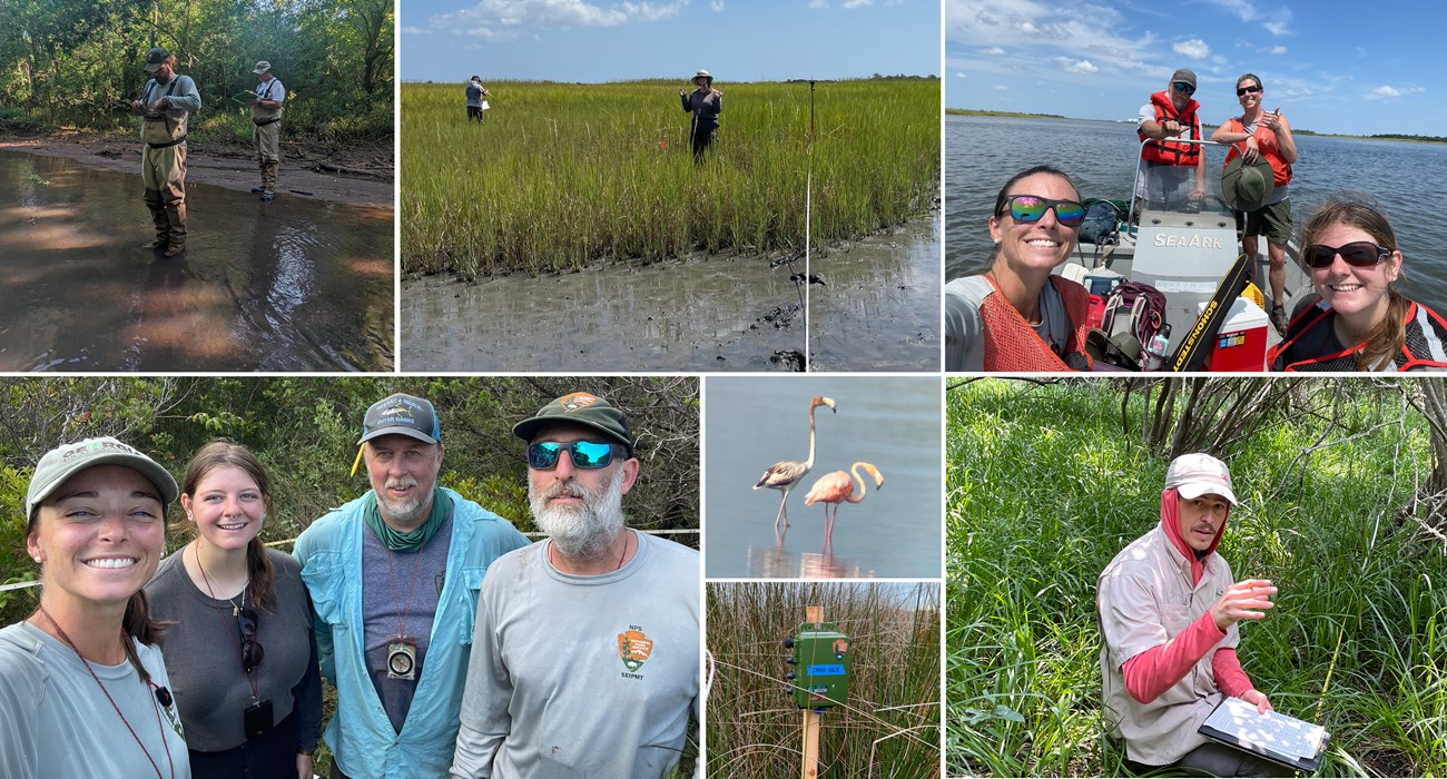
NPS photos / Katie Dagastino, Mallorie Davis, Michael Parrish and Forbes Boyle
FY2023 Monitoring Updates
The FY2023 fieldwork season has ended for the Southeast Coast Network. Data collected during this field season is being processed along with FY2022 data so reports and data packages can be prepared for publication. Stay tuned for more monitoring activities. We are currently preparing our FY2024 workplan which should be finalized in November.
Wadeable Streams
After consistent weather delays that resulted in high-water conditions, wadeable stream habitat monitoring surveys were completed at single sites in Horseshoe Bend National Military Park in August, and Ocmulgee Mounds National Historical Park in September. Two sites at Kennesaw Mountain National Battlefield Park were surveyed earlier in the summer.
Processing continues for data collected from wadeable stream monitoring surveys conducted in FY2022 at Congaree National Park and a summary report from the previous year's data collection at Chattahoochee River National Recreation Area will be published later this year.
Vegetation Communities
The second round of vegetation community monitoring at SECN parks wrapped up with plots surveyed at Cape Hatteras National Seashore in July and August, and at Fort Pulaski National Monument at the end of August. Assisting the SECN Veg Team with 77 plots at Cape Hatteras National Seashore were Wylie Paxton (Detail from Carl Sandburg Home National Historic Site), and Scott Ward (contractor from UNC-Chapel Hill Botanical Garden). There were 12 plots revisited at Fort Pulaski National Monument. Monitoring was also conducted at Timucuan Ecological and Historic Preserve and Fort Matanzas National Monument earlier this spring and summer. For the season, the team revisited 102 plots and established 29 new ones. In addition, six QA/QC plots were surveyed at Cape Hatteras National Seashore.
Data collected in FY2022 at Horseshoe Bend National Military Park, Cape Lookout National Seashore, Moores Creek National Battlefield and Canaveral National Seashore is being processed. Reports for data collected during FY2021 at Congaree National Park, and Ocmulgee Mounds National Historical Park were published this summer. Kennesaw Mountain National Battlefield Park is being finalized at the national office and Chattahoochee River National Recreation Area is in review. Both should be published before the end of the calendar year.
Water Quality
Water-quality data were collected at Fort Pulaski National Monument, Cumberland Island National Seashore, Canaveral National Seashore, Fort Matanzas National Monument, Timucuan Ecological and Historic Preserve and Congaree National Park in August and September at fixed sites. Monthly visits to parks are planned to continue in 2023 with assistance from park staff and partners at Cape Hatteras National Seashore, and Cape Lookout National Seashore.
Data collected during last summer's park-wide water-quality assessments at Cumberland Island National Seashore and Fort Matanzas National Monument will be reported later this year.
Landbird and Anuran Communities
Automated recording devices (ARDs) for the FY2023 field season finished collecting vocalizations at Cape Hatteras National Seashore, Chattahoochee River National Recreation Area, Fort Pulaski National Monument, Fort Matanzas National Monument and Timucuan Ecological and Historic Preserve. Retreivals started this summer at Chattahoochee River National Recreation Area and Fort Pulaski National Monument. The ARDs at Cape Hatteras National Seashore were collected in September and the ARDs at Fort Matanzas National Monument and Timucuan Ecological and Historic Preserve will be picked up in October and November.
Data sets from landbird and vocal anuran monitoring in FY 2022 are being processed for publication. Vocalization data collected in FY 2015 and 2016 are being processed and data sets from these monitoring events will be published in the coming weeks with reports for all three seasons to follow later this year.
Coastal Wetlands
Surface Elevation Table (SET) sites will be get second, fall readings, which started with Canaveral National Seashore in September. Fort Matanzas National Monument, Timucuan Ecological and Historic Preserve, Fort Pulaski National Monument, Fort Frederica National Monument, Cumberland Island National Seashore and Cape Hatteras National Seashore will be completed this month. First readings were conducted at all of the SET sites last spring.
An updated SET monitoring protocol, including the narrative and associated SOPs, was recently approved and is pending publication later this year.
Shorelines
Fall surveys were completed at Canaveral National Seashore in September. Fort Matanzas National Monument, Cape Lookout National Seashore and Cape Hatteras National Seashore will be surveyed this month.
Steering Committee to Meet November 8-9
The FY24 Steering Committee and Board Meeting will be held November 8-9 at Ocmulgee Mounds National Historical Park in Macon, Georgia. There will be a full day of presentations (Wednesday) from SECN staff about our work this past year as well as discussions about our future plans. The board meeting and a park tour conducted by OCMU Resource Manager Gregory Luna Golya will take place on Thursday morning. This a chance for parks to weigh in and provide feedback on our program as well for meeting participants to learn more about our host park. More information about hotels and logistics will be coming via email, or contact Brian Gregory with questions.

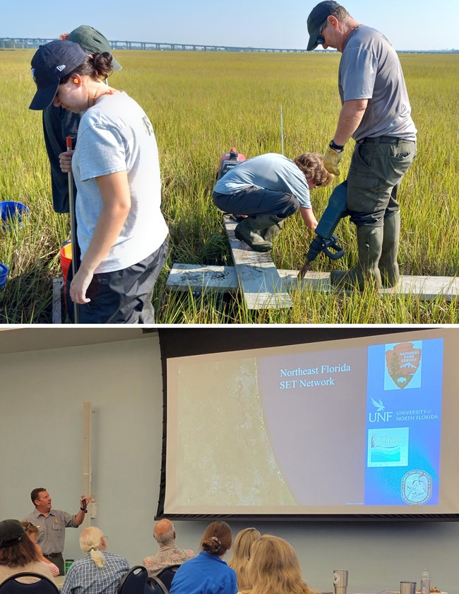
NPS photos
Beyond the Network
SECN Coastal Ecologist William "Ches" Vervake co-authored a paper that was featured in a recent issue of Coastal and Estuarine Science News (CESN). Movin' on Up: Assessing Mangrove Expansion in the U.S., highlighted the work of 52 coastal scientists who met to discuss the distribution of mangroves along the Atlantic and Gulf coasts. It is available to view at CESN 2023 Issue 4 (memberclicks.net). The paper is titled, Rapidly Changing Range Limits in a Warming World: Critical Data Limitations and Knowledge Gaps for Advancing Understanding of Mangrove Range Dynamics in the Southeastern USA.
Lecturing and Helping out at UNF
Ches lectured on mangroves at a recent Biology Seminar Series sponsored by the Biology Department in the University of North Florida's College of Arts and Sciences. In August, Ches assisted UNF students with Surface Elevation Table (SET) installations in Jacksonville.
GTMNERR Presentation
Ches presented "Changing Elevation in a Dynamic Ecotone" to the Guana Tolomato Matanzas National Estuarine Research Reserve (GTM NERR) Technical Advisory Group in July. The Reserve is a partner of the Southeast Coast Network.

Recent Publications
The Southeast Coast Network recently published the following reports:
- Terrestrial Vegetation Monitoring at Congaree National Park: 2021 Data Summary. Available at: DataStore - Terrestrial vegetation monitoring at Congaree National Park: 2021 data summary (nps.gov)
Tags
- cape hatteras national seashore
- ocmulgee mounds national historical park
- fort pulaski national monument
- terrestrial vegetation monitoring
- wadeable stream habitat monitoring
- landbird community monitoring
- vocal anuran community monitoring
- coastal elevation monitoring
- surface elevation tables
- shoreline change monitoring
- timucuan ecological and historic preserve
- water quality monitoring
- estuarine water and sediment quality
- secn-newsletter
- southeast coast network news
