Last updated: January 26, 2023
Article
Historic Rainfall Surges Bay Area Creeks, but Where are the Salmon?
By Watershed Stewards Program Corpsmembers Catherine Masatani and Elizabeth Bear, San Francisco Bay Area Network Salmonid Monitoring Program

Watershed Stewards Program Corpsmember Catherine Masatani / NPS
January 2023 - ‘Atmospheric rivers’ and ‘bomb cyclones’ have occupied headlines these past few weeks as significant storms have battered the area, bringing historic rainfall amounts and causing our local creeks to surge. But what exactly do these meteorological terms mean? And what do surging creeks mean for the Coho & Steelhead Monitoring Team and the spawning coho salmon we are trying to monitor?
Atmospheric rivers, likened to ‘rivers in the sky,’ occur when columns of water vapor are transported outside of the warm tropics and deposited over land in cooler regions. Upon landfall, the water vapor is released in the form of rain or snow. Depending on the scale of the atmospheric river, this can result in extreme rainfall and wind speeds which may flood vulnerable watersheds and result in downed trees, erosion, and runoff. Atmospheric rivers are common during the winter here on the California coast, and account for a large proportion of our annual precipitation and a source of freshwater. Bomb cyclones are associated with atmospheric rivers, and form when cold and warm air currents collide, creating a low-pressure system that experiences a sudden fall in pressure as the storm strengthens.
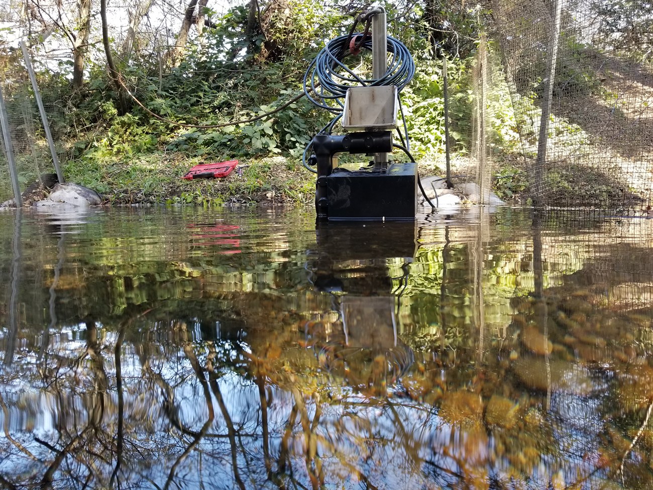
As these intense storms have moved through local watersheds this winter, the resulting sustained flows have impacted our field operations in several ways. Our crew had to remove equipment from the creeks for instance, including a DIDSON camera and PIT tag array, as high flows create concern for equipment washing away or becoming damaged. The DIDSON camera is a sonar camera deployed to capture net fish passage, and has been deployed on Lagunitas Creek this year in partnership with the California Department of Fish and Wildlife. The PIT tag monitoring system is used to electronically detect previously tagged salmon, giving them unique identification codes which can be used as a management and research tool to monitor their movement. Our PIT tag monitoring system is utilized during smolt trapping in springtime, but was removed from Olema Creek in preparation for these storms. We anticipate deploying this equipment again when flows decrease.

NPS
In addition, high flows have severely limited survey activities as conditions become unsafe and the water too turbid to allow for clear visibility. Still, since November, we have conducted over twenty spawner surveys and have yet to see a strong return of adult coho. All this rain allows adult salmon access to the streams, but where are they?
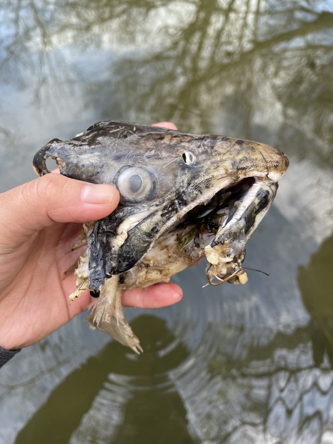
When surveys first began, more rain was needed to saturate the ground and initiate attraction flows for salmon making their way back. But the few more recent surveys indicate a potentially poor showing for this cohort. Generally, the monitoring team has not seen much in Olema, Redwood, and Pine Gulch Creeks. Only one coho salmon carcass and what is likely a coho redd have been documented in Olema Creek. The carcass was mostly eaten, and only bits and pieces, including part of the head, were recovered. Unfortunately, no spawning activity has been seen in either Redwood or Pine Gulch Creeks, and we won’t be entirely surprised if that trend continues for the remainder of the season.
That’s because we monitor coho populations at different stages of their three-year life cycle. We last saw the adult salmon returning this season when they migrated from freshwater to the ocean during the spring of 2021 as smolts (the term used for salmon as their body transforms in preparation for entering the sea). Smolt abundance in 2021 was estimated at over 700 smolts on Olema Creek and less than 80 smolts on Redwood Creek. Those are both below-average smolt outmigration numbers, which could explain why we are not seeing many adults this spawner season. On top of the low numbers, salmon survival from smolt to adult spawner is typically extremely low: an average of only 2-3%. This means we are looking for ~20 adults in Olema, and only 1-2 adults returning to Redwood Creek. Pine Gulch Creek is unique in that we have only recently documented the return of coho to the stream and have not operated a smolt trap in the watershed for more than a decade. Therefore, we do not have a 2021 smolt estimate and are waiting to see if the species continues to reestablish in this creek.
We anxiously wait for waters to finally recede so that we can resume field work and see how dire the salmon run is this year. If we do see recent arrivals in the creeks, the good news is that these fish may be able to avoid a negative impact of high flows on salmon populations: redd (nest) scour. Redd scour is when the gravels used to cover and protect the salmon eggs are picked up by the high creek flows thus exposing the unprotected salmon eggs to also being washed away. Hopefully, we’ll see coho and steelhead on the creeks once conditions allow!
For more information
- San Francisco Bay Area Network Salmonid Monitoring webpage
- Pacific Coast Science & Learning Center Coho & Steelhead webpage
- Contact Fishery Biologist Michael Reichmuth
See more from the Bay Area Nature & Science Blog
