Last updated: July 4, 2023
Article
The Sierra Nevada Monitor: Spring 2023

Yosemite National Park
The Sierra Nevada Monitor is the newsletter for the Sierra Nevada Inventory and Monitoring Network. This issue features: the relentless winter of 2022-2023, our 2023 field season, wetland data headway, recent web articles and resource briefs, highlights from the annual spring network meeting, the ¿field curious? program and inclusive field safety at University of California Sierra Nevada Field Stations, farewell to two park staff who have been excellent Inventory & Monitoring (I&M) partners, and fun life changes for our ecologist and our data manager!
From Drought to Deluge – The Relentless Winter
California experienced severe droughts in 2012-2016 and 2018-2022. Then the whiplash effect climatologists have described occurred – we went from drought to deluge. From October through March, a series of more than 20 atmospheric rivers drenched California, leading to record precipitation, snowpack, streamflow, and flooding. Portions of Sequoia and Kings Canyon and Yosemite national parks closed for extended periods of time from damaged roads and other infrastructure. Some major park roads remain closed pending substantial repairs or continued plowing of large amounts of snow, including the access road to Devils Postpile – making the monument's summer opening date uncertain.
While major precipitation events have stopped for the season, a large snowpack still remains, with potential for downstream flooding and streamflows that will be high for weeks. Park staff and contractors have worked hard to repair and re-open damaged roads and other infrastructure, and to identify additional impacts in more remote areas. Bridge losses, trail damage, high stream crossings, and snow-covered slopes and passes will affect wilderness travel for the entire season.
How big was the snowpack? In the table below, we report the 2023 April 1 snowpack for each river basin in network parks as a percent of the longer term average (calculated for the years 1991-2020). April 1 is an important date the state uses to estimate the amount of water that will melt from the snowpack for downstream reservoirs and communities.
| Park River Basins | Percent of Average April 1 Snowpack |
| Tuolumne River (Yosemite) | 244% |
| Merced River (Yosemite) | 241% |
| San Joaquin River (Devils Postpile, Kings Canyon) | 257% |
| Kings River (Kings Canyon) | 261% |
| Kaweah River (Sequoia) | 271% |
| Kern River (Sequoia) | 326% |

We are doing what we’ve learned to do from recent years of large, severe wildfires and pandemic impacts on parks and fieldwork as well as past high-snow years ― evaluate the hazards and mitigations for our field season and prioritize safety over data, remain flexible and have backup plans, and coordinate and communicate with others venturing into the field so we can help each other and share information as we learn more about wilderness conditions.
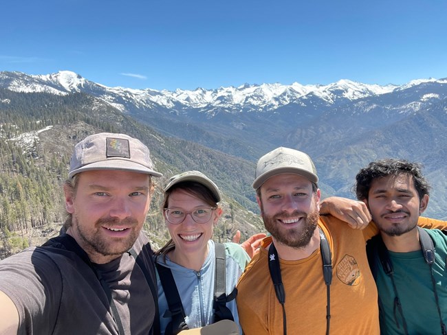
Quinn McMahon, The Institute for Bird Populations
2023 Monitoring Season
Birds
In stark contrast to 2022, when drought conditions allowed unprecedented early season access to the high country, this spring our Institute for Bird Populations (IBP) bird monitors—Quinn McMahon and Rushi Tawade in Yosemite, and Lee Bryant and Willy Lebowitz in Sequoia and Kings Canyon — arrived to a changed landscape. Anticipating a ‘normal’ year, Lee had spent the winter developing detailed itineraries for reaching our scheduled transects in the network parks. As the snowpack grew and the damage to roads and trails came into focus it became clear that those plans would have to wait for another year. Due to the deep snowpack we may not be able to reach many of our high elevation transects, and access to many lower elevation sites is complicated by washed out roads and trails. It is uncertain whether Devils Postpile will open in time to conduct bird monitoring before the end of July, when the window for collecting bird census data closes.
Working with our IBP partners, early on we agreed that we did not want to miss the opportunity to learn how Sierran birds would respond to a season like this. We are designing a very different year, that includes sites from all panels to capture as much information about bird activity from the locations we can access during this extraordinary year. Every tour is a bit of a mystery until it starts, which is a new approach for us compulsive planners! Fortunately our two returning crew leads bring a wealth of experience (Lee and Quinn are both in their third seasons with Sierra Nevada Network bird monitoring) and Rushi and Willy are excited to be part of this unusual season. If enough sites open, IBP senior staff members Rodney Siegel, Dayna Mauer, and Bob Wilkerson are standing by to pick up a handful of transects in the parks and perhaps all the points in Devils Postpile. We couldn’t do this without them!
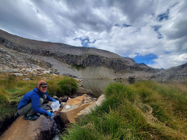
Kelly Bessem, Great Basin Institute.
Lakes
Our network lakes monitoring crews will be visiting lake sample design panels one and five, which will complete our third rotation of the 76 lakes we monitor. Two crews, one based in Sequoia and Kings Canyon and one based in Yosemite, will travel to 25 lakes across the network. Anna Shampain, having completed her MS at Colorado State University this past winter, is returning to lead our Sequoia and Kings Canyon crew. The crew will include Parker Land, a University of Nevada Reno graduate joinng us with prior aquatic research and monitoring experience, and Scientist in the Parks intern, Shannon Lavelle, who completed her Geology degree at UC Berkeley in May and is joining us for her first season. The Yosemite crew will include Michelle Gilmore, a returning employee for Yosemite Physical Sciences and Landscape Ecology, and a second crew member to be hired. Michelle has a BS and MS in Geology from the University of Pittsburgh and has extensive experience in ecosystem restoration and scientific monitoring in the Sierra Nevada. Annually, crews collect data on a suite of measures to monitor water chemistry and document amphibian observations. This year we will also be training our crews on identification of harmful algal blooms (HABs) so we have more trained eyes looking for HABs in the higher elevations.
Our lake monitoring provides managers with a snapshot of current lake resource condition and long-term trends. In addition to our 2023 field work, we are focusing on publishing our 14-year chemistry dataset, making it more widely available. We are also working with our colleagues at Colorado State University (CSU) and University of California, Davis to analyze and publish research investigating temporal and spatial patterns of algae in mountain lakes and the drivers, including temperature and nutrients, behind observed changes. Anna Shampain, through her work with CSU and I&M, is taking a lead role on writing the manuscript.
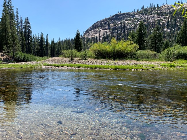
NPS / Alex Eddy
Rivers
Network Inventory & Monitoring staff, Yosemite National Park, and Devils Postpile National Monument staff work collaboratively to measure streamflow at three river gaging stations on the Tuolumne River and the Middle Fork of the San Joaquin. Yosemite Resources Management and Science staff, Rachel Hallnan, John Deane, Matt Hoffman, and Annalise Decker will be measuring streamflow this summer at the three Yosemite sites. Paul Honeywell, with the US Geological Survey (USGS) California Water Science Center, will measure streamflow along the San Joaquin in Devils Postpile.
The Sierra Nevada Network River Hydrology Monitoring Protocol reports on streamflow data from 14 gages in and near network parks, with the additional eleven gages operated by partners. In 2023, we are working with Dr. Safeeq Kahn at the University of California on the Sierra Nevada Network river hydrology and water temperature trend analysis. The report and publications are anticipated by summer 2024.

NPS / Sylvia Haultain
High-Elevation Forests
Since 2021, local scientists and managers have been documenting emerging whitebark and foxtail pine mortality in stands west of the Sierra Nevada crest. These sudden changes suggest we may be seeing the beginning of a wave of die off in the subalpine forests, possibly similar to the mass mortality in montane forests of the Sierra Nevada observed during the 2012-2016 severe drought, and in populations of whitebark pine in the northern Rocky Mountains. Data are needed to assess the cause and extent of mortality and to identify priority populations for management and restoration activities. In 2022, Sierra Nevada Network and USGS partners were awarded both Pacific West Regional Block Grant and US Forest Service (USFS) Forest Health funds to investigate the causes and document the extent of subalpine pine mortality in the network parks.
We will be resting our long-term white pines plot monitoring and focusing this season entirely on this assessment project, which affords us more flexibility in locations we visit during a season characterized by a record snowpack and challenging stream crossings. The recent federal listing of whitebark pine also lends urgency to this work. I&M Ecologist Erika Blomdahl will lead project development and implementation, and data analysis will be done in collaboration with USGS and USFS scientists.
This project will:
- Document extent and identify causes of emerging whitebark and foxtail pine mortality.
- Identify high priority areas for potential treatment to protect high priority stands from beetle outbreak.
- Identify high priority areas to sample for rust resistance and for operational cone collections.
- Prioritize areas for potential restoration plantings.
- Contribute to calibration of remote sensing mortality detection tools being developed by USFS Region 5 Mapping and Remote Sensing team.
We welcome the field staff who will help us gather these important data: Zoe Klein (crew lead), who has previously worked on our forests and wetlands monitoring crews, and first-time I&M crew members Alex Brown and Natalie Perry. All forest crew staff are employed through the Great Basin Institute.
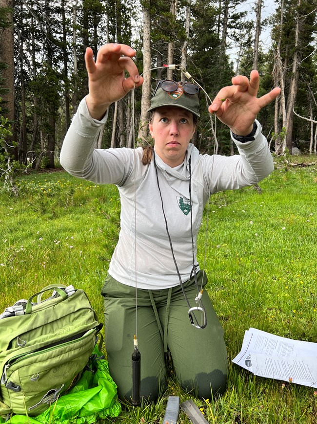
Photo by: Connor Gallagher, Great Basin Institute.
Wetlands
2023 Field Season
Hydrologic monitoring continues to be our priority focus in network wetlands in 2023. Our lake monitoring crews will be visiting the annual panel wetland sites to take groundwater field measurements, download dataloggers that are continuously monitoring groundwater levels, and perform maintenance on the wells. We are also working with Yosemite Resources Management and Science on safer and more effective methods for removing pilot monitoring site monuments. On the data front, we are quality checking the full groundwater level dataset with the goal of publishing the dataset in FY24. We are resting vegetation and invertebrate sampling this season.
Wetland Pilot Plot Removal Project
A team of Great Basin Institute employees worked with Sierra Nevada Network staff in Summer 2022 to remove wetland pilot plots, including wells and rebar monuments marking the plots. The plots removed were part of an Inventory & Monitoring wetlands pilot project to develop and test methods for monitoring wetland groundwater, vegetation, and invertebrates. This plot removal project supports park wilderness management priorities to remove research and monitoring equipment that is no longer being used. We thank Connor Gallagher (project lead), Kelly Bessem (lake monitoring crew lead), and Claire Stellick (lake monitoring crew member) for their hard work to locate and remove these plots. They visited 25 sites and removed 18 wells, four 5-foot monuments, and 53 1-foot monuments. They also wrote a report documenting what they completed and describing successful methods for locating and removing equipment.
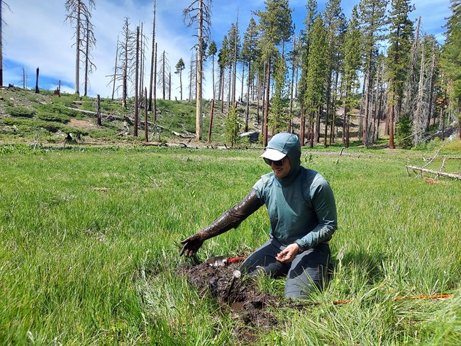
Photo by: Kelly Bessem, Great Basin Institute.
Headway with Wetland Hydrology Data
Starting in November 2021, Connor Gallagher began working with us as a Water Project Lead via the Great Basin Institute. He focused on the backlog of continuous wetland groundwater level data and improved our data processing procedures. Connor updated the field data collection protocol and drafted a new data processing standard operating procedure (SOP), which includes new protocols for processing the data in Aquarius. All continuous well data through 2022 have been organized, uploaded to the online Aquarius, the online platform used by the National Park Service (NPS) for managing continuous time-series data. The next steps are to complete quality control steps, publish the data set, and finalize the SOPs.
We thank Connor for his excellent work on this project!
Recent Web Articles or Briefs Highlight Bird Report, Lake Publications, and River Monitoring
Click on the linked headings to learn more.
Bird Population Trends in the Sierra Nevada Network, 2011-2019
Birds occur across a wide range of habitats and their sensitivity to change makes them valuable indicators of ecosystem health. The Sierra Nevada Network partners with The Institute for Bird Populations to monitor breeding-bird species. Population trends between 2011 and 2019 are summarized by species and park, and in relation to mean spring temperature and amount of snow. Learn which species were increasing or declining at network parks during this period in this article..
Environmental Policy Making a Difference: The Clean Air Act and Mountain Lakes
As early as the 1920s, Sierra Nevada lakes, despite their remote wilderness locations, showed increased acidification associated with industrialization. By the late 1970s, acidification began declining. A clear example of environmental policy making a difference, water quality in lakes improved in response to implementation of the Clean Air Act initiated in 1970 and further amended in subsequent years. Learn more about the research documenting this improved water quality.
Assessing Nitrogen in Sierra Nevada Lakes
Sierra Nevada lakes provide habitats for native animals, such as Sierra yellow-legged frogs, aquatic invertebrates, and terrestrial animals that feed on lake-dwelling organisms. Even though many of these lakes are in remote wilderness locations, air pollution can cross park boundaries and affect the lakes’ water quality. This article summarizes a study in which researchers assess nitrogen amounts and attempt to understand its effects on Sierra Nevada lakes.
River Hydrology Monitoring: Water Year 2021
The Sierra Nevada Network River Hydrology Monitoring Protocol reports on 14 river gaging stations located throughout Devils Postpile National Monument, and Sequoia, Kings Canyon, and Yosemite national parks. The purpose of this resource brief is to disseminate information on this data collection and the dataset access for the three network-managed sites for water year 2021 (October 2020 - September 2021).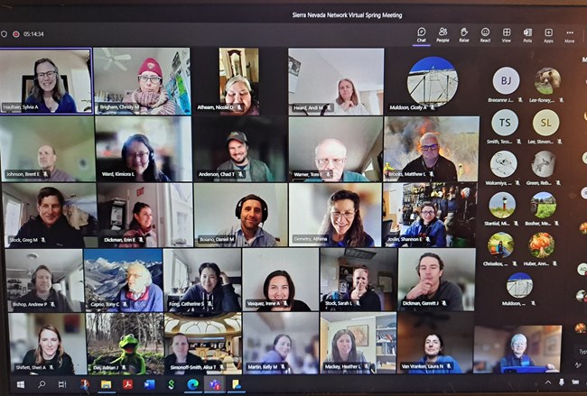
Spring Meeting: Introducing New Staff, Sharing Program Highlights
We were so looking forward to our first in-person spring meeting with the I&M network, parks, US Geolgical Survey (USGS) field stations, and the Univerity of California (UC) Merced Field Station since 2019, but as Nature intervened with more storms, we shifted to virtual. The online meeting offered opportunities to introduce new staff, to share program updates, explore implications of the Big Winter for the upcoming field season, and gain an understanding of the opportunities afforded by the Bipartisan Infrastructure Law and Inflation Reduction Act. NPS and USGS staff may contact Linda Mutch for links to meeting recordings.
News from UC Merced Natural Reserve System
Thank you to Dr. Breezy Jackson, Director for the University of California Merced Yosemite and Sequoia Field Stations for the following overview of a new program to increase students’ sense of belonging in field research, and for providing helpful links to inclusive field safety resources.

Photo by: Jessica Malisch
UC Merced Natural Reserve System launches a new program for students who are ¿field curious?
Undergraduate students who are curious about field research have access to a new program at UC Merced. The goal of ¿field curious? is to increase students’ sense of belonging in field research while encouraging them to observe and ask questions about the natural world. Our weekend long immersion is meant to remove barriers to entry to field research including gear (students receive a backpack, notebook, water bottle, and sun and rain protection), exposure to potential mentors and subjects of study, and, perhaps most importantly, sense of community. In addition to the retreat, students also gain access to job postings and research opportunities through our email list, social media, and the new ¿field curious? student-led club.
The UC Merced Natural Reserve System recently acquired funding for an additional eight retreats in the next two years, and funding to track the outcomes of the program. We welcome potential mentors and facilitators as well as ideas for content including data collection, immersive observation, and hypothesis generating activities in the Southern Sierra. Our weekend retreats begin at the UC Merced Vernal Pools and Grassland Reserve and proceed to Yosemite Field Station with optional smaller data collection and outreach opportunities at Sequoia Field Station and the Clemmie Gill School of Science and Conservation Field Station in Tulare County.
If you would like to be involved in ¿field curious?, reach out to our new program coordinator Jeniffer Amezquita-Marin (jamezquita-marin@ucmerced.edu). Before you go, be sure to flip through the ¿field curious? magazine from our latest cohort and press play on the front page. Please also send us your job postings.
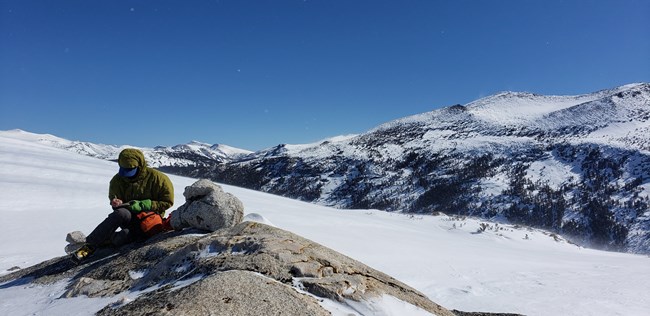
Photo by: Breezy Jackson, Yosemite and Sequoia Field Stations, UC Merced Reserve System
Inclusive Field Safety Resources
As our record-breaking snowpack turns into record-breaking runoff, keeping our teams safe in the field is top of mind, and have you thought about your code of conduct and the emotional health of your team? As we head into an unprecedented summer, here are some curated resources to help you develop an inclusive field safety plan.
The University of California Field Safety Center for Excellence
Your one-stop shop for everything you need to plan your field season including trainings, Cal/OSHA policies, and best practices for crew leads.
ADVANCEGeo
Revamp your Code of Conduct, access training on interpersonal field safety, get information about inclusivity in the disability space.
The Avarna Group
Learn about Diversity, Equity, Inclusion, and Justice work in the outdoors.
Alpenglow Education
Find Behavioral First Aid resources and training.
You can also check out our Yosemite and Sequoia Field Stations Field Safety Plan Template for inspiration.
Want to get involved? Email Breezy Jackson at bjackson10@ucmerced.edu

Farewell to Two Park I&M Partners
Monica Buhler
Monica Buhler, Resources Management Program Manager at Devils Postpile National Monument, has embarked on a new role as a Natural Resources Specialist with the Denver Service Center. In this position, she assists parks on transportation-related (roads, bridges, trails, docks) projects, doing environmental compliance to ensure protection of natural resources. She is enjoying learning about new park units and recently went to Charleston, SC for a dock replacement project at Fort Moultrie and Fort Sumter.
Monica has worked on a wide range of projects while at Devils Postpile. A few highlights include:
- Supported research and collaborations focused on investigating the potential for Devils Postpile National Monument to be a climate refugium, including contributing to published research on cold air pooling
- Worked with cooperators to initiate air quality monitoring at the monument, particularly to understand the impacts of wildfires on local air quality
- Developed the Resource Stewardship Strategy with a small team of scientists and managers
- Completed a small mammal inventory in 2015
- Coordinated Inventory & Monitoring Division-supported bat and owl inventories with collaborators in 2022
- Updated the Fire Management Plan to allow prescribed fire in wilderness
We thank Monica for all her support of our forest monitoring project in recent years, including overseeing the field crew during the 2021 and 2022 seasons. She has also supported river hydrology monitoring and joined us in the field for wetlands monitoring at Devils Postpile. Monica has worked in each of our network parks in various roles, and we will greatly miss her expertise and enthusiastic support. We are grateful she will be working remotely and remaining on the east side of the Sierra in her new job.
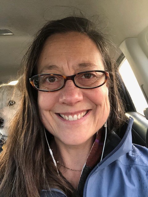
Kimiora Ward
Kimiora Ward, Plant Ecology Program Lead in Yosemite National Park, has accepted a new position as Senior Environmental Scientist in the Endangered Species Program for the California Department of Fish and Wildlife. She will be working on status assessments for terrestrial invertebrates, primarily pollinators.
Kimiora has played the role of park contact for the I&M wetland and high elevation forests monitoring projects in Yosemite and has contributed much to wetland, white pine, and alpine conservation during her tenure there. Her core responsibilities in Yosemite included programs that:
- monitor for adaptive management of meadows, as part of Yosemite’s stock use management program
- use adaptive management to protect Wild and Scenic qualities of Tuolumne and Merced River watersheds
- monitor effects of the water release schedule from the O'Shaughnessy dam on local wetlands
- monitor to detect ecological effects of restoration on meadow hydrology
She has also played a critical role in white pines conservation and management, including the following:
- worked with local staff and cooperators to initiate a program on sugar pine conservation in Yosemite, including gene conservation cone collections, blister rust resistance screening trials, and a survey on the distribution and severity of blister rust and drought stress in sugar pine.
- developed a conservation strategy for whitebark pine in Yosemite and Sequoia and Kings Canyon national parks
- contributed to the genetics section of the California Interagency Whitebark Pine Conservation Strategy
- served on the US Fish and Wildlife Service’s Whitebark Pine Recovery Plan Team
- led development of a multi-network Biological Assessment for actions impacting whitebark pine in Devils Postpile, Lassen Volcanic, Kings Canyon, Sequoia, and Yosemite national parks.
- completed summary reports of 2021 and 2022 high elevation forest monitoring data for the network I&M program
Recently, Kimiora successfully competed for funds to initiate work on the Sierra Nevada parks’ whitebark pine conservation strategy, receiving ~$2.6 million as part of a $4+ -million multiregion Inflation Reduction Act project. This project is a collaborative effort with eight parks in the Pacific West and Intermountain regions. So often, conservation success is due to the right person being in the right place at the right time — and for whitebark pine in the Sierra Nevada, that person without question has been Kimiora.
Kimiora also focused on gathering more information about the alpine ecosystem in Yosemite. She started a citizen science pollinator inventory program (see data on iNaturalist) and expanded this to include an inventory of bee species in the alpine zone. She continues to pursue funding for an alpine plant climate refugia monitoring project with USGS. We will miss Kimiora in the Sierra Nevada but are grateful her work will continue to influence and improve conservation efforts in California.

A Wedding and A New Baby –Congratulations!
Erika Blomdahl and David Soderberg Married
Sierra Nevada Network Ecologist Erika Blomdahl and David Soderberg, Ecologist with the USGS Sequoia and Kings Canyon Field Station, were married on October 15, 2022, near Moab, Utah, and enjoyed a wonderful celebration with family and friends.

Sarah Wakamiya and Family Welcome New Baby
Sierra Nevada Network Data Manager Sarah Wakamiya, her husband Vance Warren, and son Evren welcomed daughter Zara to their family on May 16, 2023. Big congratulations to all!
Sierra Nevada Inventory & Monitoring Network
47050 Generals Highway
Sequoia and Kings Canyon National Parks
Three Rivers, CA 93271
