The establishment of armories in the United States allowed the new nation to become less dependent on foreign arms manufacturers. When Congress gave President George Washington authority to choose locations for the armories, he recommended the strategically-located Harpers Ferry. This was the second of two federal armories in the country at that time.
The rugged and steep terrain surrounding the site at Harpers Ferry offered a barrier against attack, and the convergence of the Shenandoah and Potomac Rivers offered valuable transportation routes.

NPS (Harpers Ferry National Historical Park 0027)
In 1797, the United States Congress purchased land on the Potomac River, north of the confluence with the Shenandoah River, for a federal Armory at Harpers Ferry. The United States Armory property once included various sites in the town of Harpers Ferry. The Armory works that were located here were formerly referred to as the Musket Factory. The Armory works on Halls Island, approximately one mile away, were known as the Rifle Factory. Now part of Harpers Ferry National Historical Park, the landscape is historically significant for its associations with arms manufacturing, transportation, and tourism.
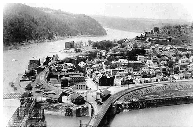
The seventy-two acre Musket Factory site is situated along the southwest bank of the Potomac River at the base of a ridge. The site is surrounded by dramatic topography characterized by three distinct landforms: Maryland Heights, Loudoun Heights, and Bolivar Heights. Located within a hundred-year floodplain, the site has been inundated with major flooding many times since the mid-1700s.
The United States Armory and Potomac Riverfront cultural landscape is a rectangular-shaped site that extends north from the intersection of Potomac and Shenandoah Streets. On its east side is Potomac Street, and the Potomac River runs along its west.

NPS
The landscape has been divided into sections to describe its unique areas:
- the Canalway,
- the Upper Armory Grounds, and
- the Lower Armory Grounds.
The Canalway
The Canalway, heading downstream from Dam 3, is characterized by a dense, deciduous riparian forest. Vegetation covers the remains of the 1801 canal prism. On the river side of the prism, a modern walking path has been worn into the top of the berm. On the opposite side of the prism, an unpaved lane extends from Potomac Street. The Canalway’s downstream border is the former hydroelectric plant.

NPS (Harpers Ferry National Historical Park 0096)
In 1929, the B&O Railroad Company built a twenty foot high railroad berm across the Armory grounds, bisecting a landscape once recognized for its linear and flat nature and marking the end of the landscape's period of historic significance. The current tracks, associated with a CSX rail line, largely follow the historic alignment of the old B&O Railroad line.
The Lower Armory Grounds
The Lower Armory Grounds section stretches from the upstream edge of the train station parking lot to the intersection of Potomac and Shenandoah Streets. This is the most commonly visited part of the landscape. Downstream from the train station, towards the river, a sunken section of land sits at or near historic Armory-grade levels.

NPS
The Upper Armory Grounds
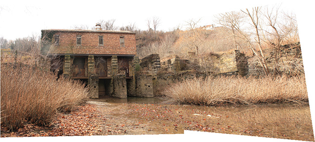
This former hydroelectric plant forms the upstream edge of the Upper Armory Grounds. During the Armory era, the plant was known as the Rolling Mill. After that, it was the Harpers Ferry Paper Company.
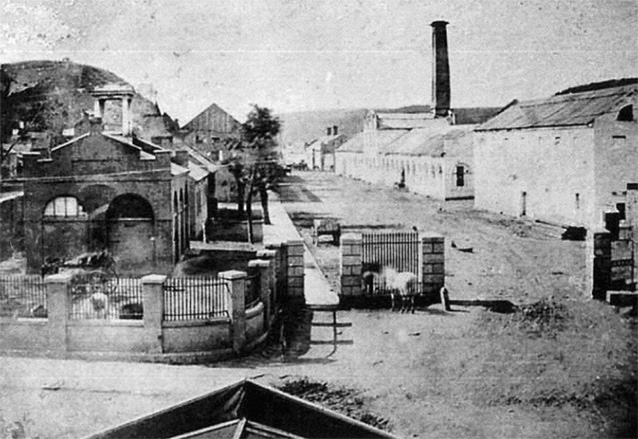
During the Armory era, the Musket Factory (or Lower Armory Grounds) was characterized by parallel rows of workshops and offices, separated by a wide lane on a rectangular-shaped riverside landscape.

NPS
In 1841, civilian leadership of the US Armory was replaced by military Superintendents. In 1945, Major John Symington took over the leadership role. A West Point graduate, skilled builder, architect, and town planner, he might also be recognized as the man with the most noteworthy influence on the Armory grounds. Symington is credited with unifying the archeological style of the Armory workshops, improving living conditions of the town, and laying out a town plan that still exists today.
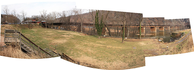
Archeological sites associated with the historic Armory are interpreted with signs and using rope and rod outlines of Armory-era buildings. The top of the B&O-built retaining wall is visible along the north side of this area. The riverside retaining wall that the Armory built was buried at some point during the historic period.
An informal path on the south end of this area provides access to the river’s edge. An elevated section at the southern side of the Lower Armory Grounds is what remains of a railroad berm that was built in 1892. This section also contains the John Brown memorial obelisk and the entrance to the railroad yard.
Quick Facts
- Cultural Landscape Type: Vernacular
- National Register Significance Level: National
- National Register Significance Criteria: A,B,D
- Period of Significance: 1797-1929
Landscape Links
Last updated: October 8, 2021
