Last updated: August 25, 2021
Article
Wadeable Streams Monitoring at Natural Bridges National Monument, 2010–2018

Long-term monitoring shows there are many armored and scoured surfaces in Armstrong Canyon that are resistant to changes from flash floods. Vegetation appears well-adapted to these events.
A ribbon of green winds through an arid landscape. Find your way there and you’ll likely also find water. Where streams and rivers flow, riparian areas are oases of life. They are biologically diverse and perform important ecosystem services. Riparian vegetation helps clean excess nutrients and sediment from surface runoff and shallow groundwater. It also shades streams, optimizing light and temperature for aquatic plants, fish, and other animals. Linked to both aquatic and terrestrial systems, riparian ecosystems are potentially sensitive indicators of landscape-level change.
Human activities can disrupt these systems. Stream damming or diversion, channel-stabilization structures, invasive exotic species, livestock grazing, timber harvesting, agricultural clearing, groundwater pumping, and trail creation can all influence downstream riparian ecosystems.
To evaluate the health of riparian systems, the Northern Colorado Plateau Network (NCPN) monitors physical and biological attributes of wadeable streams. These include flood frequency, channel shape and composition, and vegetation. Together, these indicators can tell us about “normal” conditions and also give park managers early warning of potential problems. The NCPN monitors wadeable streams at Arches National Park, Capitol Reef National Park, Natural Bridges National Monument, and Zion National Park.

Monitoring at Natural Bridges National Monument from 2010 to 2018 provided insight on the frequency and duration of large flow events in Armstrong Canyon. It also revealed how these events caused changes in the channel, and how plants have responded to the flooding. Network staff sampled vegetation and geomorphology at four stream reaches and evaluated four years of flood-stage data. Each reach is monitored at seven different transects (see figure).
Flash floods are common in Armstrong Canyon, an ephemeral stream that only flows after precipitation events. The highest-stage floods tend to occur during the monsoon season, but flow events are possible throughout the year. Unsurprisingly, surface water persists longer in cooler months. As there is currently minimal development upstream of the park, the flow regime is primarily driven by climate.
Flood events can scour sand and gravels from the channel. Because the NCPN does long-term monitoring, we were able to compare conditions at one reach before and after several large flood events in September 2013. Across the seven transects, the channel was cut deeper in some areas. The main channel was also wider in some locations. At one transect, there was nearly one half-meter of scouring associated with the widening. At another, the main channel moved into a channel about eight meters away. There was also a notable decrease in the percent of sand and gravels at this reach after the floods.
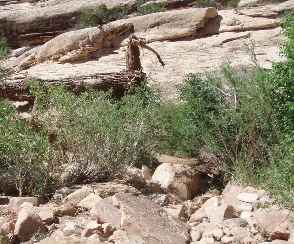
Overall, changes in vegetation after the flash floods of September 2013 were minor, considering they were powerful enough to wash large trees down the canyon and perch them over three meters above the channel (see photos).
Long-Term monitoring shows flood effects
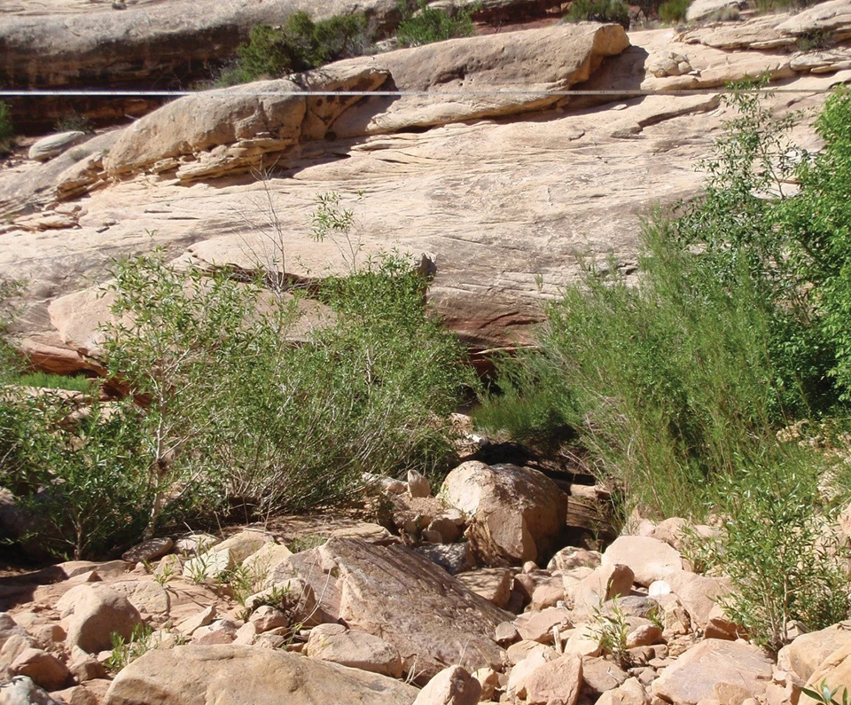
Left image
Reach 5, Transect 4 in June 2011.
Right image
Reach 5, Transect 4 in June 2014. Note large cottonwood trunk washed into channel.
Plants in this system are both resilient and well-adapted to disturbance. One reach saw a reduced number of forb species and a reduction in the frequency of exotic species. At another, there was a reduction in forb cover but a 60× increase in the density of cottonwood seedlings. Larger floods promote cottonwood germination in many Southwestern riparian areas.
Overall, there are many armored and scoured surfaces within Armstrong Canyon that are resistant to changes from flash floods. Vegetation appears to be well-adapted to flash floods, as few changes occurred after the floods of September 2013.
Information in this brief was summarized from D. L. Witwicki and R. Weissinger, Riparian monitoring of wadeable streams at Armstrong Canyon, Natural Bridges National Monument: Summary report, 2010–2018.