Last updated: June 17, 2024
Article
NPS Geodiversity Atlas—Florissant Fossil Beds National Monument, Colorado
Geodiversity refers to the full variety of natural geologic (rocks, minerals, sediments, fossils, landforms, and physical processes) and soil resources and processes that occur in the park. A product of the Geologic Resources Inventory, the NPS Geodiversity Atlas delivers information in support of education, Geoconservation, and integrated management of living (biotic) and non-living (abiotic) components of the ecosystem.

Introduction
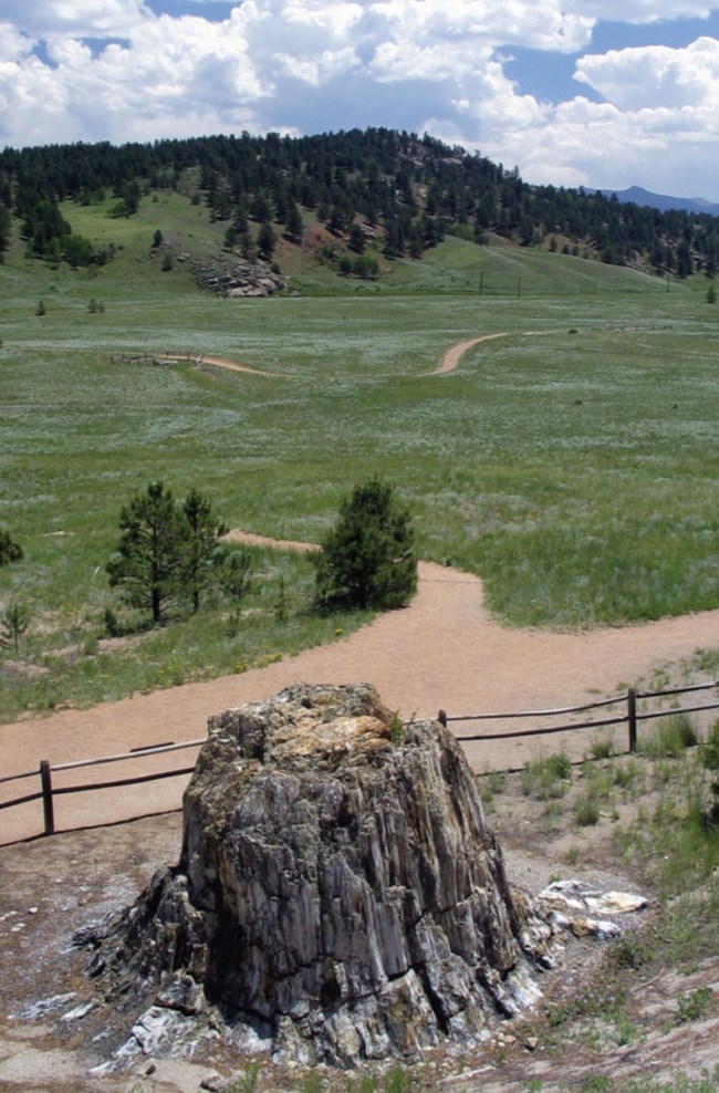
Florissant Fossil Beds National Monument (FLFO) is located in central Colorado and was established August 20, 1969 to preserve one of the richest and most diverse fossil deposits in the world. FLFO encompasses 2,427 hectares (5,998 acres) of land that have yielded spectacular fossils of finely preserved insects, spiders, beetles, ants, dragonflies, butterflies, flies, fish, plants, ferns, leaves, pollen, flowers, mammals, and birds, as well as redwood stumps up to 4.3 m (14 ft) wide. Significant research of FLFO includes the study and interpretation of more than 40,000 fossil specimens from a 34-million-year-old Eocene ecosystem which furnishes critical evidence of biologic and climatic change during a period of tectonic uplift (KellerLynn 2006).
Geologic Setting
The geologic story of FLFO is intimately linked to the existence of the rare and delicate fossil specimens which are completely absent or extremely rare in most paleontological sites. Strata of the Florissant valley were deposited on the eroded surface of the Precambrian-age Pikes Peak Granite, dated at 1.08 billion years old (Wobus 2001). Geologic units consist of lava flows, massive pumiceous tuffs, river gravels, agglomerates, and finely laminated, fossiliferous paper shales which form the most prominent outcrops. The Florissant Formation was deposited within a valley that was episodically blocked by volcanic debris flows (lahar deposits) that dammed the streams and formed Lake Florissant (KellerLynn 2006). Evanoff et al. (2001) interpreted the Florissant Formation as probably recording two episodes of lake generation: the first represented by the lower shale unit; the second represented by the middle and upper shale units, which are divided by a caprock conglomerate unit throughout most of FLFO. The lacustrine deposits were eventually buried by pumice gravel and lahars from the Thirtynine Mile volcanic field.Paleontological Resources
All NPS fossil resources are protected under the Paleontological Resources Preservation Act of 2009 (Public Law 111-11, Title VI, Subtitle D; 16 U.S.C. §§ 470aaa - 470aaa-11).
Learn More
Regional Geology
Florissant Fossil Beds National Monument is a part of the Southern Rocky Mountains Physiographic Province and shares its geologic history and some characteristic geologic formations with a region that extends well beyond park boundaries.
- Scoping summaries are records of scoping meetings where NPS staff and local geologists determined the park’s geologic mapping plan and what content should be included in the report.
- Digital geologic maps include files for viewing in GIS software, a guide to using the data, and a document with ancillary map information. Newer products also include data viewable in Google Earth and online map services.
- Reports use the maps to discuss the park’s setting and significance, notable geologic features and processes, geologic resource management issues, and geologic history.
- Posters are a static view of the GIS data in PDF format. Newer posters include aerial imagery or shaded relief and other park information. They are also included with the reports.
- Projects list basic information about the program and all products available for a park.
Source: Data Store Saved Search 2851. To search for additional information, visit the Data Store.
A NPS Soil Resources Inventory project has been completed for Florissant Fossil Beds National Monument and can be found on the NPS Data Store.
Source: Data Store Saved Search 2918. To search for additional information, visit the Data Store.

Related Links
Related Articles
Florissant Fossil Beds National Monument
National Park Service Geodiversity Atlas
The servicewide Geodiversity Atlas provides information on geoheritage and geodiversity resources and values within the National Park System. This information supports science-based geoconservation and interpretation in the NPS, as well as STEM education in schools, museums, and field camps. The NPS Geologic Resources Division and many parks work with National and International geoconservation communities to ensure that NPS abiotic resources are managed using the highest standards and best practices available.

