Last updated: July 3, 2024
Article
NPS Geodiversity Atlas—Gulf Islands National Seashore, Florida and Mississippi
Geodiversity refers to the full variety of natural geologic (rocks, minerals, sediments, fossils, landforms, and physical processes) and soil resources and processes that occur in the park. A product of the Geologic Resources Inventory, the NPS Geodiversity Atlas delivers information in support of education, Geoconservation, and integrated management of living (biotic) and non-living (abiotic) components of the ecosystem.

Introduction
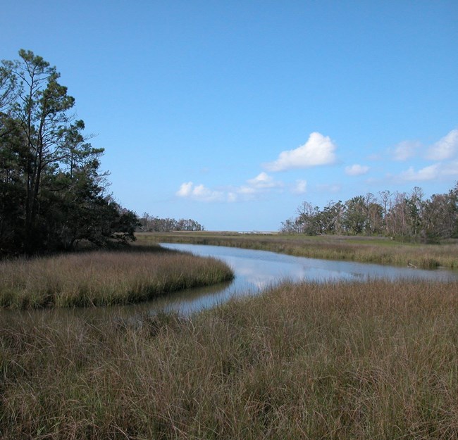
Gulf Islands National Seashore (GUIS) is a collection of barrier islands, surrounding waters, and coastal mainland sites that extend along approximately 255 km (160 mi) of the Gulf Coast of Mississippi (Harrison and Jackson Counties) and the Florida Panhandle (Escambia, Okaloosa, and Santa Rosa Counties). Authorized on January 8, 1971, GUIS encompasses about 56,322 hectares (139,175 acres) and protects a combination of beach, barrier island, and marine ecosystems, in addition to numerous archaeological sites dating back to the late Archaic and Woodland cultural periods and historic coastal fortification structures dating back to the 18th century (National Park Service 2016a). The landscape of GUIS features sandy beaches, bayous, salt marshes, relict sand dunes, oak forests, pine flatwoods, maritime forests, and open marine habitats that host more than a dozen federally listed threatened or endangered species (Schupp 2019). Historic military structures of GUIS include coastal defense fortifications, gun batteries, and barracks spanning the Spanish Colonial Era, American Civil War, and World War II. Together, the historic coastal defense sites of GUIS represent one of the most complete collections of forts and structures illustrating the evolution of harbor defense technology in the United States (National Park Service 2016b).
Geologic Setting
Gulf Islands National Seashore is located in the southernmost Coastal Plain physiographic province of Florida and Mississippi, a geologically young region comprised of unconsolidated Cenozoic sedimentary deposits. The overall geology of GUIS reflects a dynamic barrier island and coastal mainland environment that is constantly being reworked and sculpted by coastal processes that include wind, waves, tides, storms, sea level change, and anthropogenic processes such as inlet dredging and shoreline engineering (Schupp 2019). The barrier islands of GUIS were formed within the last 6,000 years and overlie buried fluvial and shallow marine strata dating back to the Miocene Epoch approximately 23 million years ago (Otvos 2005; Miselis et al. 2014). Various geomorphologic units mapped throughout the national seashore include Holocene-age dune complexes, beach ridges, sand spits, overwash zones, and beach, marsh, shoal, wetland, and vegetated barrier interior deposits.
Regional Geology
Gulf Islands National Seashore is a part of the Coastal Plain Province and shares its geologic history and some characteristic geologic formations with a region that extends well beyond park boundaries.
- Scoping summaries are records of scoping meetings where NPS staff and local geologists determined the park’s geologic mapping plan and what content should be included in the report.
- Digital geologic maps include files for viewing in GIS software, a guide to using the data, and a document with ancillary map information. Newer products also include data viewable in Google Earth and online map services.
- Reports use the maps to discuss the park’s setting and significance, notable geologic features and processes, geologic resource management issues, and geologic history.
- Posters are a static view of the GIS data in PDF format. Newer posters include aerial imagery or shaded relief and other park information. They are also included with the reports.
- Projects list basic information about the program and all products available for a park.
Source: Data Store Saved Search 2892. To search for additional information, visit the Data Store.
A NPS Soil Resources Inventory project has been completed for Gulf Islands National Seashore and can be found on the NPS Data Store.
Source: Data Store Saved Search 2963. To search for additional information, visit the Data Store.
GRI Geology Image Gallery

Related Links
Related Articles
Gulf Islands National Seashore
National Park Service Geodiversity Atlas
The servicewide Geodiversity Atlas provides information on geoheritage and geodiversity resources and values within the National Park System. This information supports science-based geoconservation and interpretation in the NPS, as well as STEM education in schools, museums, and field camps. The NPS Geologic Resources Division and many parks work with National and International geoconservation communities to ensure that NPS abiotic resources are managed using the highest standards and best practices available.

