Last updated: July 16, 2024
Article
NPS Geodiversity Atlas—Santa Monica Mountains National Recreation Area, California
Geodiversity refers to the full variety of natural geologic (rocks, minerals, sediments, fossils, landforms, and physical processes) and soil resources and processes that occur in the park. A product of the Geologic Resources Inventory, the NPS Geodiversity Atlas delivers information in support of education, Geoconservation, and integrated management of living (biotic) and non-living (abiotic) components of the ecosystem.

Introduction
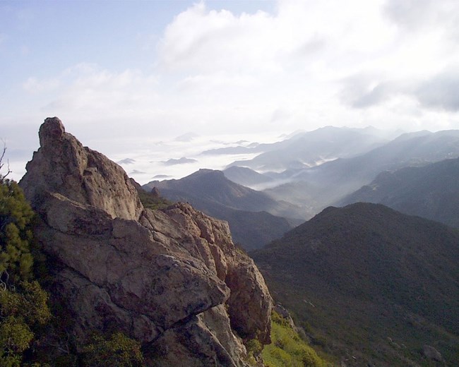
Santa Monica Mountains National Recreation Area (SAMO) is located near the greater Los Angeles metropolitan area in Los Angeles and Ventura Counties, coastal southern California. The recreation area includes a vast and varied California landscape that includes rugged mountains, chaparral-blanketed canyons, abundant wildlife, and 64 km (40 mi) of coastline with sandy beaches and rocky shores. Established on November 10, 1978, SAMO encompasses 63,402 hectares (156,670 acres) and preserves the rare Mediterranean ecosystem while also protecting historical sites (Anderson 2017). The Santa Monica Mountains are ~74 km (46 mi) long and 13 km (8 mi) wide (KellerLynn 2016). They represent part of the Western Transverse Ranges Province, which is bordered on the north by the Southern Coast Ranges and Mojave Desert Provinces, on the east by the Eastern Transverse Ranges Province, and on the south by the Peninsular Ranges Province (Lander 2011; Lander et al. 2013). The nearby northern Channel Islands situated off the southern California coast belong to a largely submerged portion of the Western Transverse Ranges Province (originally the southern part, before rotation) and in turn share the complex geologic history, see also NPS Geodiversity Atlas—Channel Islands National Park, California.
Geologic Setting
The Santa Monica Mountains are a complex and dynamic place that includes active faults, fossils, remnant volcanoes, and stratigraphic units of continental and marine origin, the latter units comprising sediments originally deposited underwater and now often found at the tops of ridgelines. SAMO is underlain primarily by rocks of Miocene age, but the oldest rocks date back ~162 to 143 million years ago to the Late Jurassic Period. The rocks of SAMO record the complicated geologic history of coastal southern California. Significant events include: the subduction and breakup of the former oceanic Farallon Plate beneath the converging western margin of the continental North American Plate; partial subduction of the East Pacific Rise, followed by extension and resulting subsidence and accompanying faulting of the margin of the North American Plate, with capture of some fragments by the Pacific Plate; subsequent rotation of crustal tectonic blocks (including the Western Transverse Ranges Province) constituting the margin; and the corresponding development of a transform boundary between the North American and Pacific Plates along the modern-day San Andreas Fault System (Lander 1994, 1997, 2011; Fritsche 1998; Hillhouse 2010; Lander et al. 2013; KellerLynn 2016). Those tectonic events, along with global glacioeustatic changes in sea level resulting from fluctuations in size of the Antarctic ice cap, are reflected in a succession of alternating marine and continental units in the Santa Monica Mountains. Unlike mountain ranges in other areas of California, in which major linear geologic structures (e.g., faults and folds) and the resulting geographic features (e.g., mountains and valleys) are oriented in dominantly northwest–southeast directions, those in the Transverse Ranges Province are principally oriented in east–west directions. They were originally oriented roughly north–south but rotated up to roughly 70°–110° clockwise away from the northern Peninsular Ranges Province as a result of complex tectonic interactions between adjacent plate margins (Lander 1997, 2011; Fritsche 1998; Calvano et al. 2008; Hillhouse 2010; Lander et al. 2013; KellerLynn 2016).
Regional Geology
Santa Monica Mountains National Recreation Area is a part of the Pacific Border Physiographic Province and shares its geologic history and some characteristic geologic formations with a region that extends well beyond park boundaries.
- Scoping summaries are records of scoping meetings where NPS staff and local geologists determined the park’s geologic mapping plan and what content should be included in the report.
- Digital geologic maps include files for viewing in GIS software, a guide to using the data, and a document with ancillary map information. Newer products also include data viewable in Google Earth and online map services.
- Reports use the maps to discuss the park’s setting and significance, notable geologic features and processes, geologic resource management issues, and geologic history.
- Posters are a static view of the GIS data in PDF format. Newer posters include aerial imagery or shaded relief and other park information. They are also included with the reports.
- Projects list basic information about the program and all products available for a park.
Source: Data Store Saved Search 3167. To search for additional information, visit the Data Store.
A NPS Soil Resources Inventory project has been completed for Santa Monica Mountains National Recreation Area and can be found on the NPS Data Store.
Source: Data Store Saved Search 3118. To search for additional information, visit the Data Store.

Related Links
Related Articles
Santa Monica Mountains National Recreation Area
National Park Service Geodiversity Atlas
The servicewide Geodiversity Atlas provides information on geoheritage and geodiversity resources and values within the National Park System. This information supports science-based geoconservation and interpretation in the NPS, as well as STEM education in schools, museums, and field camps. The NPS Geologic Resources Division and many parks work with National and International geoconservation communities to ensure that NPS abiotic resources are managed using the highest standards and best practices available.

