Last updated: April 5, 2019
Article
Yellowstone River

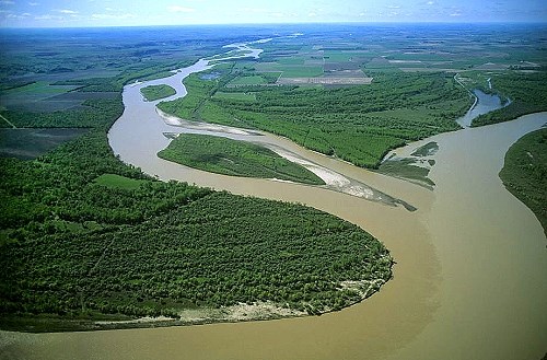
Photo: Confluence of the Yellowstone River, Courtesy of Jim Wark
Believing they were close to the mouth of the Yellowstone, Captain Lewis took a few men and some of his instruments and walked to the confluence in order to take navigational observations. He wrote in his journals, “I could not discover the junction of the rivers immediately, they being concealed by the woods, however, sensible that it could not be distant I determined to encamp on the bank of the Yellow stone river which made it's appearance about 2 miles South of me.”
The Yellowstone is the last free-flowing river in the lower 48 states. From its headwaters in Lake Yellowstone downstream to its meeting with the Missouri in North Dakota, it is undammed and untamed.
As it flows through Montana the 670-mile river goes through many changes – from steep-walled canyons where the waters churn over boulders, the river eventually becomes a lazy path through fertile farm country. Today there is plenty of recreation on the Yellowstone, including agate hunting, wildlife watching, fishing, and floating.
