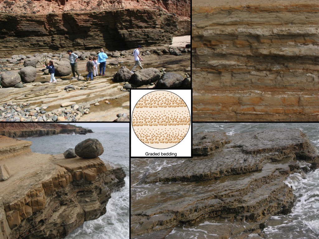
If it weren’t for the barrier that is the Point Loma peninsula, the city of San Diego as we know it would not exist today. The geologic behemoth on which the Old Point Loma lighthouse stands serves to hold back the physical forces of the mighty Pacific Ocean and protect San Diego Bay. On the ocean facing side of the peninsula, a tidepool explorer might notice the distinct horizontal striations of the rocks along the cliffs. But how did these perfect layers of mudstone and sandstone come to be?
 Photo Credit: Dr. Stephen Schellenberg, Caption: Photos taken in the Point Loma tidepools of layered sandstone.
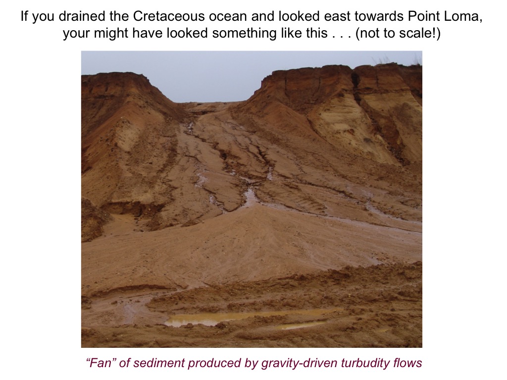
Roughly 72-76 million years ago, during the Cretaceous period, what you see above the water now was still being formed below the water line. Similar to the modern day Scripps Canyon, the Point Loma formation (one of four formations that comprise the peninsula) was formed from large, fan-shaped deposits of mud, silt, rock, and other debris in what is known as an Alluvial fan. Over geologic time, these fans would flow and compact and layer one on top of the other, with the heaviest materials sinking to the bottom and the lighter materials floating on top. Hundreds of these events occurred one on top of the other over time to create the layering effect you see today. But how did they get from below the water line to above?

Photo Credit: Dr. Stephen Schellenberg. Caption: Mud and Silt on an embankment representing an Alluvial fan.
As Southern California slowly shifts North West on the Pacific Plate, a good portion of San Diego gets stuck against the Rose Canyon Fault line. This has caused somewhat of an Earth-jam (different than a Space Jam), whereas Mt. Soledad is lifted up, Mission Bay is crinkled down, and Point Loma is also lifted. This happens in the same sense as if you were to bend a piece of paper and get crests and troughs. Thus, what was previously under water in Point Loma during the Cretaceous period, has slowly lifted out of the sea at a rate of approximately ~1.3cm per century.
Next time you are exploring the tidepools, take a minute to investigate the cake-like cliffs and see what you observe.
Note: Special thanks to Dr. Stephen Schellenberg of San Diego State University for his insight on the formation of the Point Loma peninsula. His expertise and passion for Paleoclimatology is nothing short of inspiring, thus any misstep in the explanation found here lies with the author alone.
