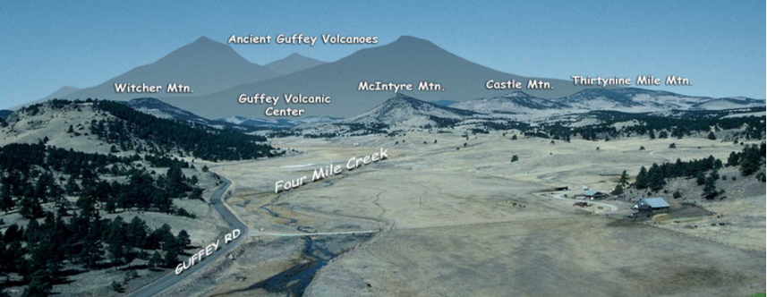
About 13 miles outside of the Florissant Fossil Beds National Monument is an overlook where the remnants of a volcanic center can be seen. The lahar, or volcanic mudflow, that originated here dammed the stream and created ancient Lake Florissant. The Guffey volcanic center set the stage for the creation of Lake Florissant and allowed for the remarkable fossilization of plants and insects that we can see today. 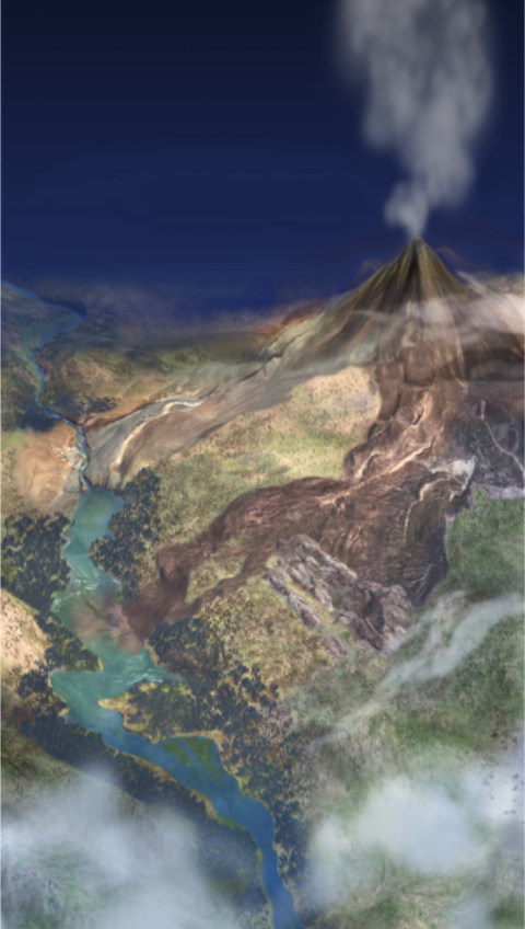
The Beginning of the Guffey Volcanic CenterDuring the Late Cretaceous period to early Tertiary (about 70-45 million years ago) subduction of a tectonic plate called the Farallon plate (now known as the Juan de Fuca plate) beneath the North American plate uplifted the Rocky Mountains. This collision exposed the 1 billion year old Pikes Peak Granite and the 1.4 billion year old Cripple Creek Granite to the effects of weathering and erosion in what is called the Laramide Orogeny. By the late Eocene (37-34 million years ago) the region was a widespread erosional surface. The Guffey volcanic center was a part of the Thirtynine Mile volcanic area. The center was a series of stratovolcanoes (similar in structure to Mt. St. Helens & Mt. Rainier). When these volcanoes erupted they would send lava and debris flows down into the paleovalleys beneath. McIntyre Mountain and Witcher Mountain are remnants of these massive flows. Guffey Volcano Sends Lahars to the ValleyWhen the Guffey volcanic center would erupt it would send lahars down ancient drainages into the valleys below. The debris that is captured in these flows can range in size from very small silt and clay particles to very large boulders. The lahar is mobilized by gravity and lubricated by water (rain or snow). When the high-viscosity flow loses momentum, it comes to a stop, leaving a path of destruction in its wake. One lahar flowed eastward from the slopes of the Guffey volcanic center. There, it intersected the stream of the Florissant paleovalley, damming the flow and creating Lake Florissant. The Guffey volcano continued to erupt, coating the valley in ash, and occasionally sending more lahars down its slopes to the Florissant lake valley. One such lahar flooded the valley, enveloping and preserving the stumps of the trees that grew there. Another flowed into the lake, churning up sediment and creating a caprock conglomerate. End of the Florissant Formation?The last layer of rock in the Florissant Formation is evidence of a large eruption. The Guffey volcanic center spewed forth masses of ash, creating a thick layer of pumice that began to fill the lake from the west. If the Guffey volcano erupted again, erosion has since removed any evidence. 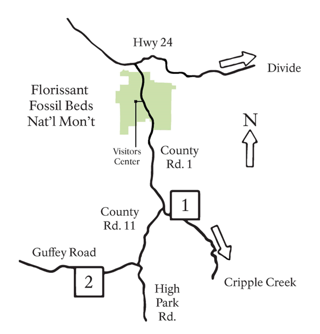
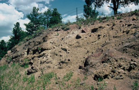
Where to See the Lahar (Stop 1):Turn right on Teller County Rd. 1 out of the Florissant Fossil Beds Visitor Center parking lot (going south). Drive 6.8 miles (10.9 km) and turn right onto County Rd 11. There will be a small parking lot at the intersection of Teller County Rd 1 and County Rd 11 where you can park. Walk across the field and onto Teller County 1 for 175 yards (160 m) south to the roadcut. This is a dangerous area for pedestrians. Use extreme caution! At the roadcut you can see the lahar that originated from the Guffey volcanic center to the west. This lahar impounded the river and created Lake Florissant. The lake was about a mile wide and extended 12 miles (19.3 km) northwards. The debris carried by the flow contained rock fragments of different size, shape, and composition. The dark fragments are pieces of Thirtynine Mile andesite (a dark, fine-grained volcanic rock that originated from the Thirtynine Mile volcanic complex), while the lighter, pinkish fragments are pieces of 1.4 billion year old Cripple Creek Granite that was exposed to the surface during the Laramide orogeny. Rounded fragments may have been picked up from the paleovalley through which the lahar flowed. 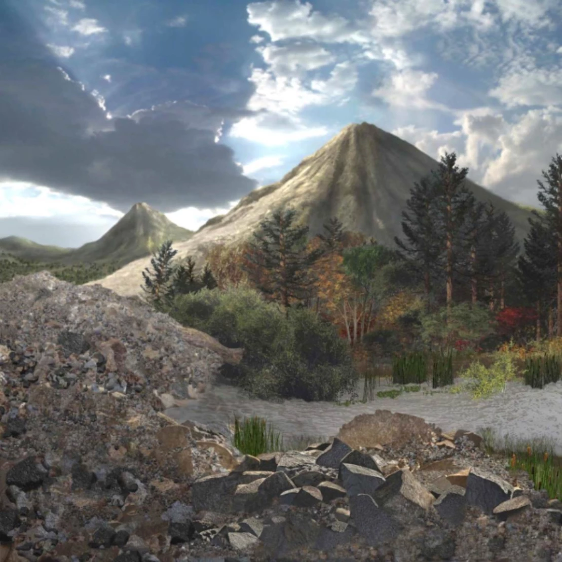
Where to See the Guffey Volcanic Center (Stop 2)Turn left out of the parking lot (going north) onto Teller County Rd. 11 after 0.1 miles (0.16 km). Go 4 miles and then turn right onto Guffey Road. Follow it for 2.7 miles (4.4 km) until you see a large turnoff on the left side of the road past mile marker 14 at the crest of the hill. Ignore the parking on the right just before the top of the hill. Park on the left and cross the road. Use caution when crossing as this is a blind hill! Walk 20 yards (18.3 m) north up the hill, pass the sign, and head to the right, off the trail. This will lead you to the overlook of the Thirtynine Mile volcanic field. Looking to the west out over the valley you can view the remnants of the ancient Guffey volcanic center. The peaks you are looking at (such as McIntyre Mt) are what remain of the lava flows and lahars that formed the slopes of the Guffey volcanic center. The layered flows are oriented in different directions for different peaks, indicating that they surrounded the volcanic center. The lahars that flowed from the Guffey volcanic center had once filled this valley to a level that would have extended far above the point on which you are standing. The valley before you formed when Four Mile Creek began to cut through the lahars. The creek became entrenched, or trapped, in its path and was not able to change direction when it encountered the much harder Cripple Creek Granite beneath it. This is how the canyon to your right (north) was formed.

Return to Geologic History Page
Geologic map of Florissant Fossil Beds |
Last updated: June 12, 2020
