The Project area is broken into Study Zones (study areas)
based on geo-political distribution.
(Click on map thumbnails to view larger maps, approx. 1M
each.)
The 4 Study Zones are:
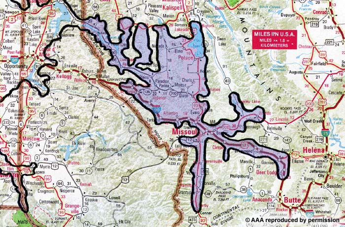 1. Glacial Lake Missoula
Montana: Area includes all of historic Lake Missoula, including the Clark Fork to the state line.
Target dates for Study Zone meetings (Missoula, Montana):
- June 1, 2
- August 3, 4
- Spring 2000
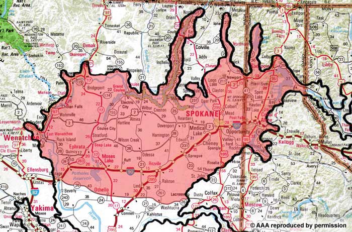
2. Idaho Panhandle and East Central Washington
Washington/Idaho: Areas include Pend Oreille, Coeur d’Alene, Post Falls, Spokane, Odessa, Moses Lake, Coulee Dam, Channeled Scablands area, Dry Falls, Potholes, and the area north of State Route 26.
Target dates for Study Zone meetings (Spokane, Washington):
- June 3, 4
- August 5, 6
- Spring 2000
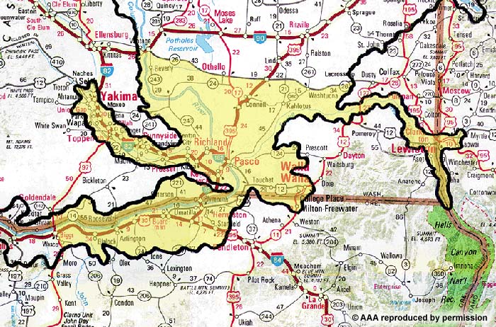
3. Mid-Columbia
Washington/Oregon: Tri-Cities, Walla Walla, the area south of State Route 26, Yakima, Umatilla, Hermiston, to the John Day Dam.
Target dates for Study Zone meetings (Richland, Washington):
- June 8, 11
- August 10, 11
- Spring 2000
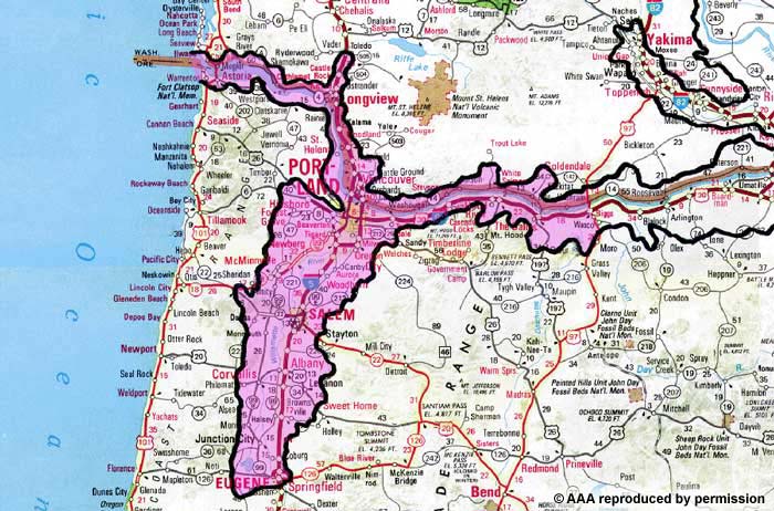
4. Gorge, Lower Columbia, and Willamette
Washington/Oregon: includes the area west of the John Day Dam, Stevenson, the Dalles, Hood River, Astoria, Portland, Eugene, Salem, Vancouver, Longview, and up the Cowlitz River to Castle Rock.
Target dates for Study Zone meetings (Portland, Oregon):
- June 15, 18
- August 17, 19
- Spring 2000
Joint Study Team Meeting (Moses Lake, Washington):
- October 13 with field trip on October 14
Composition of Study Zone Working Teams
- local regional transportation planning organization, or equivalent
- State Department of Transportation (lead region)
- Chambers of Commerce within the Study Zone
- public land management agencies within the Study Zone
- private landowners with Floods resources on property
- subject specialists and teachers within the Study Zone
- local and county governments within the Study Zone
- Ice Age Floods Institute
- State Interagency Task Force within the Study Zone
- tourism industry within the Study Zone
- local tribal governments
- interested general public
Duties of Study Zone Working Teams
- conduct in-depth inventory of local Study Zone Ice Age Floods resources
- conduct interpretive programs for local influence groups
- work with media to generate interest in the Study
- host Study Zone meetings, arrange for locations, dates, and publicity
- host public workshops to review Draft Document