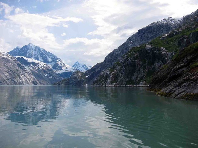
The three Southeast Alaska parks are strongly influenced by their proximity to the Gulf of Alaska and the maritime passages of the Alexander Archipelago. Southeast Alaska includes over 1,100 islands, which are the tops of the partly submerged coastal mountain range. The region is bounded to the east by a mainland mountain range with peaks reaching 10,000 feet (3,048 m) in elevation. These mountains and associated icefields are bisected by several large glacial rivers. The ocean coast to the west is lined with mountain ridges and peaks with heights ranging from 5,000 feet (1,524 m) to over 15,000 feet (4,572 m) above sea level. (See more information about the connections between a glacier-dominated landscape and the ocean in Icefields to Ocean.)
Marine environments and influences are integral components of all the Southeast Alaska parks. Storm systems typically approach Southeast Alaska from the Gulf of Alaska to the west and drive abundant moisture ashore. The dramatic topography produces a strong orographic effect with high precipitation near the ocean coast, and distinct rain shadows on the leeward side of mountain masses. Although strong gradients in precipitation characterize the region, generally high precipitation and cool temperatures support temperate rainforest ecosystems and myriad freshwater environments, including glaciers, glacial rivers, clearwater streams, lakes, and wetlands. Within the network parks, freshwater and terrestrial ecosystems are well represented. Although Glacier Bay National Park and Preserve is the only park that includes an extensive marine component within its boundaries, both Klondike Gold Rush and Sitka national historical parks border productive estuaries, and all three parks are greatly influenced by marine processes.
Freshwater Ecosystems
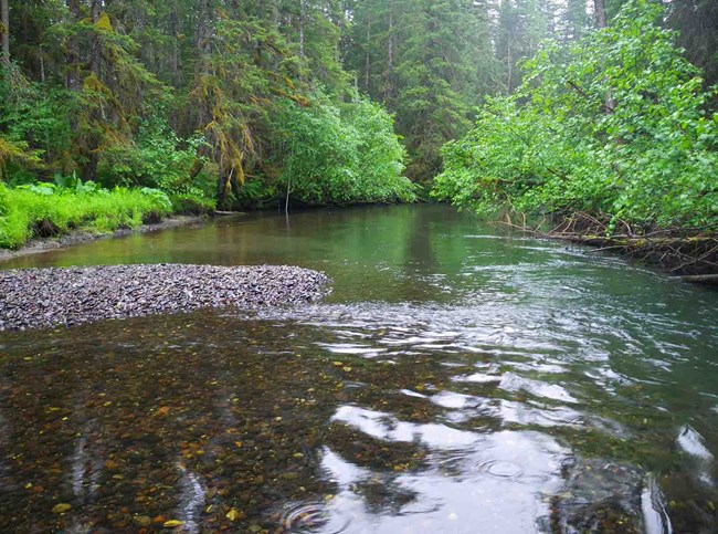
New streams and lakes are created as retreating glaciers expose fresh terrain. Upstream lakes, which trap sediment and moderate flow, allow stream communities to stabilize. The successional development of aquatic plant and animal communities is closely tied to the concurrent development of adjacent terrestrial plant communities.
As vegetation colonizes stream banks, the addition of organic matter into streams promotes invading communities of stream invertebrates. The early input of leaves and catkins from shrubs is followed by the accumulation of coarse, woody debris in stream channels. This debris provides cover for fishes and supports colonization by anadromous salmonids. The input of marine nutrients and energy from spawning salmonids to stream and riparian environments accelerates the development of stream invertebrate communities and creates a positive feedback to stream primary and secondary productivity.
Glacial activity in the upper reaches of a watershed can affect stream development for hundreds or thousands of years after streamside surfaces become ice-free. In Glacier Bay National Park and Preserve and Klondike Gold Rush National Historical Park, sediment-rich glacial streams traverse lowlands occupied by forest ecosystems that have been developing for more than 10,000 years. Productivity in these streams will remain low until sediment sources are reduced. Where lakes associated with active alpine glaciers are in the watershed of such streams, rapid ablation (the reduction in volume of a glacier due to melting and evaporation) of glaciers and snowfields in the last 30 years may have increased the potential for glacial-lake outburst flooding. Catastrophic downstream flooding and debris flows have resulted from increased meltwater and higher lake levels behind loosely consolidated and saturated alpine moraines. The Taiya River in Klondike Gold Rush National Historical Park has experienced at least three glacial lake outburst floods in the last 120 years, most recently in 2003.
Southeast Alaska watersheds that have been free of major glaciation for thousands of years, such as the Indian River in Sitka National Historical Park, tend to have mature riparian forests and rivers tend to flow clear during most of the year. These mature rivers generally drain steep topography and are cold and swift. Their beds tend to be made up of gravel, cobbles, and boulders with a low amount of fine deposits such as silt. This provides multiple surfaces and habitat for a diverse benthic community. The silt-free interstitial spaces within gravel and cobble substrates allow surface water to flow through the hyporheic zone which delivers dissolved oxygen to invertebrates, salmonid eggs and newly emerged fry, removes waste products, and provides protection from strong current and predators. The Indian River and other rivers with old-growth and mature secondary growth forests in their riparian zones are significantly influenced by large trees that fall directly into and across the stream. This large woody debris creates relatively immobile log barriers, log jams, and root wads that stabilize the river channel, provide cover, and form pools, all of which are critical for juvenile salmonid survival.
A study of 33 lakes at Glacier Bay National Park and Preserve ranging in age from 10 to 13,000 years has indicated how their successional development is closely tied to the ecological development of the land in the surrounding watershed. Due to the compounding influences of lake chemistry and watershed geomorphology, lakes eventually (over several thousand years) become less fertile and less productive as they mature, even as carbon and nutrients accumulate in the surrounding landscape. These interactions emphasize the dependence of lake development on plant succession and soil development in the surrounding terrestrial environment. There are no true lakes in Sitka or Klondike Gold Rush national historical parks, however, intermittent ponds are seasonally present in both parks.
Terrestrial Ecosystems
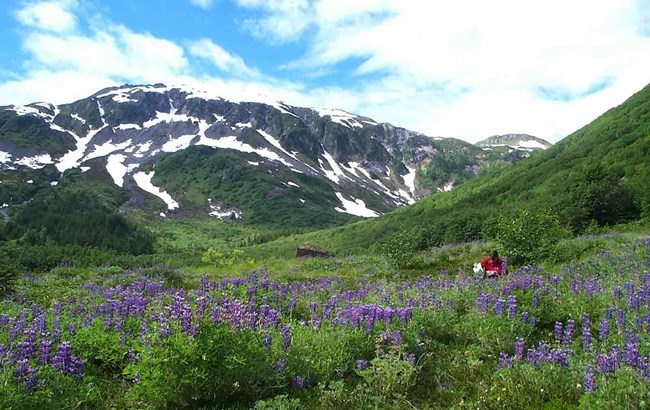
The geographic location of a site recently exposed by retreating glaciers influences the site’s climate, soil characteristics, and landscape position. Landscape position (a site’s spatial relationship to physical and ecological features) affects the rate of substrate stabilization and the proximity of mature vegetation which could supply seeds for colonizing plant populations. At Glacier Bay National Park and Preserve, these factors have varied from place to place, resulting in substantial variability in the composition of early plant communities. As succession proceeds, the ability of early plant populations to fix atmospheric nitrogen and the activity of herbivores influence interactions among plants (e.g., competition and facilitation).
Differences among sites in early nitrogen fixation and in the consequent accumulation of soil nitrogen lead to long-term differences in ecosystem function. Therefore, predicting the pathways and endpoints of terrestrial ecological succession at any site requires knowledge of landscape-scale patterns.
Marine Ecosystems
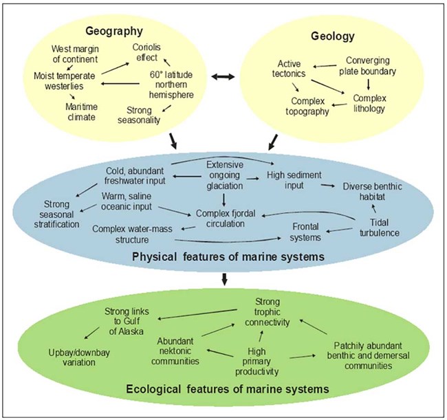
Major ecosystem processes are recognized as important determinants of the structure and function of the Glacier Bay National Park and Preserve marine ecosystem, they include:
1. Geography and climate
2. Geology
3. Physical features
4. Ecological features
What is the relative magnitude of influence of each ecosystem process on the population abundance and structure of a species? These processes often are not independent, and complex interactions can be expected. Following are a couple of the ecosystem processes in which marine and terrestrial ecosystems interact.
The Transfer of Marine-derived Nutrients and Energy to Riparian Systems
Anadromous salmonid fishes return annually to streams in Southeast Alaska parks. Adult salmon return after multiple years as marine predators and die in the streams after spawning. These large runs of fish bring important nutrients (e.g., nitrogen and phosphorous) and energy (caloric food value) from the ocean to the freshwater ecosystem. Some of these nutrients and energy become part of the aquatic food web through scavenging by invertebrates, predation on eggs, or uptake by plants. Terrestrial animals, including brown and black bears, river otters, gulls, and bald eagles, prey on live fish or scavenge dead fish. Animal waste and uneaten fish on and near the stream banks provide marine nutrients to riparian vegetation and the terrestrial food web. The water current flushes uneaten carcasses back to marine waters, and (in combination with the eventual out-migration of young salmonids) much of the marine-derived nutrients and energy in the stream may be eventually returned to the ocean. Nevertheless, a portion becomes incorporated in the terrestrial ecosystem and gradually migrates even beyond riparian areas.
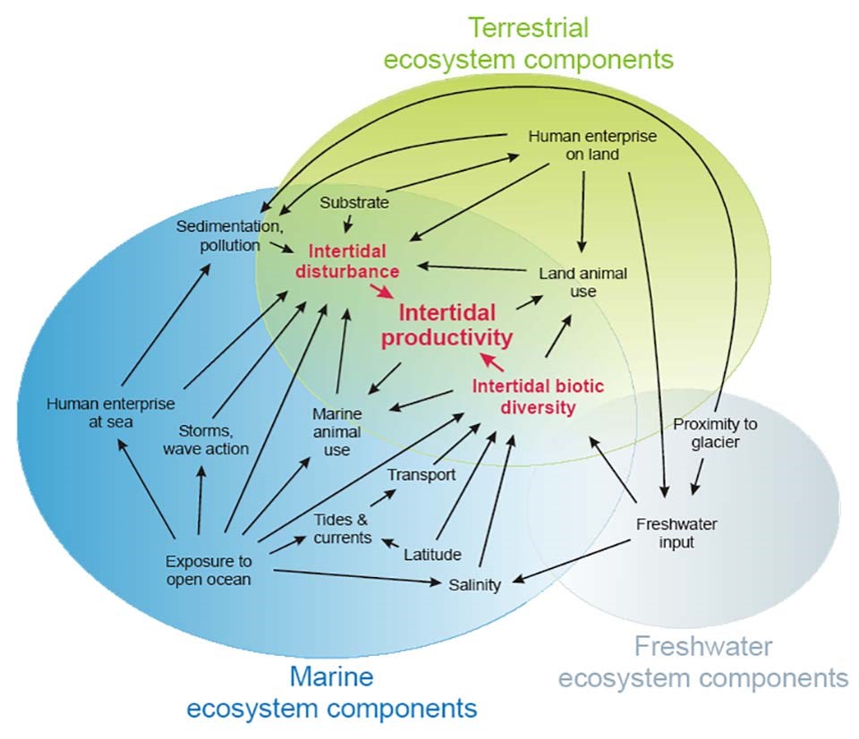
Productivity in the Intertidal Zone
Although the areal extent of the intertidal zone is small relative to the marine or terrestrial ecosystems it borders, its high species diversity and productivity make it ecologically important to a large number of terrestrial and marine animals. The particular combination of plants and animals present in the intertidal zone depends, in part, on a variety of physical factors, including latitude, exposure to the open sea, ocean currents and fronts, and proximity to tidewater glaciers and turbid outwash or clearwater streams.
Biotic interactions within the communities and interactions with land and sea animals (e.g., predation, herbivory) further modify the biotic diversity. Communities of intertidal plants and animals are subject to environmental stresses associated with daily tidal fluctuations, physical disturbance by weather events, and predation or herbivory from marine or terrestrial animals. The influx of cold, sediment-laden freshwater and icebergs from nearby tidewater glaciers influences the composition, structure, and productivity of these communities. Although they are well adapted to natural disturbance, these communities are highly vulnerable to new types of disturbance caused by human activity on land or at sea. For example, trampling by foot or vehicle traffic, changes in nearshore currents caused by docks and other shore-fast structures, and marine oil spills are threats to intertidal communities.
Last updated: February 11, 2019
