NPS photo / SECN staff

NPS photo / SECN staff
Overview
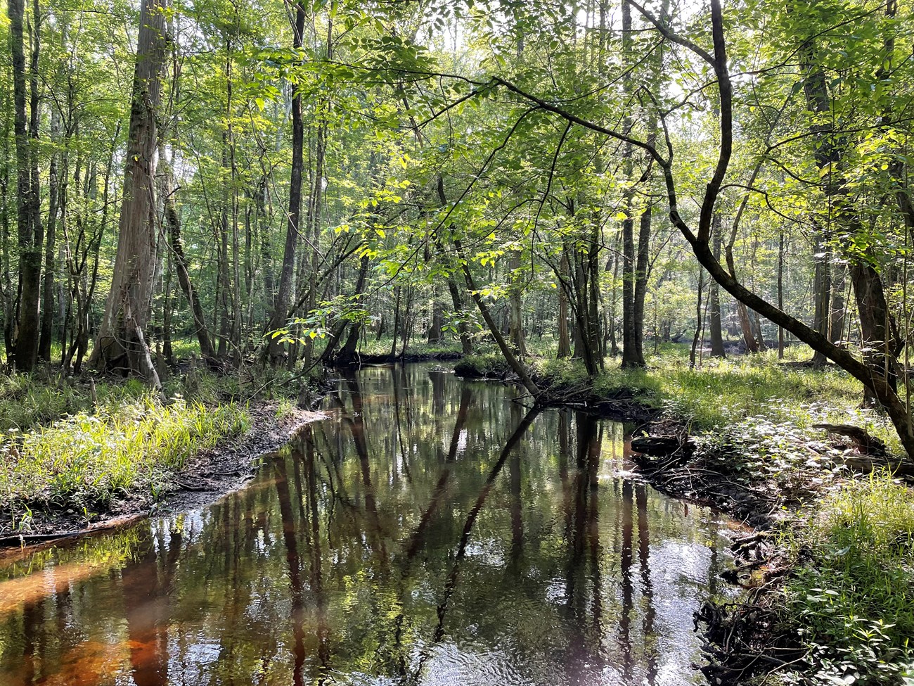
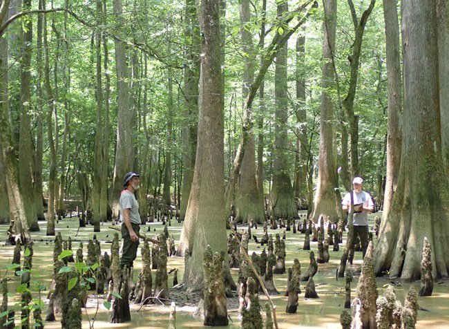
Congaree National Park is in central South Carolina approximately 30 kilometers (18.6 miles) southeast of the state capital, Columbia. The 10,802–hectare (26,693–acre) park is bordered to the south by the Congaree River and the Wateree River to the east. The park contains the largest contiguous old–growth bottomland hardwood forest remaining in the United States. As such, it represents a unique and uncommon assemblage of aquatic and terrestrial plant and wildlife community types. Congaree National Park is predominantly a floodplain forest with nearly 90 native tree species, including many recognized as national and state champions for their size. A wide variety of forest communities occur at the park, with dominant tree species ranging from upland pines (Pinus spp.) to wetland cypress (Taxodium spp.) and tupelo (Nyssa spp.). Episodic and seasonal inundations in surface water are a critical component of the integrity of the park’s floodplain forest. The frequency, magnitude, and duration of flooding events are primary drivers for many of the vegetation communities and serve as mechanisms for the delivery of sediment and nutrients to the floodplain. Although periodic inundations continue to occur, the regulated flow of water through the park since the construction of the Saluda Dam in 1930 does not follow seasonal hydrologic fluctuations or represent a natural (i.e., historic) hydroperiod. The effects of this alteration on the floodplain ecosystem remain unknown.
The Southeast Coast Network conducts monitoring for the following protocols at Congaree National Park.
- Wadeable stream monitoring began in 2018 at the park with baseline surveys at three sites on Cedar Creek (fifth-Strahler order) and one site on McKenzie Creek (third-Strahler order). Surveys were repeated in 2022 and are scheduled to be completed again in 2025. The park is comprised of an extensive floodplain ecosystem which is biologically and geomorphically diverse and contains unique stream types with flow regimes closely tied to the larger and adjacent Congaree River. In general, low gradient, intra-Coastal Plain streams such as those monitored at Congaree National Park have (1) low, often poorly-defined banks; (2) high flood plain connectivity; (3) low-energy flow regimes; (4) relatively high dissolved load; (5) relatively low suspended load (except during floods); and (6) relatively fine bed load. Methods used to monitor stream habitats at the park were primary bases on existing published methods from USGS, USFWS and EPA. Data are collected to assess both status and trends in upstream influences on stream habitat, changes to channel geomorphology, and benthic and instream habitat features.
- Landbird community monitoring and Vocal anuran community monitoring is conducted on a rotating schedule every three years. These wildlife communities play critical roles in park ecosystems and interact with several trophic levels of food webs. The network uses automated recording devices (ARDs) to collect vocalization data during mornings and evenings in the spring, which are analyzed by bioacoustics specialists. Data collected from these vital sign monitoring efforts help assess the ecological integrity and diversity of park areas and how communities and park conditions may change over time. The landbird and vocal anuran monitoring efforts in network parks began in 2012.
- Vegetation community monitoring is conducted on a rotating schedule. Monitoring vegetation is important because it’s key indicator of overall ecosystem health. Changes in vegetation reflect the effects of stressors like extreme weather, disease, invasive species, fire, and land use change. Plant communities also provide structured habitat and food resources for other species. Vegetation monitoring data provides managers with information about the degree of change in their park’s natural communities. Vegetation plots are established across the following habitats: Coastal Plain Upland Open Woodlands and Coastal Plain Alluvial Wetlands. Data reports include information about new occurrences and rare plants, species richness and abundance, tree health and regeneration, disturbance observations, soil nutrients, landform/geomorphology, and downed woody debris.
- Water-quality monitoring at Congaree National Park is conducted in Cedar Creek, which is a coastal plain, blackwater stream. This stream was selected for monitoring due to its importance as a critical resource for fish, wildlife, and visitor experience. Although not initially included as a vital sign at the park, water-quality monitoring was implemented as a park assistance project. Data will be used to assess the status of water-quality conditions at the park and changes to water-quality characteristics over time. The fixed-station sonde is located about halfway down the Cedar Creek canoe trail and measures depth, dissolved oxygen, pH, salinity, turbidity, and water temperature every 30 minutes. Fixed-station water-quality data are available at the Aquarius web portal.
| Vital Signs | Examples of Measurements |
|---|---|
| Landbird and Vocal Anuran Communities | Stream channel morphology (heights, widths, depths), channel gradient, bed sediment particle size, large wood inventory, distribution of geomorphic channel units, canopy cover |
| Terrestrial Vegetation Communities | Plant community diversity, relative species/guild abundance, structure/age class, incidence of disease |
| Water-Quality | pH, dissolved oxygen, water temperature, turbidity and water-level |
| Wadeable Stream Habitat | Channel width, depth, and gradient, sinuosity, channel cross-section, pool frequency and depth, particle size |
Source: Data Store Collection 3959. To search for additional information, visit the Data Store.
Source: Data Store Collection 3957 (results presented are a subset). To search for additional information, visit the Data Store.
Source: Data Store Collection 3960. To search for additional information, visit the Data Store.
Source: Data Store Collection 3958. To search for additional information, visit the Data Store.
Source: Data Store Collection 3963 (results presented are a subset). To search for additional information, visit the Data Store.
Source: Data Store Collection 9569. To search for additional information, visit the Data Store.
Source: Data Store Collection 3962 (results presented are a subset). To search for additional information, visit the Data Store.
Last updated: November 11, 2024
