
Hiking Trails in the Sheep Rock UnitThere are seven hiking trails in the Sheep Rock Unit, ranging from 0.25 miles to 3.25 miles in length. The trails are listed from north to south, arranged by trailhead. Please remember to recreate responsibly, stay on trail, and Don't Hurt the Dirt! Foree Trailhead
Blue Basin Trailhead
James Cant Ranch Historic District
Thomas Condon Visitor Center
Mascall Overlook

Clarno Unit Trails
See real fossils along the trail from an ancient semi-tropical rainforest. 
Painted Hills Unit Trails
Experience the colorful Painted Hills! 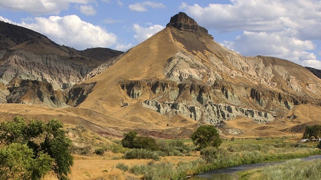
Sheep Rock Unit
Home to the Thomas Condon Visitor Center and the Cant Ranch Museum, the Sheep Rock Unit also has many trails and scenic views. 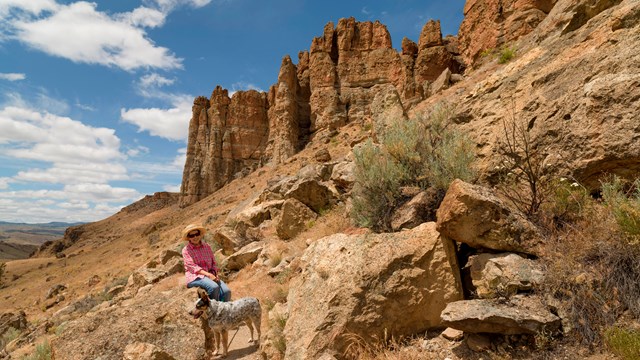
Clarno Unit
The Clarno Unit has the oldest exposed layers of the park, and the only unit with fossils along the trail. Remember, no collecting fossils. 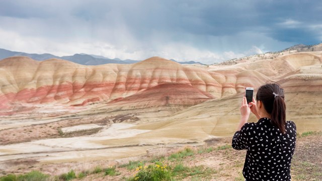
Painted Hills Unit
The colorful stripes and gentle ripples of the Painted Hills makes it one of the most popular destinations in the park. |
Last updated: September 24, 2024