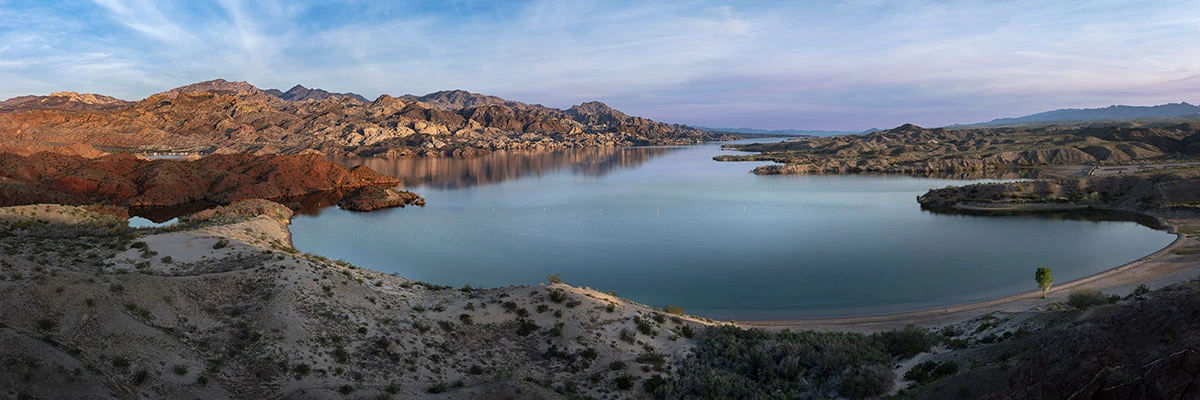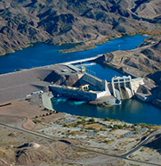
NPS Photo - Andrew Cattoir Lake Mohave is a reservoir on the Colorado River created in 1951 following the completion of Davis Dam near present-day Laughlin, Nevada, and Bullhead City, Arizona. Named for the Mohave Indians who previously inhabited this region of the Colorado River valley, Lake Mohave extends approximately 67 miles along the valley from Hoover Dam to Davis Dam straddling the southern Nevada and northwestern Arizona border, which follows the original river channel. Formation of Lake Mohave
Both narrow and shallow compared to Lake Mead, Lake Mohave lies between the Black Mountains to the east in northwestern Arizona, and the Eldorado and Newberry Mountains to the west in southern Nevada. Most of the lake's length lies within the steep, narrow walls of Black, Eldorado, Painted, and Pyramid canyons. The northern section of the reservoir is constrained by the steep rock walls of Black Canyon for a length of 22 miles and is narrower than 300 ft in places. This portion of the reservoir is primarily riverine. South of Black Canyon, Lake Mohave gradually widens to nearly four miles in Cottonwood Basin. The transition between river and true reservoir conditions occurs in Eldorado Canyon, between Black Canyon and Cottonwood Basin. Interesting FactsIn the summer, a sharp convergence zone develops in Eldorado Canyon as the cold, nutrient-rich river water flows under the warmer lake water. Mixing at the interface promotes high phytoplankton productivity resulting in a marked change in water clarity in Eldorado Canyon. The reservoir has a long north-south fetch and is subject to high winds and resulting large waves from the predominantly south/southwest summer winds and north/northeast winter winds. Small coves are formed in some areas of the basins by inundated desert washes, which are a major source of shoreline alluvial deposits that periodically are washed into the reservoir. Davis Dam is located within a narrow gorge cut into Precambrian igneous rock in Pyramid Canyon at the south end of the reservoir. At 647-foot elevation, the Lake Mohave has a total storage capacity of 1,818,300 acre-ft, a maximum depth of approximately 100 ft, and just over 28,000 surface acres with roughly half of the lake found in Arizona and half in Nevada. With the completion of Hoover Dam and Davis Dam, historic riverine temperature and flow cycles were no longer in place. Hoover Dam discharges cold water from the bottom of Lake Mead, Lake Mohave's only significant inflow. As a result, water temperatures within Black Canyon are a constant cold 53° Farenheit (12-13°C), and the shade provided by the steep walls of the canyon helps to maintain the steady low temperatures throughout the year. The change in temperature cycling and modifications to the physical features of the area brought about by damming the Colorado River in the area of Lake Mohave resulted in habitat loss for aquatic insects, which are now no longer present. Also directly and indirectly imperiled were the razorback sucker and bonytail chub, two federally listed endangered fish species for which Lake Mohave provides critical habitat. The razorback sucker population has most recently been estimated at less than 5,000 fish, which is a significant decline from previous estimates of 60,000 in the late 1980s. Once abundant throughout the Colorado River basin, Lake Mohave now contains the largest remaining population of razorback suckers. The bonytail chub presently exists in low numbers in Lake Mohave. Striped bass have become the major sport fish in Lake Mohave; this species reproduces in the seasonally warm reaches of the reservoir and moves into cold-water areas as they become larger, and eventually preys upon other fish. Largemouth bass, smallmouth bass, channel catfish, and sunfish provide the remaining portion of the sport fishery. The major forage species present, are threadfin shad, bluegill, green sunfish, and crayfish. Large striped bass are also known to prey on carp. Populations of all the forage species have remained fairly abundant with the exception of threadfin shad. Other nongame, nonnative fish include carp and red shiner. Predation by striped bass, among other factors, has reduced the threadfin shad population to a point where the species is now difficult to detect in Lake Mohave. Lake Mead National Recreation Area fishing page. |
Last updated: September 5, 2025

 Construction of Davis Dam was a requirement of the 1944 Water Treaty with Mexico to regulate water released from Hoover Dam for delivery to Mexico. Lake Mohave is used for that purpose through integrated operations with Hoover Dam. In 1947, the area where Lake Mohave would form and surrounding lands were added by revision to the Memorandum of Agreement between the National Park Service and the U.S. Bureau of Reclamation for the previously designated "Boulder Dam Recreation Area," which in 1964 would become Lake Mead National Recreation Area. Lake Mohave provides a variety of recreational opportunities, including boating, fishing, and scuba diving. Three marinas with launch ramps are located on Lake Mohave, two in Arizona (Willow Beach and Katherine Landing) and one in Nevada (Cottonwood Cove). An additional launch ramp is located at Princess Cove on the Arizona side near Katherine Landing. Lake Mohave provides aquatic and riparian habitat for native fish and a variety of introduced game fish, desert wildlife and plants.