Limited Closures in Lassen Volcanic in 2024Some emergency closures are in place for facilities, infrastructure, and areas affected by the 2021 Dixie Fire. Please adhere to all closures indicated by CLOSED signs. What to Expect When Visiting After the 2021 Dixie FireAreas most impacted by Dixie Fire are located in the east and southeast portion of the park and include Warner Valley, Juniper Lake, and portions of Lassen Volcanic Wilderness between Butte and Juniper lakes. All areas west of the park highway were not affected by the Dixie Fire. Areas to the west of and along the park highway that were unaffected by the fire are the safest areas to visit. Additional hazards may be present along the highway including fallen trees, rockfall, or slow or stopped cars. Please adhere to the posted speed limit and be patient with your fellow visitors.
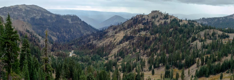
Manzanita Lake and most of the Southwest and Butte Lake Areas have limited or no impacts from the fire. Most of the highlights along the highway look the same as before the fire. You will however, see burned areas from a few sections of the highway and some areas will remain closed for safety and restoration/repair efforts. View photos of effects of the Dixie Fire in the park. Half of the Park Was Not Affected by the Dixie Fire
All Trails West of the Park Highway Were Not Affected Small sections of trail or damaged/destroyed infrastructure such as overlooks and boardwalks will be signed as CLOSED as conditions warrant. Significant closures will be noted on the trail conditions page. The park is prioritizing efforts to rehabilitate popular trails within the burn footprint as soon as possible. Major footbridges were repaired or replaced. This includes the Kings Creek Falls overlook and the Mill Creek Falls bridges. Additional smaller footbridges throughout the Dixie Fire footprint still need repair or rehabilitaiton. The rehabilitation of the 13-mile segement of the Pacific Crest Trail within the park was completed in 2023. Most park campgrounds are anticipated to open for the 2024 summer/fall season. View campground operating dates and status.
Backpacking is permitted within the Dixie Fire footprint. Backpackers should exercise caution in burned areas; learn more about burned area safety. The status of park roads is listed on the current conditions page and includes closures for snow and post-fire repair. The opening of Warner Valley and Juniper Lake roads will be delayed beyond the normal spring/summer opening to allow for post-fire repair. Butte Lake Area
Warner Valley Area
Juniper Lake Area
The Dixie Fire footprint is closed to stock use. This closure will limit the impacts to the resource and prevent soil erosion, social trailing, erosion at creek crossing, nonnative plant introduction as well as mitigate safety concerns for livestock and the stock users. Burned areas will remain closed to stock use through 2024 or until full repairs are completed. 
NPS Map of current closures as of 5/23/2023. This map does not include all closures. Please adhere to all closures indicated by CLOSED signs within the park. Learn more about the 2021 Dixie Fire. 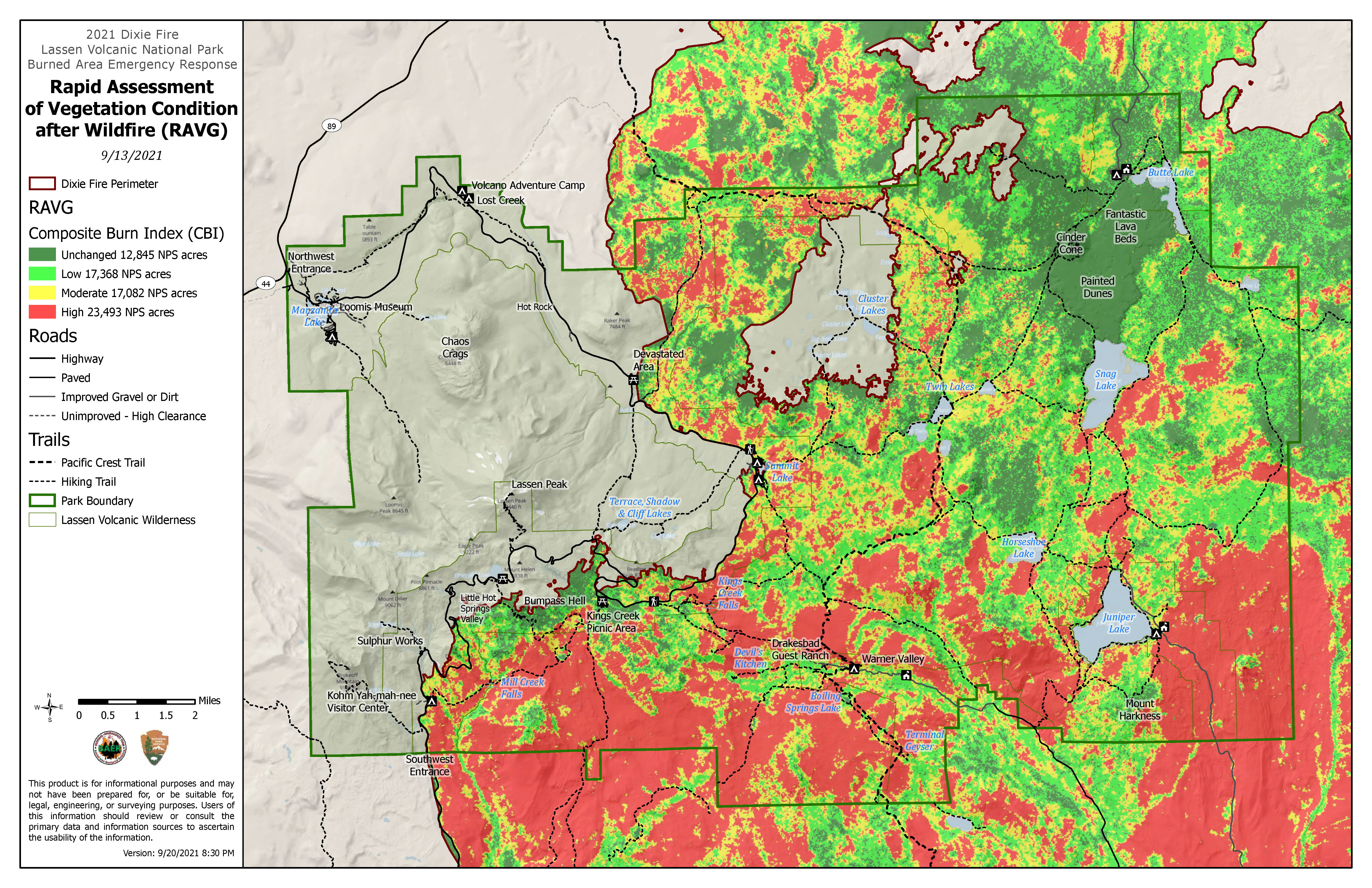
|
Last updated: March 28, 2024