Select Item below to DOWNLOAD - Once item is selected, right click and choose 'save as'
54f26987-0209-48e1-8161-1f5a54085ead
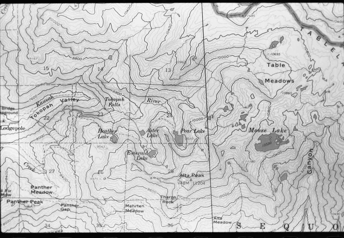
Maps and Graphics, Research Plots. Photo of topographic map showing an area of Emerald Lake Acid Precipitation Study Site.
SEKI Historic Image
Maps and Graphics, Research Plots. Photo of topographic map showing an area of Emerald Lake Acid Precipitation Study Site.
National Park Service
Larry L. Norris, 830600, Ash Mountain, SNP, Maps and Graphics, Research Plots. Photo of topographic map showing an area of Emerald Lake Acid Precipitation Study Site.
Permission must be secured from the individual copyright owners to reproduce any copyrighted materials contained within this website. Digital assets without any copyright restrictions are public domain.
Public domain
Image
Ash Mountain, Tulare County, California
06/01/1983
option 1
Tuesday, January 10, 2017 11:06:47 AM
Tuesday, January 10, 2017 11:06:47 AM
10412.tif
Monday, January 1, 0001 12:00:00 AM
tif
1.8 MB
Scenic
,
Historic