|
ALAGNAK
Alagnak Wild River An Illustrated Guide to the Cultural History of the Alagnak Wild River |

|
HISTORIC STRUCTURES
The cabins that appear along the Alagnak were generally used by trappers or subsistence hunters. Traditionally, a few of these cabins were considered "open" to passers-by, if unoccupied by the rightful owner, with an understanding that the cabin would be left as it was found. However, evidence of vandalism has taken its toll on these historic structures. In particular, dismantling cabins for firewood has become a serious threat to the future of some structures. Please explore and enjoy historic sites but leave them as you have found them. We all share the responsibility of protecting and preserving important cultural resources for others to enjoy.
|
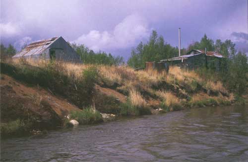
| Mary's Camp along the Alagnak River. Clumps of vegetation slide down the eroding bank as the river moves closer to these historic structures. Photo courtesy of Janet Curran, USGS. |
Preservation
What are prehistoric historic, and/or archeological remains?
Sites are places where people lived, camped, or conducted other activity.
Graves, marked or unmarked, are the locations of human remains and may be Native or non-native.
Deposits are accumulations of refuse in and around a dwelling place. Typically these deposits consist of shell fragments, fish bones, animal bones, charcoal, broken tools, fire-cracked rocks, tin cans, or other household debris.
Structures, ruins, and buildings are such things as cabins, cabin foundations, aircraft, boats, fish weirs, drive lines or fences, semi-subterranean house depressions, or cache pits.
Artifacts typically consist of tools and household items (made of wood, bone, ivory, stone, metal, glass, or plastic), art objects, and pottery (including Native made).
Fossils are any remains, impressions, or other trace of an animal or plant that was once buried and may now look rock-like.
|
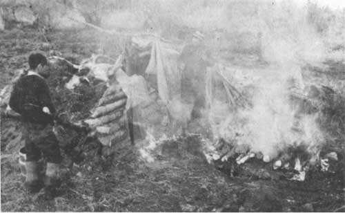
| Heating rocks outside a steambath on an open fire before taking them into the bath at left. Photo circa 1920s-1930s at Branch River. |
|
|
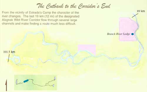
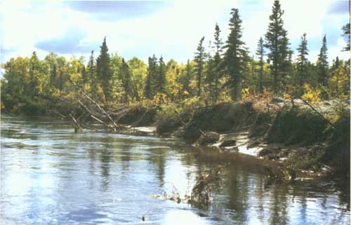
The Cutbank to the Corridor's End (click on images for PDF versions) From the vicinity of Estrada's Camp the character of the river changes. The last 19 km (12 mi) of the designated Alagnak Wild River Corridor flow through several large channels and make finding a route much less difficult. The delicate Single Delight may be seen growing along the river. |
Protection of Cultural Resources
Please observe and enjoy but do not touch, move, collect, or otherwise disturb artifacts, cultural sites, or paleontological materials (fossils). If you find cultural material or fossils:
Record the location on a map or make a sketch map referencing prominent landmarks.
Take compass bearings or note general compass orientation.
Estimate site size.
Photograph the artifacts or fossils in place. Include an object for scale. Photograph the site area and the surrounding landscape.
Note any human or natural disturbances to the site.
Report any information to either address below:
Cultural Resources Manager
National Park Service
240 West 5th Avenue
Anchorage, Alaska 99501
907/271-1383 (until 4/01/06)
Chief Ranger
Katmai National Park & Preserve
P.O. Box 7
King Salmon, Alaska 99613
907/246-3305
Safeguarding Cultural Resources
The unauthorized collection or destruction of cultural resources (any historic, prehistoric, or archeological) or paleontological [fossil] resources on lands owned or controlled by the Federal Government is prohibited by law and may carry serious criminal (felony) and civil penalties. Do not dig impromptu privies or fire pits that may disturb buried cultural deposits.
Respect Private Property
Although the National Park Service administers the Alagnak Wild River there are many parcels of private property along the river corridor. Some owners have marked their property with "No Trespassing" signs; others have not. It is important to know where you can legally camp. All cabin sites should be considered private property. Visitors should obtain a BLM land status map intended for navigational purposes to insure that you do not trespass or camp on private property.
|
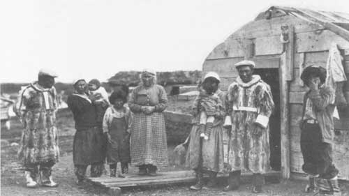
| According to local rsident, "Auntie" Roehl, this photo was taken at Diamond J Cannery (Alaska Packers Association) at Koggiung on the Kvichak River. Some individuals in the plnoto include: Maxie "Black Maxie" Evan (at left), Mary Newyaka (center) holding her first baby (a girl) with her first husband, Boukawal. |
|
|
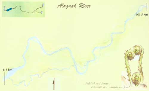
Alagnak River (click on image for a PDF version) Fiddlehead ferns—a traditional subsistence food. |
Impact of Erosion
One of the greatest threats to archeological sites along the riverbank is erosion. Erosion of riverbanks from river currents and waves is a natural process. However, increased wave action due to motorboats has become a serious concern over the years with an increase in park visitation. Actively eroding and denuded riverbanks are especially vulnerable to further wave action as high banks composed of loose sand and gravel are undercut. Visitors using motorboats can help reduce continued erosion by significantly slowing their craft in areas where erosion is evident.
|
| Eroding riverbanks threaten important cultural resources. Reducing motorboat speed can help protect streambanks from further damage. Photo courtesy of Janet Curran, USGS. |
|
|
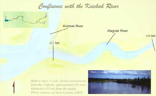
Confluence with the Kvichak River (click on image for a PDF version) Rafters enjoy a wide channel downstream from the Cutbank, approximately 85 river kilometers (53 mi) from the mouth. Photo courtesy of Janet Curran, USGS. |
| <<< Previous | <<< Contents>>> |
alag/cultural-history/sec6.htm
Last Updated: 22-Jun-2009