|
Capitol Reef
Cultural Landscape Report |

|
ANALYSIS AND EVALUATION (continued)
VEGETATION RELATED TO LAND USE (continued)
(Orchard Summaries)
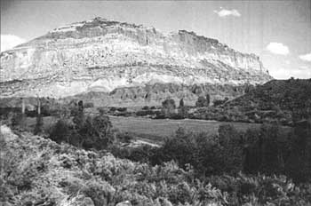
Current Name: Hattie's Field
Other Name(s): Upper Mulford Orchard; Diamond Ranch
Park Code: 0-14
Location: Approximately 1.5 miles from the visitor center west of the south end of the Scenic Drive, bordering the Fremont River.
Tract: 1
Acres Cultivated:
| Orchard | 0 |
| Field | 5.0 |
| Total | 5.0 |
| |
| Hattie's Field | |
Historical Documentation:
Number of Trees: 0
Date Recorded: March 1993
Originally part of the Hyrum Behunin homestead, this land was part of a tract owned from 1915 to 1920 by the Pendleton family. Cass Mulford acquired 56.5 acres in 1922 and added another 88 acres (purchased from J. Jorgensen) in 1929. Mulford owned the 144.5-acre tract from 1922 to 1962, when it was sold to the NPS. The entire 3.5-acre orchard was removed between 1970 and 1977. [35]
Historic Crops:
Peaches (302)
Apricots (118)
Pear (1)
Current Crops:
Pasture grass
| <<< Previous | <<< Contents >>> | Next >>> |
http://www.nps.gov/care/clr/clr4d17.htm
Last Updated: 01-Apr-2003