Geological History of Crater Lake
National Park
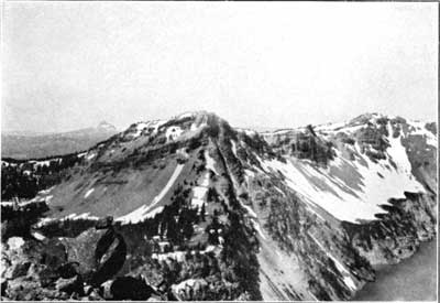
The best views of the rim are obtained from a boat on the lake, which affords an opportunity to examine in detail the position and structure of the cliffs. They are composed wholly of volcanic conglomerate and streams of lava arranged in layers, as shown in figure 12, that dip into the rim and away from the lake on all sides. Both forms of volcanic material are well exposed on the trail descending the inner slope, and, although most of the cliffs are of lava, many are of conglomerate.
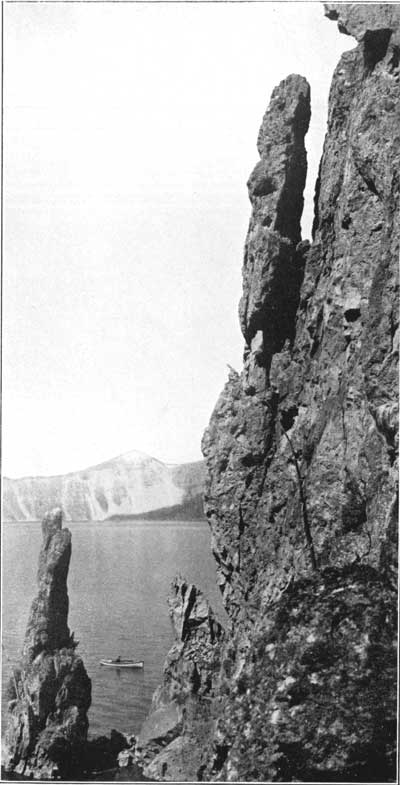
FIG. 12—SOUTHERN RIM OF CRATER LAKE FROM VIDAE CLIFF TO GARFIELD PEAK, SHOWING SHEETS OF LAVA DIPPING AWAY FROM THE LAKE.On arriving at the water's edge the observer is struck with the fact that there is no beach. (See fig. 14.) The steep slopes above the surface of the lake continue beneath its waters to great depths. Here and there upon the shore, where a rill descends from a melting snow bank near the crest, a small delta deposit makes a little shallow, turning the deep-blue water to pale green.
FIG. 14—SHORE CLIFF, EAST OF EAGLE COVE.
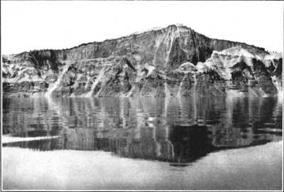
Photograph copyrighted by Kiser Photo Co., Portland, Oreg.As the boat skirts the western shore and passes toward Llao Rock the layered structure of the rim is evident, although it is fairly well illustrated on all sides. On the whole the lava streams predominate, although there is much conglomerate. Of all the flows exposed upon the inner slope that of Llao Rock is most prominent and interesting. In the middle it is over 1,200 feet thick, and fills an ancient valley down the outer slope of the rim. (See fig. 15.) Upon either side it tapers to a thin edge against the upper slope of the valley. To the lake it presents a sheer cliff—that is, it is abruptly cut off—and one wonders how much farther it may have extended in that direction. Beneath the rock the outline of the valley in cross section is evident. It rests upon pumice and many layers of older lavas, forming the rim down to the water's edge. The direction of flow in this great lava stream forces us to believe that it was erupted from a large volcano which once stood upon the site of the lake. Every layer of lava in the rim is a coulee, dipping away from the lake. This is especially well shown in the canyon of Sun Creek (see fig. 12), cut in its outer slope. The sections of these radiating flows exposed upon the inner slope of the rim all tell the same story as to their source. By projecting the lavas in their course toward a common center we can reconstruct in fancy the great volcano, Mount Mazama, which once occupied the place of the lake, and, like Shasta or Rainier, formed a great landmark of the region.
FIG. 15—LLAO ROCK FLOW FILLING AN EARLIER VALLEY OF THE RIM.
 |
 |