|
DEPARTMENT OF THE INTERIOR
Conservation in the Department of the Interior |

|
CHAPTER XIV
CONSERVATION IN THE GEOLOGICAL SURVEY
THE Geological Survey has groups of specialists out in the field constantly checking over those assets of the Government lying between Key West and Point Barrow in the conservation of which the American public may have an interest.
|

That agency has, in fact, a conservation branch which is concerned directly with the disposition and use of the public lands of the national domain. The survey classifies the public lands with respect to mineral, power, and agricultural value. It supervises the development of any mineral and power values that are reserved by the Government. It is the consulting geologist and consulting engineer of the Government on questions of public-land utility. It serves as supervising engineer in the expanding fields of mineral and power development under Federal permit, license, or lease.
Back in 1905 an inquisitive survey geologist detected wholesale fraud in the acquisition by far-sighted interests of valuable Wyoming coal lands as "agricultural land" under the homestead laws and brought the matter forcibly to the attention of his superiors. Casual surveys disclosed like conditions elsewhere in the public-land States of the West, affecting not alone the mineral resources but the water-power resources as well, and revealed a need for prompt, drastic action to prevent further looting of the Nation's treasure.
Vast areas throughout the West believed to be valuable for coal, petroleum, natural gas, phosphate, or potassium minerals, or to involve possibilities of water-power or water-storage development, were withdrawn from entry. This brought strikingly forward the necessity for an adequate study of the wealth of the public domain and methods for its conservation.
Much of the Government's remaining empire in the West does not appear very inviting from a car window, but the geologist is in his way a detective who picks up odd clews that may point the way to hidden treasure. After "reading the rocks" these geologists have had set aside for further examination 60,000,000 acres for coal, 5,000,000 acres for oil and gas, 4,000,000 acres for oil shale, 2,000,000 acres for phosphate, 9,000,000 acres for potassium, and other odds and ends.

|
| The Boundary Lie Between Canada and Alaska |
The Nation's mineral fuels which have been derived from the remains of plants and animals through the long geologic past—before the appearance on the earth of man, their user—represent stored heat from the sun. At best, future supply and demand can only be approximately measured, but the recognition of the limitation of raw materials has emphasized the desirability of assembling all available information concerning the country's stock of mineral fuels. This is one of the Survey's tasks in conservation.
The coal deposits of the country have been studied with a view to determining the quantity, quality, and geographic distribution of the coal that is still in the ground and available for future use. Workable coal beds, according to estimates prepared by the Geological Survey, underlie an area of half a million square miles in the United States and under the leasing act yielded nearly a half million dollars in royalty during the fiscal year 1930.
In connection with these estimates one may ask whether all the coal fields of the United States are known, and if their limits have been determined. Because of the field work of the Federal and State geological surveys, this question can be answered in the affirmative.
The question of how long the coal supply will last includes so many indeterminate factors that any prophecy as to the date of its exhaustion must be of questionable value. Although the authorities are sometimes alarmed because those highest grade deposits nearest to the industrial centers are rapidly declining, yet it is a safe generalization that we have sufficient coal in the United States to last our people for centuries to come.
The value of geology and geologists to the oil and gas industries is now clearly and generally appreciated, but in the earlier days the "practical" oil man looked skeptically upon geologists as a peculiar breed of theorizing dreamers who served no useful purpose. The discovery of the Cushing field in Oklahoma by geologists and its development in 1912-1915 was one of the events which convinced the most skeptical that petroleum geology has practical value.
|
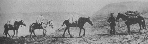
| Exploring Interior Alaska |
Forty-three petroleum engineers and assistants are responsible for supervision of the development of oil and gas on public lands. During the fiscal year 1930 over $4,000,000 was paid into the Treasury for oil and gas royalties accruing on public land alone, while over $1,500,000 accrued as royalty from naval petroleum reserves in California.
In modern times the seat of empire, it has been said, has been determined by the distribution of mineral deposits. Coal and iron, sitting side by side, contribute most of all to its establishment. Copper, lead, zinc, petroleum, and aluminum are the five mineral commodities most important as supplements.

|
| Aluminum Ore That Is Readily Accessible |
In the production of all seven of these the United States stands first among nations. Thus her natural industrial advantage is overwhelming. But there are points of weakness in her position. There are certain minor minerals that she does not produce.
Field, laboratory, and office studies of the distribution and economic geology of the ores of these metals are carried on by the United States Geological Survey with a view to estimating and increasing known reserves, and stimulating production where it is in accord with sound economic principles and consistent with conservation of natural resources. By conservation is here meant the wise and efficient utilization of resources at all times.
The economic utilization of the metals that are plentiful and a search for and development of the supply of those that are scarce constitute a constant struggle of the Government.
It has been but 50 years or so since the steel makers began to alloy their products with those little brothers to iron which, being present in small quantities, give it one quality or another that it may better serve given purposes. Outstanding among these alloys is manganese. Stir seven pounds of it into a 1,000-pound pot of steel that is ready to be poured and, lo! It takes on new and superior qualities. The addition of ferromanganese to molten steel permits the manganese to combine with the dissolved oxygen and puts back into the steel the essential carbon which has been burned out. Added in greater proportion, it produces a tough steel that can be put on those teeth of the steam-shovel dippers that gnaw so knowingly into earth excavations, hard steel for the jaws of crushing machinery, resistant steels that may go into safes that defy the tools of the cracksman. It is one of the most helpful and generally used of all steel alloys.
There are deposits of manganese in Virginia, Georgia, Montana, the Ozarks, the Southwest, but more than 90 per cent of that used in the American industry comes from Russia, India, Brazil, and other foreign lands. Russia owns what are probably the largest and best deposits of manganese ore in the world. They are down in that other Georgia by the Caspian Sea and are the envy of all nations. Some 300,000 tons of manganese metal in the form of ores and alloys valued at $25,000,000 are brought into the United States every year.
Tungsten is another of these iron relatives used with peculiar results in alloying steel. Tungsten is a comparatively rare metal, but, while vital, the world can get along with relatively small quantities of it. The United States consumes only two or three thousand tons of it in a year, but spends a million dollars for it. World production is not more than 25,000 tons. Half of what is used in the United States is produced here. Burma, Indo-China, Bolivia, and Korea make their contributions.

|
| Blast Furnaces in Which the Quality of Steel Is Improved by the Introduction of Other Metals |
But this small amount of tungsten is necessary. It furnishes the filaments for our electric lights. It contributes a peculiar quality to steel that makes possible one of its most exalted uses. Tungsten steel is tool steel. It cuts other steel as a boy might whittle a stick. A tungsten steel tool may shape the barrel of a cannon or a drill of it may pierce armor plate. Tools that do this sort of cutting grow hot. Tungsten steel does not lose its temper, however, at temperatures that destroy the usefulness of tools made of other steels. They may be operated four or five times as fast as tools of carbon steel without being affected. They are masters of the steel world.
Chromium is another of these little brothers to iron that is used in hardening steel. Chrome steel is excessively hard. Armor plate for battleships is made of it, as well as armor-piercing projectiles. So are the barrels of guns, large and small. The automobile industry utilizes large quantities of chrome steel in gears and other parts requiring great hardness. It has the virtue of not tarnishing. Its qualities are different from those of manganese steel. The steel resulting from the introduction of one of these alloy metals or another into it has its peculiarities which give it special uses. Chromium itself is used on automobiles for bright plating because of its resistance to tarnish. Chrome yellow paint comes from it, as does the dye that colors khaki cloth.
There used to be a chromium mine just north of Baltimore. It has been quite worked out. There is a good deal of the ore scattered along the Pacific coast of America but largely undeveloped. Some of the best chromium mines in the world are in New Caledonia of the Kanakas and the coral reefs. There are other mines in Rhodesia, in Greece, and one in Cuba, not so far away. We import over 200,000 tons of crude chromite every year and pay around a million and three quarters for it.
|
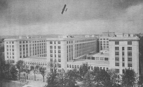
| The Geologic Survey Is in This Middle Wing of the Department of the Interior Building in Washington |
Here is a humble industrial artisan, graphite, which we must buy abroad. In the lumps which represent its most usable form it is picked up by strange people in Ceylon and Madagascar who are quite unlike the chic American stenographer who makes pothooks with cores of it running through bits of red cedar.

|
| A Graphite Mine |
Graphite is a carbon cousin of the diamond. In those formative days when the world was young it acquired a different habit from that kindred carbon which produced the smutty coal or the brilliant gem and became one of the softest and smoothest of minerals. It finds its way into lubricants, lead pencils, and stove polish. Strangely, unlike coal and oil, the other useful members of the carbon family, it is so resistant to heat that crucibles for metallurgical use are made from it. Nearly all of the crucible graphite used in the United States comes from mines that are in lands that are far away.
|
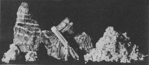
| Asbestos Ore and Fiber |
Asbestos is a fibrous material which may be spun into cloth. It is not inflammable and therefore has uses peculiarly its own. Curtains of it are rolled up at the front of theater stages and, in case of fire back stage, may be let down and will hold the flames in check. Mixed with a bit of clay, sheets of it may be put over the flame of kitchen stove to allow the victuals to cook without scorching. Collars made of a mixture of magnesia and asbestos may embrace the hot pipes that lead from the furnace, hold in and conserve the heat, and keep these pipes from setting the house on fire.
We import around 230,000 tons of asbestos every year—enough of it to load a freight train 40 miles long. Nearly all of it comes from Canada, just across the Vermont line, where the best asbestos mines in the world are to be found. We pay Canada $8,000,000 a year for this asbestos. We may not always have to do so. Down in Arizona, near the Apache Trail and the Roosevelt Dam, are deposits that may sometimes become effectively productive. During the war as much as 1,000 tons of asbestos a year were taken out of these mines, but they could not compete with the Canadian properties when normal times returned.
Potash gets its name from the fact that it was once made from the ashes of wood leached in pots. Lye used by our grandmothers in making soap was its liquid form. In the laboratory potassium is a white metal. Its salts mixed in fertilizers supply certain deficiencies in soils and make crops grow more abundantly. Potash is one of that trio of indispensable materials—potash, nitrates, and phosphates— which goes into fertilizers. The cotton crop of the South, the potato crop of Maine would be hard hit if they missed their potash dosage for a single season.

|
| A Potash Plant in Death Valley |
Germany has potash deposits scattered through an area 140 miles wide and 250 miles long and so easy to work that she has been able for decades to control the potash market of the world. In 1930 we imported 342,071 tons of pure potash, which is not a very large amount. That same year our sales from domestic sources were over 60,000 tons. So we are at present dependent. Not that we do not have good prospects of attaining independence.
Down in the vicinity of Death Valley in California, for instance, there is a salt lake, 15 square miles in extent, hard enough on top to support a narrow-gage railway and an automobile road. Underneath is a spongy, salt mass, part solid and part liquid. Pump this liquid out and crystallize it and among the products are potash and borax. Commercial potash for use in fertilizer manufacture now is being produced here in competition with France and Germany. There might be enough potash in this one lake to last the United States for a generation or more.
There is a "green sand" strip running all the way across New Jersey that may perhaps be made to yield potash on a basis that will compete if experimental work recently authorized by Congress is successful. Within recent years the Survey, after 25 years of quiet study, has pointed out that the most promising area in the United States lies in the Permian Basin of the southwestern Great Plains. These deposits in New Mexico and Texas are not unlike those in Germany. One mine already has been opened in New Mexico and is shipping commercial potash salts into the eastern markets. A vision of potash independence can be seen a short distance ahead, but for the present much more of that product is being imported than is being produced at home.
The Geological Survey is attempting to point the way to a further development of all of these vital materials. As a further practical example of the work of these Government specialists their study of iron ore deposits in the Birmingham, Ala., district may be cited.
The ore occurs here in beds that are mined from below ground. Formerly it was the mining practice to take only that portion of the ore bed that was of the best quality and leave below the portion that was mined one-third to one-half of the bed that was of lower grade. When the workings have been driven further on, the pillars of ore robbed, and the roof has caved down this lower-grade ore is lost beyond recovery. If the production of a mine could be increased 50 per cent by mining the lower part of the ore bed the gain would not only affect tonnage but the cost of ore extraction would be reduced by retarding the extension of mine slopes and rooms. Representations by the survey have helped to remedy this condition.

|
| A Rich Gold Mine at Juneau, Alaska |
Such problems involve consideration not only as to whether it will pay at the moment to reduce average grade of ore for the sake of greater recovery, but also have bearing upon future supplies and the life of the mining district. They also involve questions of conservation of human life and energy. Arguments advanced were that according to the current methods of mining and timbering it would be inconvenient, if not dangerous, to mine a greater thickness of ore and that it might result in more ground water entering the mines. Additional supplies of water for industrial purposes are, however, needed badly, and water entering the mine because of enlargement of stopes could be pumped out and recovered, so that in this proposed conservation of ore lies an opportunity also for the conservation of water. Fortunately mining methods are subject to change. American mining engineers are resourceful, have access to the experience and practice of other districts, and are able to overcome serious obstacles to progress. In this lies the hope that full conservation of ore may eventually be effected here.
Practical conservation, in its broadest sense, is constantly in the minds of the Survey's geologists who investigate metal-mining districts. As generally thought of, conservation of mineral resources implies the leaving in the ground of all that is not immediately needed and involves an acquaintance with mineral reserves and market conditions both in this country and in the world. The occurrence of mineral deposits, and therefore the existence of mineral reserves, is a geologic problem, and the relative availability of reserves is both a geologic, technologic, and economic problem, in which the Geological Survey has a fundamental share.

|
| A Geological Survey Outfit for Determining How Much Water Runs Down a River |
The Geological Survey, also, has long been the Government's guardian of water-power sites.
More than 6,000,000 acres of public land are now included in power-site reserves whose use will be required in the development of about 15,000,000 continuous horsepower. About 5,500 miles of rivers have so far been surveyed in connection with the classification of lands. Either before or at the time of the survey a field examination of the river is made to select possible dam and reservoir sites, and these are surveyed on a somewhat larger scale than the remainder of the valley. The dam and reservoir sites are also examined by geologists to obtain information as to their safety from a geologic viewpoint. When the data resulting from these field investigations and surveys are assembled with stream-flow records, estimates of the potential power of the river are prepared and plans for developing the power are outlined in a water-power report. All of this is part of the work of the survey in its work toward conserving this great resource.
The Geological Survey goes into that western area of the public domain and finds out which lands are agricultural. In the semiarid plains east of the Rockies 95,000,000 acres of such land, an area equal to three Pennsylvanias, has been classified as possible farm land. West of the Rocky Mountains and extending to the Pacific-Mountain system lies a region which contains most of the remaining public domain. Climatic or physical conditions in this region in general are unfavorable for dry farming, and the only agricultural utility of the greater part of the land is for grazing. The grazing resources, therefore, are the dominant economic factor in land classification, but in making it the dominant type of forage growth has been indicated. This classification, consequently, discloses the location of grazing lands best adapted to summer, winter, as well as spring and fall use, together with the amount of livestock which can be supported by grazing during these seasons without serious impairment of the normal vegetative growth.

|
| Summer Work With the Geological Survey |
It is estimated that the total annual income derived from livestock products in the West includes an increment of nearly $10,000,000 solely obtained from these forage resources. This increment is being obtained despite a gradual decrease in normal forage growth over a long period as a result of overgrazing and lack of efficient use of the supply now annually available, both evils being incidental to the present lack of management of the range. It is estimated that under proper management the value of the native forage growth of the livestock industry can be increased with a minimum of effort to at least $15,000,000 a year.

|
| It Was This Sort of Advance Work on the Colorado River That Made Way for Hoover Dam |
As the United States has more and more outgrown its early youth, there has developed a deepening consciousness that the supplies of many of its resources, although generally very great, are not inexhaustible. Inventories of the supplies of these have been made, and consideration has been given of ways and means to assure the greatest possible benefit from them. The majority of people in the United States, for example, have supplies of water on tap in one way or another which seems so ample in relation to immediate personal requirements and so relatively free as to make that article comparable in adequacy and availability to the air we breathe.
In the arid regions, however, the available water supply may be an important limiting factor in industrial and urban development and particularly in agriculture. It is commonly known that in many parts of the West there is more land of desirable quality than there is water to irrigate it. Although most cities of the arid regions have excellent water supplies, it is obvious that the difficulty involved in obtaining an adequately large water supply, if nothing else, would be a serious obstacle to the growth of numerous western cities into future New Yorks or Chicagos. Indeed, the same statement is more or less applicable to many eastern cities. Thus the experiences of the inhabitant of the arid regions have educated him to the conception that water is an important resource. Circumstances have not impressed this realization so strongly on the dweller of the humid regions. It requires something unusual as a drought or a flood to make him conscious of water as something about which "something should be done."
An extensive practice of cooperation has been developed between the Geological Survey, which furnishes the expert investigational service, and other Federal bureaus, States, and municipalities which require the information. In each instance the activities relate to the collection of information either directly about water or which has important bearing on the guidance of utilization. This lays the foundation for water conservation.
The topographic maps prepared and published by the United States Geological Survey, a striking example of the graphical presentation of facts, provide a basis for the study of many problems of conservation. A topographic map is a layout in small compass of many, often hundreds, of square miles graphically depicting all the works of man and of nature in their correct relation one to another.
|
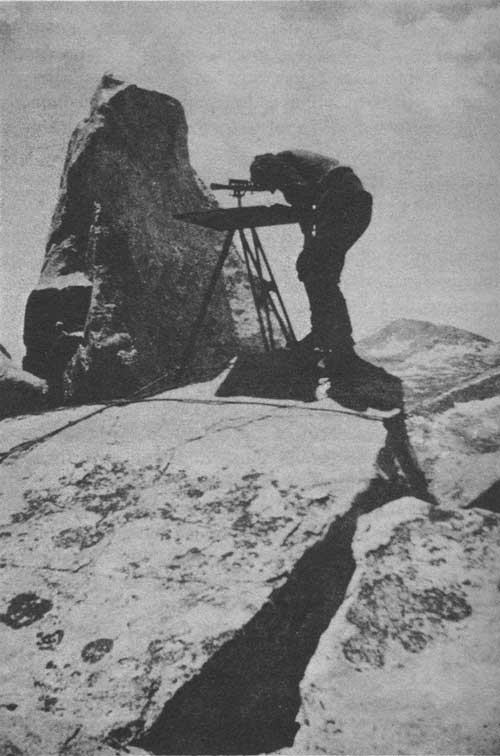
| Topographical Mapping from an Elevation of 10,000 Feet in the Sierra Nevadas |
The facts so presented are not only useful but are essential to most scientific and engineering studies which are affected by the lay of the land. Topographic maps supply accurate information for many administrative purposes; provide a basis on which to study and record geologic and other scientific data; supply data for the study of the relative merits of alternative locations for highways, railroads, transmission lines, pipe lines, canals, etc.; show locations suitable for storage reservoirs for public water supplies, power, irrigation, and flood-control purposes; accurately delineate the extent and character of watersheds, supplying data necessary for the allowance of proper bridge openings, and the design of channel cross sections for flood and drainage purposes; provide essential information for city planning and the many engineering problems connected therewith, and afford a good base on which to assess property values; serve as a base on which to study soils, the environment of insect pests, disease epidemics, archaeology, geography, botany; and are absolutely essential for military purposes in the national defense.
The development of topographical maps to cover the entire country is a continuing project that goes on through the decades and the completion of which rests with posterity.
| <<< Previous | <<< Contents>>> | Next >>> |
interior-conservation/chap14.htm
Last Updated: 20-Jul-2009