Fort Vancouver
Cultural Landscape Report
|

|
V. FORT VANCOUVER: VANCOUVER BARRACKS, 1919-1947 (continued)

|
|
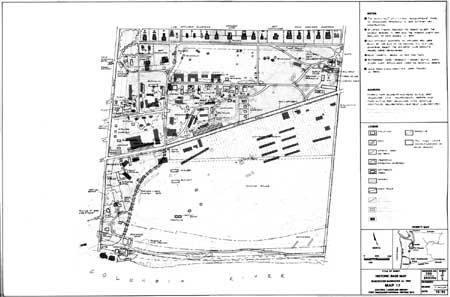
Map 20. Vancouver Staging Area, 1944,
showing rail spurs through old Hudson's Bay Company Kanaka Village, orchard
and garden sites. Buildings to right (east) of spurs are those constructed
for the Civilian Conservation Corps in the 1930s. In Fort Vancouver National
Historic Site files; original from U.S. Engineer's Office, Oregon District,
Portland, Oregon.
|

|
|
Map 21. Planimetric Map of Vancouver,
Washington. United States Department of Commerce Coast and Geodetic
Survey. Shows Vancouver Barracks and vicinity, including the Vancouver
Municipal Airport (Pearson Airpark) and the Kaiser shipyards on the
southeast edge of old Fort Plain.
|
|
|
(click on image for an enlargement in a new window)
|
fova/clr/clr2-5c.htm
Last Updated: 27-Oct-2003
|
