
|
Geological Survey Professional Paper No. 7
Forest Conditions in the Olympic Forest Reserve, Washington |
DETAILED DESCRIPTIONS.
TOWNSHIP 21 NORTH, RANGE 5 WEST.
This township, situated in the southeast corner of the reserve, consists mainly of rolling table-lands, rising into mountains along the west line and in the northwest corner. The soil is chiefly clay and loam, and the underbrush is dense. The township is heavily timbered, mainly with red fir, with a little hemlock and cedar, all of good quality.
The timber in the north part of this township can be logged to the South Fork of Skokomish River, up which it will be necessary to build a railroad, as the river is not drivable. In the south part of the township the timber can be logged cheaply by railroad by an extension to existing roads.
Forest conditions in T. 21 N., R. 5 W.
| Timbered area | acres | 16,920 |
| Burned area | do | 4,480 |
| Cut area | do | 1,640 |
| Total stand of timber | feet B. M. | 814,250,000 |
| Average stand per acre | do | 48,100 |
| Depth of humus | inches | 3 |
| Litter | Medium. |
Statistics of forest trees in T. 21 N., R. 5 W.
| Species. | Stand. | Height. | Diameter. | Clear. | Dead. | Diseased. | Age. |
| Million ft. B.M. |
Feet. | Inches. | Feet. | Per cent. | Per cent. | Years. | |
| Fir | 742 | 161 | 32 | 36 | 5 | 11 | 177 |
| Cedar | 11 | 98 | 26 | 16 | 2 | 7 | 121 |
| Hemlock | 61-1/4 | 103 | 18 | 14 | 2 | 4 | 118 |
TOWNSHIP 21 NORTH, RANGE 6 WEST.
This township, in the southern tier of the reserve, is rolling and broken in the northeastern part and in the northwest corner, while the southern part is gently rolling. It is drained by Middle and West forks of Satsop River. The timber consists chiefly of red fir of good quality and very heavy stands. There is considerable hemlock and a small amount of cedar, the latter also being of good quality. A large part of this township, fully one-third of it, has been logged off and subsequently burned, and logging operations are at present being actively carried on in sections 16, 20, 21, and 22. The lumbering is being carried on by means of a railroad built from Oyster Bay on Puget Sound.
The soil is clay loam on the creeks and rivers, becoming gravel on the uplands.
The underbrush is dense.
Forest conditions in T. 21 N., R. 6 W.
| Timbered area | acres | 15,600 |
| Cut area | do | 7,440 |
| Total stand of timber | feet B. M. | 749,500,000 |
| Average stand per acre | do | 48,000 |
| Depth of humus | inches | 5 |
| Litter | Heavy. |
Statistics of forest trees in T. 21 N., R. 6 W.
| Species. | Stand. | Height. | Diameter. | Clear. | Dead. | Diseased. | Age. |
| Million ft. B.M. |
Feet. | Inches. | Feet. | Per cent. | Per cent. | Years. | |
| Fir | 531 | 204 | 41 | 46 | 4 | 9 | 216 |
| Cedar | 39 | 153 | 41 | 25 | 7 | 17 | 212 |
| Hemlock | 179-1/2 | 124 | 21 | 21 | 3 | 5 | 134 |
TOWNSHIP 21 NORTH, RANGE 7 WEST.
This township, situated on the south line of the reserve, has a steep, rolling and broken surface, drained by the East and West forks of Satsop River. There are trifling burned areas in sections 6 and 7, amounting altogether to 50 acres.
The timber consists chiefly of red fir, in heavy stands, the trees being very large and containing much clear lumber. Perhaps four-fifths of the entire stand is of good quality. The hemlock upon the township is small, not more than half of it of good quality. The cedar, of which there is a considerable amount, is mainly of good quality. The soil consists mostly of red shot clay and loam. The underbrush is dense.
The western part of this township can be logged into Wynooche River with ease. The remainder of the township can be logged to the two branches of Satsop. River, but neither of these streams is of any value for logging purposes, as the banks are low and there are many sand bars. Their valleys, however, afford easy routes for logging railways.
Forest conditions in T. 21 N., R. 7 W.
| Timbered area | acres | 23,000 |
| Burned area | do | 50 |
| Total stand of timber | feet B. M. | 1,211,750,000 |
| Average stand per acre | do | 52,600 |
| Depth of humus | inches | 5 |
| Litter | Heavy. |
Statistics of forest trees in T. 21 N., R. 7 W.
| Species. | Stand. | Height. | Diameter. | Clear. | Dead. | Diseased. | Age. |
| Million ft. B.M. |
Feet. | Inches. | Feet. | Per cent. | Per cent. | Years. | |
| Red fir | 747 | 230 | 51 | 59 | 9 | 8 | 239 |
| Cedar | 121-3/4 | 145 | 48 | 35 | 8 | 13 | 234 |
| Hemlock | 324 | 144 | 23 | 30 | 5 | 7 | 148 |
| Spruce | 3 | 203 | 50 | 63 | 2 | 4 | 200 |
| Lovely fir | 16 | 155 | 19 | 32 | 2 | 4 | 143 |
TOWNSHIP 21 NORTH, RANGE 8 WEST.
This township consists of rolling, broken country, drained by Wynooche and Wishkah rivers, and the East Fork of Humptulips River. It is well timbered throughout, the timber consisting chiefly of red fir, with considerable hemlock, and small amounts of cedar and lovely fir. The fir is very large and of good quality; the cedar and hemlock are small and somewhat scattered, half of these two species only being of good quality. The soil consists of red shot clay and gravel. The underbrush is dense.
The eastern part of this township can be logged to Wynooche River, although this is a poor logging stream, with low banks and a great many sand bars. The southwestern part can be logged to Wishkah River, which is a good logging stream, with good banks. The method used on this river in driving logs is by means of splash dams built at favorable points along the river. The northwest corner of this township can be logged to the East Fork of Humptulips River, which can be driven during the winter season. The valley of the river is favorable for the construction of a logging railroad.
Forest conditions in T. 21 N., R. 8 W.
| Timbered area | acres | 23,040 |
| Total stand of timber | feet B. M. | 1,165,500,000 |
| Average stand per acre | do | 50,600 |
| Depth of humus | inches | 6 |
| Litter | Heavy. |
Statistics of forest trees in T. 21 N., R. 8 W.
| Species. | Stand. | Height. | Diameter. | Clear. | Dead. | Diseased. | Age. |
| Million ft. B.M. |
Feet. | Inches. | Feet. | Per cent. | Per cent. | Years. | |
| Red fir | 792-1/2 | 226 | 50 | 72 | 4 | 6 | 237 |
| Cedar | 68 | 132 | 45 | 27 | 8 | 15 | 222 |
| Hemlock | 253 | 145 | 22 | 26 | 4 | 8 | 136 |
| Lovely fir | 52 | 151 | 31 | 35 | 3 | 5 | 150 |

|
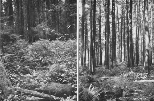
| PLATE VI. A (left), EVERGREEN POST-OFFICE. B (right), RANCH IN SEC. 14, T. 21N., R. 10 W. |
TOWNSHIP 21 NORTH, RANGE 9 WEST.
This township, situated on the south boundary of the reserve, consists of rather steep, rolling land, rising to a maximum elevation of 1,230 feet. A small part consists of level bottom land along the West Fork of Humptulips River, which with the East Fork drains the township. The timber consists chiefly of fir, of good quality, with very heavy stands. It contains also some cedar, spruce, and hemlock, but these species are quite scattering, and only 60 per cent of the trees are of good quality. The soil consists mainly of red shot clay. The underbrush is dense.
This township can be logged to Humptulips River, which is a good logging stream during the winter season. At present parties are cutting timber in sections 20, 21, and 29, in the valley of the West Fork of Humtptuilips River.
Forest conditions in T. 21 N., R. 9 W.
| Timbered area | acres | 21,809 |
| Burned area | do | 200 |
| Cut area | do | 1,031 |
| Total stand of timber | feet B. M. | 1,159,250,000 |
| Average stand per acre | do | 53,100 |
| Depth of humus | inches | 5 |
| Litter | Heavy. |
Statistics of forest trees in T. 21 N., R. 9 W.
| Species. | Stand. | Height. | Diameter. | Clear. | Dead. | Diseased. | Age. |
| Million ft. B.M. |
Feet. | Inches. | Feet. | Per cent. | Per cent. | Years. | |
| Red fir | 741-1/2 | 217 | 42 | 72 | 4 | 6 | 226 |
| Cedar | 36-1/2 | 127 | 45 | 25 | 8 | 17 | 210 |
| Hemlock | 313 | 125 | 21 | 23 | 5 | 8 | 143 |
| Spruce | 49-3/4 | 191 | 49 | 57 | 3 | 5 | 199 |
| Lovely fir | 18-1/2 | 150 | 30 | 36 | 2 | 4 | 160 |
TOWNSHIP 21 NORTH, RANGE 10 WEST.
This township, situated on the south line of the reserve, consists entirely of gently rolling land. A small part of section 6 lies within the Queniult Indian Reservation. There are within the township three small burns, comprising altogether three-fourths of a section. The timber consists almost entirely of red fir, cedar, and hemlock. The first is of good quality, with very heavy stands; the cedar occurs mainly in the swamps, and is of very good quality; the hemlock, however, is small and not more than half of it is of value. There is in the township a little spruce, but it is quite scattering. The soil consists of clay and gravel in the upland, and in the swamps clay and loam. Underbrush is everywhere dense.
This township can all be logged southeastward to Humptulips River, which is a good logging stream during the winter season. Another means of getting the timber is by building a railroad, which can be carried through in part of the township very cheaply.
Forest conditions in T. 21 N., R. 10 W.
| Timbered area | acres | 22,560 |
| Burned area | do | 480 |
| Total stand of timber | feet B. M. | 1,058,500,000 |
| Average stand per acre | do | 47,000 |
| Depth of humus | inches | 7 |
| Litter | Heavy. |
Statistics of forest trees in T. 21 N., R. 10 W.
| Species. | Stand. | Height. | Diameter. | Clear. | Dead. | Diseased. | Age. |
| Million ft. B.M. |
Feet. | Inches. | Feet. | Per cent. | Per cent. | Years. | |
| Fir | 446 | 214 | 41 | 49 | 7 | 6 | 220 |
| Cedar | 226 | 128 | 39 | 30 | 10 | 21 | 216 |
| Hemlock | 336 | 138 | 22 | 27 | 4 | 6 | 148 |
| Spruce | 50-1/2 | 197 | 48 | 54 | 3 | 4 | 192 |
TOWNSHIP 21 NORTH, RANGE 11 WEST.
More than two-thirds of this township is included within the Queniult Indian Reservation, the portion within the forest reserve comprising the southeastern part. The surface consists mainly of level, swampy land, the remainder being slightly rolling upland. The timber consists mostly of cedar of good quality, the stands of which are in some localities very heavy. Some good fir is found on the bench lands, and considerable hemlock, which, however, is small and of poor quality. There is also a little spruce, which is of excellent quality. The soil consists of clay and gravel on the uplands, and in the swamp of clay loam. The underbrush is dense.
This township can be logged eastward to Humptulips River very cheaply.
Forest conditions in T. 21 N., R. 11 W.
| Timbered area | acres | 7,095 |
| Total stand of timber | feet B. M. | 253,250,000 |
| Average stand per acre | do | 35,700 |
| Depth of humus | inches | 8 |
| Litter | Heavy. |
Statistics of forest trees in T. 21 N., R. 11 W.
| Species. | Stand. | Height. | Diameter. | Clear. | Dead. | Diseased. | Age. |
| Million ft. B.M. |
Feet. | Inches. | Feet. | Per cent. | Per cent. | Years. | |
| Fir | 19-1/2 | 196 | 39 | 45 | 7 | 9 | 217 |
| Cedar | 145-1/2 | 121 | 31 | 26 | 10 | 25 | 205 |
| Hemlock | 77 | 132 | 19 | 22 | 5 | 7 | 144 |
| Spruce | 11-1/4 | 192 | 44 | 48 | 2 | 5 | 184 |
TOWNSHIP 22 NORTH, RANGE 5 WEST.
This township is drained mainly by the South Fork of Skokomish River. East of the river the surface consists of rolling and level bench lands. On the west the country is mountainous and rugged. The soil is clay, sand, and loam on the bottom lands, while on the upland it consists of clay and gravel. The underbrush is dense. The timber consists chiefly of red fir, with some hemlock and cedar, all of excellent quality.
The timber in this township will have to be logged by two different routes, that in the northern part by a railroad from Lake Cushman through the northeastern part of the township. The south part of the township can be logged into the South Fork of Skokomish River.
DETAILED DESCRIPTIONS.
Forest conditions in T. 22 N., R. 5 W.
| Timbered area | acres | 22,080 |
| Burned area | do | 960 |
| Total stand of timber | feet B. M. | 768,750,000 |
| Average stand per acre | do | 34,800 |
| Depth of humus | inches | 3 |
| Litter | Heavy. |
Statistics of forest trees in T. 22 N., R. 5 W.
| Species. | Stand. | Height. | Diameter. | Clear. | Dead. | Diseased. | Age. |
| Million ft. B.M. |
Feet. | Inches. | Feet. | Per cent. | Per cent. | Years. | |
| Red fir | 672-1/2 | 152 | 24 | 24 | 3 | 6 | 160 |
| Cedar | 23-3/4 | 79 | 11 | 10 | 2 | 6 | 83 |
| Hemlock | 70-1/2 | 99 | 11 | 10 | 2 | 4 | 106 |
| Lovely fir | 2 | 148 | 22 | 20 | 3 | 9 | 147 |
TOWNSHIP 22 NORTH, RANGE 6 WEST.
This township is mountainous and somewhat rugged, and is drained mainly southward by the West Fork of Skokomish River, and by the East and Middle forks of Satsop River, while the northern part is drained by the North Fork of Skokomish River. The timber consists chiefly of red fir and hemlock, half of which is of good size and quality. It contains also a little cedar and lovely fir, but in scattering form. The soil is clay in the valleys, grading to gravel upon the mountains. The underbrush is dense, consisting of huckleberry, salal, vine maple, salmonberry, devil cane, yew, arrowwood, dogwood, alder, elderberry, and ferns.
The south and west parts of this township can be logged down the Middle and East forks of Satsop River, the eastern part down the West Fork of Skokomish River, while the northern part can be logged to the North Fork of Skokomish. On all these streams it would be necessary to build skid roads and tramways, as they are not drivable, and owing to the rugged character of the country the township would be an expensive and difficult one to log.
Forests conditions in T. 22 N., R. 6 W.
| Timbered area | acres | 23,040 |
| Total stand of timber | feet B. M. | 631,250,000 |
| Average stand per acre | do | 27,400 |
| Depth of humus | inches | 3 |
| Litter | Heavy. |
Statistics of forest trees in T. 22 N., R. 6 W.
| Species. | Stand. | Height. | Diameter. | Clear. | Dead. | Diseased. | Age. |
| Million ft. B.M. |
Feet. | Inches. | Feet. | Per cent. | Per cent. | Years. | |
| Red fir | 355-1/2 | 168 | 29 | 28 | 4 | 8 | 181 |
| Cedar | 32-3/4 | 95 | 17 | 13 | 6 | 11 | 106 |
| Hemlock | 224 | 123 | 18 | 16 | 4 | 9 | 141 |
| Lovely fir | 19 | 98 | 18 | 16 | 5 | 17 | 150 |
TOWNSHIP 22 NORTH, RANGE 7 WEST.
The surface of this township, with the exception of a tract of bench land and bottom land along Wynooche River, is all steep, rugged, and mountainous. It is drained by Wynooche River and the West Fork of the Satsop. There is on the former stream quite an area of bottom land. A tract of 615 acres, or nearly one section, lying mostly in section 19, has been burned. The timber in the township consists mainly of red fir in very heavy stands, large, and of good quality. There is also considerable hemlock, lovely fir, and cedar—not large, but of good quality. The soil consists of clay and gravel. The underbrush is dense.
The western part of this township can be logged to Wynooche River, which, however, is of no value as a logging stream, since it has low banks and flows through a deep canyon in this township. There is, however, a good route for a railroad along the river. The eastern part of the township can be logged to the West Fork of Satsop River, which, like the Wynooche, is of no value for driving purposes, but offers a good route for a railroad from the south.
Forests conditions in T. 22 N., R. 7 W.
| Timbered area | acres | 22,425 |
| Burned area | do | 615 |
| Total stand of timber | feet B. M. | 1,022,500,000 |
| Average stand per acre | do | 45,600 |
| Depth of humus | inches | 5 |
| Litter | Heavy. |
Statistics of forest trees in T. 22 N., R. 7 W.
| Species. | Stand. | Height. | Diameter. | Clear. | Dead. | Diseased. | Age. |
| Million ft. B.M. |
Feet. | Inches. | Feet. | Per cent. | Per cent. | Years. | |
| Red fir | 430 | 219 | 49 | 59 | 9 | 10 | 233 |
| Cedar | 101 | 132 | 39 | 25 | 10 | 18 | 209 |
| Hemlock | 364 | 147 | 22 | 22 | 6 | 9 | 143 |
| Lovely fir | 127-1/2 | 142 | 22 | 31 | 3 | 6 | 138 |
TOWNSHIP 22 NORTH, RANGE 8 WEST.
The surface of this township is rugged and mountainous, with the exception of a tract of bench land in the southeast corner, in the valley of Wynooche River. It is drained by that stream and by the East Fork of Humptulips River. The timber consists chiefly of hemlock and lovely fir, four-fifths of which is large, clear, and of good quality. It contains also some red fir, in large stands and of good quality. This is found on the bench lands in the southeastern part of the township. The soil is red shot clay, and the underbrush is dense.
The eastern part of this township can be logged to Wynooche River, which, as has been stated elsewhere, is of no value as a logging stream, having low banks and many sand bars. The western part can be logged to the East Fork of Humptulips River, which, however, is in the same condition; but a railroad call be built easily along each of these rivers, thus affording access to the timber.
Forest conditions in T. 22 N., R. 8 W.
| Timbered area | acres | 22,940 |
| Burned area | do | 100 |
| Total stand of timber | feet B. M. | 1,077,500,000 |
| Average stand per acre | do | 46,900 |
| Depth of humus | inches | 5 |
| Litter | Heavy. |
Statistics of forest trees in T. 22 N., R. 8 W.
| Species. | Stand. | Height. | Diameter. | Clear. | Dead. | Diseased. | Age. |
| Million ft. B.M. |
Feet. | Inches. | Feet. | Per cent. | Per cent. | Years. | |
| Red fir | 133 | 210 | 47 | 50 | 8 | 8 | 228 |
| Cedar | 65-1/2 | 131 | 36 | 27 | 7 | 13 | 216 |
| Hemlock | 528 | 146 | 28 | 29 | 5 | 7 | 150 |
| Lovely fir | 351 | 153 | 33 | 37 | 3 | 5 | 153 |
TOWNSHIP 22 NORTH, RANGE 9 WEST.
The surface of this township consists almost entirely of rolling and broken hills and mountains. It is drained in part by the West Fork of Humptulips River, which flows southwestward across it, and by several smaller streams. The timber consists mostly of cedar, hemlock, and lovely fir, with a trifling amount of spruce and red fir. Perhaps 70 per cent of the stand in the township is of good quality. The soil consists of clay and gravels, and the underbrush is dense.
The eastern part of this township can be logged to the West Fork of Humptulips River, which, however, is of no use as a logging stream, since there are low banks and many sand bars; still there can be built, with little expense, a tramway along the river bank, and the timber can then be handled with skid roads and chutes to the valley. The Western part of this township can be logged very cheaply toward the west.
Forest conditions in T. 22 N., R. 9 W.
| Timbered area | acres | 22,870 |
| Burned area | do | 170 |
| Total stand of timber | feet B. M. | 926,500,000 |
| Average stand per acre | do | 40,300 |
| Depth of humus | inches | 5 |
| Litter | Heavy. |
Statistics of forest trees in T. 22 N., R. 9 W.
| Species. | Stand. | Height. | Diameter. | Clear. | Dead. | Diseased. | Age. |
| Million ft. B.M. |
Feet. | Inches. | Feet. | Per cent. | Per cent. | Years. | |
| Red fir | 17-1/2 | 214 | 42 | 48 | 6 | 8 | 226 |
| Cedar | 152 | 131 | 41 | 27 | 9 | 18 | 221 |
| Hemlock | 475 | 138 | 21 | 26 | 7 | 10 | 143 |
| Spruce | 22 | 180 | 47 | 48 | 3 | 5 | 195 |
| Lovely fir | 260 | 140 | 25 | 32 | 4 | 6 | 141 |
TOWNSHIP 22 NORTH, RANGE 10 WEST.
The northwest half of this township lies within the Queniult Indian Reservation, the southeastern half only being within the forest reserve. It contains a large burn, mainly in sections 12 and 13, comprising 1,240 acres. The surface of the township is rolling, becoming more level in the western part. The timber consists chiefly of cedar and hemlock, three-fifths of which is of good quality. There is also a little red fir and spruce of good quality. The soil is red shot clay, and the underbrush dense.
This township can be logged very cheaply by means of a railroad into it from Grays Harbor.
Forest conditions in T. 22 N., R. 10 W.
| Timbered area | acres | 10,260 |
| Burned area | do | 1,240 |
| Total stand of timber | feet B. M. | 429,000,000 |
| Average stand per acre | do | 42,000 |
| Depth of humus | inches | 6 |
| Litter | Heavy. |
Statistics of forest trees in T. 22 N., R. 10 W.
| Species. | Stand. | Height. | Diameter. | Clear. | Dead. | Diseased. | Age. |
| Million ft. B.M. |
Feet. | Inches. | Feet. | Per cent. | Per cent. | Years. | |
| Red fir | 58-1/2 | 224 | 49 | 50 | 7 | 6 | 229 |
| Cedar | 119 | 141 | 48 | 29 | 14 | 24 | 219 |
| Hemlock | 215-3/4 | 138 | 21 | 28 | 7 | 6 | 147 |
| Spruce | 35-3/4 | 213 | 52 | 55 | 3 | 5 | 215 |
TOWNSHIP 23 NORTH, RANGE 5 WEST.
This township, situated in the southeastern part of the reserve, is rugged and mountainous, with the exception of a small area of bottom land above Lake Cushman and on Skokomish River just above the lake. The soil is clay and loam. The underbrush is dense. The timber consists of fir, with some hemlock and cedar, all of excellent quality.
The timber in the northern part of this township can all be logged into Lake Cushman very cheaply; that in the southern part of the township should be logged to the South Fork of Skokomish River, which would be somewhat expensive, owing to the ruggedness of the country.
Forest conditions in T. 23 N., R. 5 W.
| Timbered area | acres | 19,105 |
| Rugged and barren area | do | 640 |
| Burned area | do | 2,560 |
| Grazing area | do | 735 |
| Total stand of timber | feet B. M. | 542,250,000 |
| Average stand per acre | do | 28,400 |
| Depth of humus | inches | 3 |
| Litter | Light. |
Statistics of forest trees in T. 23 N., R. 5 W.
| Species. | Stand. | Height. | Diameter. | Clear. | Dead. | Diseased. | Age. |
| Million ft. B.M. |
Feet. | Inches. | Feet. | Per cent. | Per cent. | Years. | |
| Red fir | 287-3/4 | 138 | 25 | 21 | 6 | 10 | 160 |
| Cedar | 71-3/4. | 108 | 21 | 16 | 6 | 13 | 133 |
| Hemlock | 116-1/2 | 98 | 14 | 12 | 5 | 11 | 114 |
| Lovely fir | 66-1/4 | 98 | 15 | 13 | 5 | 14 | 114 |
TOWNSHIP 23 NORTH, RANGE 6 WEST.
This township, situated in the southern part of the reserve, is drained by the South Fork of Skokomish River. It is nearly all mountainous and rugged; it contains much snow, even in summer, and considerable areas of rocky and barren country. Its soil is thin, consisting mainly of clay and gravel. Underbrush is dense along the river and creeks, but sparse upon the mountains. The timber consists of red fir, hemlock, lovely fir, and cedar, all of excellent quality, except high upon the mountains.
The timber on this township can be logged to the South Fork of Skokomish River, although this is a poor logging stream, with low banks. It will probably be necessary to construct a railroad up its valley for the purpose of carrying out the timber.
Forest conditions in T. 23 N., R. 6 W.
| Timbered area | acres | 20,736 |
| Rocky and barren area | acres | 1,664 |
| Burned area | do | 192 |
| Grazing area | do | 448 |
| Total stand of timber | feet B. M. | 383,500,000 |
| Average stand per acre | do | 18,500 |
| Depth of humus | inches | 3 |
| Litter | Heavy. |
Statistics of forest trees in T. 23 N., R. 6 W.
| Species. | Stand. | Height. | Diameter. | Clear. | Dead. | Diseased. | Age. |
| Million ft. B.M. |
Feet. | Inches. | Feet. | Per cent. | Per cent. | Years. | |
| Red fir | 161 | 158 | 27 | 24 | 7 | 12 | 178 |
| Cedar | 42-1/4 | 103 | 17 | 12 | 7 | 15 | 108 |
| Hemlock | 96-1/4 | 109 | 14 | 11 | 5 | 16 | 115 |
| Lovely fir | 84 | 106 | 14 | 12 | 5 | 15 | 112 |
TOWNSHIP 23 NORTH, RANGE 7 WEST.
The surface of this township is rugged and mountainous. It is drained by Wynooche River. It contains a considerable area of upland pasture, lying at great elevations. The timber consists chiefly of hemlock and lovely fir, three-fourths of which is of poor quality, being stunted and scrubby. Most of the stand of any value is in the valley of Wynooche River.
The soil consists of clay and gravel. The underbrush is dense along the river and creeks, consisting of huckleberry, salal, vine maple, salmonberry, devil cane, alder, yew, and ferns. On the upland the underbrush is light.
The timber in this township will be difficult and expensive to handle, as the river is of no value for driving purposes. The only possible outlet is by building a tramway along the river bank and handling the timber by means of chutes down to the tramway.
DETAILED DESCRIPTIONS.
Forest conditions in T. 23 N., R. 7 W.
| Timbered area | acres | 19,900 |
| Rocky and barren area | do | 1,280 |
| Mountain meadows | do | 1,860 |
| Total stand of timber | feet B. M. | 369,750,000 |
| Average stand per acre | do | 19,000 |
| Depth of humus | inches | 3 |
| Litter | Medium. |
Statistics of forest trees in T. 23 N., R. 7 W.
| Species. | Stand. | Height. | Diameter. | Clear. | Dead. | Diseased. | Age. |
| Million ft. B.M. |
Feet. | Inches. | Feet. | Per cent. | Per cent. | Years. | |
| Red fir | 53 | 143 | 28 | 34 | 8 | 17 | 214 |
| Cedar | 36-3/4 | 66 | 17 | 12 | 10 | 42 | 210 |
| Hemlock | 167-1/2 | 88 | 18 | 15 | 9 | 42 | 203 |
| Lovely fir | 112-1/2 | 78 | 18 | 15 | 8 | 44 | 204 |
TOWNSHIP 23 NORTH, RANGE 8 WEST.
The surface of this township is rough and mountainous, most of it lying at great elevations. It is drained mainly by the East and West forks of Humptulips River. The timber consists mainly of hemlock and lovely fir, all of which is of poor quality excepting that along Humptulips River. The soil consists of clay and gravel. The underbrush is dense and is composed of huckleberry, salal, alder, vine maple, salmonberry, devil cane, yew, arrowwood, ferns, and elderberry.
North of the divide a narrow strip of the township consisting of between one and two sections in width, can be logged to Queniult River, while the remainder of the township can be logged down Humptulips River, which, however, is of no value as a driving stream; still, a railroad or tramway could be built into this township from the south.
Forest conditions in T. 23 N., R. 8 W.
| Timbered area | acres | 23,040 |
| Total stand of timber | feet B. M. | 481,500,000 |
| Average stand per acre | do | 20,900 |
| Depth of humus | inches | 3 |
| Litter | Light. |
Statistics of forest trees in T. 23 N., R. 8 W.
| Species. | Stand. | Height. | Diameter. | Clear. | Dead. | Diseased. | Age. |
| Million ft. B.M. |
Feet. | Inches. | Feet. | Per cent. | Per cent. | Years. | |
| Cedar | 38 | 102 | 23 | 17 | 8 | 14 | 176 |
| Hemlock | 233-1/2 | 117 | 20 | 19 | 6 | 14 | 146 |
| Lovely fir | 210 | 116 | 22 | 23 | 5 | 11 | 144 |
TOWNSHIP 23 NORTH, RANGE 9 WEST.
This township contains Queniult Lake and a trifling portion of Queniult Indian Reservation, which deducted from it leaves as the land surface of the township 31-1/4 sections, or 20,000 acres. The surface differs greatly in different parts of the township, the southeastern portion being steep and rugged, while the remainder of the township is level or rolling. The timber consists mainly of hemlock, which is found most abundantly on the high divides, and which is of very good quality. There is also some good fir timber in the bottom lands around the lake and river, while a little cedar and spruce are scattered over the township. The soil is a clay loam in the lowlands, and on the uplands clay and gravel. The underbrush is dense.
This township can be logged to Queniult Lake very cheaply, and there are numerous good locations for sawmills along its shores which can be reached by railroad from Grays Harbor to the southward.
Forest conditions in T. 23 N., R. 9 W.
| Timbered area | acres | 22,955 |
| Burned area | do | 85 |
| Total stand of timber | feet B. M. | 590,500,000 |
| Average stand per acre | do | 25,600 |
| Depth of humus | inches | 5 |
| Litter | Heavy. |
Statistics of forest trees in T. 23 N., R. 9 W.
| Species. | Stand. | Height. | Diameter. | Clear. | Dead. | Diseased. | Age. |
| Million ft. B.M. |
Feet. | Inches. | Feet. | Per cent. | Per cent. | Years. | |
| Red fir | 119-1/4 | 205 | 41 | 43 | 5 | 7 | 215 |
| Cedar | 52 | 124 | 38 | 24 | 8 | 17 | 212 |
| Hemlock | 334-3/4 | 137 | 22 | 26 | 5 | 7 | 145 |
| Spruce | 18-1/2 | 189 | 38 | 41 | 3 | 4 | 188 |
| Lovely fir | 66 | 138 | 25 | 30 | 4 | 6 | 142 |
TOWNSHIP 23 NORTH, RANGE 10 WEST.
Half of this township is included within the Queniult Indian Reservation and Queniult Lake, the northern half only being within the reserve. There is one small burn in the township, comprised mainly in Section 14, with an area of 320 acres. The surface of the township, with the exception of a strip of bench land near the line of the indian reservation, is rugged and mountainous, rising to a height of 2,700 feet. The timber consists chiefly of hemlock and lovely fir, 60 per cent of which is of good quality. There is a little scattering red fir, cedar, and spruce in the low lands, but it is small and scrubby. The soil is red shot clay in the ridges and clay loam on the bench lands. The underbrush is very dense.
The timber on this township, with the exception of a small tract near its northern boundary, can be logged very cheaply to Queniult Lake.
Forest conditions in T. 23 N., R. 10 W.
| Timbered area | acres | 10,200 |
| Burned area | do | 380 |
| Total stand of timber | feet B. M. | 457,000,000 |
| Average stand per acre | do | 45,000 |
| Depth of humus | inches | 5 |
| Litter | Heavy. |
Statistics of forest trees in T. 23 N., R. 10 W.
| Species. | Stand. | Height. | Diameter. | Clear. | Dead. | Diseased. | Age. |
| Million ft. B.M. |
Feet. | Inches. | Feet. | Per cent. | Per cent. | Years. | |
| Red fir | 40 | 185 | 34 | 40 | 2 | 4 | 200 |
| Cedar | 16-1/4 | 122 | 41 | 23 | 8 | 24 | 230 |
| Hemlock | 240-3/4 | 146 | 26 | 50 | 4 | 6 | 152 |
| Spruce | 28 | 178 | 35 | 36 | 2 | 4 | 173 |
| Lovely fir | 132 | 152 | 32 | 34 | 2 | 5 | 148 |
TOWNSHIP 23 NORTH, RANGE 11 WEST.
Five-sixths of this township is comprised within the Queniult Indian Reservation. The remaining sixth is a triangular strip along the line of the township, being the only portion within the forest reserve. The surface consists mainly of rolling country, with red shot clay soil, and heavily forested. The timber consists of hemlock, lovely fir, and cedar, there being no red fir or spruce reported. The undergrowth is dense, consisting of huckleberry, salal, salmonberry, ferns, alders, vine maples, devil cane, and arrowwood.
The timber on this fractional township can be logged only by railroad to the south or west.
Forest conditions in T. 23 N., R. 11 W.
| Timbered area | acres | 3,650 |
| Total stand of timber | feet B. M. | 179,250,000 |
| Average stand per acre | do | 49,000 |
| Depth of humus | inches | 5 |
| Litter | Heavy. |
Statistics of forest trees in T. 23 N., R. 11 W.
| Species. | Stand. | Height. | Diameter. | Clear. | Dead. | Diseased. | Age. |
| Million ft. B.M. |
Feet. | Inches. | Feet. | Per cent. | Per cent. | Years. | |
| Cedar | 14-1/4 | 115 | 49 | 22 | 8 | 31 | 243 |
| Hemlock | 97 | 147 | 25 | 29 | 4 | 8 | 157 |
| Lovely fir | 68 | 152 | 30 | 34 | 2 | 6 | 149 |
TOWNSHIP 24 NORTH, RANGE 4 WEST.
This township is in the eastern part of the reserve. With the exception of a little over a section along Hamahama River, it is practically all rugged and mountainous. The soil is clay and loam in the bottom lands of the river and gravel on the mountain ranges. The underbrush is dense except on the ridges, and the timber consists of fir and hemlock, with some cedar and a little lovely fir. It is all tributary to Hamahama River, but as this stream is of no value for logging purposes and as there is not sufficient water for driving anything larger than shingle bolts, it will be necessary to build a railroad from Hood Canal up the valley of the river across the township.
Forest conditions in T. 24 N., R. 4 W.
| Timbered area | acres | 21,917 |
| Rocky and barren area | acres | 550 |
| Burned area | do | 213 |
| Grass-land area | do | 360 |
| Total stand of timber | feet B. M. | 556,750,000 |
| Average stand per acre | do | 25,800 |
| Depth of humus | inches | 3 |
| Litter | Heavy. |
Statistics of forest trees in T. 24 N., R. 4 W.
| Species. | Stand. | Height. | Diameter. | Clear. | Dead. | Diseased. | Age. |
| Million ft. B.M. |
Feet. | Inches. | Feet. | Per cent. | Per cent. | Years. | |
| Red fir | 306-1/4 | 134 | 22 | 19 | 2 | 6 | 144 |
| Cedar | 62-1/2 | 97 | 16 | 12 | 2 | 9 | 112 |
| Hemlock | 167 | 114 | 14 | 12 | 2 | 4 | 123 |
| Lovely fir | 31 | 117 | 14 | 12 | 2 | 4 | 122 |
TOWNSHIP 24 NORTH, RANGE 5 WEST.
This township, drained by Skokomish River and its North Fork, is very rugged and mountainous, with the exception of the narrow valleys of the streams. The soil is gravelly and rocky. The underbrush is mainly light. The timber consists of red fir, hemlock, cedar, and lovely fir, all of which is of good quality, except in the high mountains.
Most of the timber in this township can be logged to the North Fork of Skokomish River, with the exception of a small area in the eastern part, which is in the drainage basin of Hamahama River. The North Fork of the Skokomish is a poor logging stream, since it flows through a deep canyon with rock walls and has a steep slope.
Forest conditions in T. 24 N., R. 5 W.
| Timbered area | acres | 17,600 |
| Rocky and barren area | do | 1,600 |
| Burned area | do | 640 |
| Mountain meadows | do | 3,200 |
| Total stand of timber | feet B. M. | 485,500,000 |
| Average stand per acre | do | 27,600 |
| Depth of humus | inches | 3 |
| Litter | Medium. |
Statistics of forest trees in T. 24 N., R. 5 W.
| Species. | Stand. | Height. | Diameter. | Clear. | Dead. | Diseased. | Age. |
| Million ft. B.M. |
Feet. | Inches. | Feet. | Per cent. | Per cent. | Years. | |
| Red fir | 137-1/4 | 176 | 28 | 20 | 8 | 12 | 178 |
| Cedar | 76-/2 | 85 | 16 | 11 | 5 | 10 | 98 |
| Hemlock | 140-3/4 | 116 | 17 | 12 | 9 | 20 | 126 |
| Spruce | 1-3/4 | 193 | 26 | 24 | 2 | 4 | 180 |
| Lovely fir | 129-1/4 | 126 | 18 | 14 | 8 | 20 | 132 |
TOWNSHIP 24 NORTH, RANGE 6 WEST.
This township is mountainous, with the exception of a small tract along Camp Six Stream. The soil is mainly clay and coarse gravel. Underbrush is chiefly light, except in the valleys of the creeks. The timber consists of lovely fir, hemlock, red fir, and cedar. The timber can be logged eastward to the North Fork of Skokomish River.
Forest conditions in T. 24 N., R. 6 W.
| Timbered area | acres | 17,920 |
| Rocky and barren area | acres | 640 |
| Mountain meadows | do | 4,480 |
| Total stand of timber | feet B. M. | 359,250,000 |
| Average stand per acre | do | 20,000 |
| Depth of humus | inches | 3 |
| Litter | Medium. |
Statistics of forest trees in T. 24 N., R. 6 W.
| Species. | Stand. | Height. | Diameter. | Clear. | Dead. | Diseased. | Age. |
| Million ft. B.M. |
Feet. | Inches. | Feet. | Per cent. | Per cent. | Years. | |
| Red fir | 59-1/4 | 145 | 24 | 21 | 8 | 16 | 153 |
| Cedar | 55-3/4 | 73 | 16 | 11 | 6 | 13 | 105 |
| Hemlock | 113-1/2 | 93 | 15 | 11 | 7 | 18 | 110 |
| Spruce | 6-1/4 | 170 | 25 | 25 | 1 | 2 | 165 |
| Lovely fir | 124-1/3 | 93 | 14 | 12 | 6 | 17 | 111 |
TOWNSHIP 24 NORTH, RANGE 7 WEST.
The surface of this township is rugged and mountainous. It is drained by Queniult River, flowing from northeast to southwest through it. It contains considerable area of grass land, lying at great elevation, mainly above timber line. The timber is nearly all hemlock and lovely fir, four-fifths of which is of poor quality. There is a small amount of red fir in the immediate valley of Queniult River. The soil is mainly gravel. The underbrush is dense along the rivers and creeks, and is composed of huckleberry, salal, yew, salmonberry, and vine maple.
The timber in this township will be very difficult and expensive to handle, as its surface is extremely rugged. It can be logged to Queniult River, but this is of no value as a driving stream, and it will be necessary to build a railroad into the township.
Forest conditions in T. 24 N., R. 7 W.
| Timbered area | acres | 19,965 |
| Rocky and barren area | acres | 480 |
| Mountain meadows | do | 2,560 |
| Burned area | do | 35 |
| Total stand of timber | feet B. M. | 358,500,000 |
| Average stand per acre | do | 18,000 |
| Depth of humus | inches | 3 |
| Litter | Light. |
Statistics of forest trees in T. 24 N, R. 7 W.
| Species. | Stand. | Height. | Diameter. | Clear. | Dead. | Diseased. | Age. |
| Million ft. B.M. |
Feet. | Inches. | Feet. | Per cent. | Per cent. | Years. | |
| Red fir | 27 | 132 | 27 | 26 | 7 | 12 | 196 |
| Cedar | 29-3/4 | 60 | 16 | 13 | 8 | 38. | 195 |
| Hemlock | 184-3/4 | 97 | 19 | 17 | 9 | 33 | 191 |
| Lovely fir | 117 | 94 | 20 | 15 | 8 | 31 | 187 |

|
| PLATE VII. A (left), B (right) RANCHES IN QUEETS RIVER VALLEY. |
TOWNSHIP 24 NORTH, RANGE 8 WEST.
The surface of this township is rugged and mountainous both in the northwest and southeast, while along Queniult River, which traverses the township from side to side, is a broad, level valley mainly of bench land. The timber on these bench lands consists mainly of fir of excellent quality. It is large and occurs in heavy stands, and scattered among it is a little spruce and cedar. Upon the hills and mountains are hemlock and lovely fir, but they are of poor quality, being stunted and scrubby.
The timber on the bench lands of Queniult River can be logged to that stream, or, since that is a poor driving stream, to a railroad up its valley, which affords an excellent route for such a road. The timber in the mountains will be very difficult and expensive to get out.
Forest conditions in T. 24 N., R. 8 W.
| Timbered area | acres | 20,907 |
| Rocky and barren area | do | 320 |
| Mountain meadows | do | 1,493 |
| Burned area | do | 320 |
| Total stand of timber | feet B. M. | 748,250,000 |
| Average stand per acre | do | 36,000 |
| Depth of humus | inches | 3 |
| Litter | Medium. |
Statistics of forest trees in T. 24 N, R. 8 W.
| Species. | Stand. | Height. | Diameter. | Clear. | Dead. | Diseased. | Age. |
| Million ft. B.M. |
Feet. | Inches. | Feet. | Per cent. | Per cent. | Years. | |
| Red fir | 187-1/2 | 201 | 39 | 40 | 6 | 9 | 213 |
| Cedar | 75-1/4 | 118 | 49 | 20 | 9 | 14 | 192 |
| Hemlock | 321 | 132 | 22 | 22 | 6 | 11 | 148 |
| Spruce | 42 | 191 | 46 | 49 | 4 | 5 | 186 |
| Lovely fir | 122-1/2 | 130 | 24 | 24 | 4 | 10 | 152 |
TOWNSHIP 24 NORTH, RANGE 9 WEST.
Nearly all this township consists of rugged, mountainous country, much of it lying at considerable altitude above sea, only one-third of its area consisting of grass land above the limit of timber, which is drained in part by the Queniult and in part by streams flowing to Queets River. A small area in the southeast corner, including most of the valley of the Queniult, has been burned. The timber consists mainly of lovely fir and hemlock, which is of good quality on the lowlands, while on the uplands it becomes scrubby and of no value except for firewood. Near the south line of the township there is a small tract of good red fir and spruce. The soil is gravelly. The underbrush is dense along the creeks and river, consisting of huckleberry, salal, vine maple, alder, yew, salmonberry, devil cane, and ferns. In the uplands it is of course light.
On the north of the divide the timber can be logged to Queets River, which is, however, of no value as a logging stream. On the south the timber can be handled to the Queniult, which also is of no value for this purpose; still both of these rivers afford a good route for a railroad, with very easy grades.
Forest conditions in T. 24 N., R. 9 W.
| Timbered area | do | 15,200 |
| Burned area | do | 640 |
| Mountain meadows | acres | 7,200 |
| Total stand of timber | feet B. M. | 539,750,000 |
| Average stand per acre | do | 34,200 |
| Depth of humus | inches | 3 |
| Litter | Light. |
Statistics of forest trees in T. 24 N., R 9 W.
| Species. | Stand. | Height. | Diameter. | Clear. | Dead. | Diseased. | Age. |
| Million ft. B.M. |
Feet. | Inches. | Feet. | Per cent. | Per cent. | Years. | |
| Red fir | 13 | 178 | 40 | 45 | 4 | 6 | 213 |
| Cedar | 28-1/4 | 80 | 21 | 17 | 8 | 20 | 172 |
| Hemlock | 246-1/2 | 118 | 24 | 22 | 6 | 15 | 161 |
| Spruce | 8 | 193 | 45 | 50 | 3 | 4 | 193 |
| Lovely fir | 244 | 123 | 27 | 26 | 4 | 11 | 156 |

|
| PLATE VIII. A (left), HOUSE IN SEC. 12, T. 24 N., R. 11 W. B (right) GRANVILLE AT MOUTH OF QUENIULT RIVER. |
TOWNSHIP 24 NORTH, RANGE 10 WEST.
This township consists almost entirely of rather steeply rolling lands. It is drained by Queets River and other smaller streams. The timber consists mainly of hemlock and lovely fir, 60 per cent of which is of good quality, the stands being quite heavy on this township. There is a small amount of cedar and a trifling amount of spruce and fir found in the lower valleys. The soil is a red shot clay and gravel and the underbrush is dense.
This township can all he logged westward to Queets River by means of logging railways. built up that stream and its branches.
Forest conditions in T. 24 N, R. 10 W.
| Timbered area | acres | 22,900 |
| Burned area | do | 140 |
| Total stand of timber | feet B. M. | 910,750,000 |
| Average stand per acre | do | 40,000 |
| Depth of humus | inches | 5 |
| Litter | Heavy. |
Statistics of forest trees in T. 24 N, R 10 W.
| Species. | Stand. | Height. | Diameter. | Clear. | Dead. | Diseased. | Age. |
| Million ft. B.M. |
Feet. | Inches. | Feet. | Per cent. | Per cent. | Years. | |
| Red fir | 6-1/4 | 188 | 33 | 39 | 3 | 4 | 211 |
| Cedar | 62-1/2 | 116 | 44 | 21 | 8 | 19 | 226 |
| Hemlock | 459 | 147 | 26 | 27 | 5 | 8 | 148 |
| Spruce | 12 | 195 | 55 | 53 | 8 | 5 | 148 |
| Lovely fir | 371 | 152 | 32 | 34 | 3 | 5 | 149 |
TOWNSHIP 24 NORTH, RANGE 11 WEST.
The surface of this township is rolling in the northern and eastern parts, and level in the southern and western parts, especially along Queets River, which flows diagonally across it from northeast to southwest. Much of the valley of this river has been burned, mainly in sections 10, 15, 16, 17, and 19, the entire burned area amounting to 2,260 acres. The timber consists chiefly of cedar, hemlock, and lovely fir, about half of which are of good quality. There was considerable spruce in the township, but much of it was burned in the fire above referred to. The soil is a clay loam and gravel, and the underbrush is dense.
This township can be logged cheaply to Queets River, which, although of no value as a logging stream, having very low banks and many sand bars, still afford an excellent route for a railroad into the township for logging purposes.
Forest conditions in T. 24 N., R. 11 W.
| Timbered area | acres | 20,780 |
| Burned area | do | 2,260 |
| Total stand of timber | feet B. M. | 788,250,000 |
| Average stand per acre | do | 37,500 |
| Depth of humus | inches | 7 |
| Litter | Heavy. |
Statistics of forest trees in T. 24 N, R. 11 W.
| Species. | Stand. | Height. | Diameter. | Clear. | Dead. | Diseased. | Age. |
| Million ft. B.M. |
Feet. | Inches. | Feet. | Per cent. | Per cent. | Years. | |
| Red fir | 7-1/2 | 188 | 33 | 39 | 2 | 4 | 207 |
| Cedar | 160-3/4 | 115 | 47 | 22 | 7 | 29 | 234 |
| Hemlock | 355 | 138 | 21 | 23 | 3 | 6 | 146 |
| Spruce | 37 | 198 | 52 | 55 | 2 | 4 | 206 |
| Lovely fir | 228 | 153 | 28 | 36 | 2 | 5 | 151 |
TOWNSHIP 24 NORTH, RANGE 12 WEST.
A strip along the southern portion of this township lies within the Queniult Indian Reservation, leaving an area within the forest reserve of 19,860 acres. The surface is mainly low, and to a great extent marshy, rising, however, in the northern part to rolling, broken hills. It is drained by Queets River, flowing from east to west across the southern portion, and by the Clearwater flowing in from the north. The timber consists chiefly of cedar and hemlock, half of which is of good quality. There is also some spruce, which is of excellent quality, and a little lovely fir. The soil is a clay loam and gravel, and the underbrush is dense.
This township can be logged very cheaply to Queets River, which, however, is of no value as a logging stream, since it has low banks and sand bars. There is an easy route for a railroad along this river, by means of which the township can be easily and cheaply logged.
Forest conditions in T. 24 N, R. 12 W.
| Timbered area | acres | 19,736 |
| Burned area | do | 124 |
| Total stand of timber | feet B. M. | 505,500,000 |
| Average stand per acre | do | 25,000 |
| Depth of humus | inches | 7 |
| Litter | Heavy. |
Statistics of forest trees in T. 24 N., R. 12 W.
| Species. | Stand. | Height. | Diameter. | Clear. | Dead. | Diseased. | Age. |
| Million ft. B.M. |
Feet. | Inches. | Feet. | Per cent. | Per cent. | Years. | |
| Red fir | 2 | 190 | 42 | 44 | 3 | 5 | 215 |
| Cedar | 166 | 132 | 49 | 24 | 7 | 39 | 239 |
| Hemlock | 221 | 124 | 20 | 20 | 4 | 7 | 141 |
| Spruce | 56 | 177 | 49 | 47 | 2 | 5 | 186 |
| Lovely fir | 60-1/2 | 164 | 27 | 38 | 3 | 5 | 148 |
TOWNSHIP 24 NORTH, RANGE 13 WEST.
This is a fractional township lying on the Pacific coast, a part of it being included in the Queniult Indian Reservation. It comprises altogether only 8,280 acres, or a little more than one-third of a complete township. The surface is rolling in the eastern part, while in the western part, bordering on the coast, it is nearly all level swamp land. All the land is forested, the timber in the eastern part being of excellent quality, While that bordering on the coast is poor and scrubby. It consists mainly of hemlock and cedar, with a little spruce and lovely fir. The soil is a red shot clay on the upland, while in the swamp lands along the coast it is clay loam. The underbrush is dense.
This township can be logged cheaply by means of a railroad built near to and parallel with the coast.
Forest conditions in T. 24 N., R. 13 W.
| Timbered area | acres | 8,280 |
| Total stand of timber | feet B. M. | 240,000,000 |
| Average stand per acre | do | 29,000 |
| Depth of humus | inches | 6 |
| Litter | Heavy. |
Statistics of forest trees in T. 24 N., R. 13 W.
| Species. | Stand. | Height. | Diameter. | Clear. | Dead. | Diseased. | Age. |
| Million ft. B.M. |
Feet. | Inches. | Feet. | Per cent. | Per cent. | Years. | |
| Cedar | 84 | 103 | 42 | 20 | 9 | 45 | 224 |
| Hemlock | 135 | 123 | 18 | 19 | 4 | 7 | 143 |
| Spruce | 14 | 169 | 44 | 40 | 2 | 4 | 192 |
| Lovely fir | 7 | 150 | 30 | 36 | 2 | 3 | 155 |
TOWNSHIP 25 NORTH, RANGE 3 WEST.
This township is mountainous, except some small tracts of bottom land along the Duckabush River. The soil is clay, loam, and gravel. The underbrush is dense except on the ridges. The timber consists mainly of red fir, with some hemlock and cedar, and the fir is of excellent quality.
This township will be very difficult to log because of the ruggedness of the country. In the southern part it can be logged southward into Hamahama River, while the eastern part of the township can be logged down Fulton Creek by tramway or skid road. The northern part can be logged into Duckabush River.
Forest conditions in T. 25 N., R. 3 W.
| Timbered area | acres | 19,182 |
| Mountain meadows | acres | 3,680 |
| Cut area | do | 178 |
| Total stand of timber | feet B. M. | 604,000,000 |
| Average stand per acre | do | 31,000 |
| Depth of humus | inches | 3 |
| Litter | Heavy. |
Statistics of forest trees in T. 25 N, R. 3 W.
| Species. | Stand. | Height. | Diameter. | Clear. | Dead. | Diseased. | Age. |
| Million ft. B.M. |
Feet. | Inches. | Feet. | Per cent. | Per cent. | Years. | |
| Red fir | 458-1/4 | 157 | 31 | 31 | 2 | 6 | 173 |
| Cedar | 34-3/4 | 73 | 11 | 9 | 3 | 5 | 89 |
| Hemlock | 102-1/2 | 94 | 13 | 12 | 2 | 4 | 110 |
| Lovely fir | 8-1/2 | 92 | 14 | 14 | 2 | 5 | 117 |
TOWNSHIP 25 NORTH, RANGE 4 WEST.
This township, which is traversed by Duckabush River from west to east, is mountainous and rugged, with the exception of about 1,000 acres of bottom land along the river. The soil on the upland is clay and coarse gravel, with clay and loam on the bottom land. The underbrush is dense on the bottom land, becoming sparser on the ridges. The timber consists of red and lovely fir and hemlock, with a little cedar.
The timber in this township is mainly in the northern part, and can be logged into Duckabush River, and the little which stands in the southern part of the township can be taken to Hamahama River.

|
| PLATE IX. RANCH NEAR HEAD OF QUENIULT LAKE. |
Forest conditions in T. 25 N, R. 4 W.
| Timbered area | acres | 16,622 |
| Rocky and barren area | acres | 1,760 |
| Burned area | do | 178 |
| Mountain meadows | do | 4,480 |
| Total stand of timber | feet B. M. | 340,000,000 |
| Average stand per acre | do | 20,400 |
| Depth of humus | inches | 3 |
| Litter | Medium. |
Statistics of forest trees in T. 25 N, R. 4 W.
| Species. | Stand. | Height. | Diameter. | Clear. | Dead. | Diseased. | Age. |
| Million ft. B.M. |
Feet. | Inches. | Feet. | Per cent. | Per cent. | Years. | |
| Red fir | 171 | 154 | 31 | 32 | 3 | 7 | 173 |
| Cedar | 6-1/2 | 74 | 12 | 10 | 3 | 7 | 90 |
| Hemlock | 91 | 96 | 15 | 13 | 3 | 7 | 115 |
| Lovely fir | 71-1/2 | 99 | 14 | 13 | 3 | 7 | 118 |
TOWNSHIP 25 NORTH, RANGE 5 WEST.
This township is drained mainly by Duckabush River, which flows across it from west to east. Its surface is mainly mountainous and very rugged. Its soil is clay and gravel, and the underbrush is light. The timber consists chiefly of hemlock and lovely and red fir, with a little cedar.
The timber in this township is principally in the northern part, and can be logged to Duckabush River. This stream, however, is of no value for driving purposes, and it will be necessary to build a tram road up its valley to get the timber out.
Forest conditions in T. 25 N., R. 5 W.
| Timbered area | acres | 12,480 |
| Rocky and barren area | acres | 5,760 |
| Mountain meadows | do | 4,800 |
| Total stand of timber | feet B. M. | 206,000,000 |
| Average stand per acre | do | 16,500 |
| Depth of humus | inches | 2 |
| Litter | Light. |
Statistics of forest trees in T. 25 N, R. 5 W.
| Species. | Stand. | Height. | Diameter. | Clear. | Dead. | Diseased. | Age. |
| Million ft. B.M. |
Feet. | Inches. | Feet. | Per cent. | Per cent. | Years. | |
| Red fir | 30-3/4 | 152 | 27 | 19 | 5 | 9 | 157 |
| Cedar | 16-1/4 | 52 | 10 | 8 | 5 | 16 | 78 |
| Hemlock | 72 | 90 | 16 | 12 | 8 | 30 | 116 |
| Spruce | 1/2 | 160 | 24 | 24 | 2 | 4 | 160 |
| Lovely fir | 86-1/2 | 108 | 17 | 13 | 9 | 42 | 119 |
TOWNSHIP 25 NORTH, RANGE 6 WEST.
This township consists entirely of rocky and mountainous country, through which flows Queniult River from northeast to southwest in a narrow valley or canyon. Nearly half its area consists of open grass lands at great elevations. The timber consists almost entirely of lovely fir and hemlock of poor quality, the stands being almost entirely in the river valley. The soil is mainly gravel and rock. The underbrush is dense along the river, while that on the upland is light. It consists of huckleberry, salal, yew, vine maple, alder, and ferns.
The timber on this township can be logged to Queniult River, which, however, is of no value as a driving stream, as it has low banks and many sand bars; still, tramways can be built along the river bank and the timber can be handled by means of chutes and skid roads.
Forest conditions in T. 25 N., R. 6 W.
| Timbered area | acres | 16,547 |
| Rocky and barren area | acres | 1,813 |
| Mountain meadows | do | 4,680 |
| Total stand of timber | feet B. M. | 196,750,000 |
| Average stand per acre | do | 12,000 |
| Depth of humus | inches | 3 |
| Litter | Light. |
Statistics of forest trees in T. 25 N., R. 6 W.
| Species. | Stand. | Height. | Diameter. | Clear. | Dead. | Diseased. | Age. |
| Million ft. B.M. |
Feet. | Inches. | Feet. | Per cent. | Per cent. | Years. | |
| Red fir | 11-1/4 | 143 | 27 | 22 | 8 | 16 | 182 |
| Cedar | 9-1/2 | 51 | 16 | 11 | 9 | 58 | 124 |
| Hemlock | 92 | 71 | 18 | 15 | 10 | 57 | 194 |
| Lovely fir | 84 | 71 | 18 | 15 | 9 | 53 | 194 |
TOWNSHIP 25 NORTH, RANGE 7 WEST.
The surface of this township is rugged and mountainous, and a large proportion of it lies above timber line and consists of open grass land. The timber is composed chiefly of hemlock and lovely fir, which, except along the streams, where it is of good quality, is small and scrubby. The soil is mainly coarse gravel, and the underbrush is dense, especially along the rivers.
It will be very expensive to get the timber out of this township, owing to the ruggedness of its surface. The only means by which it can be done is by tramways built along the streams and by the use of chutes to bring the timber down from the mountain sides.
Forest conditions in T. 25 N., R. 7 W.
| Timbered area | acres | 16,440 |
| Rocky and barren area | acres | 1,920 |
| Mountain meadow | do | 4,680 |
| Total stand of timber | feet B. M. | 399,750,000 |
| Average stand per acre | do | 24,300 |
| Depth of humus | inches | 3 |
| Litter | Light. |
Statistics of forest trees in T. 25 N., R. 7 W.
| Species. | Stand. | Height. | Diameter. | Clear. | Dead. | Diseased. | Age. |
| Million ft. B.M. |
Feet. | Inches. | Feet. | Per cent. | Per cent. | Years. | |
| Red fir | 8-1/2 | 137 | 35 | 32 | 5 | 10 | 198 |
| Cedar | 31-1/4 | 74 | 22 | 17 | 9 | 41 | 183 |
| Hemlock | 206 | 112 | 23 | 20 | 8 | 29 | 161 |
| Lovely fir | 154 | 119 | 24 | 20 | 6 | 26 | 163 |
TOWNSHIP 25 NORTH, RANGE 8 WEST.
The surface of this township is very rugged and mountainous, much of it being at a considerable altitude. One-third of the township is at such an elevation as to be practically destitute of timber, and consists of upland pastures. The timber consists almost entirely of lovely fir and hemlock, with a little cedar along the streams. On Queets River, in the northwest corner, and the North Fork of Queniult, in the southeast, the timber is of good quality, but upon the mountain slopes it is small and stunted. The soil is thin and stony. The underbrush is dense along the creeks, but scanty on the mountain sides.
With the exception of a small tract of timber in the northwest corner, which can be taken to Queets River, this township can be logged to the North Fork of Queniult River. This, however, is of no value for driving purposes, but tramways can be built up its valley for the purpose of getting out the timber.
Forest conditions in T. 25 N., R. 8 W.
| Timbered area | acres | 17,601 |
| Rocky and barren area | acres | 853 |
| Mountain meadows | do | 4,586 |
| Total stand of timber | feet B. M. | 444,000,000 |
| Average stand per acre | do | 25,200 |
| Depth of humus | inches | 3 |
| Litter | Light. |
Statistics of forest trees in T. 25 N., R. 8 W.
| Species. | Stand. | Height. | Diameter. | Clear. | Dead. | Diseased. | Age. |
| Million ft. B.M. |
Feet. | Inches. | Feet. | Per cent. | Per cent. | Years. | |
| Red fir | 1/2 | 135 | 32 | 36 | 4 | 6 | 190 |
| Cedar | 32-1/2 | 73 | 22 | 16 | 9 | 35 | 175 |
| Hemlock | 220 | 101 | 22 | 19 | 8 | 33 | 162 |
| Lovely fir | 191 | 104 | 23 | 21 | 6 | 26 | 156 |
TOWNSHIP 25 NORTH, RANGE 9 WEST.
A large part of this township, especially all the southern half, is rugged and mountainous, with a considerable area of elevated grass land. Across the northern part flows Queets River, from east to west, carrying with it a broad belt of level bottom land averaging a mile in width. The timber consists mostly of hemlock and lovely fir, especially upon the mountainous portion of the township. In the bottom land of Queets River there is some red fir, cedar, and spruce, all of good quality. The soil is a clay loam, and the underbrush is dense.
This township can be logged to Queets River, although this is not a good logging stream, having low banks and not sufficient water for driving purposes. A railroad can, however, be built cheaply along its course.
Forest conditions in T. 25 N., R. 9 W.
| Timbered area | do | 24,876 |
| Mountain meadows | do | 2,964 |
| Total stand of timber | feet B. M. | 881,500,000 |
| Average stand per acre | do | 35,400 |
| Depth of humus | inches | 3 |
| Litter | Light. |
Statistics of forest trees in T. 25 N., R. 9 W.
| Species. | Stand. | Height. | Diameter. | Clear. | Dead. | Diseased. | Age. |
| Million ft. B.M. |
Feet. | Inches. | Feet. | Per cent. | Per cent. | Years. | |
| Red fir | 112 | 206 | 43 | 42 | 2 | 5 | 216 |
| Cedar | 75 | 115 | 36 | 21 | 8 | 26 | 215 |
| Hemlock | 402 | 133 | 24 | 24 | 5 | 11 | 149 |
| Spruce | 82-1/2 | 199 | 48 | 48 | 2 | 4 | 202 |
| Lovely fir | 210 | 131 | 25 | 25 | 4 | 10 | 139 |

|
| PLATE X. A (left), B (right). FIR, SPRUCE, AND HEMLOCK IN QUEETS RIVER BOTTOM. |
TOWNSHIP 25 NORTH, RANGE 10 WEST.
The surface of this township is steep and somewhat rugged, with the exception of a tract of bottom and bench land along Queets River a little more than a mile in width, stretching across the southern part of the township. The timber along the northern part of the township is nearly all hemlock and lovely fir, three-fourths of which is of good quality and in very heavy stands. In the southern part, in the bottom and bench lands of Queets River. there are some good stands of red fir, spruce, and cedar, all of excellent quality. The soil consists of clay and loam, and the underbrush is very dense.
The northern part of this township can be logged to Clearwater River, which flows across its northern edge from east to west. This stream is, however, of no value for driving purposes, and the timber will be quite expensive to handle. The southern part of the township can be logged cheaply to Queets River by building a railroad up its valley, which can be done at little expense.
Forest conditions in T. 25 N., R. 10 W.
| Timbered area | acres | 23,040 |
| Total stand of timber | feet B. M. | 1,001,250,000 |
| Average stand per acre | do | 43,500 |
| Depth of humus | inches | 5 |
| Litter | Heavy. |
Statistics of forest trees in T. 25 N., R. 10 W.
| Species. | Stand. | Height. | Diameter. | Clear. | Dead. | Diseased. | Age. |
| Million ft. B.M. |
Feet. | Inches. | Feet. | Per cent. | Per cent. | Years. | |
| Red fir | 31-1/2 | 203 | 42 | 42 | 3 | 6 | 217 |
| Cedar | 65-1/2 | 122 | 37 | 24 | 7 | 22 | 212 |
| Hemlock | 466 | 156 | 28 | 29 | 4 | 6 | 161 |
| Spruce | 64-1/4 | 202 | 49 | 56 | 2 | 4 | 208 |
| Lovely fir | 374 | 164 | 29 | 34 | 3 | 5 | 160 |
TOWNSHIP 25 NORTH, RANGE 11 WEST.
The surface of this township is rolling, with a rather steep westward slope. It is drained by branches of Clearwater River. The entire surface is forested, the timber consisting chiefly of hemlock and lovely fir, with a little cedar and spruce. About four-fifths of the timber is of good quality, with large and heavy stands, especially along the streams. The soil is red shot clay in the valleys, grading to gravel in the uplands. The underbrush is dense everywhere.
With the exception of a small tract in the southeast corner, which can be logged to Queets River, the lumber can all be taken down the branches of Clearwater. Although none of these are good logging streams, still their valleys afford excellent routes for tramways, which can be built cheaply into the township.
Forest conditions in T. 25 N., R. 11 W.
| Timbered area | acres | 23,040 |
| Total stand of timber | feet B. M. | 860,750,000 |
| Average stand per acre | do | 37,400 |
| Depth of humus | inches | 5 |
| Litter | ----- |
Statistics of forest trees in T. 25 N., R. 11 W.
| Species. | Stand. | Height. | Diameter. | Clear. | Dead. | Diseased. | Age. |
| Million ft. B.M. |
Feet. | Inches. | Feet. | Per cent. | Per cent. | Years. | |
| Cedar | 61-1/2 | 121 | 49 | 24 | 8 | 22 | 232 |
| Hemlock | 482 | 148 | 24 | 29 | 5 | 8 | 157 |
| Spruce | 24l | 200 | 53 | 54 | 2 | 4 | 205 |
| Lovely fir | 293 | 156 | 28 | 32 | 3 | 5 | 160 |
TOWNSHIP 25 NORTH, RANGE 12 WEST.
The surface of this township is nearly all open and mountainous, with the exception of the valley of Clearwater River, which flows from east to west across the southern part of the township with a belt of bottom land nearly a mile in width. The timber consists mostly of hemlock and lovely fir, of good quality. This is found only on the high ridges, while on the lowlands it becomes small and poor. There are some good stands of spruce, of excellent quality, and a little poor, scattering cedar. The soil is red shot clay on the upland, with clay and loam on the bottom lands. The underbrush is dense.
The entire area of this township can be logged to Clearwater River, which, however, is of no value as a logging stream, though a railroad can be built up its valley at little expense.
Forest conditions in T. 25 N., R. 12 W.
| Timbered area | acres | 23,040 |
| Total stand of timber | feet B. M. | 676,750,000 |
| Average stand per acre | do | 29,400 |
| Depth of humus | inches | 6 |
| Litter | Heavy. |
Statistics of forest trees in T. 25 N., R. 12 W.
| Species. | Stand. | Height. | Diameter. | Clear. | Dead. | Diseased. | Age. |
| Million ft. B.M. |
Feet. | Inches. | Feet. | Per cent. | Per cent. | Years. | |
| Red fir | 1/4 | 200 | 60 | 60 | 4 | 6 | 230 |
| Cedar | 38-1/2 | 129 | 48 | 27 | 7 | 22 | 220 |
| Hemlock | 438 | 147 | 20 | 28 | 4 | 7 | 149 |
| Spruce | 73 | 225 | 56 | 61 | 2 | 4 | 213 |
| Lovely fir | 127 | 156 | 23 | 32 | 3 | 5 | 148 |
TOWNSHIP 25 NORTH, RANGE 13 WEST.
This fractional township lies on the Pacific coast, and comprises approximately 15,120 acres, all of which is timbered. The surface is somewhat rolling and broken in the eastern part, becoming more nearly level toward the coast. Near the latter are areas of marshy land. Along the coast the timber is small and scrubby and of poor quality, but improves in quality inland. It consists almost entirely of cedar and hemlock, 40 per cent of which, taken as a whole, is of good quality. The soil is red shot clay, and the underbrush is dense.
This township can be logged to the south and west by building a railroad into it, either from the Strait of Juan de Fuca or from Grays Harbor. There being no harbor in this neighborhood. It can not be logged directly to the coast.
Forest conditions in T. 25 N., R. 13 W.
| Timbered area | acres | 15,120 |
| Total stand of timber | feet B. M. | 533,500,000 |
| Average stand per acre | do | 35,300 |
| Depth of humus | inches | 6 |
| Litter | Heavy. |
Statistics of forest trees in T 25 N., R. 13 W.
| Species. | Stand. | Height. | Diameter. | Clear. | Dead. | Diseased. | Age. |
| Million ft. B.M. |
Feet. | Inches. | Feet. | Per cent. | Per cent. | Years. | |
| Cedar | 218 | 99 | 54 | 21 | 7 | 43 | 241 |
| Hemlock | 287 | 131 | 19 | 21 | 4 | 6 | 152 |
| Spruce | 27 | 175 | 44 | 41 | 2 | 5 | 191 |
| Lovely fir | 1-1/2 | 140 | 28 | 30 | 4 | 6 | 150 |
TOWNSHIP 26 NORTH, RANGE 3 WEST.
This township is drained mainly by Dusewallips River, which flows across it from east to west. Its surface, with the exception of small areas of bottom land along the river, is mountainous and rugged. The soil is very stony and gravelly. Underbrush is sparse. The timber consists of red fir and hemlock, with a little lovely fir and a trifling amount of cedar. It is all of good quality, except on the high divides, where it is small and stunted.
The timber in this township, with the exception of a few sections along the north line, which can be logged to Quilcene River, will go to Dusewallips River. This, however, is a poor logging stream, and it will be necessary to build a railroad or tramways along the river to get the lumber out.
Forest conditions in T. 26 N., R. 3 W.
| Timbered area | acres | 17,780 |
| Rocky and barren area | acres | 1,660 |
| Burned area | do | 1,680 |
| Mountain meadows | do | 1,920 |
| Total stand of timber | feet B. M. | 606,000,000 |
| Average stand per acre | do | 34,100 |
| Depth of humus | inches | 3 |
| Litter | Light. |
Statistics of forest trees its T. 26 N., R. 3 W.
| Species. | Stand. | Height. | Diameter. | Clear. | Dead. | Diseased. | Age. |
| Million ft. B.M. |
Feet. | Inches. | Feet. | Per cent. | Per cent. | Years. | |
| Red fir | 332 | 162 | 27 | 41 | 7 | 3 | 186 |
| Cedar | 11 | 112 | 23 | 21 | 6 | 17 | 189 |
| Hemlock | 225 | 124 | 15 | 22 | 7 | 6 | 118 |
| Lovely fir | 38 | 130 | 15 | 35 | 18 | 8 | 152 |

|
| PLATE XI. A (left), FIR 43 FEET IN CIRCUMFERENCE. B (right), SECOND GROWTH OF FIR. |
TOWNSHIP 26 NORTH, RANGE 4 WEST.
This township is drained almost entirely by Dusewallips River, which flows across it from the northwest to the southeast. Its surface is mountainous and rugged, its soil clay and gravel, and the underbrush is sparse. The timber consists of hemlock and lovely and red fir, with a little cedar, all of good quality excepting on the high ridges, where the timber becomes small and stunted.
The timber can nearly all be logged to Dusewallips River, but as this is a poor logging stream it will be necessary to build a railroad or tramways up its valley; and moreover, owing to the steepness of the slopes, it will be necessary to bring the timber down in flumes from the ridges.
Forest conditions in T. 26 N., R. 4 W.
| Timbered area | acres | 16,960 |
| Rocky and barren area | acres | 2,560 |
| Mountain meadows | do | 3,520 |
| Total stand of timber | feet B. M. | 516,000,000 |
| Average stand per acre | do | 30,400 |
| Depth of humus | inches | 2 |
| Litter | Medium. |
Statistics of forest trees in T. 26 N., R. 4 W.
| Species. | Stand. | Height. | Diameter. | Clear. | Dead. | Diseased. | Age. |
| Million ft. B.M. |
Feet. | Inches. | Feet. | Per cent. | Per cent. | Years. | |
| Red fir | 119 | 108 | 25 | 24 | 3 | 5 | 153 |
| Cedar | 13-1/2 | 72 | 19 | 27 | 6 | 19 | 133 |
| Hemlock | 186 | 72 | 15 | 15 | 4 | 9 | 120 |
| Lovely fir | 197-1/2 | 84 | 17 | 17 | 4 | 13 | 127 |
TOWNSHIP 26 NORTH, RANGE 5 WEST.
This township contains the high divide at the heads of branches of Dusewallips, Elwha, and Queniult rivers, and is mountainous and rugged, with very little soil and light underbrush. It contains but little timber, consisting mainly of lovely and red fir and hemlock. The timber can be logged down the branches of Dusewallips, Queniult, and Elwha rivers, but as these streams are very rapid the timber will have to be handled by chutes and flumes.
Forest conditions in T. 26 N., R. 5 W.
| Timbered area | acres | 9,950 |
| Rocky and barren area | do | 6,050 |
| Mountain meadows | do | 7,040 |
| Total stand of timber | feet B. M. | 101,750,000 |
| Average stand per acre | do | 12,300 |
| Litter | Light. |
Statistics of forest conditions in T. 26 N., R. 5 W.
| Species. | Stand. | Height. | Diameter. | Clear. | Dead. | Diseased. | Age. |
| Million ft. B.M. |
Feet. | Inches. | Feet. | Per cent. | Per cent. | Years. | |
| Red fir | 15-1/2 | 111 | 23 | 20 | 3 | 6 | 133 |
| Cedar | 3-1/4 | 67 | 15 | 11 | 8 | 25 | 118 |
| Hemlock | 38 | 74 | 15 | 11 | 5 | 25 | 120 |
| Lovely fir | 45 | 80 | 17 | 13 | 4 | 27 | 124 |
TOWNSHIP 26 NORTH, RANGE 6 WEST.
This township is drained almost entirely by Elwha River, and its surface is mountainous and rugged, with the exception of the narrow valley of the river. The soil is very thin and stony. The underbrush is light. The timber consists chiefly of hemlock and lovely and red fir, and is of poor quality, excepting in the narrow valley of the Elwha.
The timber can be logged mainly to Elwha River, although this is of no value as a logging stream, as it has low banks and not sufficient water for driving. Still, along its banks tramways or logging roads can be built.
Forest conditions in T. 26 N., R. 6 W.
| Timbered area | acres | 14,686 |
| Rocky and barren area | acres | 3,946 |
| Mountain meadows | do | 4,408 |
| Total stand of timber | feet B. M. | 296,000,000 |
| Average stand per acre | do | 20,100 |
| Depth of humus | inches | 2 |
| Litter | Light. |
Statistics of forest trees in T. 26 N., R. 6 W.
| Species. | Stand. | Height. | Diameter. | Clear. | Dead. | Diseased. | Age. |
| Million ft. B.M. |
Feet. | Inches. | Feet. | Per cent. | Per cent. | Years. | |
| Red fir | 64 | 144 | 31 | 36 | 3 | 6 | 172 |
| Cedar | 5 | 80 | 20 | 18 | 6 | 20 | 130 |
| Hemlock | 101 | 84 | 17 | 15 | 4 | 26 | 125 |
| Lovely fir | 126 | 92 | 18 | 17 | 4 | 28 | 127 |
TOWNSHIP 26 NORTH, RANGE 7 WEST.
This township, which is drained mainly by Elwha River, is rugged and mountainous, with the exception of a narrow strip of valley land along the Elwha. The soil is a clay in the Elwha Valley, but the uplands are rocky and gravelly. The underbrush is very dense except in the higher country, where it becomes sparse. The timber consists of red fir, hemlock, and lovely fir. The fir, which occurs chiefly in the river valley, is of good quality. Elsewhere the timber is poor.
Nearly all of the valuable timber in this township is in the immediate valley of Elwha River, and as this stream is not drivable it will be necessary to build a railroad or tramway up the valley in order to reach it.
Forest conditions in T. 26 N., R. 7 W.
| Timbered area | acres | 14,080 |
| Rocky and barren area | acres | 4,480 |
| Mountain meadows | do | 4,480 |
| Total stand of timber | feet B. M. | 177,250,000 |
| Average stand per acre | do | 12,600 |
| Depth of humus | inches | 2 |
| Litter | Light. |
Statistics of forest trees in T. 26 N., R. 7 W.
| Species. | Stand. | Height. | Diameter. | Clear. | Dead. | Diseased. | Age. |
| Million ft. B.M. |
Feet. | Inches. | Feet. | Per cent. | Per cent. | Years. | |
| Red fir | 19-1/2 | 136 | 32 | 31 | 2 | 7 | 174 |
| Hemlock | 61-3/4 | 79 | 17 | 13 | 4 | 26 | 127 |
| Lovely fir | 96 | 87 | 18 | 15 | 4 | 36 | 131 |
TOWNSHIP 26 NORTH, RANGE 8 WEST.
This township has an extremely rugged and mountainous surface, and is drained mainly into Queets River. Nearly all of its area consists of open grass land lying at considerable elevation above sea, mainly above timber line, only about one-sixth of its area being timbered. The timber consists of cedar, lovely fir, and hemlock, all of alpine character, and of little value except for fuel.
The soil consists of rocks and gravel. The underbrush is dense along the river, but light upon the uplands. It consists of huckleberry, salmonberry, salal, yew, alder, vine maple, devil cane, and ferns.
All the timber of any value in this township stands along Queets River, and will be very expensive to handle, as the river is of no value for driving purposes.
Forest conditions in T. 26 N., R. 8 W.
| Timbered area | acres | 3,760 |
| Rocky and barren area | acres | 2,560 |
| Mountain meadows | do | 16,720 |
| Total stand of timber | feet B. M. | 111,250,000 |
| Average stand per acre | do | 28,200 |
| Depth of humus | inches | 3 |
| Litter | Light. |
Statistics of forest trees in T. 26 N., R. 8 W.
| Species. | Stand. | Height. | Diameter. | Clear. | Dead. | Diseased. | Age. |
| Million ft. B.M. |
Feet. | Inches. | Feet. | Per cent. | Per cent. | Years. | |
| Cedar | 7-1/4 | 86 | 20 | 15 | 8 | 39 | 167 |
| Hemlock | 55-1/2 | 111 | 24 | 20 | 7 | 24 | 161 |
| Lovely fir | 48-1/2 | 108 | 24 | 20 | 6 | 18 | 158 |
TOWNSHIP 26 NORTH, RANGE 9 WEST.
The surface of this township is, in the main, very steep, rugged, and mountainous. The timber consists mostly of lovely fir and hemlock, which is stunted and of little value, with the exception of that in the western part of the township, where it is of good quality.
The soil consists of plain gravel on the South Fork of Hoh River. The upland consists largely of bare rocks, with coarse gravel. The underbrush is dense along the river and creeks and light on the uplands. It consists Of huckleberry, salmonberry, alder, salal, vine maple, yew, devil cane, and ferns.
On the north side of the divide the timber can be logged to the South Fork of Hoh River. This, however, is of no value as a logging stream, but affords a good route for a logging railway. South of the divide the timber can be logged to Queets River, which is also a poor logging stream. A small portion of the timber on the west side can be logged down branches of Clearwater River.
Forest conditions in T. 26 N., R. 9 W.
| Timbered area | acres | 14,720 |
| Rocky and barren area | acres | 782 |
| Mountain meadows | do | 7,538 |
| Total stand of timber | feet B. M. | 671,250,000 |
| Average stand per acre | do | 45,600 |
| Depth of humus | inches | 3 |
| Litter | Light. |
Statistics of forest trees in T. 26 N., 9 W.
| Species. | Stand. | Height. | Diameter. | Clear. | Dead. | Diseased. | Age. |
| Million ft. B.M. |
Feet. | Inches. | Feet. | Per cent. | Per cent. | Years. | |
| Red fir | 8-1/2 | 192 | 33 | 32 | 4 | 8 | 202 |
| Cedar | 46-3/4 | 94 | 20 | 18 | 9 | 29 | 161 |
| Hemlock | 305 | 120 | 23 | 22 | 7 | 24 | 154 |
| Lovely fir | 311 | 126 | 24 | 24 | 6 | 20 | 155 |
|
| PLATE XII. A (left), FIR AND SPRUCE. B (right), SMALL GROWTH IN MIXED FOREST. |
TOWNSHIP 26 NORTH, RANGE 10 WEST.
This township consists of rugged, mountainous country, drained on the north to Hoh River and on the south to the Clearwater. The timber consists chiefly of hemlock and lovely fir, four-fifths of which is of good quality, with very heavy stands. Red fir, cedar, and spruce are scattered over the township.
The soil consists of red shot clay, which becomes stony along the creeks. The underbrush consists of dense huckleberry, alder, vine maple, salmonberry, yew, arrowwood, and ferns.
The northern part of this township can be logged to Hoh River, which, however, is of no value as a logging stream, owing to the fact that its banks are low and its course interrupted by sand bars. On the south the timber can be taken to the Clearwater, which is also of no value; still each of these rivers affords excellent routes for logging railroads.
Forest conditions in T. 26 N., R. 10 W.
| Timbered area | acres | 23,040 |
| Total stand of timber | feet B. M. | 1,051,000 |
| Average stand per acre | do | 45,400 |
| Depth of humus | inches | 4 |
| Litter | Heavy. |
Statistics of forest trees in T. 26 N., R. 10 W.
| Species. | Stand. | Height. | Diameter. | Clear. | Dead. | Diseased. | Age. |
| Million ft. B.M. |
Feet. | Inches. | Feet. | Per cent. | Per cent. | Years. | |
| Red fir | 15-1/4 | 201 | 42 | 49 | 4 | 7 | 219 |
| Cedar | 43 | 119 | 35 | 22 | 7 | 19 | 215 |
| Hemlock | 476 | 152 | 28 | 27 | 4 | 6 | 159 |
| Spruce | 8-1/2 | 197 | 49 | 53 | 2 | 4 | 205 |
| Lovely fir | 508 | 162 | 30 | 37 | 2 | 4 | 165 |
TOWNSHIP 26 NORTH, RANGE 11 WEST.
The surface of this township is steep, rugged, and broken, with the exception of a strip of gently sloping-land along the north line. It is drained by Hoh River and small streams flowing directly into the Pacific. The timber consists mainly of hemlock and lovely fir, three-fourths of which is of good quality, the stand being very heavy along the dividing ridges. There are also scattering firs, cedars, and spruces, mostly of good quality.
The soil consists of red shot clay, which becomes gravelly along the streams. The underbrush consists of dense salal, vine maple, salmonberry, devil cane, huckleberry, yew, arrowwood, and ferns.
North of the divide this township can be logged to Hoh River, south of it to Clearwater. The latter, however, is of no value as a logging stream, but its valley affords an excellent route for a railroad, which can be built into the township from the south.
Forest conditions in T. 26 N., R. 11 W.
| Timbered area | acres | 22,720 |
| Burned area | do | 320 |
| Total stand of timber | feet B. M. | 937,250,000 |
| Average stand per acre | do | 41,200 |
| Depth of humus | inches | 5 |
| Litter | Heavy. |
Statistics of forest trees in T. 26 N., R 11 W.
| Species. | Stand. | Height. | Diameter. | Clear. | Dead. | Diseased. | Age. |
| Million ft. B.M. |
Feet. | Inches. | Feet. | Per cent. | Per cent. | Years. | |
| Red fir | 9-1/2 | 198 | 44 | 56 | 3 | 6 | 219 |
| Cedar | 88-1/2 | 125 | 47 | 24 | 8 | 19 | 233 |
| Hemlock | 459 | 146 | 25 | 29 | 4 | 7 | 159 |
| Spruce | 24-3/4 | 198 | 52 | 52 | 2 | 4 | 204 |
| Lovely fir | 355-1/2 | 1010 | 28 | 35 | 3 | 5 | 132 |
TOWNSHIP 26 NORTH, RANGE 12 WEST.
The eastern part of this township is mountainous and rugged; the western is gently sloping and rolling, with many cedar swamps. The soil is clay and loam along the river and in the swamps, while the upland has a red clay, gravelly soil. The underbrush is dense, except on the uplands, where it becomes sparse. The timber is mainly hemlock, with some cedar, lovely fir, and a little spruce. There is no red fir in the township. Hemlock, spruce, and lovely fir are of good quality, but the cedar is poor.
Most of the timber in this township can be logged to Hoh River, which is a good logging stream at all seasons. The western part of the township can be logged cheaply; the eastern part will be quite expensive to handle on account of the ruggedness of the surface.
Forest conditions in T. 26 N., R. 12 W.
| Timbered area | acres | 23,040 |
| Total stand of timber | feet B. M. | 682,500,000 |
| Average stand per acre | do | 29,600 |
| Humus | inches | Light. |
| Litter | Heavy. |
Statistics of forest trees in T. 26 N., R. 12 W.
| Species. | Stand. | Height. | Diameter. | Clear. | Dead. | Diseased. | Age. |
| Million ft. B.M. |
Feet. | Inches. | Feet. | Per cent. | Per cent. | Years. | |
| Cedar | 106-1/2 | 118 | 43 | 24 | 10 | 32 | 194 |
| Hemlock | 429 | 133 | 17 | 25 | 5 | 9 | 140 |
| Spruce | 42-1/4 | 195 | 54 | 53 | 3 | 5 | 198 |
| Lovely fir | 104-3/4 | 162 | 22 | 39 | 3 | 5 | 157 |
TOWNSHIP 26 NORTH, RANGE 13 WEST.
This township lies along the Pacific Ocean, the coast line traversing in part the western tier of sections. It is mainly in the drainage basin of Hoh River. The surface is steeply rolling on the north, with level bottom land all along Hoh River. The southern part of the township, like the northern part, is rolling. The soil is clay and sandy loam. The underbrush is dense. The timber consists of hemlock and cedar with some spruce and a little lovely fir. The spruce stands heavily along Hoh River and is very large. The lovely fir is of good quality, while the cedar and hemlock are poor.
With the exception of a few sections on the north of the township the timber can be logged to Hoh River, which is a good driving stream. Logging will be very cheap, excepting in the northern part of the township. As there is no harbor at the mouth of the river it will be necessary to saw the lumber at or near the coast and take it out by railroad.
Forest conditions in T. 26 N., R. 13 W.
| Timbered area | acres | 21,440 |
| Total stand of timber | feet B. M. | 697,000,000 |
| Average stand per acre | do | 32,500 |
| Depth of humus | inches | 4 |
| Litter | Medium. |
Statistics of forest trees in T. 26 N., R. 13 W.
| Species. | Stand. | Height. | Diameter. | Clear. | Dead. | Diseased. | Age. |
| Million ft. B.M. |
Feet. | Inches. | Feet. | Per cent. | Per cent. | Years. | |
| Cedar | 197-1/2 | 100 | 49 | 24 | 9 | 42 | 223 |
| Hemlock | 372 | 124 | 21 | 23 | 4 | 7 | 153 |
| Spruce | 91-1/2 | 175 | 50 | 47 | 2 | 4 | 171 |
| Lovely fir | 36 | 162 | 31 | 38 | 2 | 4 | 160 |
TOWNSHIP 26 NORTH, RANGE 14 WEST.
This is a fractional township lying on the Pacific Ocean. comprising only about four sections. Its surface is steeply rolling, with a rocky bluff along the coast. The soil is red clay. The underbrush is dense. The timber consists of hemlock, cedar, and spruce. The last is of good quality, but the other species are of little value.
Forest conditions in T. 26 N., R. 14 W.
| Timbered area | acres | 2,560 |
| Total stand of timber | feet B. M. | 93,000,000 |
| Average stand per acre | do | 36,300 |
Statistics of forest trees in T. 26 N., R. 14 W.
| Species. | Stand. | Height. | Diameter. | Clear. | Dead. | Diseased. | Age. |
| Million ft. B.M. |
Feet. | Inches. | Feet. | Per cent. | Per cent. | Years. | |
| Cedar | 21 | 110 | 58 | 27 | 9 | 40 | 226 |
| Hemlock | 60 | 124 | 19 | 21 | 5 | 9 | 150 |
| Spruce | 12 | 180 | 53 | 50 | 2 | 5 | 182 |
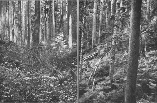
|
| PLATE XIII. A (left), HEMLOCK. B (right), HEMLOCK AND LOVELY FIR. |
TOWNSHIP 27 NORTH, RANGE 3 WEST.
This township is composed entirely of mountainous and rugged country. Quilcene River, which traverses it, has a narrow valley. The soil is very stony. The underbrush is dense along the streams, but light along the ridges. The timber consists of hemlock and red fir, with a little lovely fir. It is of good quality. excepting on the high divides, where it becomes small and knotty. Along Quilcene River red fir is very heavy.
Forest conditions in T. 27 N., R. 3 W.
| Timbered area | acres | 16,000 |
| Rocky and barren area | do | 1,280 |
| Burned area | do | 2,445 |
| Mountain meadows | do | 2,880 |
| Total stand of timber | feet B. M. | 511,500,000 |
| Average stand per acre | do | 32,000 |
| Depth of humus | inches | 2 |
| Litter | Light. |
Statistics of forest trees in T. 27 N., R. 3 W.
| Species. | Stand. | Height. | Diameter. | Clear. | Dead. | Diseased. | Age. |
| Million ft. B.M. |
Feet. | Inches. | Feet. | Per cent. | Per cent. | Years. | |
| Red fir | 167-1/2 | 174 | 33 | 44 | 16 | 9 | 200 |
| Cedar | 8 | 95 | 26 | 17 | 16 | 24 | 184 |
| Hemlock | 240-3/4 | 119 | 18 | 19 | 14 | 11 | 124 |
| Lovely fir | 95-1/4 | 112 | 18 | 20 | 14 | 25 | 122 |
TOWNSHIP 27 NORTH, RANGE 4 WEST.
The surface of this township is rugged and mountainous. It is drained mainly toward the northeast by Dungeness River. The southwest corner is drained by Dusewallips River. The soil is chiefly a clay derived from the underlying slates. The underbrush is dense along the rivers and light on the ridges. The timber, which is very light, consists of lovely fir and hemlock of little value.
Forest conditions in T. 27 N., R. 4 W.
| Timbered area | acres | 11,200 |
| Rocky and barren area | do | 5,440 |
| Mountain meadows | do | 7,040 |
| Total stand of timber | feet B. M. | 33,500,000 |
| Average stand per acre | do | 3,000 |
| Depth of humus | inches | |
| Litter | Light. |
Statistics of forest trees in T. 27 N., R. 4 W.
| Species. | Stand. | Height. | Diameter. | Clear. | Dead. | Diseased. | Age. |
| Million ft. B.M. |
Feet. | Inches. | Feet. | Per cent. | Per cent. | Years. | |
| Red fir | 1-1/2 | 120 | 20 | 20 | 2 | 8 | 140 |
| Hemlock | 12-3/4 | 72 | 16 | 12 | 2 | 21 | 124 |
| Lovely fir | 19-1/4 | 79 | 17 | 13 | 2 | 25 | 128 |
TOWNSHIP 27 NORTH, RANGE 5 WEST.
This township is mountainous throughout. It has little soil, and what little there is is very stony. The underbrush is light. It contains little timber, consisting of lovely fir and hemlock of poor quality.
Forest conditions in T. 27 N., R. 5 W.
| Timbered area | acres | 2,560 |
| Rocky and barren area | do | 5,760 |
| Burned area | do | 7,040 |
| Mountain meadows | do | 7,680 |
| Total stand of timber | feet B. M. | 35,750,000 |
| Average stand per acre | do | 14,000 |
| Depth of humus | inches | 2 |
| Litter | Light. |
Statistics of forest trees in T. 27 N., R. 5 W.
| Species. | Stand. | Height. | Diameter. | Clear. | Dead. | Diseased. | Age. |
| Million ft. B.M. |
Feet. | Inches. | Feet. | Per cent. | Per cent. | Years. | |
| Red fir | 1-1/2 | 95 | 19 | 18 | 2 | 7 | 135 |
| Hemlock | 14-1/4, | 72 | 16 | 11 | 3 | 22 | 124 |
| Lovely fir | 20 | 80 | 17 | 13 | 4 | 26 | 126 |
TOWNSHIP 27 NORTH, RANGE 6 WEST.
With the exception of a narrow strip of bench land along Elwha River, the surface of this township is mountainous. The soil is clay and gravel. The underbrush is dense in the Elwha Valley, but light upon the ridges. The timber consists of red and lovely fir and hemlock. The red fir is of good quality, but the other species are of little value. The timber in this township can be logged most economically to Elwha River, although this is a poor logging stream, and it will be necessary to build a railroad or tramway up its valley.
Forest conditions in T. 27 N., R. 6 W.
| Timbered area | acres | 18,880 |
| Rocky and barren area | do | 1,280 |
| Burned area | do | 1,280 |
| Mountain meadows | do | 1,600 |
| Total stand of timber | feet B. M. | 425,000,000 |
| Average stand per acre | do | 22,500 |
| Depth of humus | inches | 2 |
| Litter | Medium. |
Statistics of forest trees in T. 27 N., R. 6 W.
| Species. | Stand. | Height. | Diameter. | Clear. | Dead. | Diseased. | Age. |
| Million ft. B.M. |
Feet. | Inches. | Feet. | Per cent. | Per cent. | Years. | |
| Red fir | 155-1/2 | 176 | 29 | 37 | 3 | 5 | 207 |
| Hemlock | 146 | 91 | 18 | 17 | 5 | 12 | 122 |
| Lovely fir | 123-1/2 | 88 | 17 | 18 | 5 | 12 | 120 |
TOWNSHIP 27 NORTH, RANGE 7 WEST.
This township is mountainous throughout, with very thin, scanty soil and light underbrush. The timber, which is scanty, consists mainly of lovely fir and hemlock, with a little red fir, all of poor quality.
Forest conditions in T. 27 N., R. 7 W.
| Timbered area | acres | 14,720 |
| Rocky and barren area | do | 5,440 |
| Mountain meadows | do | 2,880 |
| Total stand of timber | feet B. M. | 49,250,000 |
| Average stand per acre | do | 3,300 |
| Depth of humus | inches | 2 |
| Litter | Light. |
Statistics of forest trees in T. 27 N., R. 7 W.
| Species. | Stand. | Height. | Diameter. | Clear. | Dead. | Diseased. | Age. |
| Million ft. B.M. |
Feet. | Inches. | Feet. | Per cent. | Per cent. | Years. | |
| Red fir | 8 | 98 | 18 | 16 | 2 | 7 | 132 |
| Hemlock | 17 | 72 | 15 | 11 | 3 | 23 | 125 |
| Lovely fir | 24-1/4 | 80 | 17 | 13 | 3 | 25 | 123 |
TOWNSHIP 27 NORTH, RANGE 8 WEST.
This township is drained mainly by Hoh River toward the north. Its surface is mountainous and rugged, with the exception of the valley of Hoh River. The mountainous country contains much snow and many glaciers. The soil is clay and in the upper country rocky. Underbrush is dense along the river, but sparser on the upland. The timber is mainly hemlock, lovely fir, and red fir, all of poor quality. being small and scrubby.
The timber in this township can be logged to Hoh River, although this is of no value as a logging stream, being very rapid with many deep canyons. Flumes can however, be built for its transportation.
Forest conditions in T. 27 N., R. 8 W.
| Timbered area | acres | 6,080 |
| Rocky area | do | 13,440 |
| Mountain meadows | do | 3,520 |
| Total stand of timber | feet B. M. | 67,000,000 |
| Average stand per acre | do | 11,000 |
| Depth of humus | inches | 2 |
| Litter | Light. |
Statistics of forest trees in T. 27 N., R. 8 W.
| Species. | Stand. | Height. | Diameter. | Clear. | Dead. | Diseased. | Age. |
| Million ft. B.M. |
Feet. | Inches. | Feet. | Per cent. | Per cent. | Years. | |
| Red fir | 25 | 110 | 25 | 18 | 2 | 5 | 155 |
| Hemlock | 18-3/4 | 75 | 16 | 12 | 4 | 16 | 127 |
| Lovely fir | 23-1/4 | 79 | 17 | 13 | 4 | 20 | 131 |
TOWNSHIP 27 NORTH, RANGE 9 WEST.
This township consists almost entirely of mountainous, rugged country. The north half drains to Hoh River, which flows across its northern edge in a narrow valley. The south half is drained by tributaries of the South Fork of Hoh River. Nearly three-fourths of the township lies above timber line and is open and grassy.
The timber consists mainly of hemlock and lovely fir, 40 per cent of which is of good quality. The remainder is small and stunted. There is along Hoh River a little good red fir and cedar.
The soil consists of clay and gravel. The underbrush is dense along Hoh River, consisting of huckleberry, salal, salmonberry, vine maple, and alder.
The timber, which lies almost entirely upon the portion sloping to Hoh River, can all be logged to that stream, which is, however, of no value as a logging stream, on account of its low banks and many sand bars; still along its bank there is an easy grade for a railroad, which can be cheaply built.
Forest conditions in T. 27 N., R. 9 W.
| Timbered area | acres | 10,560 |
| Rocky and barren area | do | 9,364 |
| Mountain meadows | do | 7,916 |
| Total stand of timber | feet B. M. | 273,000,000 |
| Average stand per acre | do | 25,800 |
| Depth of humus | inches | 3 |
| Litter | Light. |
Statistics of forest trees in T. 27 N., R. 9 W.
| Species. | Stand. | Height. | Diameter. | Clear. | Dead. | Diseased. | Age. |
| Million ft. B.M. |
Feet. | Inches. | Feet. | Per cent. | Per cent. | Years. | |
| Red fir | 45 | 117 | 35 | 28 | 2 | 9 | 157 |
| Cedar | 16 | 66 | 19 | 16 | 8 | 35 | 130 |
| Hemlock | 129 | 91 | 22 | 19 | 5 | 22 | 137 |
| Lovely fir | 83 | 89 | 21 | 18 | 5 | 19 | 131 |

|
| PLATE XIV. A (left), SPRUCE AND HEMLOCK GROWING FROM ONE STUMP. B (right), LOVELY FIR. |
TOWNSHIP 27 NORTH, RANGE 10 WEST.
This township ts drained mainly by Hoh River. Its surface is steep and mountainous, with the exception of a tract of bench land at the forks of Hoh River. The soil is clay and gravel, and the underbrush is dense. The timber consists mainly of hemlock, red fir, and lovely fir, with a little spruce and a trifling amount of cedar. The fir and spruce are of excellent quality. The hemlock and lovely fir are of little value, being very scrubby, especially on the divides.
The timber in this township, with the exception of a small tract along the north line, can be logged to Hoh River, which here is a poor logging stream with low banks and many sand bars. A railroad can, however, be extended up Hoh River with easy grades and thus serve as an outlet.
Forest conditions in T. 27 N, R. 10 W.
| Timbered area | acres | 22,685 |
| Mountain meadows | do | 355 |
| Total stand of timber | feet B. M. | 994,250,000 |
| Average stand per acre | do | 43,800 |
| Depth of humus | inches | 3 |
| Litter | Medium. |
Statistics of forest trees in T. 27 N., R. 10 W.
| Species. | Stand. | Height. | Diameter. | Clear. | Dead. | Diseased. | Age. |
| Million ft. B.M. |
Feet. | Inches. | Feet. | Per cent. | Per cent. | Years. | |
| Red fir | 295 | 186 | 48 | 51 | 1 | 3 | 242 |
| Cedar | 6-3/4 | 100 | 20 | 16 | 4 | 14 | 200 |
| Hemlock | 386 | 122 | 19 | 20 | 1 | 3 | 126 |
| Spruce | 60-1/2 | 202 | 55 | 41 | 1 | 3 | 220 |
| Lovely fir | 246 | 108 | 16 | 24 | 1 | 3 | 129 |
TOWNSHIP 27 NORTH, RANGE 11 WEST.
This township slopes on the north to the valley of the Bogachiel and on the south to that of Hoh River. Its surface is steeply rolling and broken, with some bottom land along Hoh River. The soil is clay, gravel, and loam. The underbrush is dense. The timber, consisting of hemlock, lovely fir, and red fir, with a little cedar and spruce, is of excellent quality, excepting the cedar, which is small. That on the southern part of the township can be logged to Hoh River, a good driving stream. The northern part should go to the valley of the Bogachiel. This stream is of no value for driving, and the lumber will have to be taken out by rail.
Forest conditions in T. 27 N., R. 11 W.
| Timbered area | acres | 23,040 |
| Total stand of timber | feet B. M. | 843,000,000 |
| Average stand per acre | do | 36,200 |
| Depth of humus | inches | 3 |
| Litter | Light. |
Statistics of forest trees in T. 27 N., R. 11 W.
| Species. | Stand. | Height. | Diameter. | Clear. | Dead. | Diseased. | Age. |
| Million ft. B.M. |
Feet. | Inches. | Feet. | Per cent. | Per cent. | Years. | |
| Red fir | 134 | 187 | 52 | 56 | 2 | 4 | 230 |
| Cedar | 36-1/2 | 121 | 43 | 23 | 4 | 21 | 231 |
| Hemlock | 383 | 119 | 16 | 22 | 3 | 5 | 138 |
| Spruce | 64-1/4 | 200 | 65 | 40 | 2 | 4 | 213 |
| Lovely fir | 225-1/4 | 108 | 15 | 25 | 2 | 4 | 127 |
TOWNSHIP 27 NORTH, RANGE 12 WEST.
The northern part of this township is drained by Bogachiel River and the southern part by Hoh River. The surface is steeply rolling, with bottom land along the rivers. The soil is clay and loam, and the underbrush is dense. The timber, all of good quality, consists chiefly of hemlock, cedar, and lovely fir, with a little spruce and red fir intermixed. The fir and spruce in the immediate valleys of the rivers are exceptionally large and fine.
The timber in the southern part of this township can be logged to Hoh River, which is a good driving stream. That in the northern part can be logged to the valley of the Bogachiel, but will have to be taken out by rail, as the stream is not drivable.
Forest conditions in. T. 27 N., R. 12 W.
| Timbered area | acres | 23,040 |
| Total stand of timber | feet B. M. | 738,000,000 |
| Average stand per acre | do | 32,000 |
| Depth of humus | inches | 3 |
| Litter | Heavy. |
Statistics of forest trees in T. 27 N., R. 12 W.
| Species. | Stand. | Height. | Diameter. | Clear. | Dead. | Diseased. | Age. |
| Million ft. B.M. |
Feet. | Inches. | Feet. | Per cent. | Per cent. | Years. | |
| Red fir | 32 | 209 | 48 | 57 | 5 | 4 | 227 |
| Cedar | 146-1/2 | 121 | 49 | 29 | 7 | 31 | 239 |
| Hemlock | 413 | 138 | 16 | 28 | 4 | 4 | 141 |
| Spruce | 37-1/2 | 193 | 56 | 51 | 8 | 4 | 218 |
| Lovely fir | 109 | 162 | 25 | 36 | 4 | 4 | 140 |
TOWNSHIP 27 NORTH, RANGE 13 WEST.
The surface of this township is rolling and broken, comprising an alternation of steep ridges and deep valleys. The soil is loam and clay. The underbrush is dense. The timber consists of hemlock, cedar, and lovely fir, with a little spruce. The cedar is of poor quality. The other species are excellent.
With the exception of a small area in the northeast corner, which can be logged into Bogachiel River, the timber on this township should be logged westward down the valleys of the creeks toward the coast, but as there is no harbor on this coast it will be necessary to build a railroad from some inland point to carry out the timber or the sawed lumber.
Forest conditions in T. 27 N, R. 13 W.
| Timbered area | acres | 23,040 |
| Total stand of timber | feet B. M. | 1,015,500,00 |
| Average stand per acre | do | 44,100 |
| Depth of humus | inches | 3 |
| Litter | Heavy. |
Statisics of forest trees in T. 27 N., R. 13 W.
| Species. | Stand. | Height. | Diameter. | Clear. | Dead. | Diseased. | Age. |
| Million ft. B.M. |
Feet. | Inches. | Feet. | Per cent. | Per cent. | Years. | |
| Cedar | 306 | 109 | 52 | 24 | 7 | 43 | 222 |
| Hemlock | 493 | 131 | 21 | 24 | 5 | 8 | 150 |
| Spruce | 65 | 175 | 46 | 48 | 3 | 5 | 175 |
| Lovely fir | 151-1/2 | 158 | 33 | 40 | 3 | 15 | 160 |
TOWNSHIP 27 NORTH, RANGE 14 WEST.
This township lies in the western part of the reserve, on the Pacific coast, and comprises the equivalent of 24-1/2 sections. Its surface is rolling and broken, with a bluff, rocky coast. Its soil is clay and loam. The underbrush is dense. The timber is chiefly hemlock, with some spruce and cedar. The spruce is large and excellent, but the other species are second class. Owing to the rocky character of the coast and the absence of any harbor, it will be necessary to ship this timber by railroad from some point in the interior.
Forest conditions in T. 27 N., R. 14 W.
| Timbered area | acres | 15,680 |
| Total stand of timber | feet B. M. | 634,750,000 |
| Average stand per acre | do | 40,500 |
| Depth of humus | inches | 3 |
| Litter | Heavy. |
Statistics of forest trees in T. 27 N., R. 14 W.
| Species. | Stand. | Height. | Diameter. | Clear. | Dead. | Diseased. | Age. |
| Million ft. B.M. |
Feet. | Inches. | Feet. | Per cent. | Per cent. | Years. | |
| Cedar | 83 | 145 | 53 | 28 | 8 | 22 | 205 |
| Hemlock | 464 | 134 | 21 | 23 | 5 | 8 | 148 |
| Spruce | 87-3/4 | 191 | 51 | 53 | 2 | 4 | 187 |
TOWNSHIP 27 NORTH, RANGE 15 WEST.
This is a fractional township, lying on the north Pacific coast, comprising less than a square mile.
Forest conditions in T. 27 N., R. 15 W.
| Timbered area | acres | 600 |
| Total stand of timber | feet B. M. | 13,750,000 |
| Average stand per acre | do | 22,900 |
Statistics of forest trees in T. 27 N., R. 15 W.
| Species. | Stand. | Height. | Diameter. | Clear. | Dead. | Diseased. | Age. |
| Million ft. B.M. |
Feet. | Inches. | Feet. | Per cent. | Per cent. | Years. | |
| Cedar | 3/4 | 100 | 44 | 22 | 8 | 40 | 200 |
| Hemlock | 12 | 125 | 20 | 22 | 6 | 10 | 140 |
| Spruce | 1 | 175 | 44 | 40 | 4 | 6 | 177 |
TOWNSHIP 28 NORTH, RANGE 3 WEST.
This township is situated on the eastern border of the reserve. It is drained in part by Dungeness River and in part by the Little Quilcene. Its surface is mountainous and rugged. The soil is clayey and sandy, being derived from underlying slates and sandstones. The underbrush is scanty. This township is well timbered with a good quality of fir, hemlock, and lovely fir, with a little cedar. The timber from the eastern part of it can be logged to Quilcene River by means of skid roads; that from the western part to Dungeness River in a similar manner.
Forest conditions in T. 28 N., R. 3 W.
| Timbered area | acres | 16,420 |
| Rocky and broken area | do | 640 |
| Burned area | do | 5,970 |
| Mountain meadows | do | 640 |
| Total stand of timber | feet B. M. | 641,250,000 |
| Average stand per acre | do | 39,000 |
| Depth of humus | inches | 2 |
| Litter | Light. |
Statistics of forest trees in T. 28 N., R. 3 W.
| Species. | Stand. | Height. | Diameter. | Clear. | Dead. | Diseased. | Age. |
| Million ft. B.M. |
Feet. | Inches. | Feet. | Per cent. | Per cent. | Years. | |
| Red fir | 155 | 179 | 30 | 44 | 14 | 8 | 198 |
| Cedar | 32-1/4 | 128 | 25 | 27 | 32 | 22 | 151 |
| Hemlock | 266 | 143 | 20 | 24 | 28 | 15 | 122 |
| Lovely fir | 188 | 137 | 21 | 29 | 34 | 19 | 125 |
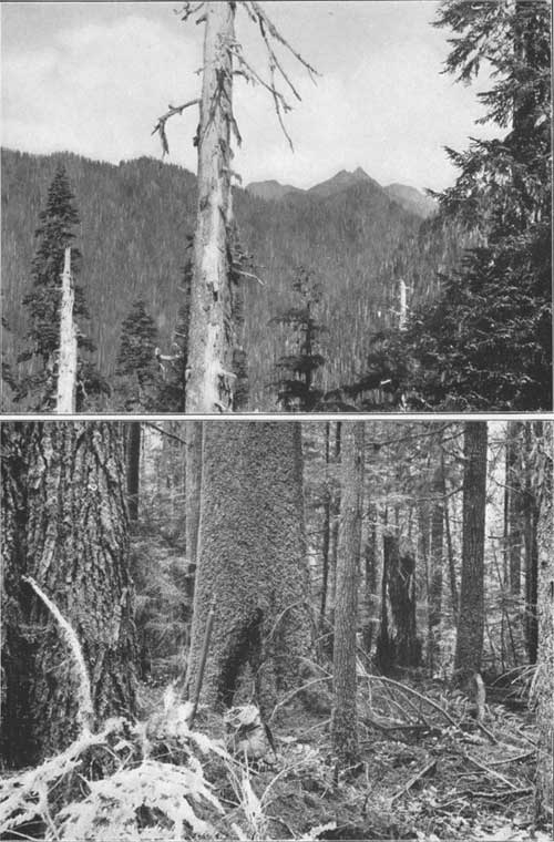
|
| PLATE XV. A (top), FOREST ON RANGE ABOVE HEAD OF WEST FORK OF SATSOP RIVER. B (bottom), LOVELY FIR 5 FEET IN DIAMETER. |
TOWNSHIP 28 NORTH, RANGE 4 WEST.
This township is situated in the eastern part of the reserve and is drained by Dungeness River. The surface of the township is mountainous and rugged. The soil is clay and sand, being derived from underlying slates and sandstones. The undebrush is scanty. The township is sparsely timbered with hemlock and lovely fir. The timber in the township can be logged to Dungeness River by means of skid roads.
Forest conditions in T. 28 N., R. 4 W.
| Timbered area | acres | 13,120 |
| Rocky and broken area | do | 3,840 |
| Burned area | do | 3,200 |
| Mountain meadows | do | 2,880 |
| Total stand of timber | feet B. M. | 50,500,000 |
| Average stand per acre | do | 4,000 |
| Depth of humus | inches | 2 |
| Litter | Light. |
Statistics of forest trees in T. 28 N., R. 4 W.
| Species. | Stand. | Height. | Diameter. | Clear. | Dead. | Diseased. | Age. |
| Million ft. B.M. |
Feet. | Inches. | Feet. | Per cent. | Per cent. | Years. | |
| Hemlock | 19 | 60 | 16 | 11 | 7 | 28 | 101 |
| Lovely fir | 31-1/2 | 63 | 16 | 14 | 7 | 26 | 103 |
TOWNSHIP 28 NORTH, RANGE 5 WEST.
This township, situated in the eastern part of the reserve, is drained by Dungeness River and its branches. Its surface is entirely mountainous and broken. Its soil is derived from sandstones and slates. Underbrush is light. The timber consists of a scrubby growth of hemlock and lovely fir, much of which on the east side of the township has been burned. The timber can be logged to the valleys of the branches of Dungeness River, up which skid roads or tramways may be built.
Forest conditions in T. 28 N., R. 5 W.
| Timbered area | acres | 17,000 |
| Rock area | do | 1,920 |
| Burned area | do | 640 |
| Mountain meadows | do | 4,480 |
| Total stand of timber | feet B. M. | 83,500,000 |
| Average stand per acre | do | 4,900 |
| Depth of humus | inches | 2 |
| Litter | Light. |
Statistics of forest trees in T. 28 N., R. 5 W.
| Species. | Stand. | Height. | Diameter. | Clear. | Dead. | Diseased. | Age. |
| Million ft. B.M. |
Feet. | Inches. | Feet. | Per cent. | Per cent. | Years. | |
| Hemlock | 30 | 62 | 16 | 11 | 5 | 30 | 111 |
| Lovely fir | 53-1/2 | 69 | 18 | 14 | 4 | 28 | 118 |
TOWNSHIP 28 NORTH, RANGE 6 WEST.
This township, situated in the eastern part of the reserve, is mainly composed of high mountains drained by Elwha River and its branch, Lillian Creek. The soil is chiefly clay derived from underlying slates. The underbrush is light, and along Elwha River has been mainly burned away. Over large areas the timber as well as the underbrush has been destroyed by fire. The timber consists of fir, hemlock, and lovely fir, nearly all of pool-quality.
This timber can in the main be logged to the valley of Elwha River, but as that river and its branch, Lillian Creek, are of no value for driving purposes, it will be necessary to handle the timber with chutes or flumes; consequently, it will be expensive to log this township.
Forest conditions in T. 28 N., R. 6 W.
| Timbered area | acres | 13,760 |
| Rocky area | do | 960 |
| Burned area | do | 3,840 |
| Mountain meadows | do | 4,480 |
| Total stand of timber | feet B. M. | 143,000,000 |
| Average stand per acre | do | 10,900 |
| Depth of humus | inches | 2 |
| Litter | Light. |
Statistics of forest trees in T. 28 N., R. 6 W.
| Species. | Stand. | Height. | Diameter. | Clear. | Dead. | Diseased. | Age. |
| Million ft. B.M. |
Feet. | Inches. | Feet. | Per cent. | Per cent. | Years. | |
| Red fir | 49 | 128 | 26 | 28 | 5 | 6 | 150 |
| Hemlock | 52 | 65 | 17 | 14 | 7 | 16 | 103 |
| Lovely fir | 42 | 64 | 17 | 15 | 7 | 16 | 105 |
TOWNSHIP 28 NORTH, RANGE 7 WEST.
This township is drained by Elwha River and Cat Creek. Its surface is mountainous throughout. Its soil is clay and gravel. Underbrush is light. The timber, which is very light, consists of hemlock, fir, and lovely fir, all of poor quality, having to a large extent been destroyed by fire.
The timber can be logged to Elwha River, although that is a poor logging stream, with low banks and many canyons and gravel bars. It is probable that flumes would have to be constructed along the river to carry the timber out.
Forest conditions in T. 28 N., R. 7 W.
| Timbered area | acres | 16,000 |
| Barren area | do | 1,280 |
| Burned area | do | 3,840 |
| Mountain meadows | do | 1,920 |
| Total stand of timber | feet B. M. | 177,500,000 |
| Average stand per acre | do | 11,100 |
| Depth of humus | inches | 2 |
| Litter | Medium. |
Statistics of forest trees in T. 28 N., R. 7 W.
| Species. | Stand. | Height. | Diameter. | Clear. | Dead. | Diseased. | Age. |
| Million ft. B.M. |
Feet. | Inches. | Feet. | Per cent. | Per cent. | Years. | |
| Red fir | 59-1/2 | 159 | 29 | 22 | 13 | 6 | 185 |
| Hemlock | 71 | 113 | 17 | 16 | 13 | 8 | 124 |
| Lovely fir | 47 | 108 | 18 | 15 | 10 | 9 | 121 |
TOWNSHIP 28 NORTH, RANGE 8 WEST.
This township is all rugged and mountainous. It is drained on the south by Hoh River, on the north by Cat Creek and the Soleduck, whose headwaters it includes. The soil is mainly coarse and gravelly. Underbrush is dense along the rivers, while on the uplands it is light, the high divides consisting of open grass land. The timber is chiefly fir, with some hemlock and lovely fir, and a few scattering cedars. It is in the main of poor quality.
The timber in the southern part of this township can be logged to Hoh River; on the east it can be sent down Cat Creek to the Elwha, and on the west to the Soleduck, but owing to the mountainous character of the township logging will be extremely expensive.
Forest conditions in T. 28 N., R. 8 W.
| Timbered area | acres | 15,552 |
| Rocky area | do | 2,400 |
| Grazing area | do | 4,960 |
| Burned area | do | 128 |
| Total stand of timber | feet B. M. | 207,750,000 |
| Average stand per acre | do | 13,400 |
| Depth of humus | inches | 2 |
| Litter | Medium. |
Statistics of forest trees in T. 28 N., R. 8 W.
| Species. | Stand. | Height. | Diameter. | Clear. | Dead. | Diseased. | Age. |
| Million ft. B.M. |
Feet. | Inches. | Feet. | Per cent. | Per cent. | Years. | |
| Red fir | 112 | 157 | 32 | 38 | 3 | 4 | 198 |
| Cedar | 4 | 51 | 18 | 14 | 7 | 29 | 104 |
| Hemlock | 53-1/4 | 68 | 16 | 13 | 5 | 38 | 106 |
| Lovely fir | 38-1/2 | 63 | 17 | 14 | 5 | 39 | 102 |

|
| PLATE XVI A (left) CEDAR 6 FEET IN DIAMETER. B (right) SPRUCE NEAR LAKE QUENIULT. |
TOWNSHIP 28 NORTH, RANGE 9 WEST.
This township is drained by Soleduck, Hoh, and Bogachiel rivers. Most of it lies very high and it is all mountainous and broken. The soil is stony. Underbrush is scanty on the uplands, but dense in the narrow river valleys.
The timber consists mainly of hemlock and lovely fir, with a trifling amount of red fir. The latter is of good quality, but the hemlock and lovely fir are scrubby and of no value.
The timber can be logged to the rivers by which the township is drained. They are, however, poor logging streams, and it is not probable that the small amount of timber in the township will ever tempt lumbermen to bring a raihroad into it.
Forest conditions in T. 28 N., R. 9 W.
| Timbered area | acres | 25,778 |
| Rocky area | do | 128 |
| Mountain meadows | do | 1,742 |
| Burned area | do | 192 |
| Total stand of timber | feet B. M. | 266,750,000 |
| Average stand per acre | do | 10,300 |
| Depth of humus | inches | 2 |
| Litter | Light. |
Statistics of forest trees in T. 28 N., R. 9 W.
| Species. | Stand. | Height. | Diameter. | Clear. | Dead. | Diseased. | Age. |
| Million ft. B.M. |
Feet. | Inches. | Feet. | Per cent. | Per cent. | Years. | |
| Red fir | 18 | 84 | 24 | 19 | 2 | 9 | 133 |
| Cedar | 1 | 45 | 13 | 8 | 3 | 40 | 100 |
| Hemlock | 137-3/4 | 66 | 19 | 15 | 4 | 12 | 103 |
| Lovely fir | 110 | 68 | 17 | 14 | 5 | 15 | 105 |
TOWNSHIP 28 NORTH, RANGE 10 WEST.
This township is drained by Bogachiel River and the South Fork of the Kalawa. It is nearly all a mountainous region, sloping to the west, with narrow valleys along the rivers. The soil is clay and gravel. The underbrush is dense in the valleys but sparse upon the ridges. The timber is mainly hemlock and lovely fir, most of it being of good quality. There is a little red fir also, of fine quality.
This township, with the exception of a small tract in the northwest corner which can be logged to Kalawa River, can be logged to the Bogachiel, although this is a poor logging stream, with low banks and not sufficient water for driving. The valley, however, furnishes an excellent route for a railroad, which will probably be the method employed for clearing the township.
Forest conditions in T. 28 N., R. 10 W.
| Timbered area | acres | 23,040 |
| Total stand of timber | feet B. M. | 539,500,000 |
| Average stand per acre | do | 23,400 |
| Depth of humus | inches | 3 |
| Litter | Medium. |
Statistics of forest trees in T. 28 N., R. 10 W.
| Species. | Stand. | Height. | Diameter. | Clear. | Dead. | Diseased. | Age. |
| Million ft. B.M. |
Feet. | Inches. | Feet. | Per cent. | Per cent. | Years. | |
| Red fir | 40-1/2 | 104 | 21 | 20 | 3 | 4 | 133 |
| Hemlock | 262 | 113 | 19 | 15 | 3 | 5 | 126 |
| Spruce | 7 | 129 | 36 | 26 | 3 | 5 | 144 |
| Lovely fir | 230 | 115 | 19 | 14 | 3 | 5 | 127 |
TOWNSHIP 28 NORTH, RANGE 11 WEST.
This township is drained to the westward by the Bogachiel and Kalawa rivers. It consists of mountainous spurs running nearly east and west, with narrow valleys along the streams. The soil is red clay in the upland and loam along the rivers. The underbrush is dense in the valleys and sparse upon the ridges. The timber consists mainly of hemlock, red and lovely fir, with a little spruce and cedar.
The timber can be logged to the Bogachiel and Kalawa rivers, but as they are poor driving streams it is probable that it will be necessary to construct railroads to get the lumber out. It will be an expensive township to log on account of the steepness and ruggedness of the ridges.
Forest conditions in T. 28 N., R. 11 W.
| Timbered area | acres | 23,040 |
| Total stand of timber | feet B. M. | 811,500,000 |
| Average stand per acre | do | 35,300 |
| Depth of humus | inches | 3 |
| Litter | Medium. |
Statistics of forest trees in T. 28 N., 11 W.
| Species. | Stand. | Height. | Diameter. | Clear. | Dead. | Diseased. | Age. |
| Million ft. B.M. |
Feet. | Inches. | Feet. | Per cent. | Per cent. | Years. | |
| Red fir | 140 | 177 | 37 | 35 | 2 | 3 | 203 |
| Cedar | 10-1/2 | 100 | 38 | 21 | 5 | 17 | 206 |
| Hemlock | 428 | 126 | 21 | 22 | 2 | 3 | 132 |
| Spruce | 27 | 175 | 44 | 30 | 2 | 5 | 190 |
| Lovely fir | 206 | 144 | 28 | 34 | 2 | 3 | 150 |
TOWNSHIP 28 NORTH, RANGE 12 WEST.
This township is drained by the Kalawa and Bogachiel rivers, and consists almost entirely of rugged mountain ridges. The soil is mainly clay. The underbrush, as everywhere else, is dense in the valleys and sparse upon the ridges. The timber is chiefly hemlock and lovely fir, with some red fir, spruce, and cedar scattered through it. The stand is extremely heavy and the timber of all kinds is of good quality.
The timber may be logged to the rivers, but as they are poor driving streams it is probable that it will be found necessary to build railroads up their valleys for the purpose of getting the lumber out.
Forest conditions in T. 28 N., R. 12 W.
| Timbered area | acres | 23,040 |
| Total stand of timber | feet B. M. | 1,050,500,00 |
| Average stand per acre | do | 45,600 |
| Depth of humus | inches | 3 |
| Litter | Medium. |
Statistics of forest trees in T. 28 N., R. 12 W.
| Species. | Stand. | Height. | Diameter. | Clear. | Dead. | Diseased. | Age. |
| Million ft. B.M. |
Feet. | Inches. | Feet. | Per cent. | Per cent. | Years. | |
| Red fir | 98 | 199 | 40 | 49 | 3 | 5 | 229 |
| Cedar | 27 | 128 | 45 | 26 | 6 | 15 | 209 |
| Hemlock | 555 | 141 | 24 | 34 | 2 | 4 | 151 |
| Spruce | 43-1/2 | 215 | 56 | 56 | 2 | 4 | 213 |
| Lovely fir | 327 | 147 | 28 | 41 | 2 | 4 | 151 |
TOWNSHIP 28 NORTH, RANGE 13 WEST.
This township, lying toward the western part of the reserve, is made up in considerable part of low bottom land along Kalawa and Bogachiel rivers, rising to the south in somewhat broken ridges. The soil is clay and sandy loam, and gravel on the ridges. The underbrush is dense. The township has a heavy stand of timber consisting in the main of hemlock, red fir, spruce, and lovely fir, with a little cedar. It is nearly all of good quality.
The timber can be logged to Kalawa and Bogachiel rivers, which are good driving streams, and the area can be logged quite cheaply.
Forest conditions in T. 28 N., R 13 W.
| Timbered area | acres | 21,580 |
| Forks Prairie | do | 1,460 |
| Total stand of timber | feet B. M. | 951,500,000 |
| Average stand per acre | do | 44,100 |
| Depth of humus | inches | 3 |
| Litter | Light. |
Statistics of forest trees in T. 28, N., R. 13 W.
| Species. | Stand. | Height. | Diameter. | Clear. | Dead. | Diseased. | Age. |
| Million ft. B.M. |
Feet. | Inches. | Feet. | Per cent. | Per cent. | Years. | |
| Red fir | 131 | 219 | 44 | 46 | 5 | 7 | 223 |
| Cedar | 31-1/2 | 129 | 40 | 24 | 8 | 25 | 179 |
| Hemlock | 512 | 125 | 21 | 27 | 5 | 7 | 115 |
| Spruce | 152 | 184 | 47 | 51 | 3 | 5 | 153 |
| Lovely fir | 125 | 148 | 30 | 43 | 3 | 4 | 157 |
TOWNSHIP 28 NORTH, RANGE 14 WEST.
This township lies in the valley of Soleduck and Dickey rivers and consists in the main of gently rolling bench and bottom lands. The soil is commonly clay and loam, with clay and gravel in the uplands. The underbrush is dense everywhere. The timber consists mainly of hemlock and spruce, with a little fir and scattering cedar, all of good quality. The spruce timber is found along the rivers and is large and valuable.
The timber can be logged to the rivers which traverse it, which are good logging streams at all seasons of the year, and timber can be gotton out very cheaply. This township contains considerable areas of prairie land lying between Soleduck and Dickey rivers. The largest of these areas is that known as Quillayute Prairie.
Forest conditions in T. 28 N., R. 14 W.
| Timbered area | acres | 21,370 |
| Prairie area | do | 1,670 |
| Total stand of timber | feet B. M. | 722,000,000 |
| Average stand per acre | do | 33,800 |
| Depth of humus | inches | 3 |
| Litter | Light. |
Statistics of forest trees in T. 28 N., R. 14 W.
| Species. | Stand. | Height. | Diameter. | Clear. | Dead. | Diseased. | Age. |
| Million ft. B.M. |
Feet. | Inches. | Feet. | Per cent. | Per cent. | Years. | |
| Fir | 50 | 192 | 45 | 47 | 5 | 6 | 205 |
| Cedar | 14-1/2 | 131 | 28 | 21 | 7 | 23 | 174 |
| Hemlock | 350-1/2 | 124 | 19 | 22 | 5 | 8 | 141 |
| Spruce | 307 | 183 | 55 | 58 | 3 | 5 | 188 |

|
| PLATE XVII CEDAR. |
TOWNSHIP 28 NORTH, RANGE 15 WEST.
This fractional township lies upon the Pacific coast, at the mouth of Quillayute River. Its surface is in the main gently rolling, consisting of bottom and bench lands of the river. The soil is of clay and sandy loam. The underbrush is extremely dense. The timber consists mainly of hemlock, with some spruce and cedar. The spruce is good quality, but the cedar and hemlock are second rate.
The timber, with the exception of a small tract in the southeast corner of the township, can be logged to Quillayute River, which is a good logging stream; but as there is no harbor at its mouth it will be necessary to mill the timber within the township.
Forest conditions in T. 28 N., R. 15 W.
| Timbered area | acres | 13,765 |
| Prairie area | do | 235 |
| Total stand of timber | feet B. M. | 318,500,000 |
| Average stand per acre | do | 23,100 |
| Depth of humus | inches | 3 |
| Litter | Heavy |
Statistics of forest trees in T. 28 N., R. 15 W.
| Species. | Stand. | Height. | Diameter. | Clear. | Dead. | Diseased. | Age. |
| Million ft. B.M. |
Feet. | Inches. | Feet. | Per cent. | Per cent. | Years. | |
| Cedar | 14 | 111 | 44 | 22 | 8 | 24 | 200 |
| Hemlock | 251 | 126 | 21 | 24 | 7 | 9 | 135 |
| Spruce | 53-1/2 | 159 | 41 | 33 | 4 | 7 | 183 |
TOWNSHIP 29 NORTH, RANGE 3 WEST.
This township, in the eastern part of the reserve, is composed of rolling bench land, which becomes steep on the west, sloping down to the valley of Dungeness River. The soil is mainly clay. The underbrush is dense. On the south and west of this township the timber has all been killed by fire and is standing in good condition. If cut immediately it will make excellent lumber, but is in constant danger of destruction by fire.
The timber consists chiefly of fir of excellent quality. With it there is some cedar and hemlock, but it is small and poor.
The timber, with the exception of a small part in the west sloping to Dungeness River, can be logged to Squim Bay, in the northeast corner of the township, and can be taken out very cheaply.
Forest conditions in T. 29 N., R. 3 W.
| Timbered area | acres | 15,150 |
| Burned area | do | 6,890 |
| Total stand of timber | feet B. M. | 739,250,00 |
| Average stand per acre | do | 48,700 |
| Depth of humus | inches | 3 |
| Litter | Heavy. |
Statistics of forest trees in T. 29 N., R. 3 W.
| Species. | Stand. | Height. | Diameter. | Clear. | Dead. | Diseased. | Age. |
| Million ft. B.M. |
Feet. | Inches. | Feet. | Per cent. | Per cent. | Years. | |
| Fir | 506 | 183 | 39 | 49 | 33 | 14 | 214 |
| Cedar | 24-3/4 | 123 | 31 | 26 | 50 | 22 | 209 |
| Hemlock | 208-1/2 | 135 | 23 | 26 | 38 | 19 | 137 |
TOWNSHIP 29 NORTH, RANGE 4 WEST.
This township, situated in the northeastern part of the reserve, has been greatly burned over. It is drained by Dungeness River and McDonald Creek. It consists of high, rolling country sloping toward the north. The soil is clay and gravel on the north, changing to a stony soil in the south. Underbrush is very dense. The timber on this township is mainly fir and cedar, with a little hemlock. The fir timber is small except in the eastern part of the township, where it is large and of good quality. Most of this township has been burned over, and the timber left standing is scattered in small bodies.
The timber in the eastern part of this township can be logged to Dungeness River, although this is a poor logging stream, with low banks and many gravel bars. A railroad could be built up its valley at slight expense, however. The timber in the western part can be logged by way of McDonald Creek, using skid roads.
The valley of Dungeness River has been to a large extent cleared and is thickly settled.
Forest conditions in T. 29 N., R. 4 W.
| Timbered area | acres | 9,280 |
| Burned area | do | 13,440 |
| Grazing area | do | 320 |
| Total stand of timber | feet B. M. | 217,750,000 |
| Average stand per acre | do | 23,400 |
| Depth of humus | inches | 2 |
| Litter | Light. |
Statistics of forest trees in T. 29 N., R. 4 W.
| Species. | Stand. | Height. | Diameter. | Clear. | Dead. | Diseased. | Age. |
| Million ft. B.M. |
Feet. | Inches. | Feet. | Per cent. | Per cent. | Years. | |
| Fir | 132-3/4 | 161 | 35 | 38 | 27 | 9 | 193 |
| Cedar | 72-3/4; | 106 | 22 | 22 | 70 | 23 | 161 |
| Hemlock | 124 | 98 | 16 | 27 | 31 | 10 | 133 |
TOWNSHIP 29 NORTH, RANGE 5 WEST.
The southern part of this township is very steep and mountainous, descending northward into a rolling country. The soil in the northern and lower part is gravelly clay, while in the mountainous southern portion it is coarse gravel. The underbrush is dense on the north, becoming sparser southward. The timber consists mainly of fir and hemlock, with a little cedar and lovely fir. The fir is of good quality. The other timber is of little value.
The timber of this township can be logged northward by means of skid roads or tramways.
Forest conditions in T. 29 N., R. 5 W.
| Timbered area | acres | 15,360 |
| Burned area | do | 7,040 |
| Rocky area | do | 640 |
| Grazing area | do | 640 |
| Total stand of timber | feet B. M. | 360,250,000 |
| Average stand per acre | do | 23,500 |
| Depth of humus | inches | 2 |
| Litter | Medium. |
Statistics of forest trees in T. 29 N., R. 5 W.
| Species. | Stand. | Height. | Diameter. | Clear. | Dead. | Diseased. | Age. |
| Million ft. B.M. |
Feet. | Inches. | Feet. | Per cent. | Per cent. | Years. | |
| Red fir | 169 | 170 | 30 | 41 | 16 | 9 | 198 |
| Cedar | 20-1/4 | 125 | 23 | 23 | 30 | 23 | 188 |
| Hemlock | 119 | 109 | 15 | 19 | 20 | 11 | 144 |
| Lovely fir | 52 | 96 | 20 | 18 | 9 | 9 | 139 |
TOWNSHIP 29 NORTH, RANGE 6 WEST.
This township lies in the northeastern part of the reserve, and is made up entirely of mountainous and rugged country of little value except for grazing purposes. The soil is thin and stony. The underbrush is light, excepting in the immediate gorges of three or four creeks. The timber consists chiefly of fir and hemlock, with a little lovely fir and scattering cedars. The fir is of good quality, but the hemlock and lovely fir are poor.
The timber of this township can mainly be logged to Morse Creek on the east side.
Forest conditions in T. 29 N., R. 6 W.
| Timbered area | acres | 13,749 |
| Barren rocky area | do | 896 |
| Burned area | do | 3,435 |
| Mountain meadows | do | 4,960 |
| Total stand of timber | feet B. M. | 265,000,000 |
| Average stand per acre | do | 19,000 |
| Depth of humus | inches | 2 |
| Litter | Medium. |
Statistics of forest trees in T. 29 N., R. 6 W.
| Species. | Stand. | Height. | Diameter. | Clear. | Dead. | Diseased. | Age. |
| Million ft. B.M. |
Feet. | Inches. | Feet. | Per cent. | Per cent. | Years. | |
| Red fir | 107 | 174 | 31 | 48 | 9 | 8 | 204 |
| Cedar | 5-1/2 | ---- | ---- | ---- | 12 | ---- | 200 |
| Hemlock | 93 | 88 | 17 | 16 | 10 | 8 | 130 |
| Lovely fir | 59-1/2 | 83 | 19 | 18 | 7 | 8 | 133 |
TOWNSHIP 29 NORTH, RANGE 7 WEST.
This township is steep and mountainous, with the exception of a narrow strip along Elwha River. The soil is clay and gravel and it is very stony. The underbrush is dense along the river, but on the uplands it is light. The timber is chiefly fir and hemlock and is of second quality.
Most of the timber can be logged to Elwha River. This is a poor logging stream, but along its valley a railroad could be built for the purpose of transporting logs.
Forest conditions in T. 29 N., R. 7 W.
| Timbered area | acres | 20,900 |
| Rocky area | do | 64 |
| Burned area | do | 980 |
| Mountain meadows | do | 1,100 |
| Total stand of timber | feet B. M. | 196,500,000 |
| Average stand per acre | do | 9,400 |
| Depth of humus | inches | 1 |
| Litter | Light. |
Statistics of forest trees in T. 29 N., R. 7 W.
| Species. | Stand. | Height. | Diameter. | Clear. | Dead. | Diseased. | Age. |
| Million ft. B.M. |
Feet. | Inches. | Feet. | Per cent. | Per cent. | Years. | |
| Red fir | 109 | 140 | 30 | 29 | 8 | 9 | 181 |
| Cedar | 9 | 84 | 31 | 19 | 15 | 23 | 177 |
| Hemlock | 69-1/2 | 78 | 18 | 17 | 7 | 9 | 134 |
| Lovely fir | 9 | 91 | 19 | 18 | 7 | 8 | 139 |
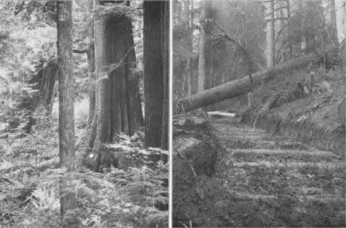
|
| PLATE XVIII A (left) CEDAR. B (right) SKID ROAD. |
TOWNSHIP 29 NORTH, RANGE 8 WEST.
This township, drained by Boulder and Barnes creeks, is entirely mountainous and broken. Parts of its area are rocky and without vegetation; other parts, lying above the limit of timber, are composed of high grass lands, while the timber is found on the slopes of the ridges and in the valleys of creeks. The underbrush is heavy in the valleys and becomes sparser on the ridges. The timber consists of lovely fir, hemlock, and a little red fir, all of poor quality.
The timber can be logged on the north to Lake Crescent by way of Barnes Creek, and on the south down Boulder Creek into Elwha River. It will be very expensive getting the timber out of this township, as, owing to the steepness of the ridges, it will have to be run down by chute to the streams.
Forest conditions in T. 29 N., R. 8 W.
| Timbered area | acres | 20,480 |
| Rocky area | do | 640 |
| Mountain meadows | do | 1,920 |
| Total stand of timber | feet B. M. | 288,500,000 |
| Average stand per acre | do | 14,100 |
| Depth of humus | inches | 2 |
| Litter | Light. |
Statistics of forest trees in T. 29 N., R. 8 W.
| Species. | Stand. | Height. | Diameter. | Clear. | Dead. | Diseased. | Age. |
| Million ft. B.M. |
Feet. | Inches. | Feet. | Per cent. | Per cent. | Years. | |
| Red fir | 18-1/2 | 105 | 21 | 21 | 2 | 6 | 142 |
| Hemlock | 117-1/2 | 76 | 18 | 14 | 4 | 9 | 122 |
| Lovely fir | 152-1/2 | 84 | 19 | 17 | 4 | 8 | 128 |
TOWNSHIP 29 NORTH, RANGE 9 WEST.
This township is in the main drained by Soleduck River and its north fork. Its area is mountainous, steep, and very rugged. The soil is clay and gravel. The underbrush in the river valleys is dense, but on the uplands is light. The timber is chiefly made up of fir, with considerable hemlock and a trifling amount of other species. The fir is of good quality, except on the high divides, where it becomes small. The hemlock and fir are of poor quality.
The timber can be logged to Soleduck River, with the exception of that in a few sections in the north, which can be logged direct to Lake Crescent. The Soleduck, however, is not a drivable stream, and it will be necessary to construct a railroad up its valley. Outside of the timber in the immediate valley of the Soleduck, this township will be expensive to log, owing to the steepness of the slopes and the ruggedness of the country.
Forest conditions in T. 29 N., R. 9 W.
| Timbered area | acres | 27,200 |
| Mountain meadows | do | 640 |
| Total stand of timber | feet B. M. | 555,000,000 |
| Average stand per acre | do | 20,400 |
| Depth of humus | inches | 2 |
| Litter | Light. |
Statistics of forest trees in T. 29 N., R. 9 W.
| Species. | Stand. | Height. | Diameter. | Clear. | Dead. | Diseased. | Age. |
| Million ft. B.M. |
Feet. | Inches. | Feet. | Per cent. | Per cent. | Years. | |
| Red fir | 306-1/2 | 125 | 23 | 27 | 3 | 6 | 160 |
| Cedar | 1-1/2 | 85 | 20 | 12 | 8 | 15 | 140 |
| Hemlock | 165 | 83 | 16 | 17 | 5 | 7 | 125 |
| Spruce | 3 | 175 | 40 | 49 | 2 | 4 | 180 |
| Lovely fir | 79 | 88 | 18 | 17 | 4 | 6 | 125 |
TOWNSHIP 29 NORTH, RANGE 10 WEST.
This township is drained almost entirely by Soleduck River. Its surface is nearly all steep, broken, and rugged, rising to a great elevation in the south part. Soil is clay and gravel. Underbrush is dense. The timber is chiefly fir and hemlock, with a trifling amount of lovely fir. It is all of good quality, and stands very heavy in the northern part of the township.
The timber can be logged to Soleduck River, with the exception of a few sections in the southwest corner, which can best be logged to the Kalawa. It will be expensive to transport the lumber down to the river, owing to the steepness and ruggedness of the country, but it can be done by building skid roads up the main branches of the river and chutes down the hillsides.
Forest conditions in T. 29 N., R. 10 W.
| Timbered area | acres | 23,040 |
| Total stand of timber | feet B. M. | 862,000,000 |
| Average stand per acre | do | 37,400 |
| Depth of humus | inches | 2 |
| Litter | Light. |
Statistics of forest trees in T. 29 N., R. 10 W.
| Species. | Stand. | Height. | Diameter. | Clear. | Dead. | Diseased. | Age. |
| Million ft. B.M. |
Feet. | Inches. | Feet. | Per cent. | Per cent. | Years. | |
| Red fir | 345 | 180 | 27 | 32 | 3 | 6 | 198 |
| Cedar | 4 | 100 | 25 | 22 | 8 | 15 | 156 |
| Hemlock | 418 | 130 | 18 | 25 | 4 | 6 | 134 |
| Spruce | 2 | 180 | 48 | 43 | 2 | 4 | 180 |
| Lovely fir | 93 | 138 | 19 | 29 | 3 | 7 | 130 |
TOWNSHIP 29 NORTH, RANGE 11 WEST.
This township is drained mainly by the North Fork of Kalawa River. Its surface is nearly all steep and rolling and broken in the south. The soil is clay and gravel. The underbrush is heavy. It is heavily timbered with hemlock and red fir, some lovely fir, and a trifling amount of spruce and cedar. The timber is good, excepting on the high divides, where the elevation has prevented its development.
This timber can be logged to the North Fork of Kalawa River, with the exception of an area on the south line, which can be logged to the South Fork of Kalawa River.
Forest conditions in T. 29 N., R. 11 W.
| Timbered area | acres | 22,440 |
| Burned area | do | 600 |
| Total stand of timber | feet B. M. | 889,250,000 |
| Average stand per acre | do | 39,600 |
| Depth of humus | inches | 3 |
| Litter | Medium. |
Statistics of forest trees in T. 29 N., R. 11 W.
| Species. | Stand. | Height. | Diameter. | Clear. | Dead. | Diseased. | Age. |
| Million ft. B.M. |
Feet. | Inches. | Feet. | Per cent. | Per cent. | Years. | |
| Red fir | 255-1/2 | 215 | 42 | 48 | 7 | 5 | 235 |
| Cedar | 8 | 101 | 29 | 24 | 8 | 19 | 161 |
| Hemlock | 456 | 133 | 26 | 51 | 11 | 8 | 151 |
| Spruce | 9-3/4 | 207 | 53 | 57 | 15 | 5 | 200 |
| Lovely fir | 160 | 141 | 31 | 37 | 4 | 6 | 158 |
TOWNSHIP 29 NORTH, RANGE 12 WEST.
This township is drained in the main by the North Fork of Kalawa River. Its surface is very steep and broken, with the exception of the north tier of sections, which consist of gently rolling land. Soil is clay and gravel along the creeks and rivers, while on the uplands it is stony. Underbrush is dense. The timber consists mainly of hemlock and red fir, with some lovely fir and spruce and a little cedar, all of good quality.
This timber, with the exception of that in the northern portion, can be logged into the North Fork of Kalawa River, although this is a poor logging stream, with low banks and insufficient water for driving. A better plan for logging the township would be to construct a railroad in the valley of this stream. The timber would, however, in any case be expensive to handle, requiring chutes to transport it to the railroad or the river.
Forest conditions in T. 29 N., R. 12 W.
| Timbered area | acres | 22,240 |
| Burned area | do | 800 |
| Total stand of timber | feet B. M. | 1,152,500,000 |
| Average stand per acre | do | 51,800 |
| Depth of humus | inches | 3 |
| Litter | Medium. |
Statistics of forest trees in T. 29 N, R. 12 W.
| Species. | Stand. | Height. | Diameter. | Clear. | Dead. | Diseased. | Age. |
| Million ft. B.M. |
Feet. | Inches. | Feet. | Per cent. | Per cent. | Years. | |
| Red fir | 387 | 219 | 45 | 59 | 5 | 8 | 221 |
| Cedar | 22-1/2 | 134 | 43 | 25 | 9 | 18 | 204 |
| Hemlock | 519 | 137 | 22 | 29 | 7 | 10 | 143 |
| Spruce | 99 | 211 | 66 | 69 | 7 | 5 | 214 |
| Lovely fir | 125 | 140 | 26 | 35 | 3 | 5 | 149 |

|
| PLATE XIX LOADING LOGS ON RAILWAY. |
TOWNSHIP 29 NORTH, RANGE 13 WEST.
This township is drained mainly by Soleduck River, which flows through the middle. A small part in the southeast is drained by the Kalawa and in the northwest by Dickey River. The valley of the Soleduck contains much timbered bottom land and two small prairies, Shuwah and Maxfield, and considerable areas of the township have been burned. The country between the rivers is steep, rolling, and broken in the eastern part of the township, while in the western part it is gently sloping. The soil is clay and loam on the bottom lands, while the uplands are gravelly. Underbrush is everywhere dense. The timber is chiefly fir, spruce, and hemlock, all of good quality. The fir stands very heavily along Soleduck and Kalawa rivers. The hemlock is found mostly in the eastern part of the township, on the high ridges. Cedar is very scattering in this township and is of poor quality.
The timber can be logged into Soleduck River, with the exception of a small tract in the northwest corner, from which the timber should be taken to the East Fork of Dickey River, and another small portion in the southeast, which should go to the Kalawa River. The last is a good logging stream during winter season.
Forest conditions in T. 29 N., R. 13 W.
| Timbered area | acres | 21,960 |
| Burned area | do | 800 |
| Prairie area | do | 280 |
| Total stand of timber | feet B. M. | 1,086,000,000 |
| Average stand per acre | do | 49,500 |
| Depth of humus | inches | 3 |
| Litter | Medium. |
Statistics of forest trees in T. 29 N R 13 W.
| Species. | Stand. | Height. | Diameter. | Clear. | Dead. | Diseased. | Age. |
| Million ft. B.M. |
Feet. | Inches. | Feet. | Per cent. | Per cent. | Years. | |
| Red fir | 384 | 206 | 46 | 57 | 6 | 9 | 220 |
| Cedar | 4 | 122 | 46 | 30 | 9 | 34 | 211 |
| Hemlock | 454 | 120 | 19 | 22 | 5 | 9 | 147 |
| Spruce | 196-1/2 | 195 | 57 | 61 | 3 | 5 | 193 |
| Lovely fir | 47-1/2 | 151 | 28 | 32 | 3 | 5 | 158 |
TOWNSHIP 29 NORTH, RANGE 14 WEST.
This township is drained by the East and West forks of Dickey River. Along the east streams and other branches is some timbered bottom land, while between them the country is steep and rugged. The soil is clay and loam along the rivers and in the swamps, while the uplands have gravel and clay soils. Underbrush is everywhere dense.
The timber is mainly hemlock, spruce, and cedar, more than half being hemlock. This and the spruce are of good quality. The cedar is large but overripe, most of it having dead tops. There is a small amount of fir in the township, mainly in the east tier of sections.
The timber can all be logged to Dickey River, which is a good logging stream below the forks in winter. It can also be logged cheaply with tramways and railroads built up the valleys of the river and its branches.
Forest conditions in T. 29 N., R. 14 W.
| Timbered area | acres | 23,000 |
| Total stand of timber | feet B. M. | 788,000,000 |
| Average stand per acre | do | 34,300 |
| Depth of humus | inches | 4 |
| Litter | Heavy. |
Statistics of forest trees in T. 29 N., R. 14 W.
| Species. | Stand. | Height. | Diameter. | Clear. | Dead. | Diseased. | Age. |
| Million ft. B.M. |
Feet. | Inches. | Feet. | Per cent. | Per cent. | Years. | |
| Fir | 19 | 211 | 48 | 53 | 5 | 8 | 215 |
| Cedar | 78-1/2 | 142 | 47 | 23 | 9 | 23 | 195 |
| Hemlock | 471-1/2 | 127 | 20 | 22 | 5 | 9 | 150 |
| Spruce | 219 | 189 | 57 | 65 | 2 | 5 | 190 |
TOWNSHIP 29 NORTH, RANGE 15 WEST.
This township borders on the Pacific coast, the coast line running through the west tier of sections. It also contains the south end of Ozette Lake. The surface is rolling and the banks of some of the creeks are steep. It contains numerous swamps covered with a thick growth of cedar. The soil is a deep, red clay loam.
The timber consists of hemlock, cedar, and spruce of second-class quality. The cedar is in the main very large, but has hollow trunks, and most of the trees are dead at the top. Hemlock is mostly small. Spruce is rough and knotty and stands mostly along the coast, although in some cases along the banks of the creeks. The timber in the eastern part of this township can be logged to Dickey River, that in the northern to Ozette Lake, and that in the western to the Pacific.
Forest conditions in T. 29 N., R. 15 W.
| Timbered area | acres | 19,200 |
| Total stand of timber | feet B. M. | 744,750,000 |
| Average stand per acre | do | 38,800 |
| Depth of humus | inches | 3 |
| Litter | Heavy. |
Statistics of forest trees in T. 29 N., R. 15 W.
| Species. | Stand. | Height. | Diameter. | Clear. | Dead. | Diseased. | Age. |
| Million ft. B.M. |
Feet. | Inches. | Feet. | Per cent. | Per cent. | Years. | |
| Cedar | 228-3/4 | 107 | 46 | 22 | 9 | 28 | 210 |
| Hemlock | 367 | 123 | 19 | 20 | 5 | 9 | 152 |
| Spruce | 149 | 180 | 51 | 50 | 3 | 5 | 149 |
TOWNSHIP 30 NORTH, RANGE 9 WEST.
This township, lying in the northern part of the reserve, includes nearly all of Lake Crescent. The surface of the township is rugged and mountainous, the only exception being along the north line and the valley of Lyre River. The soil is clay in the lowlands and gravel upon the mountains. Underbrush is very dense. This township is heavily timbered, mainly with fir and hemlock, with a little cedar and spruce.
The timber can all be logged to Lake Crescent and Lyre River, with the exception of a small tract in the western part, which is tributary to the East Twin River. At present the Seattle Logging Company has a logging railroad built from Port Crescent, on the Strait of Juan de Fuca, to a point near the north line of this township, its intention having been to continue this road along Lyre River to the outlet of the lake, when all the timber tributary to the lake can be logged into Lake Crescent and hence towed in rafts to the end of the railroad.
Forest conditions in T. 30 N., R. 9 W.
| Timbered area | acres | 22,336 |
| Lake area | do | 4,352 |
| Burned area | do | 1,115 |
| Total stand of timber | feet B. M. | 876,250,000 |
| Average stand per acre | do | 40,000 |
| Depth of humus | inches | 3 |
| Litter | Light. |
Statistics of forest trees in T. 30 N., R. 9 W.
| Species. | Stand. | Height. | Diameter. | Clear. | Dead. | Diseased. | Age. |
| Million ft. B.M. |
Feet. | Inches. | Feet. | Per cent. | Per cent. | Years. | |
| Red fir | 549-3/4 | 170 | 36 | 45 | 5 | 7 | 134 |
| Cedar | 48-1/2 | 115 | 31 | 24 | 9 | 25 | 162 |
| Hemlock | 203-1/2 | 122 | 16 | 23 | 6 | 9 | 138 |
| Spruce | 16-1/2 | 174 | 45 | 54 | 2 | 5 | 192 |
| Lovely fir | 58 | 163 | 34 | 47 | 2 | 6 | 166 |
TOWNSHIP 30 NORTH, RANGE 10 WEST.
This township is in the northern tier of the reserve. Its surface is steep and mountainous, with the exception of a strip of bench land in the southern part along Soleduck River. The soil consists of gravel and clay, while the high divides are very stony. Underbrush is dense.
Timber consists mostly of fir and hemlock. The fir is all of good quality, and in the western part of the township is all large. Most of the hemlock is small in size and of second class. Along the south line of this township is a small amount of western white pine of good quality. More than half of this township, including the entire northwestern portion, has been burned over, destroying nearly all the timber.
The timber in this township can in the main be logged to Soleduck River, which is a good logging stream during the winter season, while the northern part of it can be logged by means of a railroad to be built from Lake Crescent.
Forest conditions in T. 30 N., R. 10 W.
| Timbered area | acres | 8,685 |
| Burned area | do | 14,355 |
| Total stand of timber | feet B. M. | 397,500 |
| Average stand per acre | do | 45,800 |
| Depth of humus | inches | 2 |
| Litter | Heavy. |
Statistics of forest trees in T. 30 N., R. 10 W.
| Species. | Stand. | Height. | Diameter. | Clear. | Dead. | Diseased. | Age. |
| Million ft. B.M. |
Feet. | Inches. | Feet. | Per cent. | Per cent. | Years. | |
| Fir | 228 | 213 | 46 | S2 | 19 | 5 | 236 |
| Cedar | 9 | 104 | 34 | 22 | 6 | 7 | 200 |
| Hemlock | 160-1/2 | 128 | 23 | 30 | 26 | 6 | 145 |
TOWNSHIP 30 NORTH, RANGE 11 WEST.
This township lies in the northern part of the reserve. Its surface is broken and very rugged, excepting in the southern part, along Soleduck River, which is gently rolling. Its soil is clay or gravel along the river, while the upland is very rugged. Underbrush is dense everywhere.
The timber consists chiefly of fir of good quality. The cedar and hemlock are scattering and of poor quality, having been to a large extent destroyed by fire. The spruce is good and is found only in small amounts along Soleduck River and Bear Creek.
The timber in this township can all be logged into Soleduck River, with the exception of a small tract in the northern part of the township which can be logged into Pysht River. The timber in that part of the township which can be logged into the Soleduck can be gotten out very cheaply; that along Bear Creek, however, just to the north, will be somewhat expensive, as it will be necessary to build a railroad or tramway to the timber.
Two-thirds of the area of this township, including practically all of the high land outside of the immediate valley of the Soleduck, has been burned, being part of one of the great burns of this region.
Forest conditions irn T. 30 N., R. 11 W.
| Timbered area | acres | 7,935 |
| Burned area | do | 15,105 |
| Total stand of timber | feet B. M. | 375,250,000 |
| Average stand per acre | do | 47,400 |
| Depth of humus | inches | |
| Litter | Heavy. |
Statistics of forest trees in T. 30 N., R. 11 W.
| Species. | Stand. | Height. | Diameter. | Clear. | Dead. | Diseased. | Age. |
| Million ft. B.M. |
Feet. | Inches. | Feet. | Per cent. | Per cent. | Years. | |
| Red fir | 216 | 218 | 41 | 73 | 10 | 8 | 217 |
| Cedar | 19-1/4 | 127 | 41 | 28 | 11 | 19 | 199 |
| Hemlock | 104 | 128 | 21 | 25 | 15 | 11 | 145 |
| Spruce | 22 | 198 | 69 | 59 | 12 | 6 | 201 |
| Lovely fir | 14 | 137 | 19 | 30 | 8 | 7 | 147 |

|
| PLATE XX TRAIN OF LOGS ON NORTHERN PACIFIC RAILWAY. |
TOWNSHIP 30 NORTH, RANGE 12 WEST.
The northern part of this township, which is one of the northern tier of townships of the reserve, is steep, broken, and rocky, descending southward to the valley of Soleduck River, which is mostly level bench land. The underbrush is dense and varied in character. The timber consists mainly of red fir, hemlock, and spruce, with but little cedar or lovely fir. The fir and spruce are of good quality, but have to a large extent been destroyed by fire. The hemlock is small and poor. The cedar is very scattering, and found mostly along the streams.
The timber in this township can all be logged to Soleduck River, which is a good logging stream during the winter season. The work of moving the timber from the northern part of the township will, however, be somewhat expensive, owing to the rugged character of the country.
Forest conditions in T. 30 N., R. 12 W.
| Timbered area | acres | 17,166 |
| Burned area | do | 5,750 |
| Prairie area | do | 125 |
| Total stand of timber | feet B. M. | 746,000,000 |
| Average stand per acre | do | 43,400 |
| Depth of humus | inches | 3 |
| Litter | Medium. |
Statistics of forest trees in T. 30 N., R. 12 W.
| Species. | Stand. | Height. | Diameter. | Clear. | Dead. | Diseased. | Age. |
| Million ft. B.M. |
Feet. | Inches. | Feet. | Per cent. | Per cent. | Years. | |
| Red fir | 413 | 238 | 51 | 70 | 29 | 10 | 231 |
| Cedar | 15-1/2 | 129 | 4S | 28 | 22 | 20 | 180 |
| Hemlock | 191-1/2 | 126 | 20 | 31 | 24 | 9 | 139 |
| Spruce | 84 | 218 | 54 | 72 | 36 | 7 | 211 |
| Lovely fir | 42 | 164 | 26 | 47 | 7 | 6 | 165 |
TOWNSHIP 30 NORTH, RANGE 13 WEST.
This township comprises the headwaters of the East Fork of Dickey River and Hoko River, also a small part of the drainage basin of the Soleduck, including Lake Pleasant. In the eastern part of the township is a heavy ridge, rising to an altitude of 2,540 feet, which is very steep and broken. In the northwestern part the township is also composed of high hills, rising to an altitude of 1,700 feet. The divide separating the East Fork of Dickey River from the Hoko is low, the valleys of the two streams being practically one. About Lake Pleasant in the southeast corner is much level land, including two patches of prairie.
The soil is clay and loam along the rivers, with red clay on the ridges. The prairie land, however, about Lake Pleasant is very gravelly and stony. The underbrush is dense.
The timber consists of fir, cedar, hemlock, and spruce. The fir is abundant in the eastern part of the township and is all of good quality. The cedar, though large, is poor. Hemlock is all good except along the streams, where it is small and poor.
The spruce, all of first-class quality and very large, is found near the rivers and about Lake Pleasant.
The timber on the north of the divide, between Hoko and Dickey rivers, can be logged down the valley of Hoko River by means of a railroad, since the river is not large enough to float logs. The southern part of the township can be similarly logged by means of a railroad up the valley of the Dickey. In the southeast corner about Lake Pleasant the timber can be logged directly into the Soleduck, which is a drivable stream.
Forest conditions in T. 30 N., R. 13 W.
| Timbered area | acres | 21,760 |
| Burned area | do | 3,150 |
| Prairie area | do | 410 |
| Total stand of timber | feet B. M. | 894,750,000 |
| Average stand per acre | do | 41,100 |
| Depth of humus | inches | 3 |
| Litter | Medium. |
Statistics of forest trees in T. 30 N., R. 13 W.
| Species. | Stand. | Height. | Diameter. | Clear. | Dead. | Diseased. | Age. |
| Million ft. B.M. |
Feet. | Inches. | Feet. | Per cent. | Per cent. | Years. | |
| Red fir | 74-1/2 | 243 | 54 | 77 | 14 | 9 | 223 |
| Cedar | 42-3/4 | 144 | 51 | 30 | 20 | 19 | 202 |
| Hemlock | 394-1/2 | 105 | 21 | 29 | 17 | 9 | 142 |
| Spruce | 236-1/2 | 226 | 62 | 81 | 24 | 6 | 209 |
| Lovely fir | 146-1/2 | 143 | 24 | 36 | 5 | 5 | 150 |
TOWNSHIP 30 NORTH, RANGE 14 WEST.
This township lies in the northwestern part of the reserve and contains Dickey Lake near the center, in secs. 9 and 16.
The surface is steeply rolling on the east, rising to a height of 1,500 feet. The western and much the greater part of the township is gentle rolling land, with much level bottom land heavily timbered near the foot of Dickey Lake. The soil is clay and loam in the bottom lands, while the uplands are composed of red clay. Underbrush is very dense.
The timber is chiefly cedar, hemlock, and spruce, more than half the timber on the township being composed of hemlock. This stands heavily in the eastern part of the township and is of good quality, while that on the west is small and poor. The cedar is very large, but poor, being of value only for shingle bolts. The spruce, which is found mainly near Dickey Lake and along the streams, is of good quality. The general outlet for this timber is to the south, down the West Fork of Dickey River. This, however, is not large enough for driving logs, but shingle bolts and small timber can be driven during the winter season. A better outlet, however, would be by way of a railroad crossing the divide above Dickey Lake and going down Hoko River to the Strait of Juan de Fuca.
Forest conditions in T. 30 N., R. 14 W.
| Timbered area | acres | 16,000 |
| Burned area | do | 160 |
| Timbered bottom lands | do | 830 |
| Total stand of timber | feet B. M. | 883,500,000 |
| Average stand per acre | do | 55,200 |
| Depth of humus | inches | 3 |
| Litter | Light. |
Statistics of forest trees in T. 30 N., R. 14 W.
| Species. | Stand. | Height. | Diameter. | Clear. | Dead. | Diseased. | Age. |
| Million ft. B.M. |
Feet. | Inches. | Feet. | Per cent. | Per cent. | Years. | |
| Red fir | 6 | 228 | 54 | 55 | 3 | 6 | 240 |
| Cedar | 200 | 129 | 51 | 24 | 9 | 30 | 216 |
| Hemlock | 485 | 125 | 21 | 23 | 6 | 9 | 162 |
| Spruce | 132-1/2 | 182 | 51 | 52 | 3 | 5 | 190 |
| Lovely fir | 60 | 157 | 34 | 40 | 2 | 4 | 165 |
TOWNSHIP 30 NORTH, RANGE 15 WEST.
This township, in the northwestern part of the reserve, contains most of Ozette Lake, which comprises approximately the equivalent of eleven sections in the middle of the township. Aside from this lake the area of the township is entirely forested.
The surface is in the main gently rolling, sloping toward the lake on both sides. The soil is clay and loam on the bottom land and on the upland it is red clay. The underbrush is dense.
The timber consists of hemlock, cedar, and spruce; mainly of the first two species. On the east side of the lake the hemlock is of good quality; that on the west is poor and small. The cedar is of poor quality in all parts of the township, though large east of the lake. The trunks are commonly short and hollow at the base, but can be used for shingles. Spruce is of good quality and very large. It is found mainly on the bottom lands bordering the lake.
The timber can be logged to Ozette Lake, which can be reached by a railroad up Hoko River from the Strait of Juan de Fuca, or it could be milled at the lake and carried out as lumber.
Forest conditions in T. 30 N., R. 15 W.
| Timbered area | acres | 14,080 |
| Timbered bottom lands | do | 1,695 |
| Total stand of timber | feet B. M. | 591,250,000 |
| Average stand per acre | do | 42,000 |
| Depth of humus | inches | 3 |
| Litter | Medium. |
Statistics of forest trees in T. 30 N, R. 15 W.
| Species. | Stand. | Height. | Diameter. | Clear. | Dead. | Diseased. | Age. |
| Million ft. B.M. |
Feet. | Inches. | Feet. | Per cent. | Per cent. | Years. | |
| Cedar | 223 | 109 | 41 | 23 | 9 | 37 | 199 |
| Hemlock | 278 | 114 | 19 | 21 | 4 | 7 | 145 |
| Spruce | 90-1/4 | 173 | 47 | 46 | 3 | 5 | 177 |
TOWNSHIP 30 NORTH, RANGE 16 WEST.
This is a fractional township, consisting of parts of the eastern tier of sections along the Pacific coast. The total area of the township does not exceed two sections. Its surface is gently rolling, dropping to the coast by a rocky bluff ranging in height from 60 to 160 feet. The underbrush is dense.
The timber consists of cedar, hemlock, and spruce, and is all of poor quality. It can be logged to the eastward into Ozette Lake.
Forest conditions in T. 30 N., R. 16 W.
| Timbered area | acres | 1,280 |
| Total stand of timber | feet B. M. | 31,000,000 |
| Average stand per acre | do | 24,200 |
| Depth of humus | inches | 2 |
| Litter | Light. |
Statistics of forest trees in T. 30 N., R. 16 W.
| Species. | Stand. | Height. | Diameter. | Clear. | Dead. | Diseased. | Age. |
| Million ft. B.M. |
Feet. | Inches. | Feet. | Per cent. | Per cent. | Years. | |
| Cedar | 13-3/4 | 92 | 40 | 22 | 8 | 39 | 200 |
| Hemlock | 9-1/2 | 103 | 20 | 19 | 5 | 8 | 143 |
| Spruce | 7-3/4 | 163 | 40 | 37 | 2 | 5 | 163 |
TOWNSHIP 31 NORTH, RANGE 14 WEST.
This township is in the northwestern part of the reserve. The northern part of it rises to an altitude of 2,000 feet above sea level, from which the land descends southward to the broad valley of Big River, a tributary of Ozette Lake, and eastward to Hoko River. Most of the area is rolling land, with low ridges. The soil is clay and loam on the bottom lands, while the uplands are also clay, but quite stony in places, especially in the northern part of the township. The underbrush is very dense.
The timber consists of hemlock, cedar, and spruce, with considerable silver fir and a little red fir. The total stand is very heavy, this being one of the most heavily timbered townships of the State. The hemlock is mainly of good quality and with a heavy stand, especially in the northern part of the township. The spruce also is very large and of good quality, being found mainly on the bottom lands in the south half of the township. The cedar timber is large, but of poor quality. It can, however, be used for shingles.
With the exception of a small tract in the northwest corner, the timber in this township can all be logged into Hoko River, which is a good logging stream, with good banks and sufficient water during the winter season for driving. Another outlet is by railroad from the Strait of Juan de Fuca up Hoko River and across a low divide to the valley of Big River. The southern part of the township can be logged very cheaply, but the northern part, being hilly, will be more expensive. It is probable that in this part of the township chutes will have to be employed for the transportation of timber.
Forest conditions in T. 31 N., R. 14 W.
| Timbered area | acres | 23,040 |
| Timbered bottom land | do | 3,945 |
| Total stand of timber | feet B. M. | 1,171,750,000 |
| Average stand per acre | do | 50,860 |
| Depth of humus | inches | 3 |
| Litter | Medium. |
Statistics of forest trees in T. 31 N., R. 14 W.
| Species. | Stand. | Height. | Diameter. | Clear. | Dead. | Diseased. | Age. |
| Million ft. B.M. |
Feet. | Inches. | Feet. | Per cent. | Per cent. | Years. | |
| Red fir | 31 | 219 | 56 | 71 | 4 | 7 | 230 |
| Cedar | 291-3/4 | 116 | 54 | 30 | 10 | 33 | 219 |
| Hemlock | 539 | 127 | 26 | 31 | 4 | 9 | 148 |
| Spruce | 181 | 188 | 53 | 63 | 2 | 5 | 198 |
| Lovely fir | 129 | 147 | 35 | 40 | 2 | -- | 159 |
TOWNSHIP 31 NORTH, RANGE 15 WEST.
This full township lies in the northwestern part of the reserve, near the coast. The land rises at the summit to an altitude of over 1,000 feet, from which it descends on all sides and is drained by several small streams to the Pacific Ocean and to Ozette Lake to the south. In the southern part is considerable bottom and swamp land.
The underbrush is very dense, being made up of a great variety of plants.
The entire area, with the exception of a few acres burned, is timbered with a heavy stand, consisting mainly of cedar and hemlock, with some spruce and a little lovely fir. The cedar is very large, but of poor quality, and makes a heavy stand in the southern part of the township. The hemlock, which is mainly in the northern part of the township, is of good quality. The spruce timber is very large and excellent. It has a heavy stand on the bottom lands in the southern part of the township.
The timber in the northern part of this township will have to be logged to Ozette River; that in the southern part of it to Ozette Lake, or by railroad from Hoko River through a low divide, it can be logged very easily and cheaply.
Forest conditions in T. 31 N., R. 15 W.
| Timbered area | acres | 23,040 |
| Burned area | do | 60 |
| Timbered bottom land | do | 2,800 |
| Total stand of timber | feet B. M. | 982,000,000 |
| Average stand per acre | do | 42,600 |
| Depth of humus | inches | 4 |
| Litter | Heavy. |
Statistics of forest trees in T. 31 N., R. 15 W.
| Species. | Stand. | Height. | Diameter. | Clear. | Dead. | Diseased. | Age. |
| Million ft. B.M. |
Feet. | Inches. | Feet. | Per cent. | Per cent. | Years. | |
| Cedar | 370-1/2 | 111 | 48 | 30 | 10 | 35 | 219 |
| Hemlock | 429 | 122 | 23 | 26 | 5 | 8 | 144 |
| Spruce | 128 | 184 | 49 | 54 | 3 | 5 | 195 |
| Lovely fir | 54-1/2 | 149 | 33 | 38 | 2 | 5 | 159 |
TOWNSHIP 31 NORTH, RANGE 16 WEST.
This is a fractional township upon the Pacific coast, consisting of secs. 24, 25, and 36 and fractional secs. 1, 12, 13, 23, 26, and 35, together with Flattery Rocks, in sec. 21, and Ozette Island, in secs. 28 and 33. The township includes Ozette Indian Reservation, which comprises parts of secs. 23, 24, 25, and 26.
The surface is mainly a gentle slope toward the sea, dropping off on the coast line by a steep, rocky bluff ranging in height from 100 to 200 feet. The underbrush is very dense.
The timber consists of cedar, hemlock, and spruce, all of poor quality. It can all be logged to Ozette River, which flows through the township and is a good logging stream. There is, however, no harbor at its mouth; consequently it will be necessary to manufacture the timber on the spot or ship it out by railroad.
Forest conditions in T. 31 N., R. 16 W.
| Timbered area | acres | 3,520 |
| Burned area | do | 55 |
| Total stand of timber | feet B. M. | 96,750,000 |
| Average stand per acre | do | 27,500 |
| Depth of humus | inches | 3 |
| Litter | Medium. |
Statistics of forest trees in T. 31 N., R. 16 W.
| Species. | Stand. | Height. | Diameter. | Clear. | Dead. | Diseased. | Age. |
| Million ft. B.M. |
Feet. | Inches. | Feet. | Per cent. | Per cent. | Years. | |
| Cedar | 53-1/2 | 101 | 34 | 19 | 10 | 40 | 208 |
| Hemlock | 26-1/2 | 98 | 18 | 20 | 6 | 10 | 141 |
| Spruce | 16-3/4 | 160 | 39 | 38 | 2 | 4 | 178 |
TOWNSHIP 32 NORTH, RANGE 14 WEST.
This township, in the northwestern part of the reserve, has a broken, hilly surface drained to the eastward by Sekiu River. In the northern part of the township the land rises to an altitude of 1,000 feet, and in the southern part to a height of 1,800 feet. The soil is red clay and sandy, and stony on the divides and on the banks of the creeks. The underbrush is very dense.
The timber can all be logged to the Sekiu River, with the exception of that in a small tract in the southwest corner of the township, which can be logged down the Suez. Sekiu River is a poor logging stream, not having sufficient water for driving large logs, although shingle bolts can be driven during the winter season. The valley along the river affords a good route for a railroad, which can be built very cheaply into this township.
This is the most heavily timbered township in the reserve, and one of the most heavily timbered in the State of Washington. The timber consists chiefly of hemlock and lovely fir, of large size and excellent quality. The cedar timber, though large, is poor. Spruce is very scattering, being found only on the creeks and along the Sekiu River. Fir timber is limited to a small area, most of it being in the northeast corner of the township.
Forest conditions in T. 32 N., R. 14 W.
| Timbered area | acres | 23,040 |
| Total stand of timber | feet B. M. | 1,360,000,000 |
| Average stand per acre | do | 59,000 |
| Depth of humus | inches | 3 |
| Litter | Medium. |
Statistics of forest trees in T. 32 N., R. 14 W.
| Species. | Stand. | Height. | Diameter. | Clear. | Dead. | Diseased. | Age. |
| Million ft. B.M. |
Feet. | Inches. | Feet. | Per cent. | Per cent. | Years. | |
| Red fir | 37-3/4 | 205 | 45 | 50 | 4 | 7 | 218 |
| Cedar | 286-1/2 | 119 | 50 | 30 | 9 | 28 | 220 |
| Hemlock | 669 | 134 | 28 | 33 | 4 | 7 | 152 |
| Spruce | 34-3/4 | 187 | 41 | 53 | 2 | 4 | 195 |
| Lovely fir | 332 | 155 | 33 | 42 | 3 | 5 | 163 |
TOWNSHIP 32 NORTH, RANGE 15 WEST.
This is a fractional township, consisting of secs. 19 to 36, inclusive, and the south half of secs. 13 to 18, the remainder of the township being included in the Makah Indian Reservation. Secs. 18 and 19 are fractional, as they extend to the Pacific Ocean.
The surface is very steep and broken in the northeast and southeast corners. The balance of the area is rolling, with level bottom land along the Suez River. The soil is a clayey loam on the bottom lands, with red clay and sand on the uplands. The underbrush is very dense.
The timber on this township can all be logged to the Suez River. This has good banks and sufficient water in the winter season for driving logs, but as there is no harbor south of Cape Flattery on this coast it will be necessary to build a road of some kind from Neah Bay to the mouth of Suez River.
The hemlock and cedar timber in the east and south parts of this township are of good quality, but on the west they are very small and poor. The spruce timber is large and of good quality. It is found along the rivers and in the bottom lands.
Forest conditions in T. 32 N., R. 15 W.
| Timbered area | acres | 12,800 |
| Timbered bottom lands | do | 1,195 |
| Total stand of timber | feet B. M. | 579,000,000 |
| Average stand per acre | do | 45,000 |
| Depth of humus | inches | 4 |
| Litter | Light. |
Statistics of forest trees in T. 32 N., R. 15 W.
| Species. | Stand. | Height. | Diameter. | Clear. | Dead. | Diseased. | Age. |
| Million ft. B.M. |
Feet. | Inches. | Feet. | Per cent. | Per cent. | Years. | |
| Cedar | 221 | 107 | 42 | 24 | 10 | 30 | 210 |
| Hemlock | 241-1/2 | 117 | 21 | 26 | 4 | 8 | 141 |
| Spruce | 78-1/2 | 175 | 45 | 50 | 2 | 5 | 191 |
| Lovely fir | 38 | 150 | 32 | 41 | 2 | 4 | 161 |
TOWNSHIP 32 NORTH, RANGE 16 WEST.
This is a small fraction of a township, comprising parts of secs. 25 and 26 only, with a total area of less than one square mile, immediately on the Pacific coast. The surface is steep and rolling, with a sharp bluff on the coast line. The underbrush is very dense. The timber consists mainly of cedar, very large and of poor quality. It can be gotten out easily to the coast.
Forest conditions in T. 32 N., R. 16 W.
| Timbered area | acres | 640 |
| Total stand of timber | feet B. M. | 16,500,000 |
| Average stand per acre | do | 25,800 |
Statistics of forest trees in T. 32 N., R. 16 W.
| Species. | Stand. | Height. | Diameter. | Clear. | Dead. | Diseased. | Age. |
| Million ft. B.M. |
Feet. | Inches. | Feet. | Per cent. | Per cent. | Years. | |
| Cedar | 10 | 105 | 48 | 24 | 10 | 40 | 210 |
| Hemlock | 5 | 100 | 17 | 22 | 9 | 12 | 130 |
| Spruce | 1-1/2 | 160 | 40 | 44 | 2 | 6 | 180 |
TOWNSHIP 33 NORTH, RANGE 14 WEST.
This is a fractional township, bordering on the Strait of Juan de Fuca. It comprises secs. 19 and 28 to 35, together with fractional secs. 17, 18, 20, 21, 22, 26, 27, and 36, with a total area of approximately 14 square miles. The surface is steep and broken with many canyons, the land rising to a height of 1,060 feet. The soil is clay or sand. The underbrush is very dense everywhere.
The timber on this township can all be logged to the strait very cheaply by means of roads built up the creeks, but as there are no good harbors along this part of the coast it will be necessary to make small booms of the logs and tow them to some safe harbor up the coast.
The timber is chiefly hemlock and lovely fir of good quality. The cedar though large is of inferior quality. The spruce timber, found merely along the strait, is excellent. The fir timber is found mainly in the southern part and is of excellent quality.
Forest conditions in T. 33 N, R. 14 W.
| Timbered area | acres | 8,960 |
| Total stand of timber | feet B. M. | 395,750,000 |
| Average stand per acre | do | 44,200 |
| Depth of humus | inches | 3 |
| Litter | Medium. |
Statistics of forest trees in T. 33 N., R. 14 W.
| Species. | Stand. | Height. | Diameter. | Clear. | Dead. | Diseased. | Age. |
| Million ft. B.M. |
Feet. | Inches. | Feet. | Per cent. | Per cent. | Years. | |
| Red fir | 7-1/2 | 213 | 47 | 49 | 4 | 6 | 225 |
| Cedar | 20-3/4 | 115 | 48 | 30 | 9 | 28 | 218 |
| Hemlock | 236 | 138 | 29 | 33 | 4 | 8 | 155 |
| Spruce | 32 | 196 | 53 | 55 | 3 | 5 | 212 |
| Lovely fir | 99-1/2 | 154 | 34 | 41 | 3 | 6 | 167 |
| <<< Previous | <<< Contents >>> | Next >>> |
pp/7/sec2.htm
Last Updated: 06-Aug-2010