
|
Geological Survey Professional Paper 715—A
Combined Ice and Water Balances of Gulkana and Wolverine Glaciers, Alaska, and South Cascade Glacier, Washington, 1965 and 1966 Hydrologic Years |
1966 HYDROLOGIC YEAR
(continued)
WOLVERINE GLACIER
Field Program
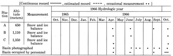
Wolverine Glacier was selected as a site for a combined balance study of the IHD in 1966, but permanent installations were not installed until 1967. Only limited data for ice and snow balance are available for the 1966 hydrologic year (table 7, pl. 6A).
TABLE 7.—Instrumentation at Wolverine Glacier during the 1966 hydrologic year
Climate
The weather recorded at Seward, Alaska, 45 km southwest of Wolverine Glacier, departed significantly from the long-term means. Precipitation from October 1965 through July 1966 was 0.76 m, which was only about 50 percent of that normally recorded. The August and September precipitation totaled 0.81 m and was about 200 percent of that usually recorded. Temperatures were in the near-normal range. Precipitation data from Wolverine Glacier, as yet unpublished (obtained in subsequent years), indicate that a close correlation exists between Seward and Wolverine Glacier precipitation. Therefore, the 1966 ice balances on Wolverine Glacier were probably below average, like the precipitation at Seward.
Ice Balance
The late-winter snow balance,  m(s), on Wolverine Glacier was
measured at eight points from the head to the terminus on April 23,
1966. Although no basin snow map was constructed, the altitude
distribution of the point data is shown (pl. 6B) and was used to
compute the glacier and basin average late-winter snow balances of 1.83
and 1.55 m, respectively (table 8). No data are available for Wolverine
Glacier prior to April 1966, so the changes in snow balance (pl.
6C) for the first half of the 1966 hydrologic year are only
estimated.
m(s), on Wolverine Glacier was
measured at eight points from the head to the terminus on April 23,
1966. Although no basin snow map was constructed, the altitude
distribution of the point data is shown (pl. 6B) and was used to
compute the glacier and basin average late-winter snow balances of 1.83
and 1.55 m, respectively (table 8). No data are available for Wolverine
Glacier prior to April 1966, so the changes in snow balance (pl.
6C) for the first half of the 1966 hydrologic year are only
estimated.
TABLE 8.—Snow and ice balances, Wolverine Glacier, 1966 hydrologic year
[Parameter values and errors in meters except where indicated, Date: Hydrologic year, Oct. 1, 1965 (t0), to Sept. 30, 1966 (t1)]
| Glacier |
Basin |
Date | Term | Explanation | |||
| Value | Error | Value | Error | ||||
Parameters for annual mass balance | |||||||
| a |
-0.26 | 0.34 | -0.16 | 0.26 | Hydrologic year | Annual balance | Net change in glacier mass from t0 to t1; approximately equal to the difference between precipitation as snow and melt-water runoff for one hydrologic year. |
Parameters relating annual and net mass balance | |||||||
| a(fi) |
-0.36 | 0.23 | -0.26 | .18 | Oct. 1, 1965 | Firn and ice annual balance | Change in mass of firn and ice from t0 to t1. |
| 0(s) |
.20 | .20 | .15 | .15 | Oct. 1, 1965 | Initial snow balance | New snow accumulated on summer surface (ss0) at t0. |
| 0(i) |
.05 | .05 | .03 | .03 | Oct. 1 to 14, 1965 | Initial ice balance | Ice melt in the ablation area after t0 and before ice melt begins the following spring; measured by ablation stakes. |
| 1(s) |
.30 | .10 | .25 | .10 | Sept. 30, 1966 | Final snow balance | New snow accumulated on summer surface (ss1) at t1. |
| a(i) |
.99 | .15 | .72 | .12 | Hydrologic year | Annual ice balance | Ice and firn melt in the ablation area for the hydrologic year. |
| a(f) |
.63 | .20 | .46 | .15 | do | Annual firnification | New firn formed on the glacier from t0 to t1; not definable if snow melt continues after t1. |
Parameters for snow accumulation | |||||||
| m(s) |
1.83 | 0.30 | 1.55 | 0.30 | Apr. 23, 1966 | Later-winter snow balance | Balance measured to the summer surface (ss0) in late winter or spring; measured in pits or by probing. |
Parameters for glacier dimensions | |||||||
| S | 118.0 | 0.2 | 24.9 | 0.2 | Sept. 30, 1966 | Area | Area of glaciers, excluding the ice-cored moraines. |
| AAR | 2.56 | 2.05 | 2.40 | 2.05 | do | Accumulation-area ratio | A rough index of annual balance, measured at time t1, neglecting new snow overlying ss1. |
| ELA | 1250 | 30 | do | Equilibrium-line altitude | Do. | ||
| δL | -4 | 2 | Hydrologic year | Advance or retreat | Average horizontal-distance change of terminus in direction of glacier flow. | ||
1Square kilometers. 2Dimensionless. | |||||||
The basin was often photographed from aircraft during the summer (table 7). These photographs provide the basis for most of the results reported here. A small number of stakes, pits, and probing points provided some point data on the snow and ice balance.
Part of the terminus was blown bare of snow on April
23, 1966, where 8.0 m water equivalent of ice melted from the glacier
during the 1966 hydrologic year. An additional 0.25 m of ice ablation at
the terminus occurred after the end of the hydrologic year. The previous
year's firn was exposed between the transient snowline and the glacier
ice at the end of the ablation season. Ablation of this firn is included
in table 8 as part of the annual ice balance, a(i). The average equilibrium line
reached an altitude of 1,250 m. Isolated ablation areas occurred at
altitudes as high as 1,500 m.
Approximately 30 percent of the snow on the glacier
in April remained in September 1966 and was buried under the new snow.
The residual snow thus became the increment of new firn in the
accumulation area, a(f). Several small perennial snowfields at
an altitude of 800 m were the lowest areas of firn formation. These
deposits are due to wind drifting.
New snow began accumulating high in the basin by late August 1966. A series of severe storms crossed the region in September, and by the end of the hydrologic year approximately 0.30 m water equivalent of new snow covered the glacier (pl. 6C). The lower edge of the new snow was at an altitude of 1,000 m on the glacier and at 1,100 m on the mountain slopes by September 21, 1966.
The amount of ice and old firn ablation, a(i), exceeded
the formation of new firn, a(f), during the 1966 hydrologic year. The
firn and ice annual balance, a(fi), thus was -0.36 m over the glacier
(table 8, pl. 6D). The total mass net balance, n, was very
likely equal to the firn and ice annual balance.
Runoff
The annual runoff from the heavily glacierized Nellie Juan River basin, to which Wolverine Creek is tributary, has been gaged from 1960 to 1965 and averaged 2.1 m per year. The 1966 annual loss in ice storage from Wolverine Basin, 0.26 m, was equal to 12 percent of the 1960-65 annual runoff of the Nellie Juan River and illustrates to what extent long-term loss in ice storage may affect the larger rivers of the Kenai Peninsula. During a drought year the glaciers could contribute nearly all the riverflow.
| <<< Previous | <<< Contents >>> | Next >>> |
pp/715-A/sec5b.htm
Last Updated: 28-Mar-2006