
|
Geological Survey Water-Supply Paper 1475-G
Water-Supply Possibilities at Capitol Reef National Monument, Utah |
INTRODUCTION
PURPOSE OF THE INVESTIGATION
The purpose of this investigation was to evaluate the possibility of obtaining an adequate water supply for the headquarters area of Capitol Reef National Monument from a ground-water source. The National Park Service could then compare the cost of obtaining an adequate ground-water supply for the monument with the cost of an adequate surface-water supply.
LOCATION OF THE AREA
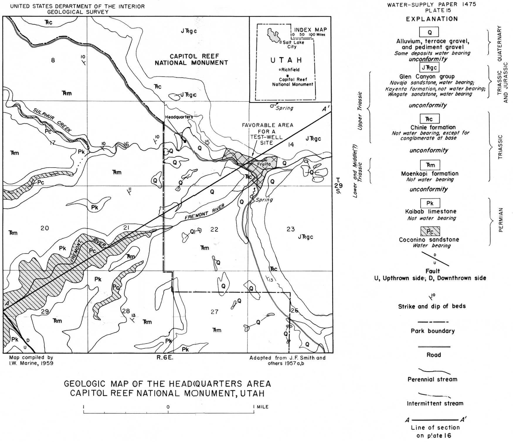
Capitol Reef National Monument is in Wayne County, Utah and occupies parts of Tps. 28, 29, and 30 S., Rs. 5, 6, and 7 E. of the Salt Lake baseline and meridian. However, the present headquarters, and the area where most of the future development will take place, is in the vicinity of the town of Fruita, principally in secs. 14 and 15, T. 29 S., R. 6 E. (pl. 15). This is the area covered by this investigation.
|
| PLATE 15.—GEOLOGIC MAP OF THE HEADQUARTERS AREA, CAPITOL REEF NATIONAL MONUMENT, UTAH. (click on image for an enlargement in a new window) |
MAP COVERAGE AND PREVIOUS INVESTIGATIONS
Topographic-map coverage of Capitol Reef National Monument on a scale of 1:62,500 is complete. Parts of the monument appear on the Fruita, Notom, and Torrey quadrangle maps of the U.S. Geological Survey. Preliminary geologic maps completely cover the area of this investigation and are on a scale of 1:24,000. Several publications that discuss the stratigraphy and structure of the monument and nearby areas are listed in "Selected references" at the end of this report. These reports, however, have few or no references to the ground-water resources of the area.
CLIMATE
The climate at Fruita is warm and dry. The following table shows the annual precipitation at Fruita since the station was established in 1948.
Annual precipitation at Fruita, 1943-58
[From records of U.S. Weather Bureau]
| Year | Precipitation (inches) |
Year | Precipitation (inches) |
Year | Precipitation (inches) |
| 1943 | 8.46 | 1949 | 9.48 | 1954 | 4.11 |
| 1944 | 8.43 | 1950 | 3.91 | 1955 | 5.22 |
| 1945 | 8.20 | 1951 | 11.79 | 1956 | 4.08 |
| 1946 | -- | 1952 | 6.18 | 1957 | 13.78 |
| 1947 | 8.64 | 1953 | 4.89 | 1958 | 4.83 |
| 1948 | 6.26 |
WATER USE AND FUTURE WATER NEED
About 16,000 persons visited the monument in 1957. Water was stored in two storage tanks near the superintendent's residence for both household and campground use.
In connection with plans formulated under the Mission 66 program, the Park Service estimates that the peak demand for all purposes except irrigation will be about 30,000 gpd (gallons per day) in 1966, and, if sufficient storage facilities are provided, a water supply of about 50 gpm (gallons per minute) should be satisfactory.
| <<< Previous | <<< Contents >>> | Next >>> |
wsp/1475-G/intro.htm
Last Updated: 28-Jul-2007