|
Grant-Kohrs Ranch
Administrative History |

|
Chapter Seven:
REAL RANCH OR NOT: NATURAL RESOURCES MANAGEMENT (continued)
The natural resources research initiative of the early 1980s revealed a more insidious threat to park resources -- toxic waste pollution. Superintendent Tom Vaughan was alerted to the potential for harmful emissions when it was proposed that a previously inactive phosphate plant at Garrison, eight miles north of the Site, be re opened. The facility had been in flagrant violation of state air quality laws and eventually went bankrupt. The park, however, had no baseline data by which it could monitor the effects of the plant's operation, should it be opened again. Vaughan initiated requests to fund a research program in the event the plant were re-activated.
With the prospect of a significant threat at their doorstep downstream, the park staff questioned a potentially greater threat from mining activity upstream. Park Ranger Paul Kirkland installed a number of test plots along the west bank of Clark Fork as an introductory measure until formal scientific research could be contracted. The soil in the so-called "slickens," areas devoid of vegetation, was found to be dead for all practical purposes. Although the phosphate plant at Garrison failed to be revived, Kirkland's tests indicated a more serious danger than that posed by the potential for airborne contaminants from that source, or the impacts from the Anaconda Smelter at the south end of the valley. [10]
In the early years of the twentieth century both Butte and Anaconda were the scenes of extensive copper mining activity. Silver Bow Creek drained the watershed in the vicinity of Butte, while Warm Springs Creek flowed past the Anaconda smelter the ranch, the two joining near Warm Springs, Montana to form the Clark Fork River. At flood stage, this stream carried heavy metals waste from the mines in the form of tailings that were deposited along the streams. [11] Arrangements were made for Peter Rice and Gary Ray, from the University of Montana, to analyze park resources. Their Floral and Faunal Survey and Toxic Metal Contamination Study (May 1984) presented irrefutable evidence that the river floodplain within the Site contained high concentrations of cropper, arsenic, and cadmium. Abnormally high levels of these pollutants were discovered in broth soils and vegetation. In 1984 two areas, Silver Bow Creek (including Grant-Kohrs Ranch NHS) and Anaconda Smelter, were designated for cleanup as Superfund sites. [12]
The next summer Superintendent Jim Taylor assisted the Montana Fish, Wildlife, and Parks Department to conduct a survey to determine the effects of these heavy metals on fish in the Clark Fork. Fish were netted above and below the ranch in order to weigh and measure them. Fin clippings identified the fish tested. Above the park, where lime was added to neutralize the pollutants, the sample showed nearly 500 fish to the mile. Below the ranch, in untreated waters, a mere 31 survived. [13]
Following the Superfund designation, meetings were held in the area to afford interested parties an opportunity to discuss the issues and to tour affected sites. These meetings, which were attended by park staff, also became strategy sessions to determine just what data were needed and how studies might be accomplished. By 1985 several research projects were underway to study the effects of headwater pollution caused by the Butte mining operations. Soil samples, which were taken in every mile of river from Butte to Missoula, showed the hazard was far greater than anyone had previously imagined. As a result of these surveys, the entire 140-mile stretch of river was included in the largest Superfund cleanup area in the nation. [14]
As the Superfund issue gained momentum, meetings of Interior Department agencies were called by the Solicitor's Office during 1990 in an effort to learn whether or not managers were aware of the extent of pollution on the lands within their respective jurisdictions. The Solicitor directed each agency to develop assessments of injury; Grant-Kohrs Ranch was to have its two-miles of the Clark Fork surveyed by summer 1991. [15]
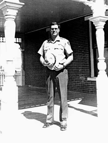 Superintendent Anthony J. Schetzsle. (Courtesy of Deer Lodge Silver State Post) |
As the Superfund became the preeminent resource issue in the park, it impacted other aspects of the operation. In 1993 the staff identified several actions that were needed to adapt certain activities to existing conditions. Monitoring the quality of the river was important, since it was a primary source of water for the cattle and other livestock on the Site. While it was evident that a grazing plan was needed for the entire park in order to better manage the pastures, Superintendent Jim Taylor followed the recommendations of the Rice-Ray report by fencing the cattle from grazing in the riparian zone until the pollution problem could be mitigated. [16] Short of a major cleanup, little else could be done, except to continue to support the Environmental Protection Agency (EPA) in its efforts and to cooperate in research activities. In recent years, Superintendent Tony Schetzsle made the ranch available as an unequalled research site to gather data for heavy metals toxicity. Much of the information generated at Grant-Kohrs Ranch had application to other Interior agencies with lands in the Superfund area and would prove valuable for assessing damage and necessary corrective measures.
Grant-Kohrs Ranch is unique as the only National Park Service unit to be included on the National Priority List for Superfund cleanup. The EPA was designated as the lead agency for remedial cleanup, however Superintendent Schetzsle noted that, "if they are resistent to the National Park Service taking certain remedial actions that are consistent with the final remedial plan, then it is our position that EPA must then assume our congressional mandate, acknowledging that National Park System lands are special." [17]
The Atlantic-Richfield Company (ARCO) purchased the Anaconda Cropper Company a few years prior to the enactment of the Superfund law, the Comprehensive Environmental Response, and the Compensation and Liability Act. Subsequently, suits were filed in which ARCO accepted the responsibility for the cleanup, but did not fully realize the complexities of the rehabilitation process. But, according to the law, as Schetzsle synthesized it, "if you own it, whether you did it or not, the problem is yours." [18] Some remedial work is already underway at the time of this writing on the Silver Bow Creek, Colorado Tailings, and Warm Springs Ponds, but the process of eventually settling the issue and reclaiming the Clark Fork Basin promises to be a lengthy one that will continue to challenge NPS management at Grant-Kohrs for at least seventy-five years to come.
Several years after the Site was established, it became obvious that the increased attention focused on natural resources issues would require someone on the park staff to serve as a principal contact and to coordinate the various activities. A 1990 operations evaluation reinforced this need when it noted that the park was no longer a "new" area and ought to devote more attention to aspects of resource management beyond the cultural. Acting on this recommendation, Superintendent Eddie Lopez designated Cheryl Clemmensen, formerly the chief ranger, to head a separate natural resources management division. The supervisory ranger previously serving as the lead interpreter was realigned to function as the chief of interpretation. [19]
With the creation of a natural resources division, Grant-Kohrs Ranch ". . . had made the transition in terms of establishing the direction of the program," Superintendent Tony Schetzsle recalled in a 1996 interview. "It now [1994] became time to bring in skills and expertise to take that forward . . . "and to decide ". . . who was going to do the work." [20] Schetzsle originally planned to install a supervisory historical architect to oversee the combined resource operation, but later decided that he could streamline the organization by placing the two functions directly under the superintendent, without a division chief to serve as intermediary. This would reduce the a layer of supervision in concert with a Servicewide reorganization plan being affected at the time.
This segregation of responsibilities was to bode well for the park. Within a few months after his arrival at the ranch in 1994, Schetzsle and Clemmensen took advantage of a special natural resources professionalization funding initiative to improve the park's capabilities in this field. The funding of this proposal enabled the park to create three new positions -- a computer assistant, an ecologist-biologist, and a resource management specialist -- to elevate the program to a new level of sophistication. A special resources laboratory also was established at park headquarters. [21] Ironically, Cheryl Clemmensen, holding a master's degree in anthropology, lacked the appropriate academic credentials necessary to qualify for any of the newly-established jobs that she had been so instrumental in designing. She therefore elected to return to interpretive duties.
Earlier, in 1992, Clemmensen had laid groundwork for programs founded on space-age technology, the Geographical Information System (GIS) and the Global Positioning System (GPS). The former was a computer software program designed especially for land management functions. While it had numerous applications in park environments, the agricultural industry has adopted it as well. GIS, relying upon a layered spatial data base, could combine data from various sources, including maps, tabular data, and remote sensing, such as aerial and infrared photography. The GPS incorporated satellites and hand-held computers to enable precise location and recordation of almost anything, anywhere on the earth's surface.
Both of these technologies held great importance for resources management at Grant-Kohrs Ranch. In fact, the site was designated as a demonstration park for GIS applications. Cultural resources, such as archeological sites and character defining features of the cultural landscape, such as fences, headgates, irrigation ditches and other structures, could be mapped with great accuracy. Areas infested with noxious weeds could be plotted to monitor them for increases and decreases. Not only did GIS have applications in the area of fire management, its ability to show relationships between soils and vegetation made it a valuable tool in the Superfund project for detecting slickens and other affected areas. Additionally, it proved valuable for managing floodplains and riparian zones. Despite these innovations, however, these technologies have not yet been incorporated into a comprehensive monitoring system for the park's natural resources. [22]
| <<< Previous | <<< Contents >>> | Next >>> |
grko/adhi/adhi7a.htm
Last Updated: 28-Aug-2006