 | ||
 | ||
 | ||
 | ||
 | ||
 | ||
 | ||
 | ||
 | ||
 | ||
 | ||
 | ||
 | ||
 | ||
 | ||
 | ||
 |
 |
 |
Colonial Parkway
Jamestown, Williamsburg, Yorktown, Virginia
Simple timber bridges of hand-built appearance cross the marshlands of Jamestown Island, providing visitors with unobstructed views at the tidal landscape. (Jack Boucher, HAER, 1995) |
TOUR ROADS
Like many parks, Colonial NHP has a system of loop or circuit roads providing visitor access to areas of scenic and historical significance outside the main parkway corridor. In the 1930s, a battlefield tour road was developed around Yorktown which touched upon the significant sites of the siege and battle of 1781. Engineers, landscape architects, and historians worked closely to identify colonial-era road traces from which an integrated single-lane tour could be developed. Simple road grades and rustic bridges characterized the original routes through the heavily forested battlefield, but increases in visitation over the past twenty years have required more substantial paving and bridge replacement.
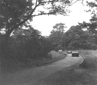
Jamestown Island roads were slower to develop due to a general lack of historical knowledge about the island and the "wilderness area" ??? designation that protected the flora and fauna typical of 17th-century Jamestown. In preparation for the 350th anniversary, however, a two circuit loop road was constructed to the interior of the island with automobile-accessible roadside exhibit areas that feature interpretive paintings by local artist Sidney King. Simple timber trestle bridges span interior wetlands and provide visitors with an up-close view of the region's diverse ecosystem. Historical markers were put in place along both tour roads integrating them within the interpretive framework of the main parkway corridor.
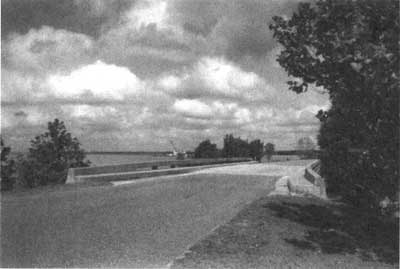
Crossing the Isthmus Bridge with a view of the James River. (Jack Boucher, HAER, 1995) |
COLONIAL PARKWAY FOR THE FUTURE
Since the completion of the parkway in 1957 the park has been aggressive in its attempts to limit access and fight visual encroachments along the road. Numerous grade crossings have been eliminated by bridges and interchanges and many scenic easements have been acquired to preserve the experience of motoring or a scenic roadway. Rapid regional growth is placing increasing demands upon the natural and cultural resources of Colonial National Historical Park. Sections of the parkway between Williamsburg and Yorktown have become popular commuter corridors despite objections of the park. With increased traffic comes increased stresses upon the roadway and new dangers from more and larger vehicles traveling at speeds in excess of what the parkway was designed to handle. Despite these problems, the park has succeeded in balancing the needs of highway safety while retaining the integrity of the parkway's original design as a scenic road. Between 1985 and 1995 a massive three-phase restoration program was undertaken along the parkway. Along with needed structural work on the bridges, construction joints on the pavement were replaced and safety features such as steel-backed timber guardrails were built along much of the road. The restoration insures that Colonial Parkway will continue to provide motorists a way to experience the cultural and natural resources of Tidewater Virginia well into the 21st century.
| Introduction | Acadia | Blue Ridge Parkway | Colonial Parkway | Generals Highway | George Washington Memorial Parkway | Great Smoky Mountains | Mount Rainier | Rock Creek and Potomac Parkway | Shenandoah's Skyline Drive | Southwest Circle Tour | Vicksburg | Yellowstone | Yosemite | Discover History |
