Jefferson National Expansion
Administrative History
|

|
Administrative History
Bob Moore |
MAPS AND DIAGRAMS
|
|
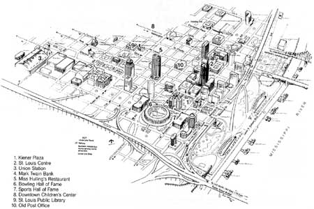
Area Map, Downtown St. Louis. (click
on image for an enlargement in a new window)
|
|
|
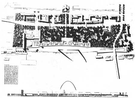
Original Landscape Plan, Dan Kiley, Jefferson
National Expansion Memorial, 1947. (click on image for an enlargement in a
new window)
|
|
|
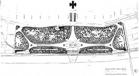
Modified Landscape Plan, Dan Kiley, 1959. (click on image for an enlargement in a
new window)
|
|
|
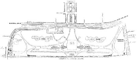
Schematic of Landscape, JEFF, 1980s. (click on image for an enlargement in a
new window)
|
jeff/adhi/adhi2-m.htm
Last Updated: 15-Jan-2004
|


