Jean Lafitte
Historic Resource Study (Chalmette Unit)
|

|
ILLUSTRATIONS

|
|
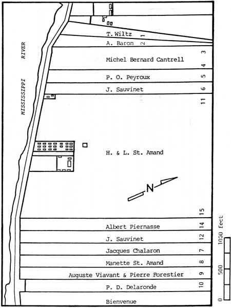
Illustration 21. Redrawn detail of
d'Hemecourt's 1867 plat of the battleground plantations. (Chalmette
Unit, Jean Lafitte National Historical Park)
|
|
|
Illustration 22. Artist's reconstruction
of a missing 1831 d'Hemecourt Plan showing the subdivision of the St.
Amand Plantation. (C. Pollock, April 10, 1832, NONA)
|

|
|
Illustration 23. Redrawn detail of part
of the Louis St. Amand estate, from d'Hemecourt's 1841 Plan. (NONA,
C.V. Toulon, December 13, 1841)
|

|
|
Illustration 24. Redrawn detail of
d'Hemecourt's 1837 plan of the St. Amand Plantation. (NONA, Plan book
79, p. 6)
|

|
|
Illustration 25. Redrawn detail of the
March, 1927, Chalmette Cemetery Survey, Mississippi River Commission,
Lake Borgne Levee District. (Office of Public Works, Baton Rouge,
Louisiana)
|
jela/hrs/hrsi5.htm
Last Updated: 05-Sep-2004
|