NATCHEZ TRACE PARKWAY
Excavations at the Pharr Mounds and the Bear Creek Site
|

|
Bear Creek
FIGURES
|
|
FIGURE 5.
|
FIGURE 6.—(omitted from the online edition)

|
|
FIGURE 7.—The mound in 1950 (top). The mound in 1965, after
years of cultivation (bottom).
|

|
|
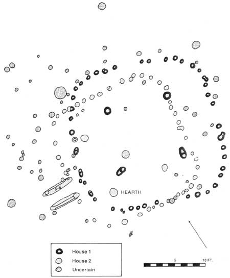
FIGURE 8.—Houses 1 and 2 (top). Partially excavated pit in
village area (bottom).
|

|
|
FIGURE 9.—a-c, Plain, fine shell tempered; d, Moundville
Incised; e, unidentified incised, shell tempered; f, Barton incised.
|

|
|
FIGURE 10.—a, b, plain, sand tempered; c, cord impressed,
sand tempered; d, Moundville Filmed-Incised; e, f, Mulberry
Creek Cordmarked.
|

|
|
FIGURE 11.—Moundville Incised (top left). Plain, course shell
tempered (top right). Moundville Incised (bottom).
|

|
|
FIGURE 12.—a, Lost Lake; b, Morrow Mountain; c, Type "A";
d, Type "B"; e, Cumberland Fluted; f, Big Sandy I; g, h,
Provisional Category I; i, Provisional Category II; j-l,
Madison.
|
|
|
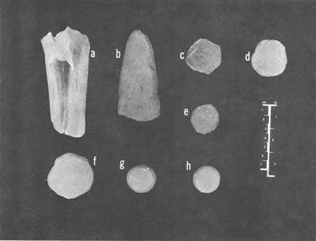
FIGURE 13.—a, bone beamer; b, celt; c-e, pottery disks;
f-h, stone disks.
|

|
|
FIGURE 14.—a-e, knives; f-h, end scrapers; i-k, side
scrapers; l-o, inscribers.
|

|
|
FIGURE 15.—a-c, shaped cores; d, spokeshave; e-g, undifferentiated
cores.
|
pharr_mounds-bear_creek/figures-2.htm
Last Updated: 15-May-2008
|