

|
GLACIER National Park |
 |
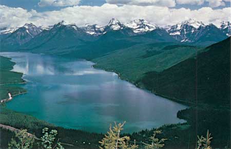 Lake McDonald, 16 kilometers long, 2 kilometers wide, and 134 meters deep, is the largest lake in the park. Its basin is the classic U-shaped glacial valley. Forested lateral moraines on either shore gently rise 600 meters above lake level. Going-to-the-Sun Road snakes along the eastern shore, and Logan Pass lies near the center of the photograph, behind the peaks of the Lewis Range. |
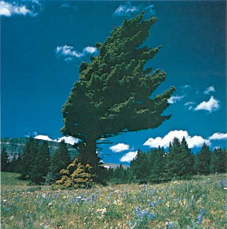 Subjected to the drying and shaping effects of wind both winter and summer, this Douglas-fir, growing in the prairie community near St. Mary, will attain neither the symmetrical shape nor the great size of the Douglas-firs growing in moister, more sheltered sites on the western slopes of the Continental Divide. |
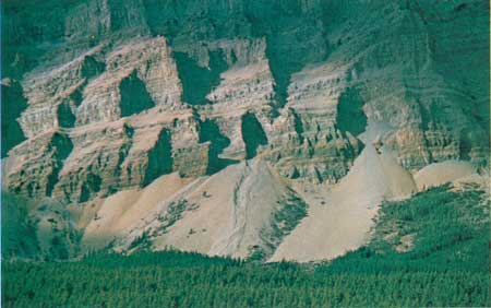 Freeze-and thaw cycles continually fracture and loosen rocks along joints making them subject to removal by the actions of water gravity and avalanche. The resulting fans of rock debris (talus cones) indicate the extent of erosion since the withdrawal of the Pleistocene glaciers. |
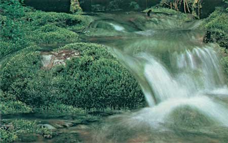 Although moving water is an agent of erosion—the primary destructive force of mountain masses—it also permits life. Even small watercourses, such as this freshet, abound with plant and invertebrate life. |

|

|

| NPS History | History & Culture | National Park Service | Contact |
|
Last Modified: Sat, Nov 4 2006 10:00:00 pm PST |