|
| ||||||||||
| Intro | Author | Subject | Volume | Volume/Title | NPS | |||||
|
Volume IV - No. 1 |
January, 1940 | |||
|
THE APPALACHIAN TRAIL And the Shenandoah and Great Smokies BY MYRON H. AVERY
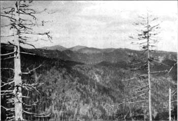
The Appalachian frail is too well-known a project to require any extensive elaboration for those who deal, professionally, with the recreational areas in the eastern Atlantic States under the jurisdiction of the National Park Service. It is a route for foot travel, distinguished, it may be said, by its practically endless character. As it winds its course through fourteen states of the Atlantic seaboard, it presents a unique opportunity for a study of the changing zones of botany, geology and kindred sciences - a fascinating pursuit for even those who observe such features only casually. For instance, as one traverses the eastern Great Smokies along their 6,000-foot ridge crest, the traveler may well believe himself back again in the cathedral-like spruce and fir forests of the Maine woods. The Appalachian Trail Conference and its affiliated groups have also served as a medium for conveying to the National Park Service their points of view and suggestions. But this project, of late, has acquired a deeper significance. The national parks are in themselves a distinct type of recreational area. Perhaps to those who forecast and determine the future of these areas it would seem illogical and unnecessary that still another type of recreational area should be created within the confines of a national park. And it would seem all the more extraordinary that this new type of area should exist for the benefit of a decided minority. Yet such a development has occurred during the past two years. The Appalachian Trail in the national parks - and we deal here with the Shenandoah and Great Smoky Mountains National Parks - has assumed a unique significance. This is not without importance even in a protected area such as a national park. From a mere trail it has become a narrow zone which has received the status of a protected, insulated area. Here no new paralleling motor roads are to be built. Where roads are now within a mile of the Trail and where feasible, the Trail is to be relocated. A system of simple shelters is to be built along the route. No development generally imcompatible with the Trail is to be permitted in this zone. The creation of this status has its genesis in an agreement executed between the National Park Service and the U. S. Forest Service in October, 1937. Subsequently thirteen of the fourteen States through which the Trail route passes have adhered to the Trailway Agreement. The area affected in the national parks is 159 miles, being divided almost equally between the Shenandoah and the Great Smoky Mountains. The significance of this agreement will be appreciated. I have referred to the agreement as a boon to a minority but I also view it as a distinct benefit to the National Park Service. The pressure on the National Park Service to develop further these two areas is a matter of common knowledge. It perhaps may be beside the point to overstress their primitive aspect, for much of the terrain in these two parks had been modified and altered in the course of the economic development of the eastern United States. However, given protection and with the benefit of trained and far-seeing planning, these regions bid fair to revert to the primeval and become an indication of the type of land that our forefathers knew. Pressure on the Service for development will be ever-present. The ridge crest of these areas is particularly susceptible. It will be readily understood that the Trailway Agreement thus affords a medium for the preservation of the existing status. While these agreements are not as unchanging as the laws of the Medes and Persians in that they can be abrogated by six months' notice, they do represent a distinct declaration of policy and it may be presumed that neither the Service nor any state will reverse its policy in this connection without overwhelmingly valid considerations. The effect of the Trailway Agreement on the future of the ridge crest sections of these parks may be noted here. The Skyline Drive in the Shenandoah National Park is an accomplished fact. In some sections, by accident of terrain, the Trail and the Drive are in a proximity which could be avoided now only by dropping the Trail an undesirably long way down the mountain crest. Therefore, in the Shenandoah National Park, where the situation was fixed when the Trailway Agreement came into effect, no major change of route in the Trail appears to be of advantage at the present moment. The situation in the Great Smokies is quite otherwise. This agreement is a shield which the Service may find of advantage in resisting pressure for further road development along the ridge crest of the Great Smokies. The agreement is, moreover, of distinct value as a manifestation of the policy of the Service. It should be recognized as such by those who declare themselves to be vitally concerned with the preservation of the primeval and primitive. The significance of this agreement and its effect, as long as it remains unaltered, should be thoroughly appreciated. For its policy in this connection the Service should receive due credit. The existence of the Appalachian Trail has also been of value in the development of these parks. It has brought to the Service the view point of the users of these trails. A trail is completed, physically, when, shall we say, the CCC detachment has finished the grading. It is then, however, far from a usable thing. It requires a definite system of signs; it must be mapped; essential guidebook description must be prepared to induce its use. Further - and this is of importance - a system of shelters, having due regard to the practical situation, must be built. This is a matter of very real concern in a region such as the Great Smokies where torrential rains are experienced. The technician dealing with his specialty may not appreciate all these essentials.
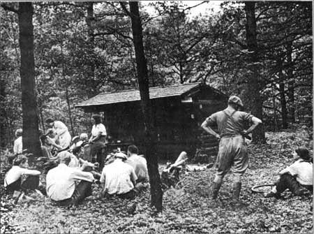
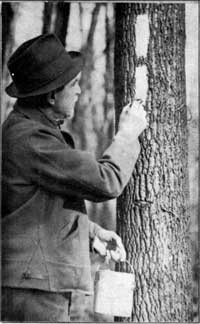
Thus, a well-planned shelter from an architectural point of view often leaves much to be desired from the practical point of view of the shelter user. In addition, the through Trail, which we may regard as the master trail in each park, needs to be fitted in and coordinated with the route to the north and south, outside of the park boundaries. Private land ownership on each side of the park may produce an anomalous situation of a trail ending, practically, nowhere. Much progress has been made along these lines. We note the situation in the Great Smokies. Since the problems have been intensively pursued by the Conference after its meeting at Gatlinburg some two years ago, eight lean-tos along the 62 miles of Appalachian Trail here have come into existence. These are at intervals of an easy day's journey for the traveler who would devote more time to the rewards of his route. For the traveler who moves at a faster pace, the device of "skipping" a lean-to meets his requirements. We are told that signs, adequately designating the junction of all side trails and the main Trail, have been installed for two-thirds of the Great Smokies. A more reliable maintenance program for Western Smoky - where the Trail is marked by paint blazes and an unworked footway - bids fair to care for the problems reported here of inadequate Trail maintenance. A trail of the type that exists in Western Smoky requires, of course, far more frequent attention than the graded type where the route is unmistakable. While the Shenandoah is forced to yield the palm to the Great Smokies as far as the lean-to situation is concerned, its trail system, regarding the Appalachian Trail as the trunk line from which side trails radiate to points of interest, has reached a stage near completion. With the cooperation of the Potomac Appalachian Trail Club, this park has carried out a systematic program of trail signing. Maintenance problems are being systematically cared for. In addition to five closed shelters available along its route, the open lean-tos for the north half of the park, accessible to all comers, will have been completed by the spring of 1940. The next year should see this chain well toward completion. I have emphasized that this recreational area of The Appalachian Trailway is for a minority interest. Those who camp, walk and seek their own recreation on foot represent a decided minority. Perhaps at times their presence and views have been considered not an unmixed blessing. Certainly, in terms of representation and use, the cost of the construction of these trails (albeit a lower standard might well serve the purpose) is disproportionate with the cost of highway construction. This theory, of course, carried to its logical conclusion, would overrun the national parks with roads. Trails, their users, and a trail system may therefore, well be regarded as a means of defense against over-development. As such trails and trail development are an essential and an integral part of our park system, their existence is justified on grounds of proper planning and use and not by a census of the number of trail users and automobile riders, respectively. It is perhaps well to appreciate this factor and evaluate it. At times, emphasis on this comparison and insufficient use of trails (statistics entirely correct in themselves), emanating from the officials in charge of these areas, may unwittingly tend to create the impression that the roads and kindred appurtenances are, in their view, the only developments which justify the expenditure and activity involved. Such an impression is indeed an unfortunate one to be abroad, for it can form the basis of unfair and improper criticism of the Service policy. To this end, the Trailway Agreement, as representing a distinct boon to what we must admit without question is a decided minority, forms a very useful answer of a recognition of the part that trails and trail systems play in contrast with overdevelopment.
Perhaps when pursued to their ultimate conclusion, these suggestions of inadequate use of any aspect of the recreational features of the parks except the roads disclose some failure on the part of the authorities in charge of these areas to appreciate the practicabilities of the situation. It is not enough to have a trail (ummapped, unsigned, unrecorded) built to some outstanding feature. It is essential to have the existence of a route publicized and made known. The mere completion of the trail will not, ipso facto, insure its use. Yet one looks in vain for any activity which would publicize or stimulate the use of these trails in the eastern parks. The Service has available no maps, no guidebooks or publicity which meets this essential need. An instance, however, of an approach to the problem is the large-scale mounted maps being erected by the Landscape Architect along the Skyline Drive in the Shenandoah National Park where there are trail connections with the Drive. The outing clubs, as a voluntary contribution, have picked up where the Service stopped. They have issued the only maps and guidebooks for the area, and endeavored to stimulate the use of these facilities through the medium of their publications. Naturally, the response to this needed publicity manifests itself first in the membership of those groups and this, curiously, brings the suggestion that the facilities are being provided, with much expense, for the benefit of a few organizations. The résumé of this situation means this. A trail is not to be afflicted with some apochryphal character. Its building is only the initial step. Granted that facilities to that end have been inadequate, those who stress insufficient use of any park facility except the roads must recognize a failure to complete the job, to put it bluntly. The clubs and the Conference have endeavored to remedy this deficiency to the extent their limited resources permit and have to some degree.
While this résumé is somewhat detailed, it points to two factors in the situation of controlling importance. The first is the assurance that the Service, through the Appalachian Trailway Agreement, holds out to those who fear for the future of the ridge crest in these areas. The second is that the Trail system - a recreational feature of the park - through its medium of fitting into the Appalachian Trailway Agreement, has been brought to a state of near completion and better utilization than would have occurred had the matter been pursued independently. There is a third area under the jurisdiction of the National Park Service which perhaps can be best summarized by saying that it presents an outstanding problem to the Appalachian Trail Conference. Perhaps the least said about the area the better. In any event, it is a tribute to the original location of the Appalachian Trail that the route of the Blue Ridge Parkway should be almost squarely imposed upon it for its entire length of 150 miles. This section along the curving rim of the Blue Ridge crest in Virginia is a section very little frequented, inaccessible and somewhat removed from the activities of maintaining organizations which care for the Trail elsewhere. Perhaps in the course of economic development which is manifesting itself here independently of the Blue Ridge Parkway, its fate might have been sealed anyway. What relocations can now be made to advantage are being made at the present time. For the most part, the Trail parallels the Parkway. Ultimately, it is planned to make the last major change in the Appalachian Trail route by shifting this section far to the west through the publicly owned lands in western Virginia, which afford a possibility not available at the time the Trail route was originally projected. This résumé of the development of the Appalachian Trail in the areas under the jurisdiction of the National Park Service is perhaps well made at this time to make clear the situation to all those interested in these regions. Its primary significance as a "Maginot Line" to those who fear overdevelopment and as the perfection of a "finished" trail system seems at the moment - if one's vision of the forest is not too much clouded by the presence of the trees - to be outstanding. Perhaps it will also not be without future significance. | ||||
| <<< Previous | > Contents < | Next >>> | ||
|
http://www.cr.nps.gov/history/online_books/regional_review/vol4-1g.htm Date: 04-Jul-2002 | ||||