|
War in the Pacific
Historic Resource Study |

|
B. Asan Beach Unit, Asan Inland Unit and Fonte Plateau Unit
II. Asan Inland Unit (continued)
Matgue (Nidual) River Area
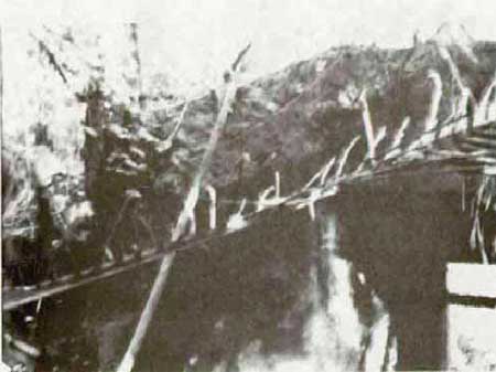
No. 86. Bridge. Concrete bridge over the Matgue River, near its mouth. The bridge now serves a short, dirt road that runs up the west side of the river. In 1944 a bridge existed in this area, serving the Agana-Piti road. On W-Day, elements of the 9th U.S. Marines crossed the bridge and came under fire from Japanese dug into the west side of the Asan Point. Following the battle for Guam, U.S. forces established four large petroleum storage tanks in the river valley. A service road joined this storage area to the newly constructed Marine Drive, crossing the river where the bridge now stands. The consensus appears to be that today's bridge was built in this period. The writer disagrees, believing the bridge to be a part of the pre-war route from Agana to the Piti Navy Yard. A document, uncovered by Historian Charles Snell, that was prepared by the U.S. Office of Naval Intelligence prior to the American invasion of Guam discussed the pre-war bridges and roads on Guam. In part, this report states, "On the AGANA-PITI-SUMAY road, which is maintained by the [U.S.] Federal Government, all bridges are two-way, and of heavy reinforced concrete construction until the ATANTANAO River is crossed." [3] The deck of the bridge measures 32.5 feet in length and 19 feet in width. An iron pipe rail is affixed to the north side. Thick vegetation prohibits a clear photo.
|
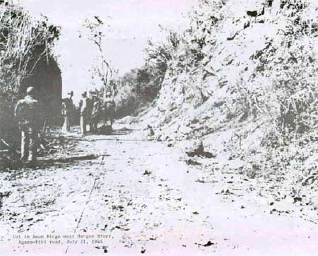
| Cut in Asan Ridge near Matgue River, Agana-Piti road, July 21, 1944. |
|
| Matgue River bridge, Asan, 1984. |
|
| Matgue River bridge, Asan, 1984. |
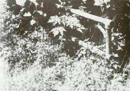
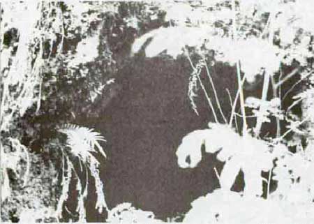
Nos. 88 and 89. Caves. Two man-made caves tunneled into the side of the cliff along the west side of Matgue River. No. 88 is 10 feet in depth and 4.3 feet in width, and No. 89 is 10 feet deep and 7 feet wide. Both were suited as personnel shelters or for storage.
|
| No. 88. Japanese cave, Matgue Valley, Asan, 1984. |
|
| No. 89. Japanese cave, Matgue Valley, 1984. |
Nos. 90, 94, and 97. Caves. Man-made. No. 90 has two entrances and is 13.5 feet in depth. Ore of these entrances is blocked with rock rubble. No. 94 consists of three small caves that have collapsed. No. 97 is a large cave, 27 feet deep, suited as a personnel shelter.
No. 106(?). Gun emplacement. It is on the ridge west of Matgue River and south of Asan Point. The principal feature is a gun emplacement, cup-shaped, 8 feet in diameter and 2.5 feet in depth. A raised lip surrounds it. Possibly an emplacement for a Japanese antiaircraft gun. In the vicinity are several foxholes or shell craters. (No. 106 seems to have been assigned to two sites.)
| <<< Previous | <<< Contents >>> | Next >>> |
wapa/hrs/hrsb2a.htm
Last Updated: 07-Mar-2005