Last updated: March 8, 2021
Place
Eagle Point Trailhead
Quick Facts
Amenities
1 listed
Trailhead
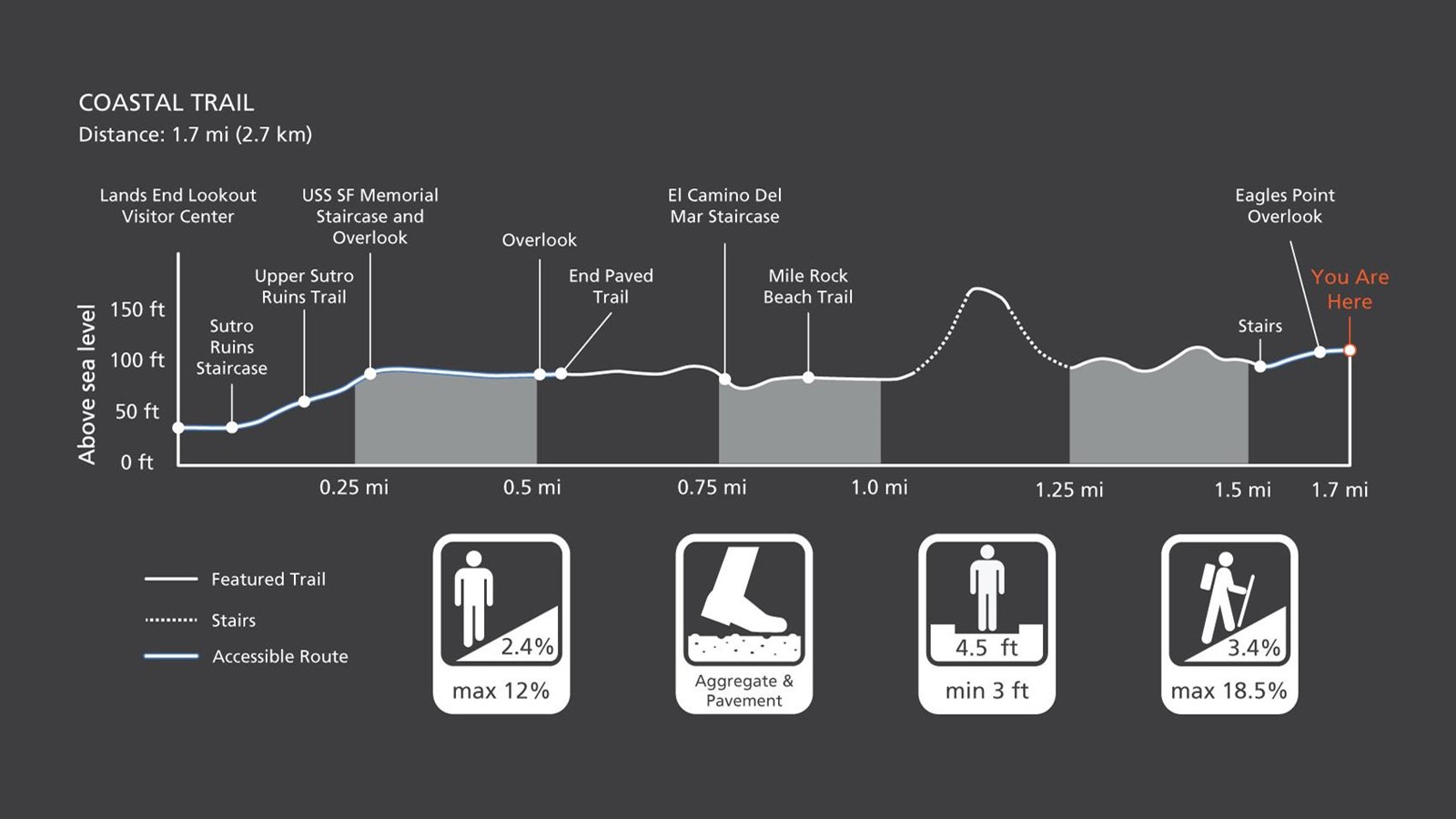
BE AWARE: This trail has sections with stairs.
From Eagles Point, the Coastal Trail follows the 1880s roadbed of the Ferries and Cliffhouse Railroad. At every turn of the trail on this windy and rocky northwestern corner of San Francisco, there is another stunning view. Along the way you'll see hillsides of cypress and wildflowers, views of old shipwrecks, access to the epic ruins of Sutro Baths, pocket beaches and a new Lookout Visitor Center.
Coastal Trail Overview
Distance: 1.7 mi (2.7 km, one-way)
Trailhead: Eagle Point Trailhead
Slope: Avg 3.4%, Max 18.5%
Side Slope: Avg 2.4%, Max 12%
Width: Avg 4.5 ft., Min 3 ft.
Trail Surface: Compacted aggregate and pavement.
Safety
- Stay on the established trail. Keep an eye out for poison oak.
- Observe warning signs and railings-these exist for your safety.
- Dress in layers and be prepared for varying weather conditions. Sunny days along the coast can turn windy, foggy, and cold very fast.
- Do not climb on the coastal bluffs or edges, the sand and rocks are loose and eroding and dangerous!
- People have fallen from these cliffs -- and died!
Parking
Parking is available at the USS SF Memorial, the Lands End Lookout Visitor Center, and along El Camino Del Mar.
Dog and Trail Etiquette
Dog walking is allowed in areas for on-leash or voice/sight control. Off-trail travel harms plants and causes erosion. Keep your food within arm's reach at all times and do not feed the wildlife. Carry out all trash and food waste (fruit peels, shells, etc.).